 Canyoneering | Hidden Canyon (Technical Route)


Hype:
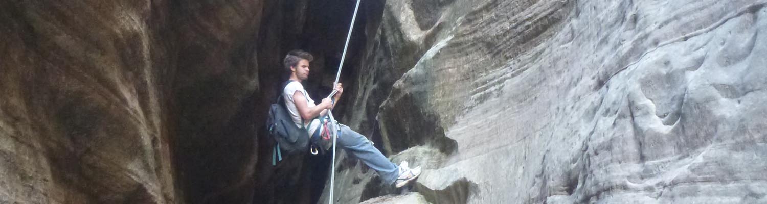
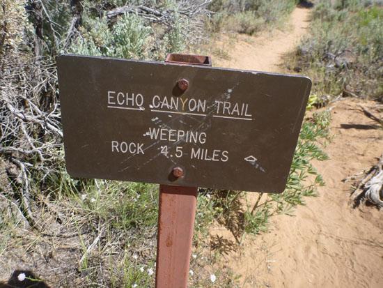
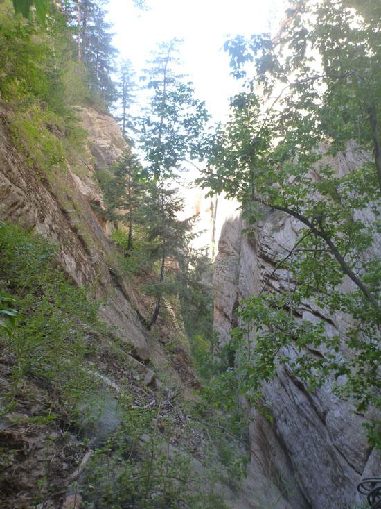
The technical version of Hidden Canyon turns the classic day hike into a full-day canyoneering adventure. The canyon is entered from the top and after several rappels, the canyoneers exit the canyon near the Weeping Rock shuttle stop.
Canyon Rating: 3A 
Time: 8-9 hours from Weeping Rock shuttle stop; 6-7 hours from Stave Spring Trailhead; ??? hours from East Entrance
Length: 9.6 miles from Weeping Rock shuttle stop; 5.8 miles from Stave Spring Trailhead; 10.9 miles from East Entrance
Longest Rappel: 100 ft
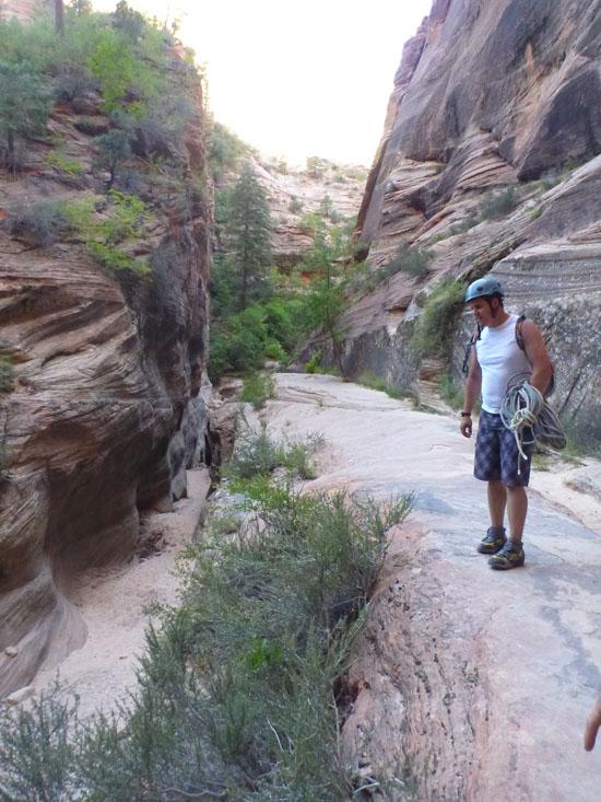
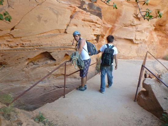
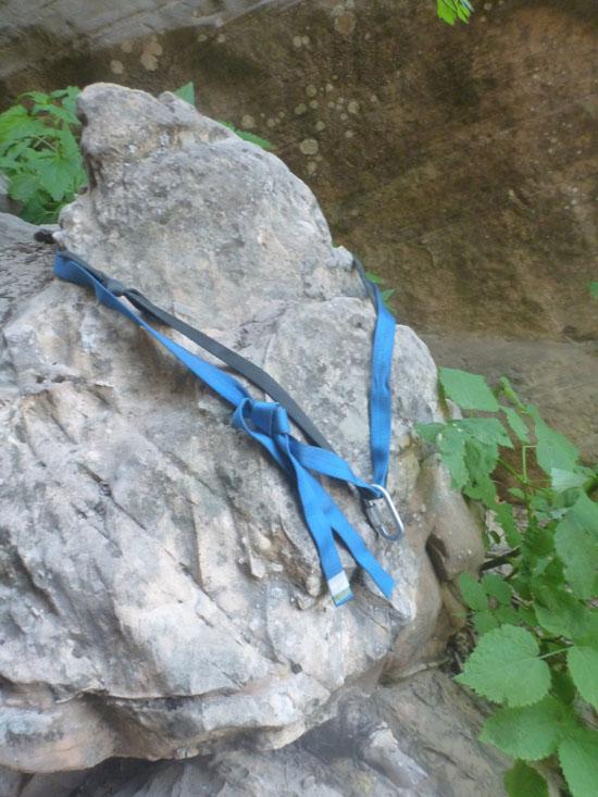
Gear: 200 feet of rope with one rope being at least 100 feet long. Our preferred rope combo is (2) 100 ft. Standard rappelling gear. Lots of water.
Fees: Entrance fee, optional backcountry reservation fee, permit
Recommended Ages:
 | 0-3 |
 | 4-11 |
 | 12-19 |
 | 20-49 |
 | 50-69 |
 | 70+ |
Recommended Months to Visit:
| Jan |
| Feb |
| Mar |
| Apr |
| May |
| Jun |
| Jul |
| Aug |
| Sep |
| Oct |
| Nov |
| Dec |
Permits: Required. Reservations are not available online. Get your reservation at the Zion Canyon Backcountry Desk.
Navigate to 37.267706, -112.899363.
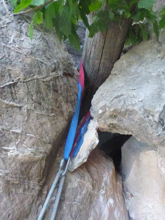
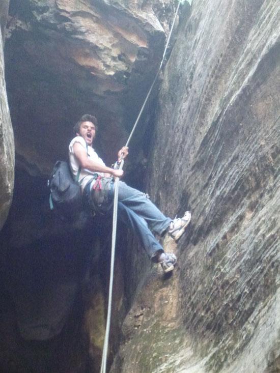
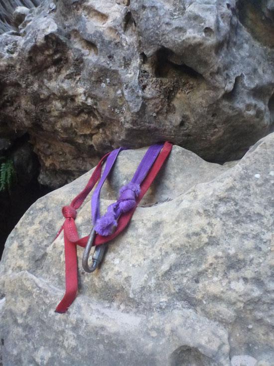
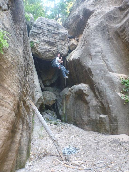
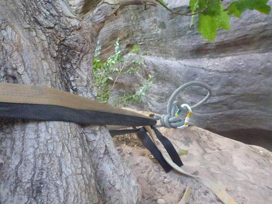
Rappel #1 - 100 ft off a pine tree
Rappel #2 - 20 ft handline from a tree high on the left LDC, optional
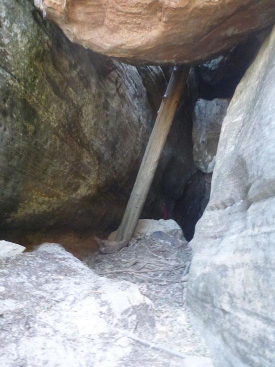
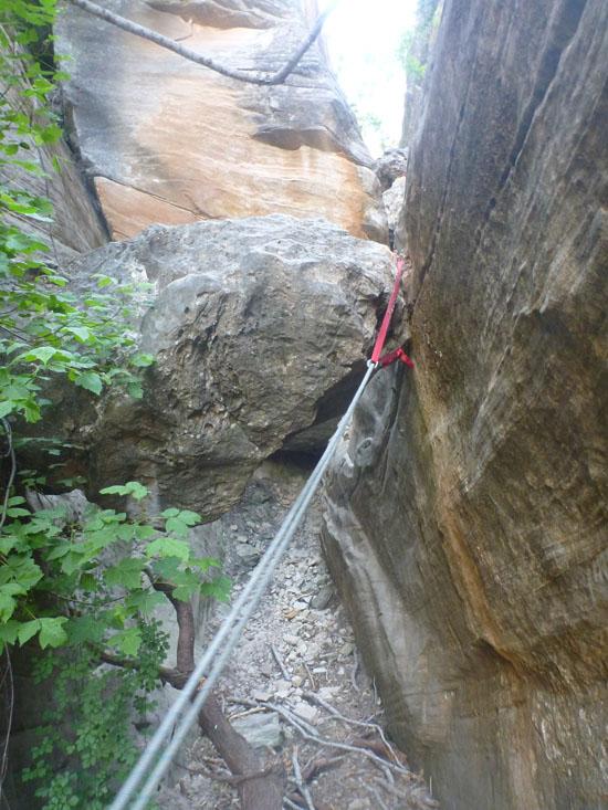
Rappel #3 - Option 1: 60 ft off a log, Option 2: 20 ft off a log (or downclimb) followed by 40 ft off a bolt
Rappel #4 - [Short] off a rock
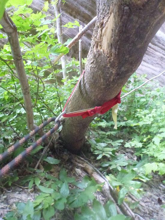
Rappel #5 - 30 ft off a tree
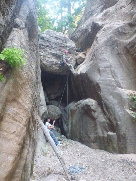
Rappel #6 - 100 ft off a tree
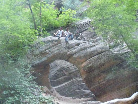
Arch #1 - Supposedly there is an arch LDC right before the last rappel. We didn't look for it.
Rappel #7 - Option 1: Follow ledge LDC to arch and rappel 60 ft off a tree, Option 2: Scramble down canyon and rappel 30 ft off a rock
Closest City or Region: Zion National Park, Utah
Coordinates: 37.244816, -112.932571
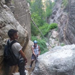
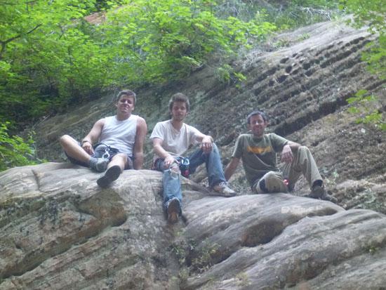
By Jeremy Dye
Jeremy Dye, Anthony Dye, Zac Dye,
We left at 9:15 am and finished at 6:00 pm -- almost 9 hours total. All three of us are fast hikers and can all set up and take down rappels efficiently.
Total distance was 11.7 miles (approx. 2 extra miles because we got lost and did a lot of backtracking).
Temperature was 104° F.
Total water was 8 liters for 3 people (enough that we didn't get dehydrated, but not nearly enough to be comfortable).
Would we do it again? Maybe. But it would have to be from the Stave Spring trailhead and when it was a LOT cooler.
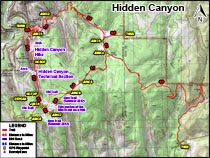
We didn't feel like shuttling cars, so we started from the Weeping Rock shuttle stop/trailhead (37°16'15.12"N, 112°56'18.67"W).
At 37°16'13.55"N, 112°56'18.17"W, the trail forks. The left fork goes to weeping rock. Take the right fork.
Near the top of the switchbacks (37°16'7.87"N, 112°56'12.21"W), the trail forks again. Take the left fork toward the East Rim Trail.
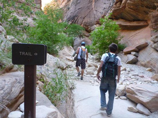
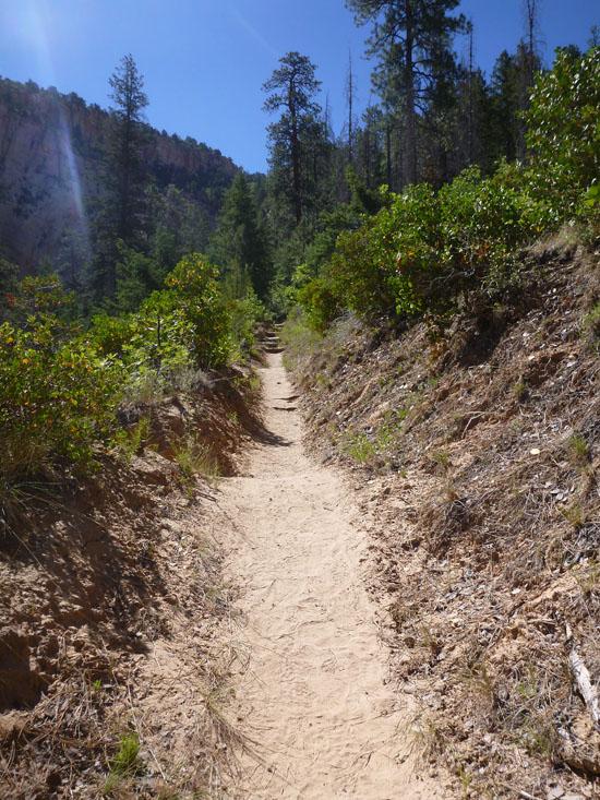
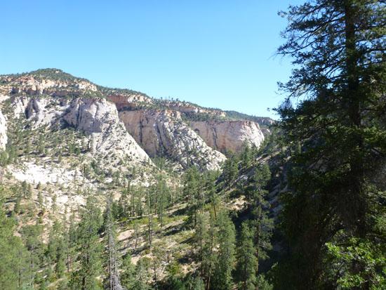
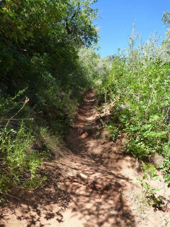
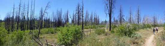
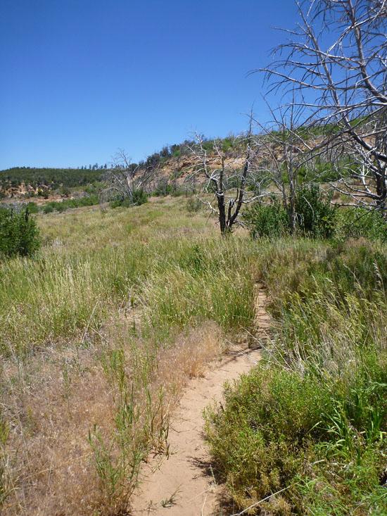
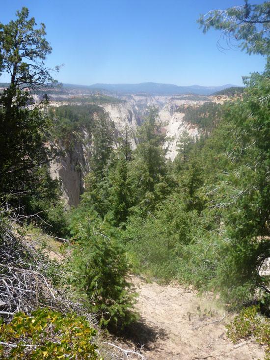
The trail rounds the corner and parallels Lower Echo Canyon for a while. For a short while, the trail enters Echo Canyon. This is the exit for Middle Echo Canyon. Don't enter Middle Echo. Instead, take the trail to the left of Echo up on the side.
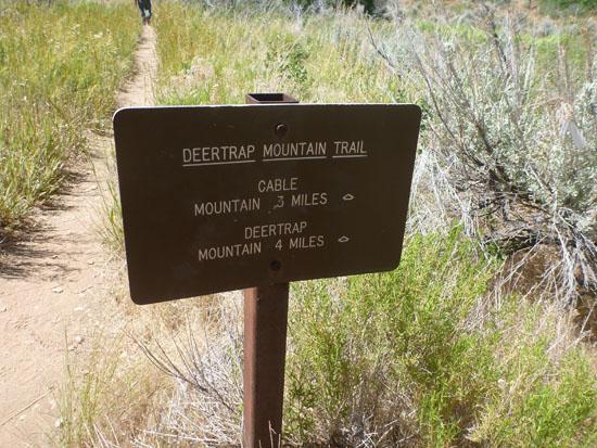
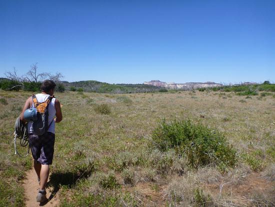
At the next fork (37°16'27.11"N, 112°55'43.02"W), take a right toward Deer Trap trail. The trail crosses over slick rock in several places. Follow the rock cairns.
The first 3.5 miles gains over 2,000 ft of elevation. The rest of the trail is fairly flat from here.
At 37°15'57.07"N, 112°54'28.23"W, a trail joins from the east. This is where hikers who started at the Stave Spring Trailhead (37°16'3.71"N, 112°53'57.09"W) join the Cable Mountain Trail. If I were to do Hidden Canyon again, I would definitely start at the Stave Spring Trailhead. It shaves off about 4 miles of hiking (roughly 2 hours at a fast pace) and over 2,000 feet of climbing. It does require a shuttle, but it lets you do another hike on the same day.
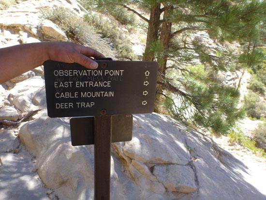
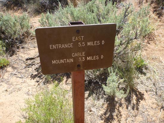
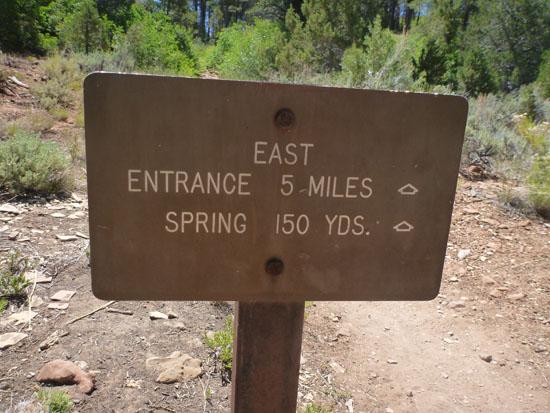
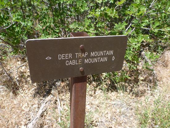
The third optional trailhead is the East Entrance (37°13'57.47"N, 112°52'34.61"W). The sign says it's 5 miles from the East Entrance trailhead to the junction with the Cable Mountain trail, but I think it's actually closer to 5.9 miles, which makes it 0.9 miles longer than from Weeping Rock but 300 feet less elevation gain. From this junction (37°15'43.59"N, 112°54'22.75"W), follow the trail south toward Deer Trap Mountain.
The next trail junction is at 37°15'9.69"N, 112°55'1.03"W. Take the left fork toward Deer Trap Mountain.
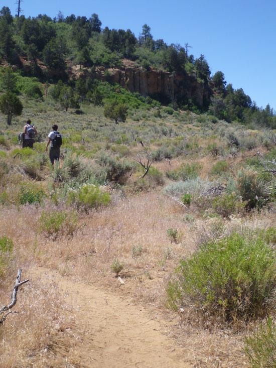
Sometime shortly before our trip in 2012, the park re-routed Deer Trap Trail. The ranger at the backcountry desk alerted us to this fact and warned us that the trail beta we had would likely be wrong.
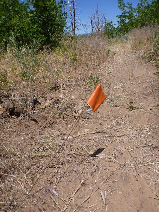
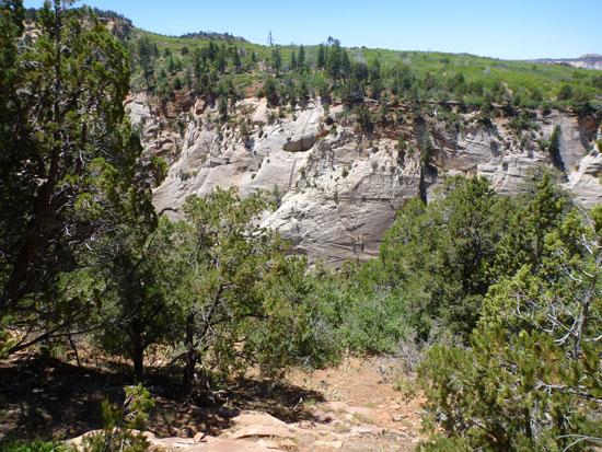
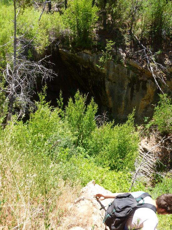
We knew that we needed to get off the Deer Trap trail at some point, but we weren't sure where. We were following directions from CanyoneeringUSA, which didn't have waypoints, plus we accidentally left the printout in the car, so we got a bit lost. We ended up leaving the new Deer Trap trail at about the right point and we intersected the old Deer Trap trail very close to the head of Hidden Canyon. But then we followed the trail to the east instead of to the west. We ended up on the east rim of Hidden Canyon, but the cliffs were way too tall for us to rappel down with the ropes we had on us.
We found a nice spring and alcove that looked like it might form a side canyon we could descend into Hidden Canyon, but it ended at a dropoff so tall we couldn't see the bottom.
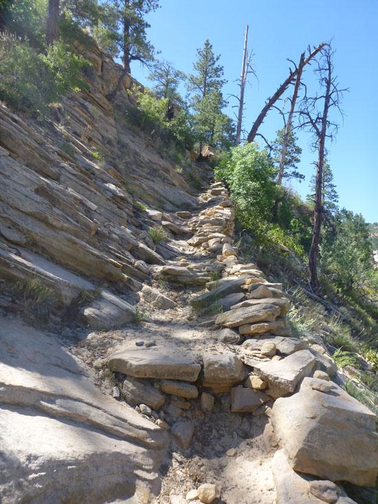
At that point, we figured the top of Hidden Canyon must be farther to the west. So we backtracked to the old Deer Trap Trail and followed that for a ways. Eventually I got enough 3G on my cell phone to download a topo map, but my battery was running low. By this point it was after 2:00, so we stopped for lunch.
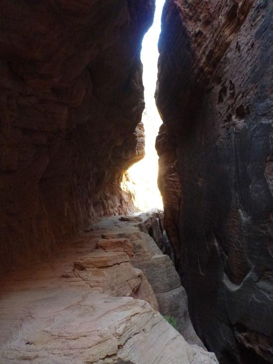
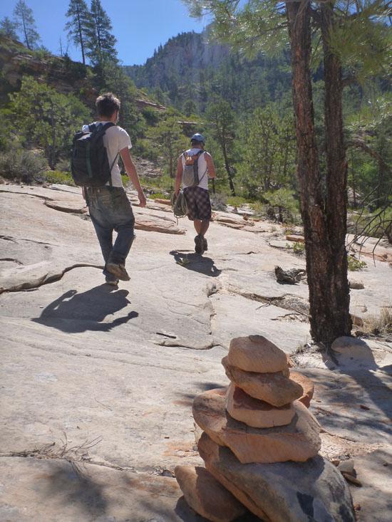
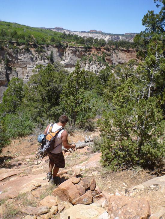
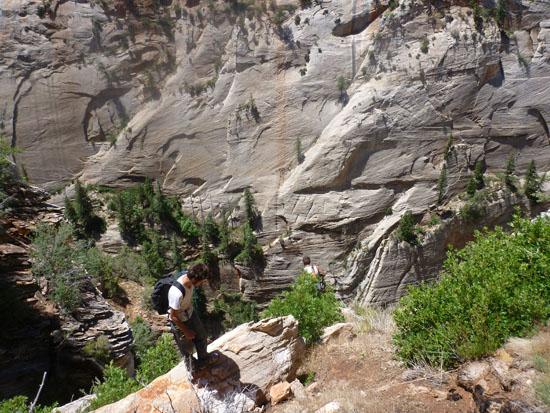
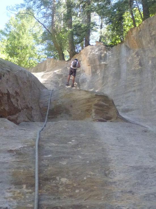
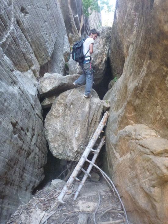
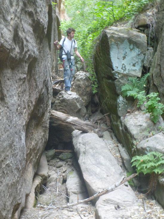
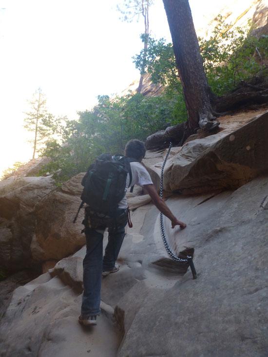
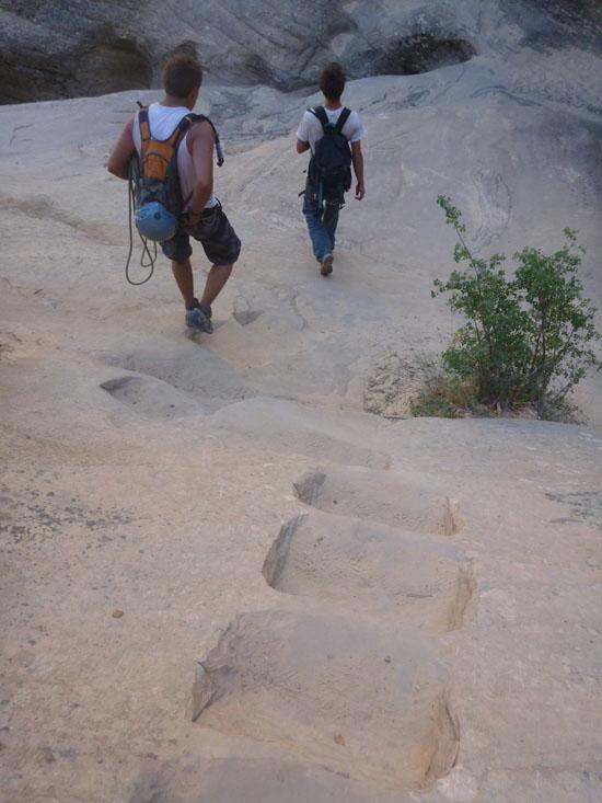
I tried my phone again and found Bluugnome's trail beta for Hidden Canyon. I had just enough time to take a picture of my phone with my camera before my phone died. We were then able to read the GPS coordinates from the camera and put them into the GPS. Once we had coordinates, it was quite easy to find where we were supposed to go. We backtracked a half mile along the old Deer Trap trail to the point in the picture below where the trail bends and there are some rock steps.
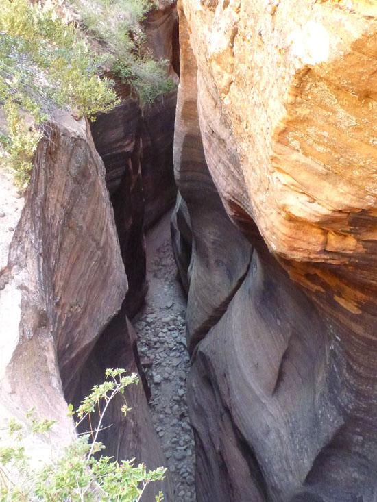
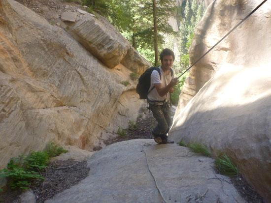
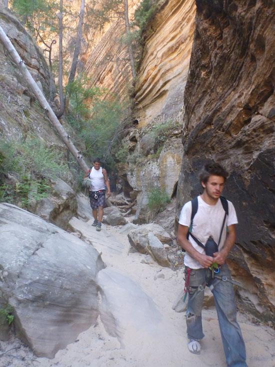
From there it was a quick scramble down the canyon to the first rappel.
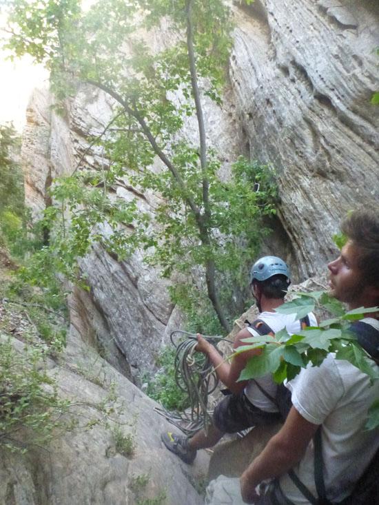
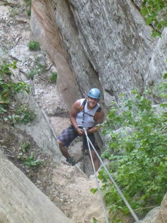
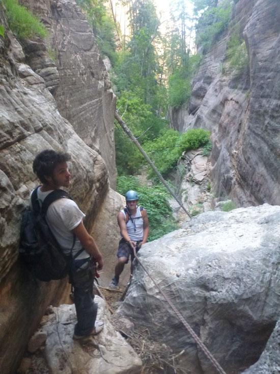
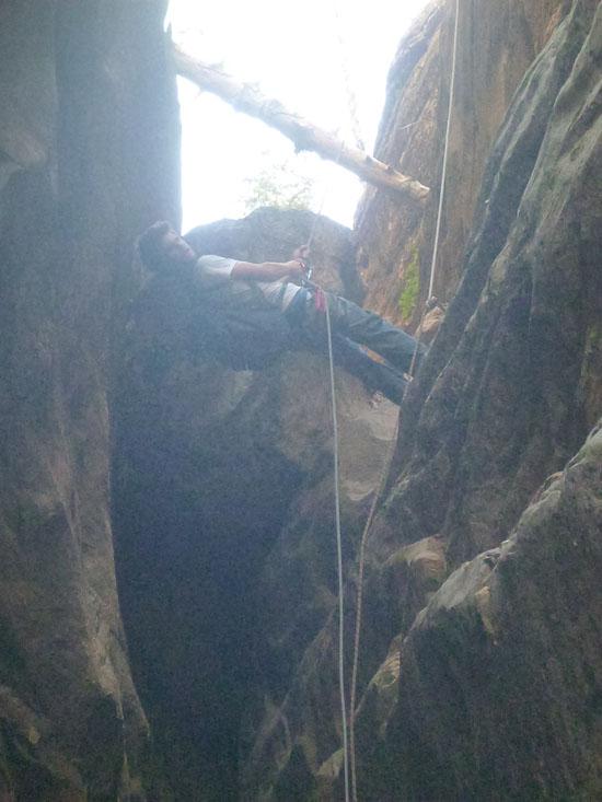
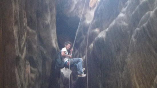
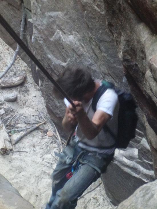
After several rappels on a fat rope, Zac and I got sick of rappelling double strand, so we each rappelled single strand with the other person acting as a counterweight.
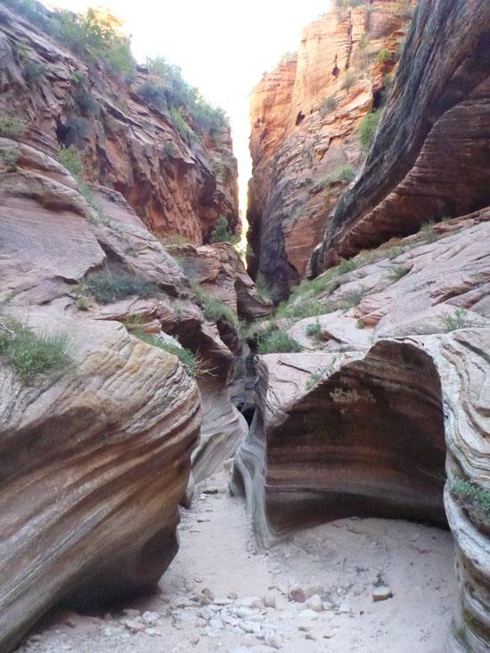
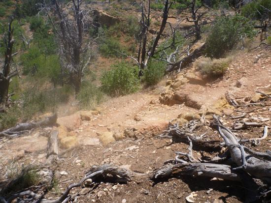
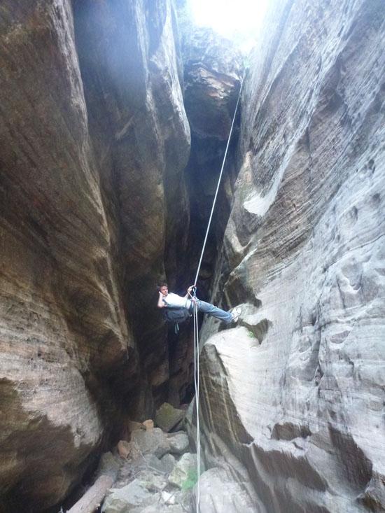
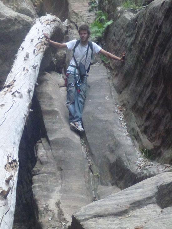
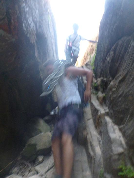
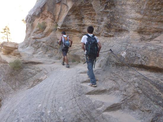
The entire canyon is a long series of downclimbs. Lots and lots of boulders to walk, slide, scoot, and shuffle down.
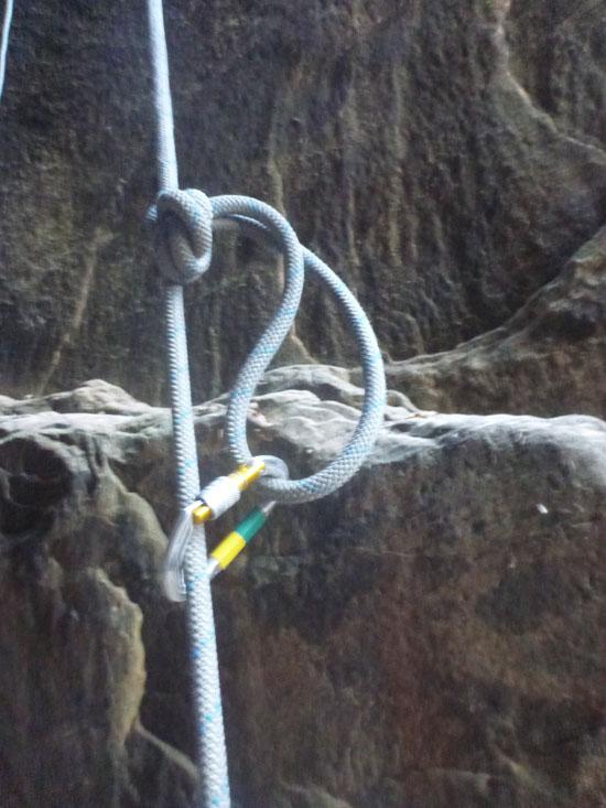
At rappel #6, Anthony was the first one going down the canyon at this point, and he missed the rappel anchor and downclimbed a ways before getting to the top of the ledge. So I lowered my rope down to him, he tied his rope to mine, and I pulled his up to me. Then I set a knot block, he rappelled the rest of the way down, and Zac and I followed.
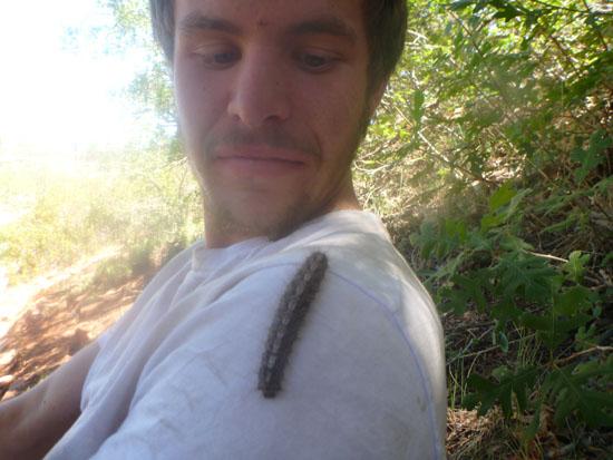
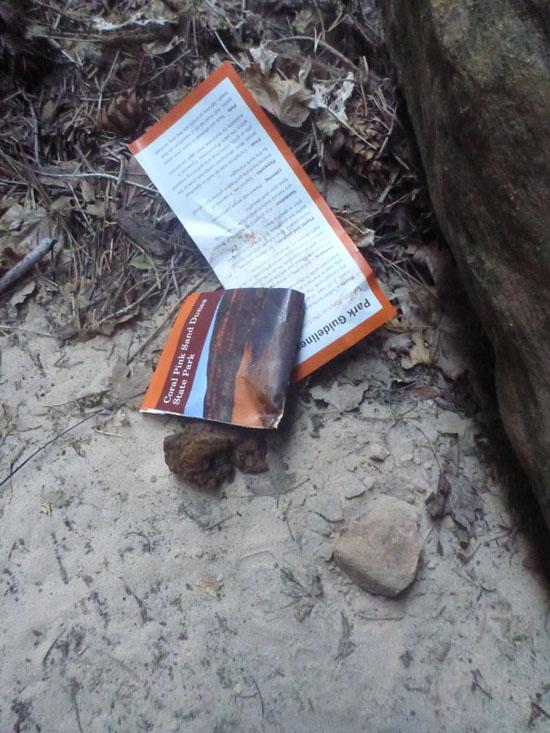
Funny story: As we were hiking down the canyon, I noticed a Coral Pink Sand Dunes brochure that someone had accidentally dropped. Being the responsible person that I am, I picked up the litter. Well, it was a little heavier that I expected. Actually a lot heavier. Turns out someone had used the brochure as toilet paper and there was a big old poop inside. Come on guys! Dig a hole or something! Luckily I had only touched the paper, and no lasting harm was done. Close one.
By Rappel #7, we were ready to be out of the canyon, so we just handlined it to speed things up.
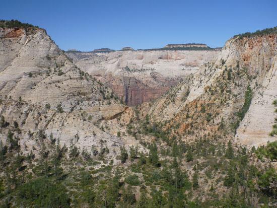
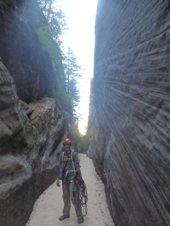
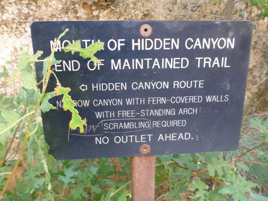
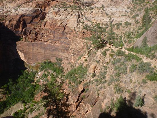
We soon reached the arch, then the mouth of the canyon, the paved trail to the bottom. We took the shuttle back to our car.


Hidden Canyon (Technical Route)
Kolob Reservoir Primitive Camping
Hidden Canyon (Technical Route)
Flaming Gorge National Recreation Area
Little Black Mountain Petroglyph Site
St. George Dinosaur Discovery Site at Johnson Farm
Zion National Park Visitor Center
 Rappels
 Downclimbs
 Fixed Anchors
 Wetsuit Generally Not Required
 No Drinking Water
 Slot Canyon
 Mountains
 Arches
 Wayfinding
 Marked Trails
 No Restrooms
 Road Access is Paved
 Access Road is 2WD Accessible
 Hiking Trails
 Wildflowers and Vegitation
 Wildlife and Birding