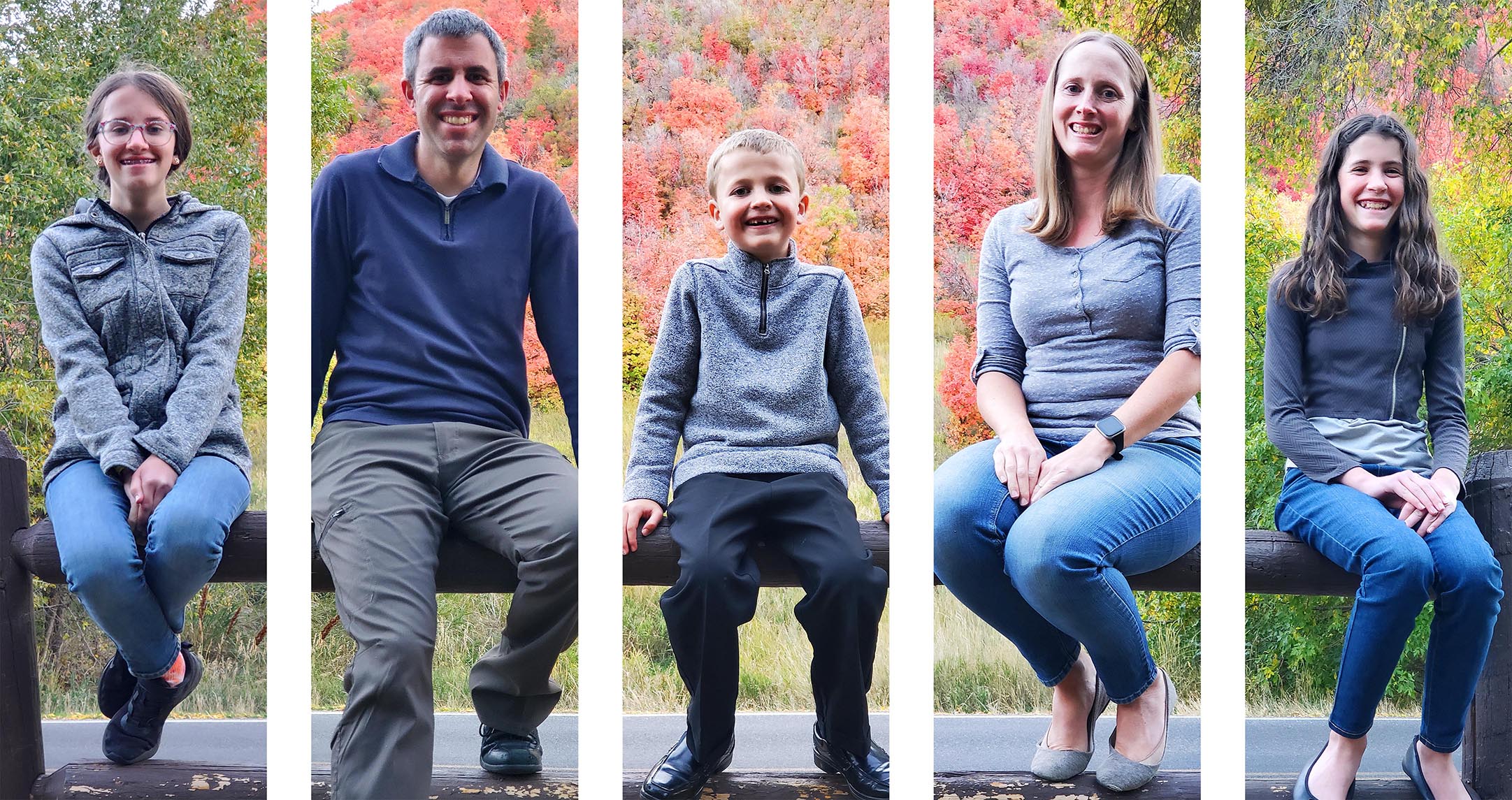
Grand Staircase-Escalante National Monument, Utah
37° 28’52.14”N, 111° 13’5.08”W
20-40 minutes
1.6 miles round trip from the parking lot or 1.0 mile round trip from the Spooky/Peek-a-Boo trail.
The Dry Fork Narrows of Coyote Gulch is a fun and very easy hike through a shaded, sandstone canyon. While not a true slot canyon, it is still very narrow and can be enjoyed by the whole family. The canyon floor is covered with sand and gravel that make the walking very easy for most of the trail. The approach is about 0.5 miles. The entire canyon is only about 0.6 miles long
None
Free permits are required for overnight trips. Permits are available at several trailheads and at the Escalante Interagency Visitor Center
Yes
*Map has Topo Map layer and Satellite Image layer.
Most Recent: June 18, 2011
Big Hollow Wash US Topo (2011)
Big Hollow Wash (1968)

The Dry Fork Narrows of Coyote Gulch is an excellent family-friendly hike up a narrow canyon. While not technically a slot canyon because you can't touch both walls at the same time, the canyon walls are narrow and very tall.
Access to the Dry Fork of Coyote Gulch is via the hole-in-the-rock road, which starts between Escalante, Utah and Boulder, Utah. Passenger cars can most likely make it to the parking area as long as recent storms haven't eroded the road too much. From the parking area, hike north down the hill. There are several "trails" so take your pick. At the bottom of the hill, you will enter the dry fork wash. On your left (northwest) will be the mouth of the Dry Fork Narrows. Walk up the canyon as far as you want to go and return the way you came.
While you are in the area, consider visiting Spooky Slot Canyon, Peek-a-Boo Slot Canyon, and Brimstone Gulch.
Download KML file to view in Google Earth.
| Waypoint | Latitude | Longitude | Description |
| TURN1 | 37.4666516 | -111.2239595 | Turn 1, 26.2 miles down Hole in the Rock Road |
| CAMP | 37.4662378 | -111.2059334 | One good place to camp |
| PARK | 37.4768015 | -111.2201705 | Park |
| DFBOT | 37.4812382 | -111.2176675 | Dry Forks Bottom |
| DFTOP | 37.4834545 | -111.2249238 | Dry Forks Top |
| PBBOT | 37.4816014 | -111.2166066 | Peek-a-Boo Bottom |
| PBTOP | 37.4852864 | -111.2166052 | Peek-a-Boo Top |
| SPTOP | 37.4851380 | -111.2094564 | Spooky Top |
| SPBOT | 37.4814013 | -111.2093207 | Spooky Bottom |
| JUNC1 | 37.4761991 | -111.1970365 | Junction #1 |
| LBBOT | 37.4873471 | -111.1932913 | Lower Brimstone Bottom |
| LBTOP | 37.4930344 | -111.1906222 | Lower Brimstone Top |
| LIBOT | 37.4747478 | -111.1950517 | Little Canyon Bottom |
| LITOP | 37.4769922 | -111.1933339 | Little Canyon Top |
Download KML file to view in Google Earth.
Brimstone Gulch, Little Canyon, and Dry Fork Narrows of Coyote Gulch at EveryTrail
After our hike to Brimstone Gulch and Little Canyon, Zac and I met up with Arianne, Tara, and Savannah at the mouth of Dry Fork Narrows of Coyote Gulch.

Since we were already there, we decided to hike the Dry Fork Narrows of Coyote Gulch even though the girls had just barely finished it.

Dry Fork Narrows of Coyote Gulch is a fun and very easy hike through a shaded, sandstone canyon.

While not a true slot canyon, it is still very narrow and can be enjoyed by the whole family.

The canyon floor is covered with sand and gravel that make the walking very easy for most of the trail.

The entire canyon is only about 0.6 miles long.


We turned around shortly before the canyon opened up. There was a cool log wedged between the two canyon walls about 30-40 feet off the ground.

A butterfly (moth?) on the return trip.

It took us 25 minutes to return to the car. That means that Zac and I explored 3 canyon in 5 hours and 20 minutes for a total of 8.1 miles.

We then went to camp to hang out for a while, then we went to Batty Pass Caves.