 Hiking | West Thumb Geyser Basin


Hype:
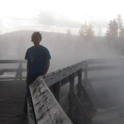
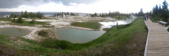
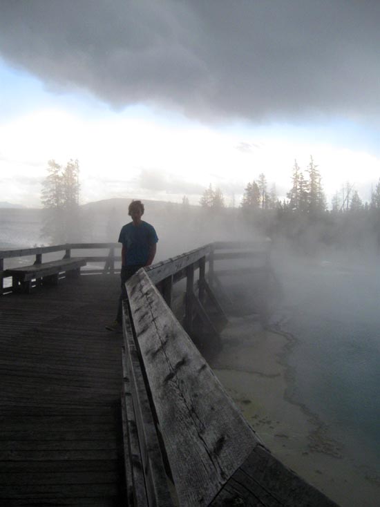
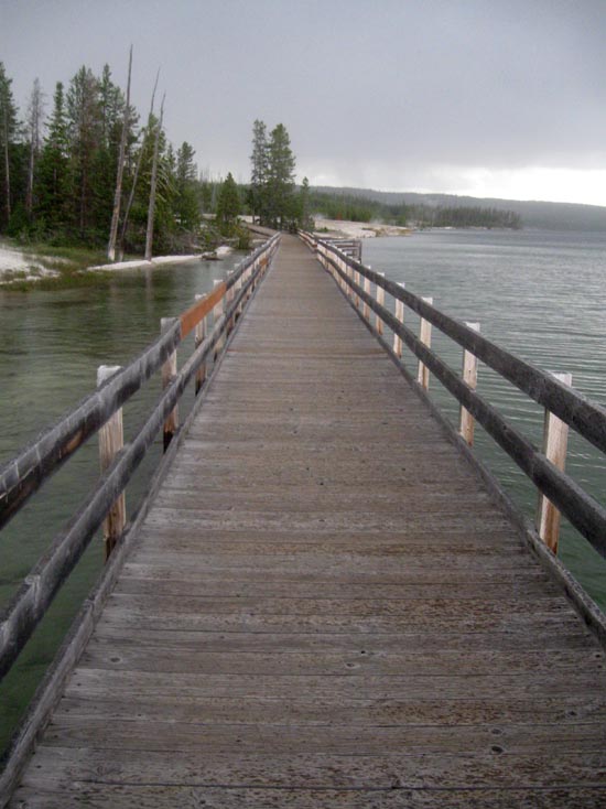
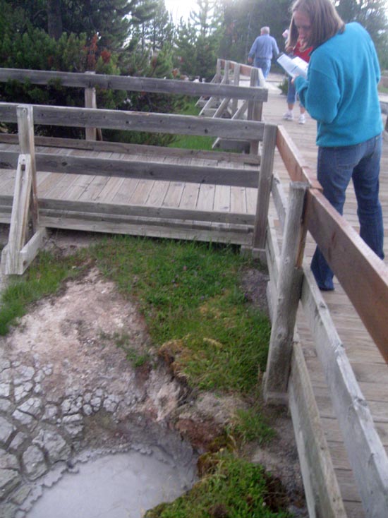
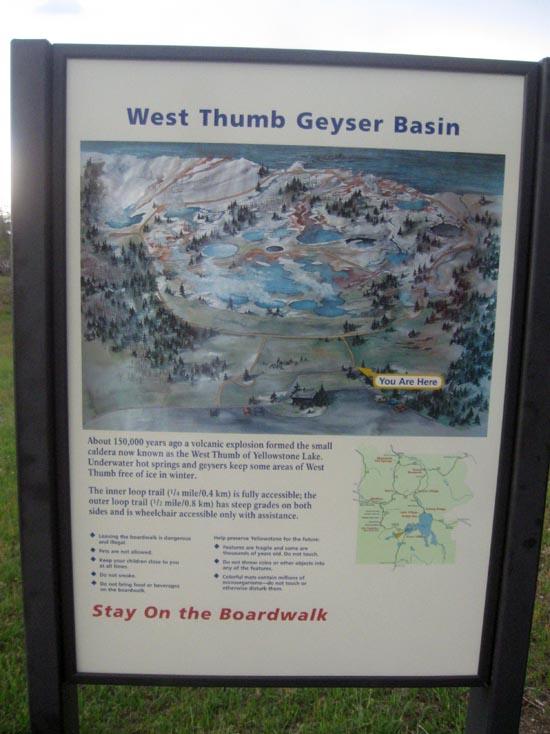
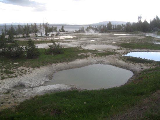
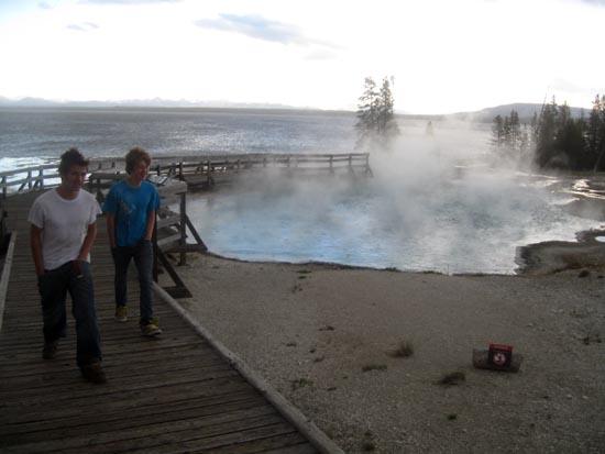
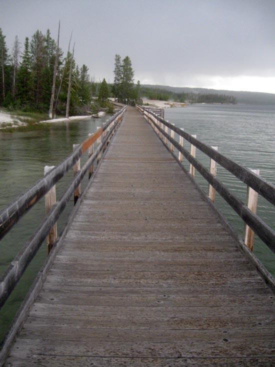
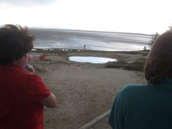
West Thumb Geyser Basin is located on the west thumb of Yellowstone Lake. This trail/boardwalk makes a loop and passes several hot springs and pools.
Trail Condition: Class 0 (Trail is paved. No elevation gain.)
Time: 30 minutes
Length: 0.5 miles
Fees: Entrance fee
Recommended Ages:
 | 0-3 |
 | 4-11 |
 | 12-19 |
 | 20-49 |
 | 50-69 |
 | 70+ |
Recommended Months to Visit:
| Jan |
| Feb |
| Mar |
| Apr |
| May |
| Jun |
| Jul |
| Aug |
| Sep |
| Oct |
| Nov |
| Dec |
Navigate to 44.415573, -110.573120.


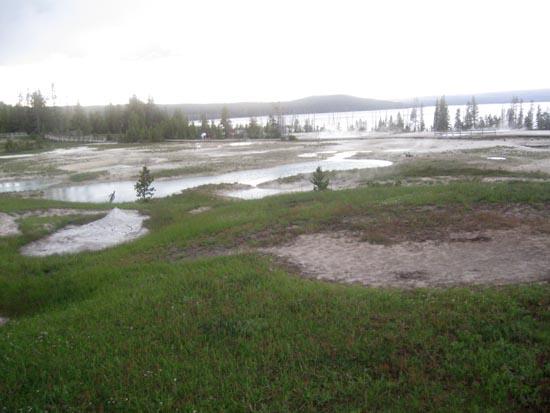
West Thumb Geyser Basin overlooks Yellowstone Lake, the largest lake at high elevation in North America. You can best appreciate its vastness in winter when the frozen surface extends as a white sheet for miles. Summer is the season to appreciate the lake's many moods. Here you can enjoy its calm, quiet mornings or witness the wind-whipped whitecaps of afternoon storms. After storms, look for rainbows arching into the wilderness beyond, a land nearly as wild as when Native Americans and explorers experienced it centuries ago.
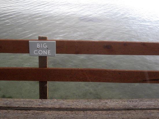
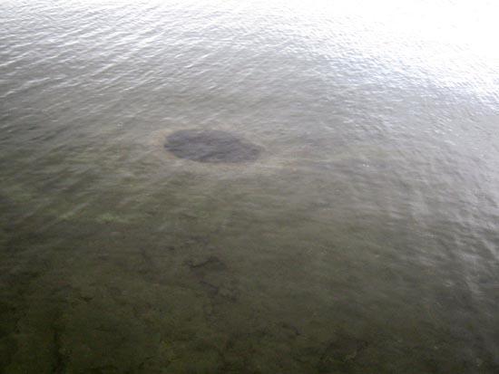
The surface of the lake hints of what exists below. Surveys of the lake bottom in the 1990s documented hot springs and hydrothermal vents just offshore in West Thumb. Look closely?you may see their swirling patterns in the water.
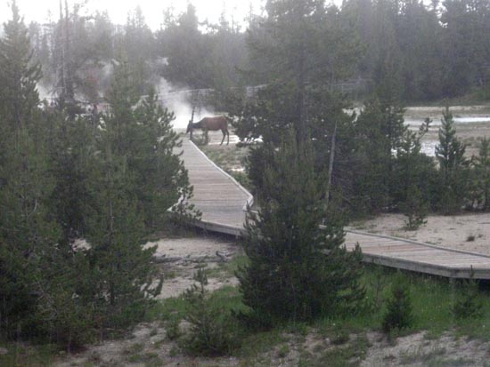
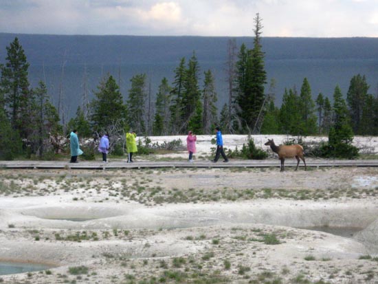
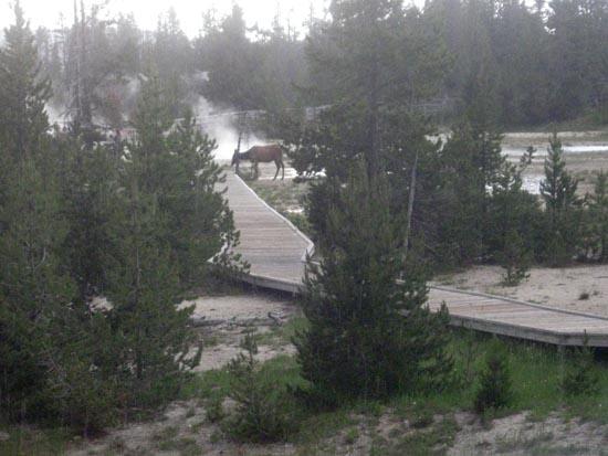
Framed on the east by the Absaroka Range, the lake may be thought of as the heart of Yellowstone. Its waters are the lifeblood for a large network of plant and animal communities. Trumpeter swans and moose thrive on the aquatic growth in shallow waters along the shore. Trout are drawn to zooplankton living in these waters. Cutthroat trout are food for pelicans, otters, eagles, black and grizzly bears, and other wild life. Unfortunately, this population of cutthroat trout is now threatened by non-native lake trout.
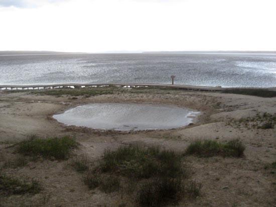
As you walk among the basin's superheated waters, you may wonder if the lake is warmer here than elsewhere. After all, the geyser basin pours an average of 3,100 gallons (11,733 liters) of hot water into the lake every day. But even here, the lake's average summer temperature is 45°F (7°C).
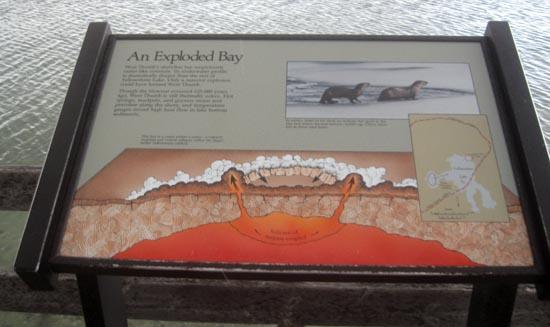
The large circular bay of West Thumb is an excellent example of a volcanic caldera. A powerful volcanic explosion approximately 174,000 years ago caused the earth's crust to collapse, creating the West Thumb caldera. The depression produced by the volcano later filled with water to become this large bay of Yellowstone Lake.

The West Thumb caldera lies within an even greater caldera, the Yellowstone Caldera, which is one of the world's largest and encompasses the central and southern portions of the park. Much of your visit in Yellowstone may be spent within the boundaries of this huge caldera. This larger caldera, and the lava that eventually filled it, shaped much of the present Yellowstone landscape. It resulted from a massive eruption roughly 640,000 years ago. Since that time, numerous lava flows have filled the caldera.
People have long been drawn to West Thumb. Native Americans favored campsites in this area as they hunted bison in the summer. The Crow people gathered medicinal herbs here. Shoshone and Bannock peoples have stories about the formation of the lake. Early scientific expeditions, which corroborated the tales of colorful hot springs mentioned by mountain men, rested here. Visitors in the late 1890s and early 1900s appreciated a refreshing boat ride to Lake Yellowstone Hotel after several dusty days on rutted roads. The rustic log cabin near the parking lot was the original West Thumb Ranger Station built in 1925; it is one of the few such stations remaining. Now it serves as a summer visitor information station and a winter warming hut.
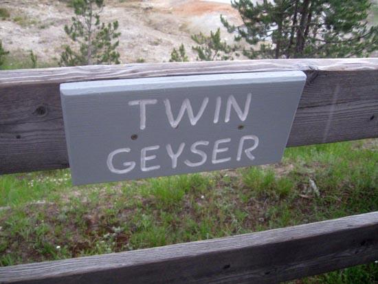
Twin Geysers?one geyser with two vents?has short periods of dramatic eruptions and extended periods of dormancy. Its last known eruption was in 1999. Visitors lucky enough to witness an eruption see a two-part event, with both vents erupting as high as 75 feet (23 m).


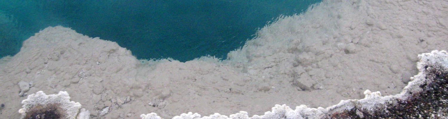
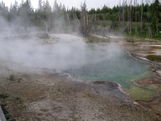
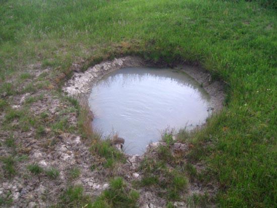
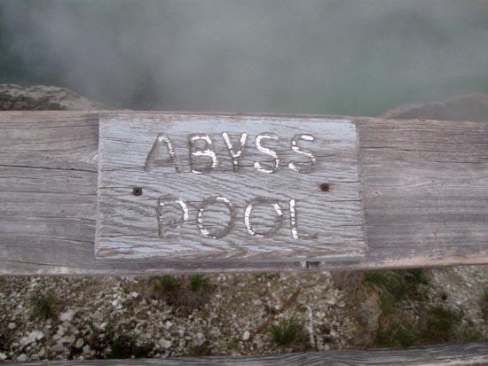
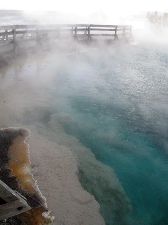
One of the deeper hot springs in the park, Abyss Pool descends to 53 ft (16 m). It varies from turquoise blue to emerald green to various shades of brown. In 1883, a park visitor described it as "a great, pure, sparkling sapphire, rippling with heat."
Abyss Pool erupted for the first time in recent history in August 1987. It remained quiet again until September 1991, when it erupted frequently in spectacular, but short, 100 ft (30 m) bursts. The next active period lasted December 1991 through June 1992, when it erupted several times per day. Each eruption was a series of explosive bursts, sending water 30-80 ft (9-24 m) high and a plume of steam above the treetops. The pool's entire body of water appeared to turn end-over-end in a turbulent boil. Since that time, Abyss has been a quiet, distinctive feature at West Thumb.

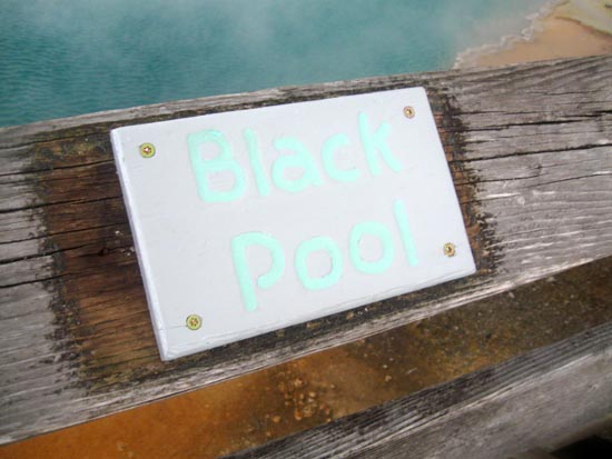
At one time, Black Pool really was black. Lower water temperature allowed thick mats of dark green and brown thermophiles (heat-loving microorganisms) to grow in the pool, causing it to appear black. The water temperature rose during the summer of 1991, killing the organisms. Black Pool also erupted that summer and several times the following winter. Black Pool is now a quiet and beautiful pool.


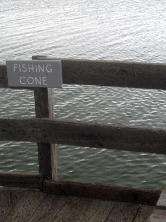
Mountain men told of a geyser along an alpine lake where one could catch a trout, swing the pole around, dip it into the boiling pool, and cook the fish without taking it off the line.
This cooking-on-the-hook feat at Fishing Cone became famous after being described by the 1870 Washburn Expedition. Visitors often dressed in a cook's hat and apron to have their pictures taken at the "Chowder Pot" or the "Fish Pot." Anglers often injured themselves while straddling the boiling water, and their feet damaged the geyser conc. Fishing is no longer allowed from Fishing Cone.
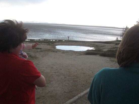
Visitors are sometimes surprised to find Fishing Cone underwater. During the spring and early summer, lake levels rise from melting snow and cover the vent. When exposed, the temperature of the cone's water averages just above boiling (199°F 193°C).

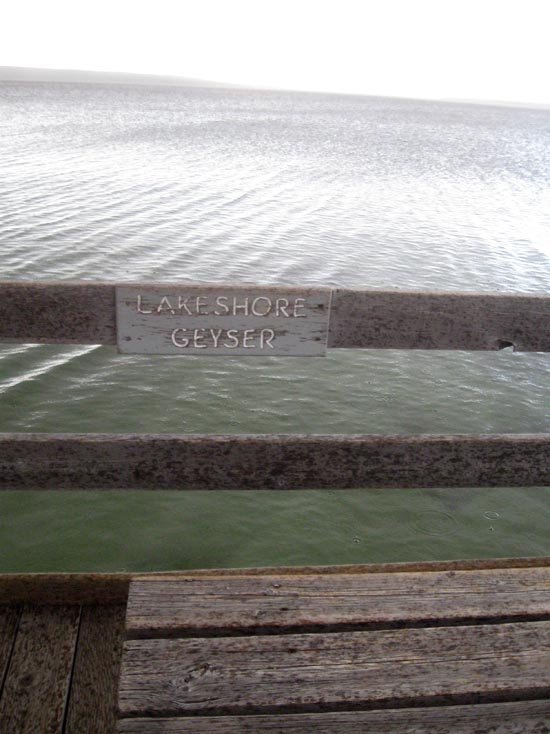
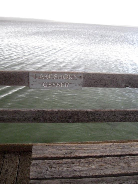
Lakeshore's two vents are underwater in the spring and early summer. Once exposed, the geyser may splash a couple feet. Accounts from the 1920s and 1930s tell of Lakeshore Geyser erupting frequently to 25 ft (7.6 m). Since then, it has been mostly inactive?eruptions haven't been seen since 2003, and those were small. One day, however, earthquake activity or other processes may cause the geyser to gain energy and begin erupting more forcefully again.

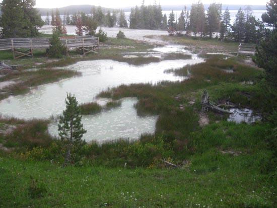
These pools used to be known as the "Blue Pools." After the Hebgen Lake Earthquake of 1959, which measured 7.5 on the Richter scale, the pools were renamed. No one knows why, but perhaps someone thought Seismograph Pool somehow "registered" the earthquake. (A seismograph measures the intensity and time of earthquakes.) These days, Seismograph is sometimes muddy?but not from earthquakes. The mud comes from the runoff of nearby mudpots.
The Hayden Expedition of 1871 originally named these fanciful features the "Mud Puffs." Picture a field of miniature mud volcanoes 3-4 ft (1 m) high with steam curling from delicate mud chimneys in various shades of red. Surrounding the cones, the mud appears to be stirred and mixed to a smooth, satiny consistency by some unseen hand. Sometimes the mud was thrown 25 ft (7.6 m). Beginning in the 1970s, the Paint Pots became less active. Activity has recently increased.

Mudpots differ from other thermal features; their water is much more acidic and dissolves the surrounding rock into wet clay mud. Also, mud pots vary with precipitation and groundwater levels. Sometimes they look like muddy water; other times they look as if you could build pottery with their mud.
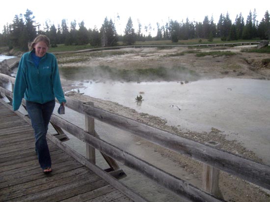
"Dynamic" describes any geyser basin, but particularly the central area at West Thumb where features frequently change.
Surging Spring is true to its name?when it is active. It domes and overflows, sending waves of water surging into the lake. Quiet since 2002, it began overflowing in early 2010.
Named for their appearances, Ledge Spring and Collapsing Pool have both erupted: Ledge in 2004 and 2005, Collapsing Pool in 2001. In early 2010, both overflowed and receded several times, and Ledge roiled several feet. Percolating Spring erupts sometimes, too?most recently in 2005.
Blue Funnel Spring was long known for the distinctive color around its perimeter. But when Abyss Pool began erupting in 1991, the water in Blue Funnel and in adjacent Perforated Pool and Ephedra Spring cooled and sank below the rim. The next year, all four springs were quiet, full pools. In early 2010, though, Blue Funnel, Ephedra, and Perforated pools drained.
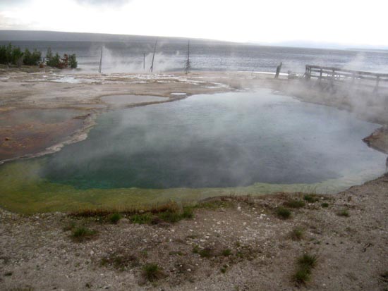
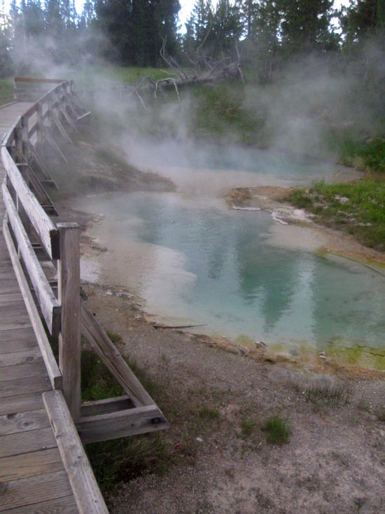
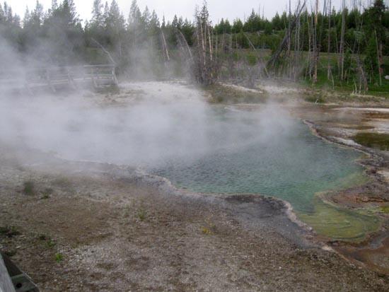
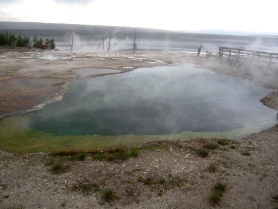
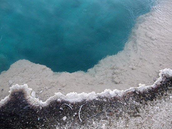
The colors you see in the pools of West Thumb are created, in part, by thermophiles (heat-loving microorganisms). Generally, green and brown indicate organisms living in cooler water, orange and yellow indicate those living in hotter water. Only a few microorganisms thrive in the springs where the temperature is close to boiling, so we see the clear, blue water. In these hot springs, the water absorbs all wavelengths of light except blue, which the pool reflects.
Closest City or Region: Yellowstone National Park, Wyoming
Coordinates: 44.415573, -110.573120
By Jeremy Dye
Jeremy Dye, Tara Dye, Savannah Dye, Greg Dye, Laura Dye, Zac Dye, Bryce Ball,


 Geothermal Features
 No Drinking Water
 Mountains
 Marked Trails
 No Restrooms
 Road Access is Paved
 Access Road is 2WD Accessible
 Interpretive Signs
 Viewpoint, Overlooks, Vistas
 Hiking Trails
 Wildlife and Birding
 Wildflowers and Vegitation
 Lakes and Reservoirs