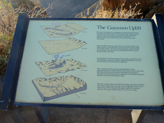
Interpretive Sign - The Gunnison Uplift
Have you noticed that you are standing on a broad, elevated portion of the earth's crust? This is known as the Gunnison uplift. Perhaps it seems strange that the Gunnison River cuts through the heart of this uplift instead of following an easier course north or south of here. To understand thsi, we must think back to when the Gunnison uplift first formed. About 65 million years ago, a large section of hard Precambrian rock, deeply buried by softer sediments, was thrust upward forming a bulge on the earth's surface. This newly formed Gunnison uplift (1) and the Sawatch Range to the east (2) were immediately attacked by erosion. Streams flowed to the north. As the eons passed, the Sawatch Range (3) was greatly eroded. Most of the soft sediments covering the Gunnison uplift were planed off, leaving a broad, flat plain over which streams meandered. Then, repeated volcanic eruptions deposited layers of rock. Mountainous piles of volcanic debris created what we knot as the West Elk Mountains (4) and the San Juan Mountains to the south (5). Drainage was diverted around the south side of hte West Elk Mountains directly across the buried Gunnison uplift. Once the Gunnison River resumed downcutting, it became entrenched and could no longer alter its course, even though later erosion of the softer rocks to the north and south again exposed the Gunnison uplift (6). The result is Black Canyon (7) as we see it today.