Hiking | Hidden Secrets


Hype:
Now you will have a chance to explore the cliffs and grasslands in a part of the park and Fishlake National Forest that we have done a pretty good job of keeping a secret. Try to find the trail's hidden secrets.
Trail Condition: Class 2 (Trail may have tree roots or rocks jutting out. Navigation skills may consist of following rock cairns and choosing turns at junctions. Elevation gains may be more substantial.)
Time: 20-30 minutes
Length: 0.6 miles one way
Elevation Gain: 200 ft
Fees: Entrance fee
Recommended Ages:
 | 0-3 |
 | 4-11 |
 | 12-19 |
 | 20-49 |
 | 50-69 |
 | 70+ |
Recommended Months to Visit:
| Jan |
| Feb |
| Mar |
| Apr |
| May |
| Jun |
| Jul |
| Aug |
| Sep |
| Oct |
| Nov |
| Dec |
Navigate to 38.579266, -112.334137.
There are four ways to gain access to the Hidden Secrets Trail.
Now that you have found the Hidden Secrets Trail, we hope that you enjoy it. The trail is comprised of three loops that are connected together. Continue to go around them until you have seen all of it or want to return to the visitor center. To return, follow any trail that goes south, downhill or toward Clear Creek and it will bring you back.
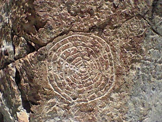
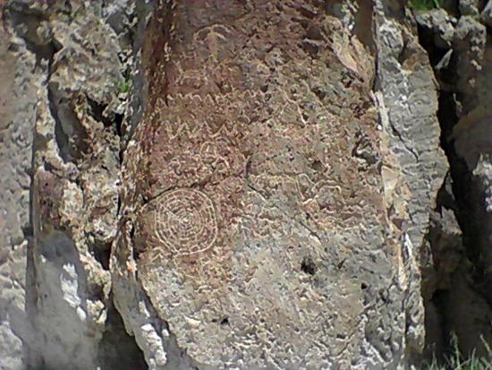
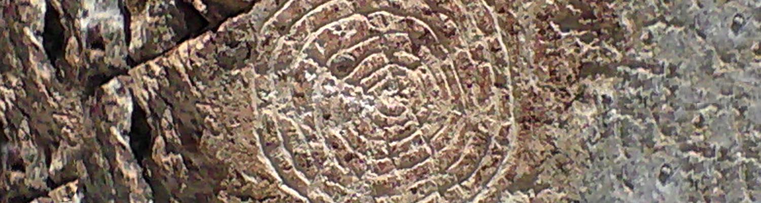
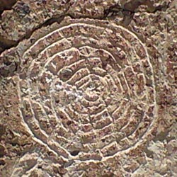
The petroglyph panel located on a prominent south facing cliff is the high point of the Hidden Secrets Trail. This panel is interesting because of the intricacy in which the desert bighorn sheep (and deer) are drawn and the detail of the creation story in which wavy lines separate each world. The shield figure is similar to a Hopi calendar. The thirteen concentric circles show the lunar cycle of months. The lines radiating from the center and then forking are said to divide the year into festival periods. No solar interaction has been observed with this panel.
Geology of Fremont Indian State Park
 Hiking Trails
 No Drinking Water
 Mountains
 Marked Trails
 No Restrooms
 Road Access is Paved
 Access Road is 2WD Accessible
 Wildflowers and Vegitation
 Wildlife and Birding