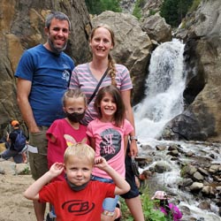


Hype:
Boulder falls is a quick hike with big reward. This 100-yard hiking trail just outside Boulder, Colorado leads you into a cliff lined notch in Boulder Canyon where the creek gushes out to form one of the best waterfalls near Denver.
Trail Condition: Class 0 (Trail is paved. No elevation gain.)
Time: 10-20 minutes
Length: 400 feet one way
Elevation Gain: Negligible
Fees: None
Recommended Ages:
 | 0-3 |
 | 4-11 |
 | 12-19 |
 | 20-49 |
 | 50-69 |
 | 70+ |
Recommended Months to Visit:
| Jan |
| Feb |
| Mar |
| Apr |
| May |
| Jun |
| Jul |
| Aug |
| Sep |
| Oct |
| Nov |
| Dec |
Navigate to 40.004496, -105.405383.
From the trailhead, follow the well-maintained trail 400 feet north to the base of Boulder Falls.
Closest City or Region: Boulder, Colorado
Coordinates: 40.005785, -105.406386
By Jeremy Dye
Jeremy Dye, Tara Dye, Savannah Dye, Madilyn Dye, Cooper Dye, Greg Dye, Laura Dye, Arianne Dye, Miller Dye, Ondylyn Wagner, Jaren Wagner, Killian Wagner,
There was road construction in the canyon, so it took us quite a while to get up to Boulder Falls. When we got there, the area was packed. I don't know if it's always that busy, but there were a ton of people there. We all walked over to the base of Boulder Falls and took some pictures before heading back. It was nice but not spectacular.