

Hype:
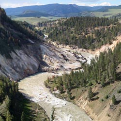
The Yellowstone River overlook is a short interpretive trail overlooking the Yellowstone River. Along the trail are signs describing Calcite Springs and Columnar Basalt formations.
Trail Condition: Class 1 (Trail is either paved or gravel. Navigation skills are not needed because there is only one trail or because there are signs. Elevation gains are gradual or there are stairs.)
Time: 10 minutes
Length: 0.2 miles round trip
Fees: Entrance fee
Recommended Ages:
 | 0-3 |
 | 4-11 |
 | 12-19 |
 | 20-49 |
 | 50-69 |
 | 70+ |
Recommended Months to Visit:
| Jan |
| Feb |
| Mar |
| Apr |
| May |
| Jun |
| Jul |
| Aug |
| Sep |
| Oct |
| Nov |
| Dec |
Navigate to 44.901852, -110.393097.
Yellowstone River Overlook, also called Calcite Springs Overlook Trail, is a short, easy loop walk that leads to a platform overlooking the Yellowstone River. Layers of basalt columns and thermal springs along the river's edge are also visible. The area was named by USGS geologist Arnold Hague in 1885, but the name was based on previous usage. The constriction in the river is called "The Narrows." Early explorers discovered the sulphur to be "pure enough to burn readily when ignited." Research conducted during the 1930s found the springs to have the highest percentage of hydrogen sulfide gas as well as deposits of calcite and gypsum. Calcite Springs is the lowest elevation of any hot area in the park.
The east wall of the Grand Canyon, facing the overlook, is a cross-section of layers of glacial drift resting on lake deposits and columnar basalt. The pentagonal columns of basalt are caused by cooling, shrinking and cracking of several basaltic flows.

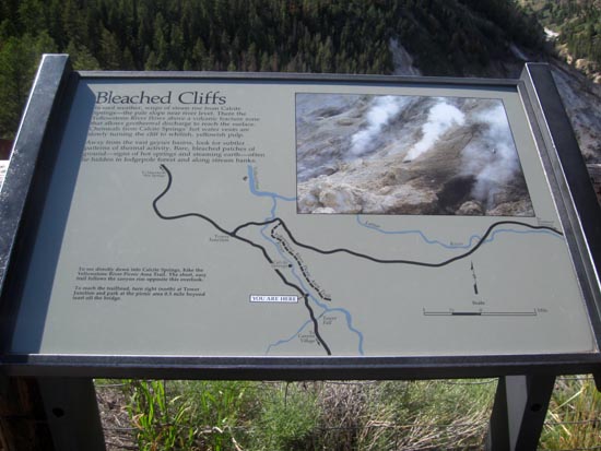
In cool weather, wisps of steam rise from Calcite Springs?the pale slope near river level. There the Yellowstone River flows above a volcanic fracture zone that allows geothermal discharge to reach the surface. Chemicals from Calcite Springs? hot water vents are slowly turning the cliff to whitish, yellowish pulp.
Away from the vast geyser basins, look for subtler patterns of thermal activity. Bare, bleached patches of ground?signs of hot springs and steaming earth?often lie hidden in lodgepole forest and along stream banks.

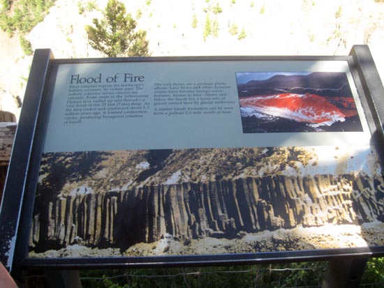
River canyons expose the landscape?s hidden excesses, its violent past. The orderly columns across canyon are volcanic. From vents in the Yellowstone Plateau lava welled up and flowed?a vast flood of fire 25 feet deep. As the lava cooled and contracted about 1.3 million years ago, it formed contraction cracks, producing hexagonal columns of basalt.
The rock layers are a geologic photo album. Lava flows and other dynamic events have become benign scenic features, frozen in time. Above and below the basalt lies a loose mix of gravel carried here by glacial meltwater.
A similar basalt formation can be seen from a pullout 0.5 miles south of here.
Closest City or Region: Yellowstone National Park, Wyoming
Coordinates: 44.901852, -110.393097
By Jeremy Dye
Jeremy Dye, Tara Dye, Savannah Dye, Greg Dye, Laura Dye, Zac Dye, Bryce Ball,
By Jeremy Dye
Greg Dye, Laura Dye, Jeremy Dye, Anthony Dye, Ondylyn Wagner, Zac Dye, ,
We went to Yellowstone as a family. We drove the loop and stopped at most of the overlooks and short hikes.
Brink of the Lower Falls Trail