 Hiking | West Mountain Petroglyph Trail


Hype:
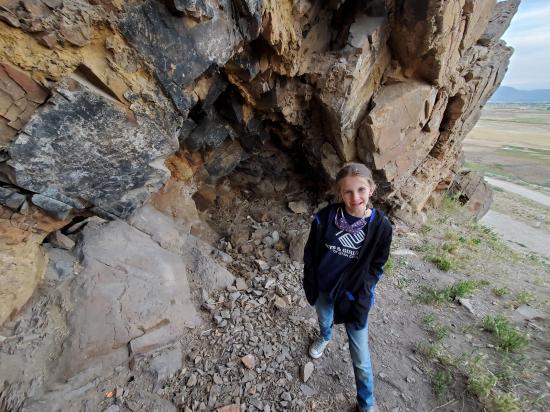
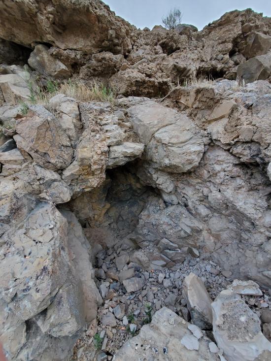
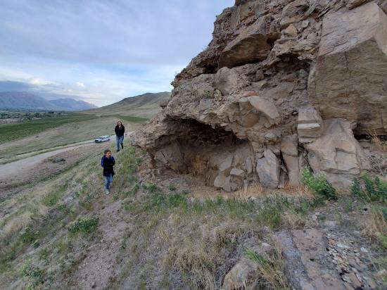
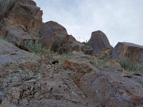
This short trail takes hikers past several petroglyph panels and a couple small alcoves and caves. The trail is not maintained or marked.
Trail Condition: Class 3 (Trail may have sections where hands are needed. Trail may not be visible in spots or may not exist at all.)
Time: 15 minutes
Length: 0.25 miles round trip
Elevation Gain: 50 ft
Fees: None
Recommended Ages:
 | 0-3 |
 | 4-11 |
 | 12-19 |
 | 20-49 |
 | 50-69 |
 | 70+ |
Recommended Months to Visit:
| Jan |
| Feb |
| Mar |
| Apr |
| May |
| Jun |
| Jul |
| Aug |
| Sep |
| Oct |
| Nov |
| Dec |
Navigate to 40.128859, -111.810615.
Park on the shoulder of the road near the fork in the road.
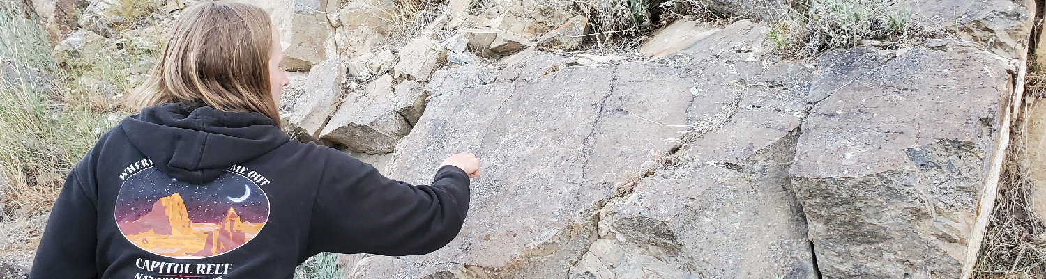
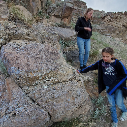
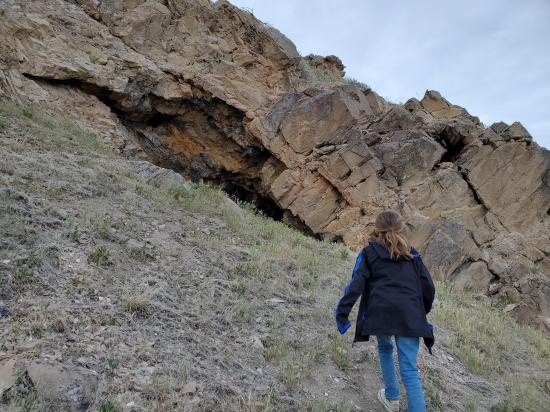
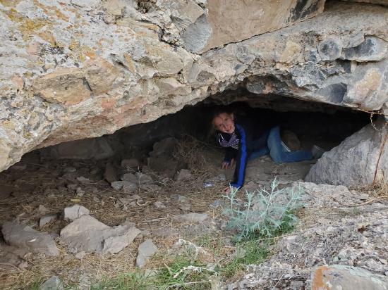
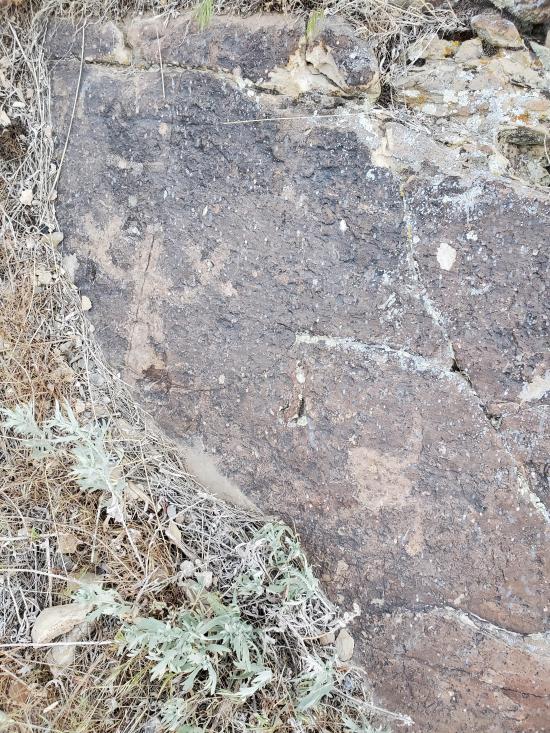
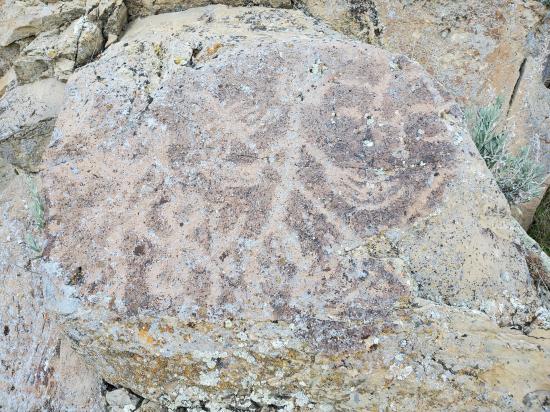
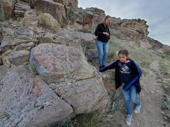
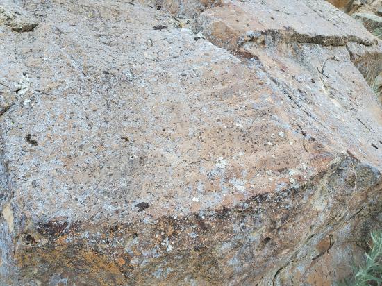
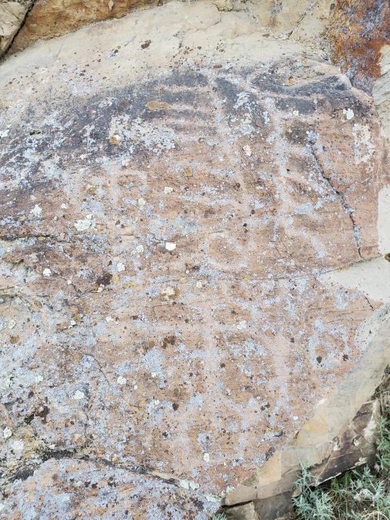
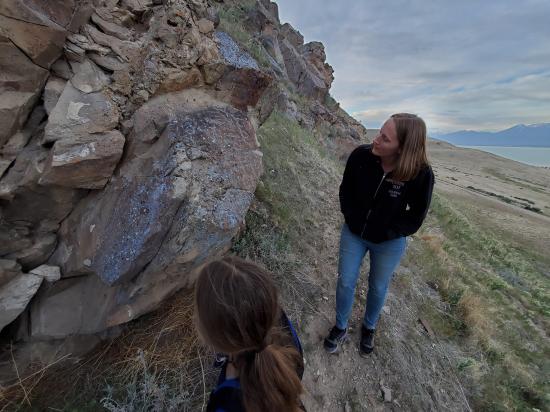
From the road, head north up the social trail that leads to a very visible rock shelter. Continue along the base of the cliff band. The petroglyphs are hard to find at first because they are faint and covered with lichen. Once you get to the north end of the cliffs, the trail switches back. Climb up the hill to a fun tunnel cave. Return the way you came.
Closest City or Region: West Mountain, Utah
Coordinates: 40.129516, -111.810546
By Jeremy Dye
Jeremy Dye, Tara Dye, Savannah Dye,
For family night, we grabbed some fast food and headed over to West Mountain and explored around a bit.
We stopped at the Cave of the Chocolate Drop first. Everyone but Tara dropped into the entrance pit, but only Savannah could fit down the crack in the floor. She wriggled down a ways until she got to a dropoff that was too big for her to safely climb down on her own then she came back up. We were amazed by how much air was blowing through the cave and by how hot and humid it was.
After the cave, we walked down the hill to a prospect. The prospect doesn't have a name as far as we know, but it shows up on the USGS topo maps. We found some cool crystals on the wall of the mine, so after we took some pictures inside the prospect, we dug around in the tailing pile for a while. We found a bunch of small crystals and geodes and had fun rockhounding a bit. Immediately to the side of the tailing pile, we found a bunch of limestone rocks with a high concentration of fossils in them, so that was exciting too.
Next we drove up to the peak of West Mountain and looked out over the valley. It was windy and starting to get chilly, so we didn't stay too long.
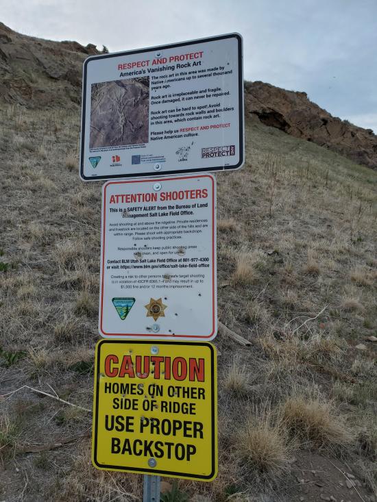
On the way back down the mountain, we saw a small cave on the side of the hill next to a shooting range, so we stopped to explore it. There was a sign about protecting rock art, so we explored around a bit and found several petroglyphs on the boulders and several more small saves or alcoves.


 Petroglyphs and Pictographs
 Caves
Caves Hiking Trails
 No Drinking Water
 Mountains
 Wayfinding
 No Restrooms
 Road Access is Dirt - Low Clearance
 Access Road is 2WD Accessible


