 Hiking | Halls Creek Narrows


Hype:
This multi-day backpacking trip takes hikers from the east rim, down a steep cut in the cliffs, down Halls Creek drainage, and through a deep, winding, narrow canyon known as Halls Creek Narrows.
Trail Condition: Class 2 (Trail may have tree roots or rocks jutting out. Navigation skills may consist of following rock cairns and choosing turns at junctions. Elevation gains may be more substantial.)
Time: 2-3 days
Length: 22 miles round trip from Halls Creek Overlook. 14 miles round trip from Airstrip trailhead.
Elevation Gain: 1,500 ft
Fees: Park Entrance
Recommended Ages:
 | 0-3 |
 | 4-11 |
 | 12-19 |
 | 20-49 |
 | 50-69 |
 | 70+ |
Recommended Months to Visit:
| Jan |
| Feb |
| Mar |
| Apr |
| May |
| Jun |
| Jul |
| Aug |
| Sep |
| Oct |
| Nov |
| Dec |
Links: https://www.nps.gov/care/planyourvisit/hallscreek.htm
Navigate to 37.677415, -110.914993.
Backpack in from the airstrip trailhead or Halls Creek Overlook.
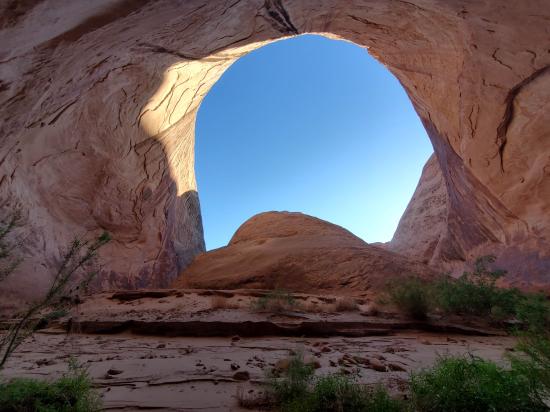
The hike begins at Halls Creek Overlook. From this spectacular viewpoint, a steep trail marked with rock cairns descends 800 feet over 1.2 miles to the Halls Creek drainage. Pay attention to landmarks as no signs mark the point where this route climbs out of the canyon; it would be easy to walk past the route on your return trip. The remainder of the route is largely unmarked, but it is simply a matter of walking down canyon (south) to the narrows. An old wagon trail followed this same route and is still visible in many places. Cutting across many of the wide meanders in the wash, it provides a convenient path for much of the route to the narrows.
Alternativey, you can begin at the airstrip trailhead. This cuts off approximately 4 miles each way of less-exciting hiking.
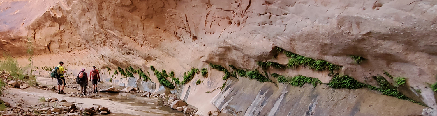
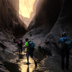
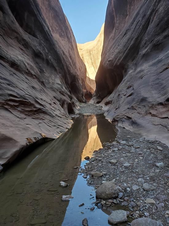
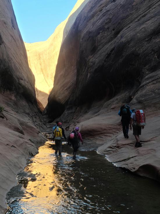
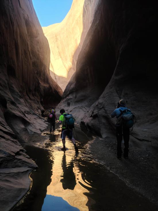
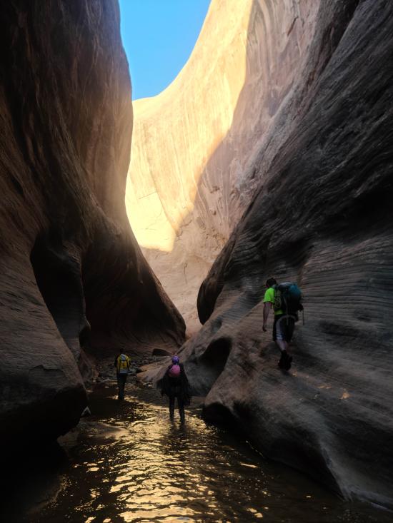
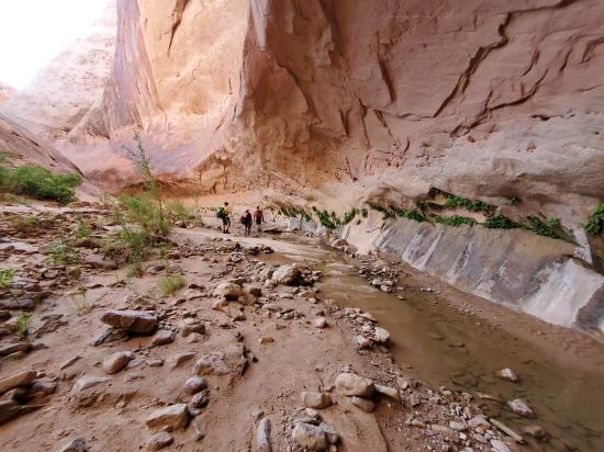
At the narrows, Halls Creek abandons its logical path down the wide canyon separating the Waterpocket Fold and Halls Mesa and cuts into the Navajo sandstone on the west side of the canyon. The change is sudden and dramatic. A large grove of cottonwood trees is located near the entrance to the narrows. For the next 3.8 miles, the creek meanders through a deep, narrow canyon that always requires some walking in water. The depth of the pools can vary greatly from year to year and from season to season. Flash floods periodically scour out the sediment, leaving pools that may require deep wading or short swims.
If you choose not to enter the narrows and want to continue south in the main drainage, or if you want to bypass the narrows on your return trip, follow the route over Hall Divide which blocks the main canyon just beyond (south of) the entrance to the narrows. The easiest way to negotiate the 1.7 mile Hall Divide is to look for the old wagon route and follow it over this obstacle. The hike across Hall Divide can be hot and shade-less; make sure you have adequate water. An alternative is to hike over Hall Divide first, during the cooler part of the day, and return via the narrows. To return to the trailhead, simply retrace the route back up the canyon to Halls Creek Overlook.
Closest City or Region: Capitol Reef National Park, Utah
Coordinates: 37.621945, -110.893619
By Jeremy Dye
Jeremy Dye, Luke Galyan, Tracy Kwan, Adam Anderson, Tom Collins, Erik Burnhoft, Ryan Hone, Matthew Hickenlooper, Wayne Herrick,
Halls Creek Alcove Primitive Camping
Camping at Halls Creek and Millers Creek Confluence
Halls Creek Alcove Primitive Camping
Baboon Laughs Canyon (aka Laughing Baboon Canyon)
Poe Canyon (aka Smiling Cricket Canyon)
 Hiking Trails
 Non-potable Water - filterable
 Rivers and Streams
 Slot Canyon
 Marked Trails
 No Restrooms
 Road Access is Dirt - High Clearance
 Access Road is 2WD Accessible
 Wildflowers and Vegitation
 Wildlife and Birding
