 Hiking | Wrather Arch


Hype:
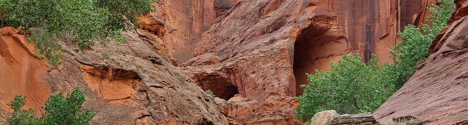
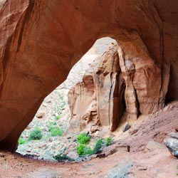
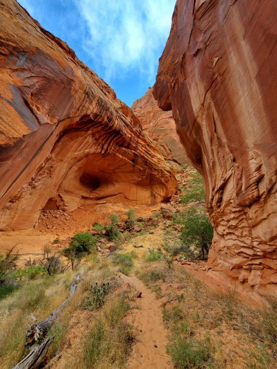
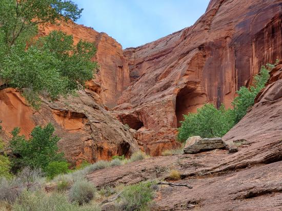
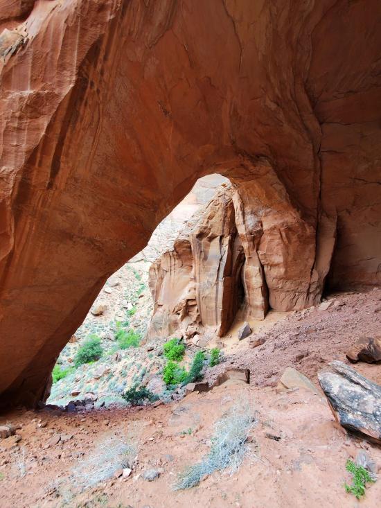
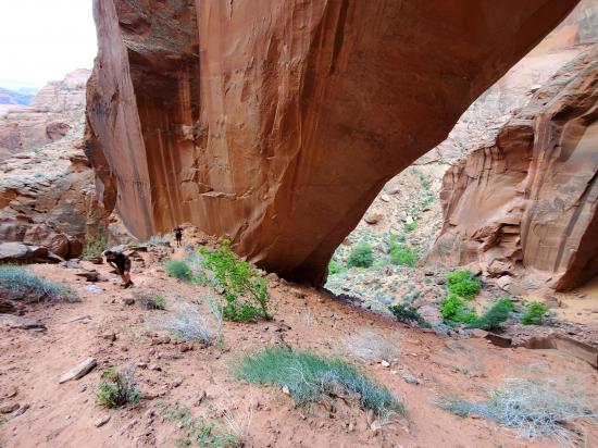
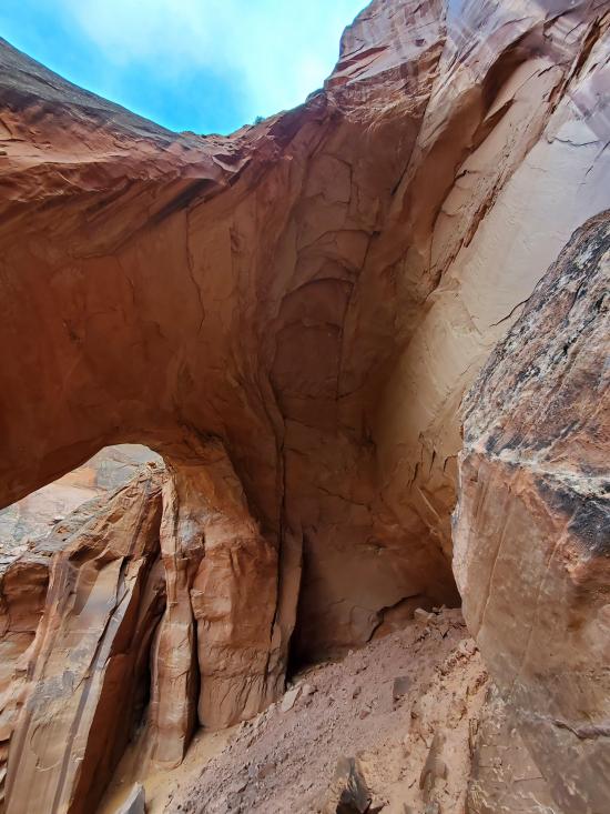
Wrather Arch is a cave type natural arch in the Paria Canyon-Vermilion Cliffs Wilderness. The sandstone arch is located in the eponymous Wrather Canyon, a short side canyon of Paria Canyon. Wrather Arch was once thought to be the longest natural arch span outside of the state of Utah, originally reported to be 246 feet in span. The recent discovery of longer arches in China, Afghanistan, and Chad; and a shortening of its estimated length by the Natural Arch and Bridge Society, have taken Wrather Arch off their "largest arches over 200 feet in span list." Recent NABS assessments estimate the span has an approximate length of 180 feet. Wrather Arch is distinguished as being the least accessible among the major natural bridges in the Southwestern United States. It is located in the heart of the Paria Canyon-Vermilion Cliffs Wilderness area and can only be accessed by the Paria Canyon Trail. Being located near the midway point of the hiking trail, visitors must walk around 18 miles to reach and see Wrather Arch. Permits for the hike are required from the BLM office in Kanab, Utah.
Trail Condition: Class 3 (Trail may have sections where hands are needed. Trail may not be visible in spots or may not exist at all.)
Time: 1-1.5 hours
Length: 1.5 miles round trip in addition to Paria Canyon hike of 38+ miles
Elevation Gain: 600 ft
Fees: Overnight permit fee for Paria Canyon
Recommended Ages:
 | 0-3 |
 | 4-11 |
 | 12-19 |
 | 20-49 |
 | 50-69 |
 | 70+ |
Recommended Months to Visit:
| Jan |
| Feb |
| Mar |
| Apr |
| May |
| Jun |
| Jul |
| Aug |
| Sep |
| Oct |
| Nov |
| Dec |
Links: https://en.wikipedia.org/wiki/Wrather_Archhttp://www.naturalarches.org/big9-5.htm
Navigate to 36.969246, -111.770873.
Wrather Arch is located along the Paria Canyon trail. To reach the start of the hike to Wrather Arch, you'll have to backpack at least 18 miles from one of the Paria Canyon or Buckskin Gulch trailheads.
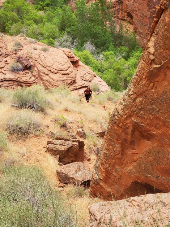
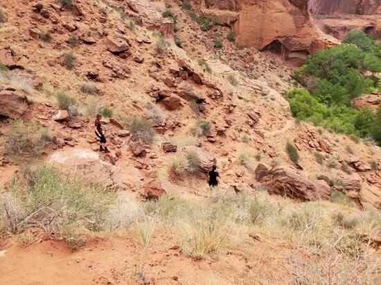
From the Paria River, hike up the drainage to the south. Follow the drainage up as far as you can. The trail leaves the drainage in a few spots to go around dense vegitation or other obstacles. There are numerous social trails that weave in and out of each other. Stay on the most traveled trail. As you approach Wrather Arch, the trail gets steep and sandy. Cut up the hill early to avoid difficult scrambling. The trail ends at the upper end of Wrather Arch.
Return the way you came.
Closest City or Region: Vermilion Cliffs National Monument, Arizona
Coordinates: 36.964294, -111.779682
By Jeremy Dye
Jeremy Dye, Tara Dye, Ondylyn Wagner,
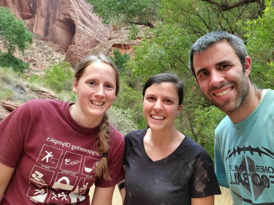
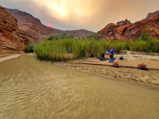
Near the end of our second day through Buckskin Gulch and Paria Canyon, we took a short side hike up to Wrather Arch. Shawn, Marci, and Becca rested by the river while Tara, Ondy, and I hiked up to the arch. We weren't really sure how long it would take or exactly where the trail was, but we had a waypoint for the arch, so we figured we'd be OK. It was actually quite easy to find because there was a very obvious trail the whole way up. We hiked up very quickly and were very out of breath because the trail was so steep in spots. We admired the arch then hiked back down. We forgot to get a group picture of the side hike until we were most of the way back to the river. Considering how prominent the arch is and how you're already 90% of the way to the arch by the time you've hiked that far down Paria Canyon, I think Wrather Arch should be a priority for every group that hikes Paria Canyon.
Buckskin Gulch and Paria Canyon from Wire Pass to Lees Ferry
Stud Horse Point Primitive Camping
Vermilion Cliffs National Monument
Buckskin Gulch and Paria Canyon from Wire Pass to Lees Ferry
Lee's Ferry Historic District River Trail
 Arches
 No Drinking Water
 Wayfinding
 No Restrooms
 Viewpoint, Overlooks, Vistas
 Hiking Trails
 Wildflowers and Vegitation
 Wildlife and Birding