 Fun Places | Mesa Top Loop Drive


Hype:
Stops along the six-mile Mesa Top Loop Drive reveal the full range of architecture at Mesa Verde, from the earliest pithouses to the latest cliff dwelling. Here you can see a progression of the homes and religious structures of the Ancestral Puebloans, ho lived here for more than size centuries, from around A.D. 600 until about 1300. Ten excavated sites and a number of cliff dwellings are visible. Parking areas exist on both sides of this mostly one-way route, with sites beside the road or within a short walk.
Time:
Fees: Entrace
Recommended Ages:
 | 0-3 |
 | 4-11 |
 | 12-19 |
 | 20-49 |
 | 50-69 |
 | 70+ |
Recommended Months to Visit:
| Jan |
| Feb |
| Mar |
| Apr |
| May |
| Jun |
| Jul |
| Aug |
| Sep |
| Oct |
| Nov |
| Dec |
Navigate to 37.174549, -108.485485.
Stops along the six-mile Mesa Top Loop Drive reveal the full range of architecture at Mesa Verde, from the earliest pithouses to the latest cliff dwelling. Here you can see a progression of the homes and religious structures of the Ancestral Puebloans, ho lived here for more than size centuries, from around A.D. 600 until about 1300. Ten excavated sites and a number of cliff dwellings are visible. Parking areas exist on both sides of this mostly one-way route, with sites beside the road or within a short walk.
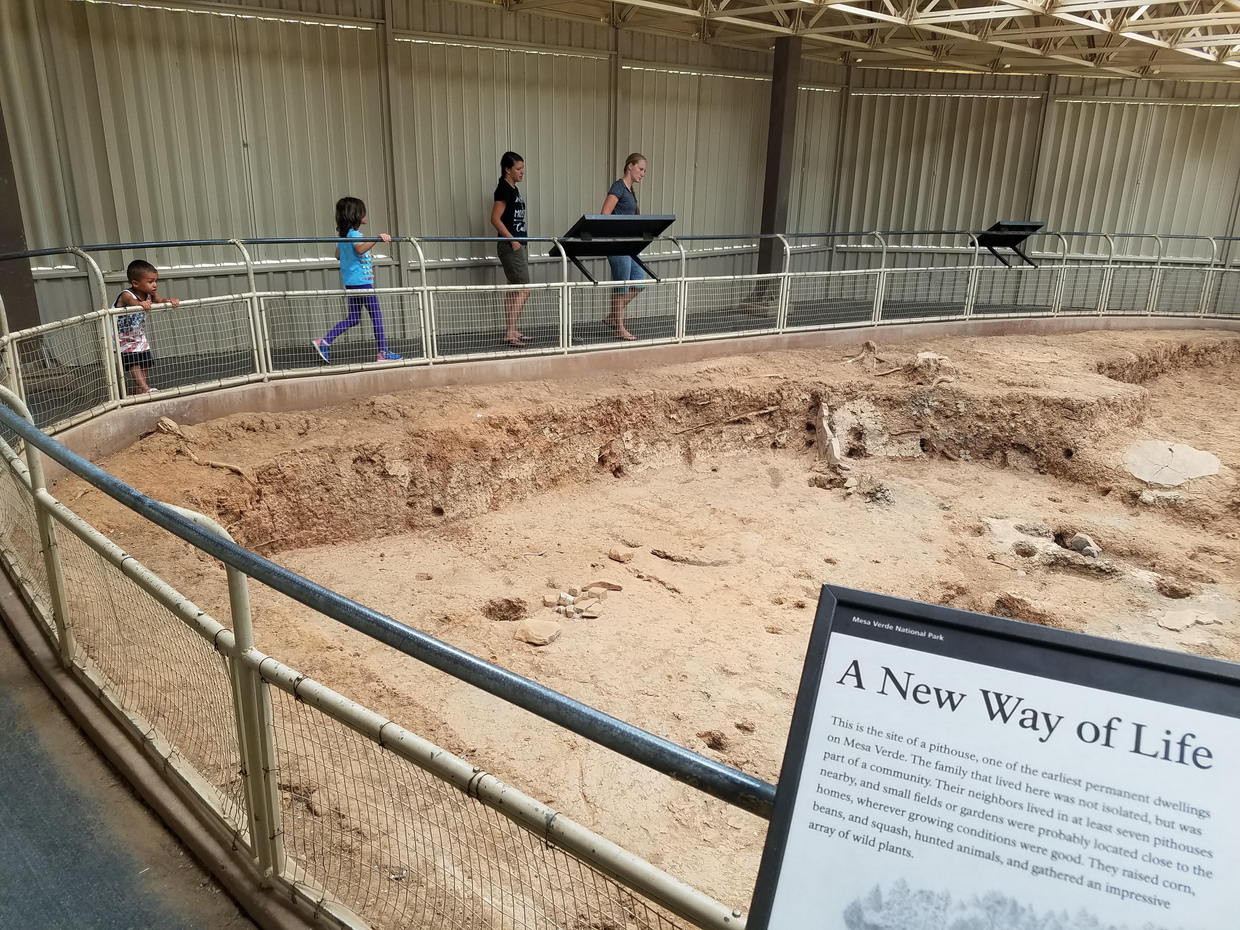
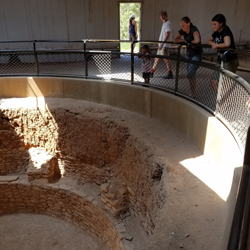
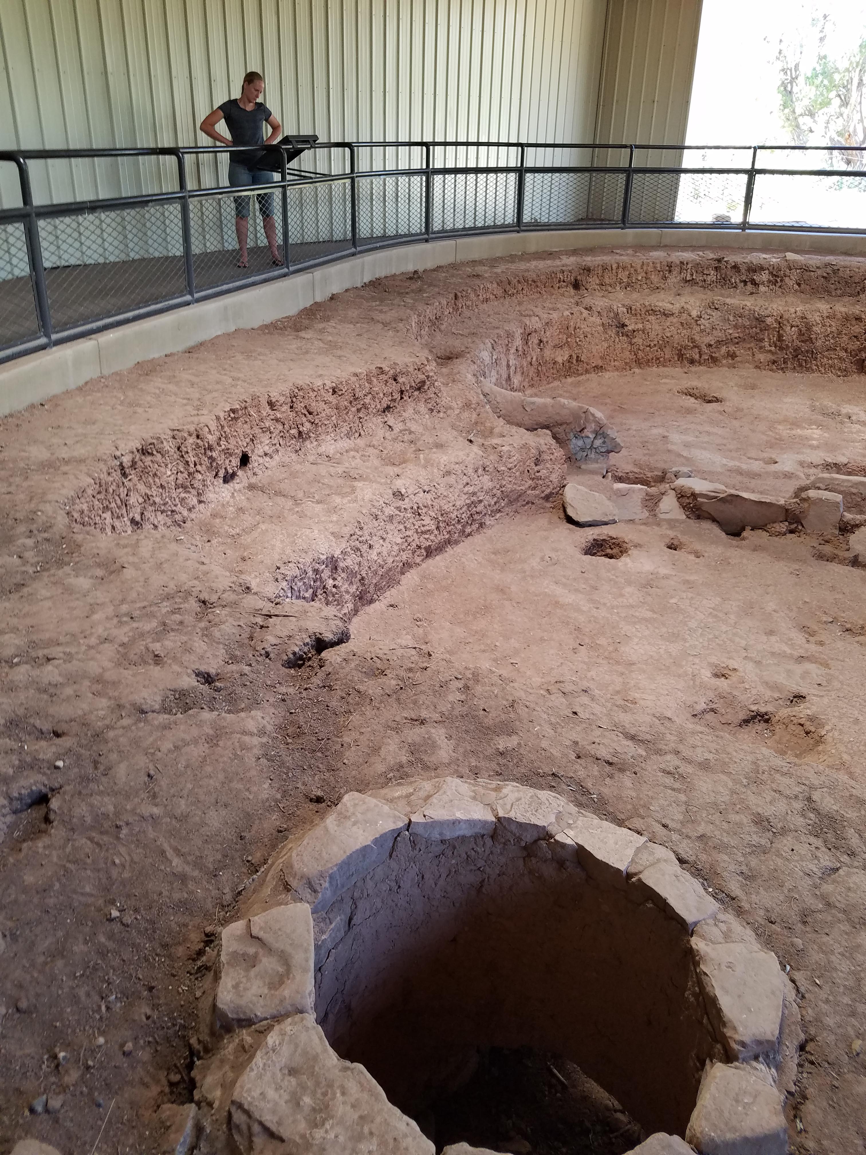
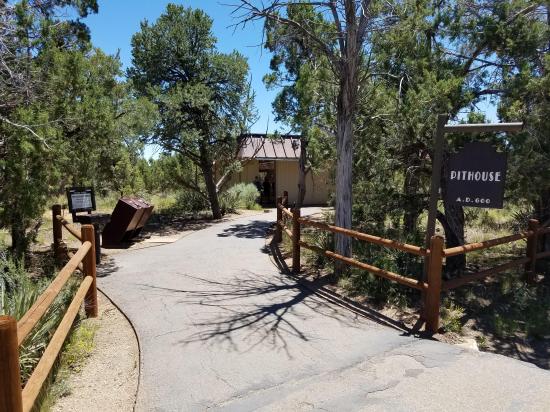
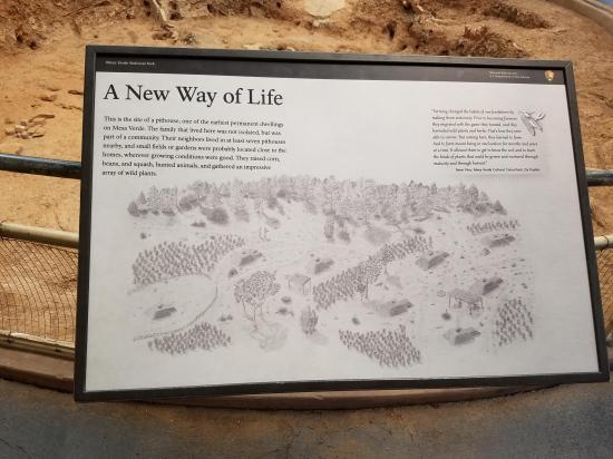
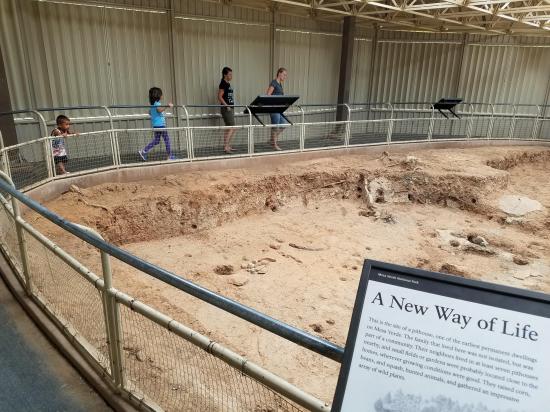
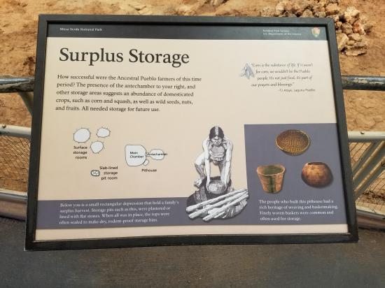
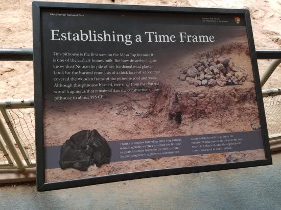
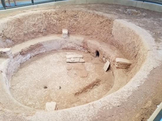
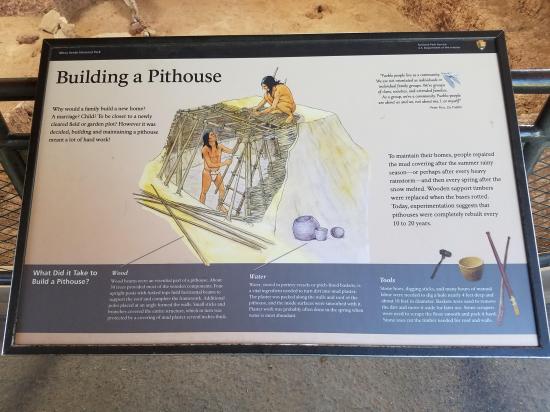
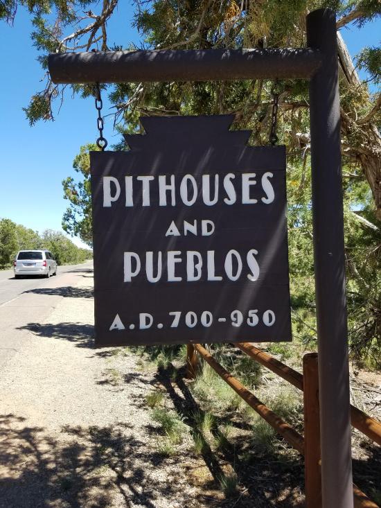
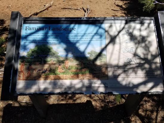
For thousands of years, people were living in the surrounding area before they came to Mesa Verde itself. Here, earliest evidence of their presence dates to about A.D. 550 to 500. As people did all over the Southwest, the Ancestral Puebloans built modest dwellings – shallow pits dug into the ground, covered with pole and mud roofs and walls, with entrances through the roofs.
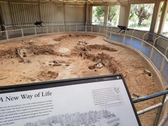
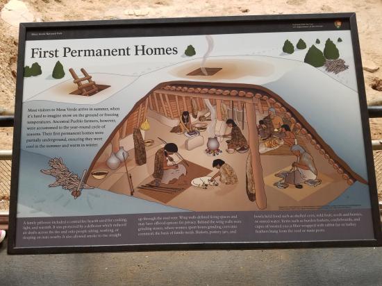
The pithouse at this site, one of the best preserved anywhere, shows features common to nearly all these houses. The larger space was the living room. In the center is a firepit, where the people did their cooking. Although many other things changed over time, a hearth remained a constant feature in their homes. A stone slab was placed in front of the firepit to keep the air circulating – both deflecting cool drafts and drawing smoke up and out.
Adjoining this larger space is a smaller room, called an antechamber, where food and firewood were stored.
Consider what life was like in the dim confines of a pithouse, where an extended family – parents, children, and grandparents – slept on the floor on twill mats and tried to keep warm on long winter nights on this high plateau. Though digging a large pit into the ground with a stick was labor-intensive work, pithouses were generally warmer than alcoves, and provided snug shelter out of the elements.
The idea of settling down in a permanent home caught on, and hundreds of pithouses were built on the mesa top during the next couple of centuries.
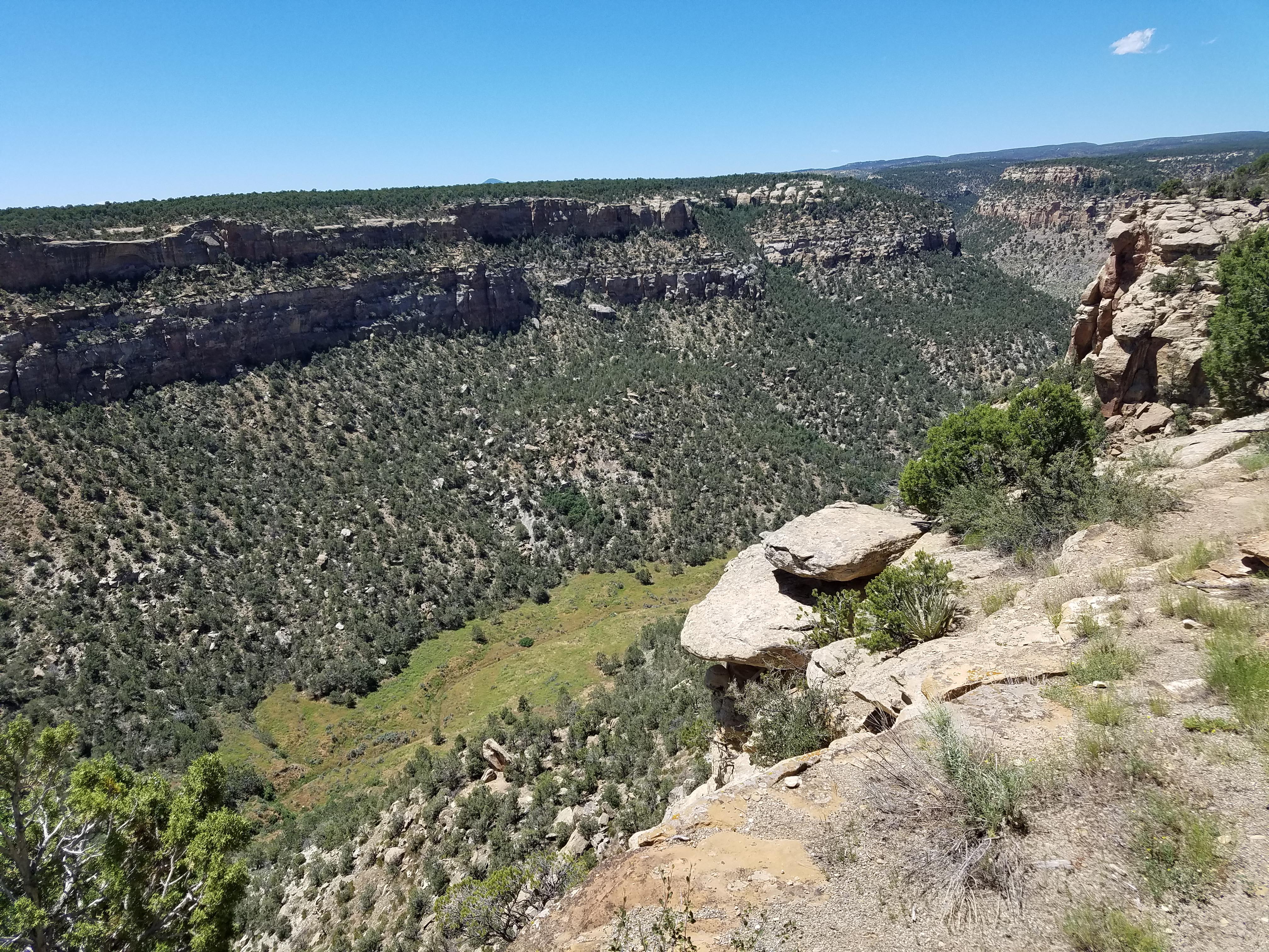
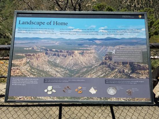
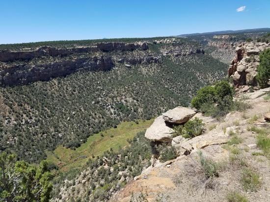
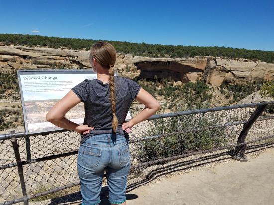
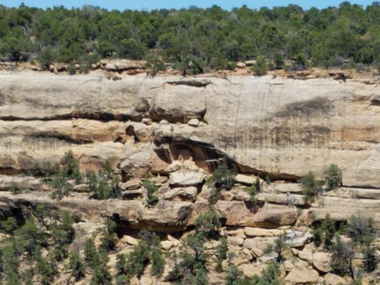
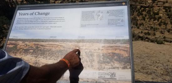
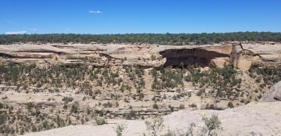
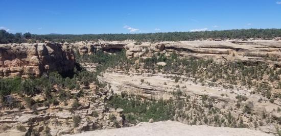
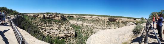
This expansive viewpoint gives a good idea of the lay of the land. Once a continuous landmass, the Mesa Verde has been cut into a series of several smaller mesas that reach like long fingers to the south. Deep, sandstone-walled canyons such as Navajo Canyon have incised northward, isolating each smaller mesa. All the canyons drain to the south in the Mancos River.
The high mesas average around 7,000 feet in elevation and receive about 18 inches of precipitation a year. This moisture, in the form of rain and snow, feeds springs at the heads of many of the canyons and supports a dense forest of pinyon and juniper. This forest gave Mesa Verde its Spanish name, which means “green table”.
On the southern horizon on a clear day, you can see the Chuskas and Lukachukais, mountains in northeast Arizona.
Today the land is silent, save for the wind rustling the trees and the song of a canyon wren. But for the early people of Mesa Verde, the land was everything. It provided water; soil for crops; plants and animals for food; stone and wood for houses and tools; clay for pottery; and fiver for clothing and baskets. The land was also significant because topography determined where and how people moved and communicated.

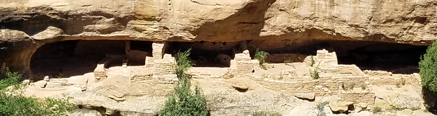
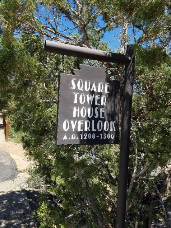
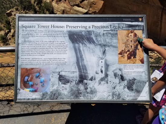
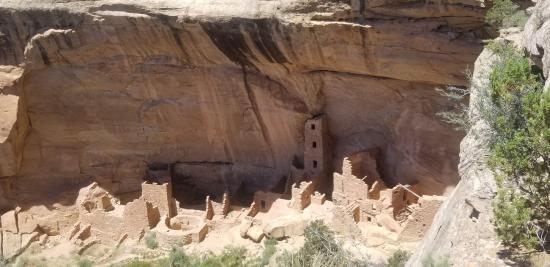
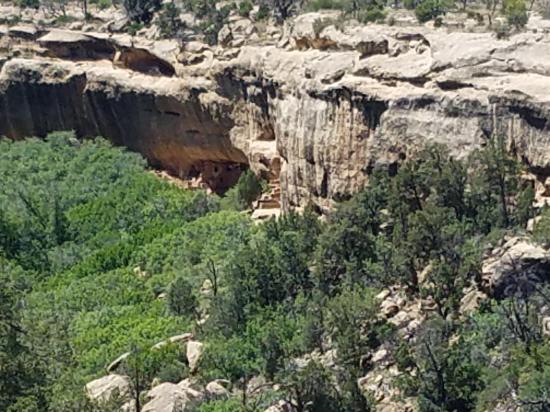
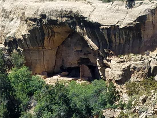
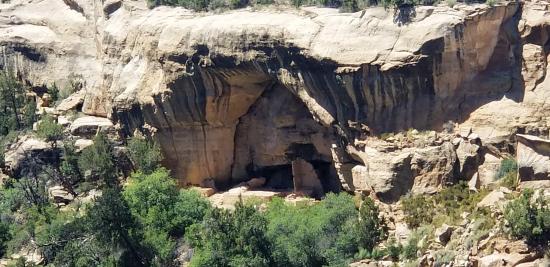
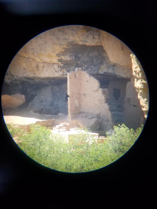
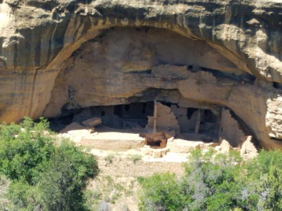
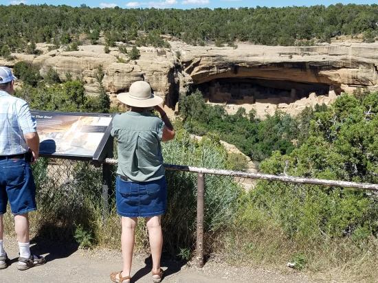
A gentle 500-foot-long trail leads to a close view of Square Tower House, a beautiful cliff dwelling built in an alcove in the upper walls of Navajo Canyon.
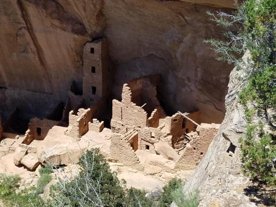
The name comes from the striking four-story-high structure still standing against the curving back wall of the alcove. This was not like the free-standing round towers found elsewhere at Mesa Verde, but part of the overall plan of Square Tower House. The “tower” had windows, doorways, and flooring, and the inner walls had been plastered. In other rooms were found an almost perfect reed mat, a pottery rest, some feathered cloth, and a humanlike figurine.
About 60 of the original 80 rooms of Square Tower House remain. A spring below the alcove provided water for the residents. They went to and from the dwelling by way of hand-and-toe holds pecked into the cliff walls.
As with all the cliff dwellings, Square Tower House represents the final phase of building at Mesa Verde. People lived here between A.D. 1200 and 1300, but there may be signs of much earlier habitation in pithouses under this alcove.
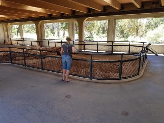
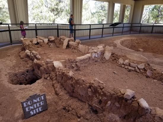
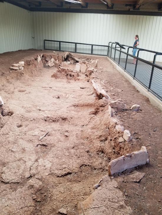
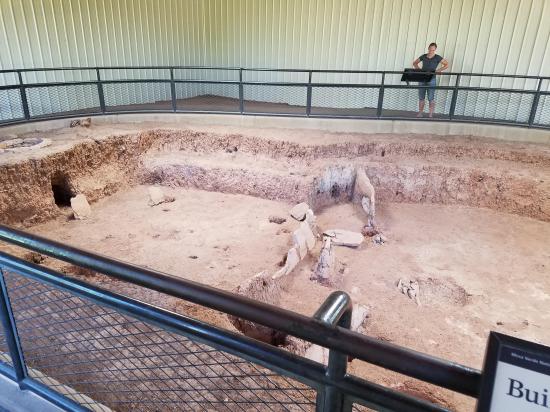
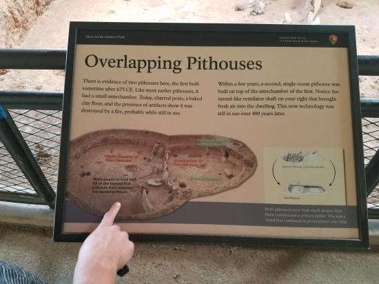
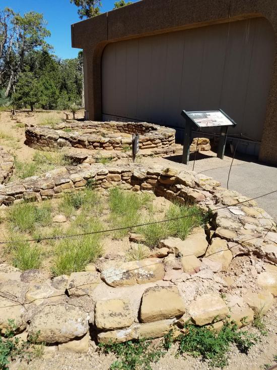
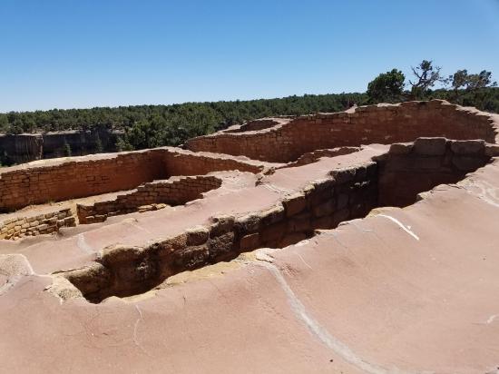
This site shows two significant architectural developments: the trend toward deeper pithouses, and the move from pithouses to aboveground dwellings.
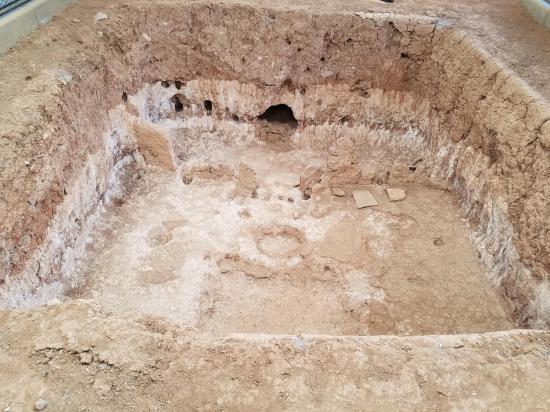
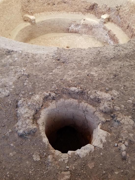
What appears here to be one pithouse is actually two. The larger one was built first, around A.D. 700, but was destroyed in a fire. The smaller one, which looks like an antechamber to the larger room, is in fact a second pithouse built soon after the first one burned. It contains a new feature, a vertical ventilator shaft in on the side, which appears in pithouses from then on.
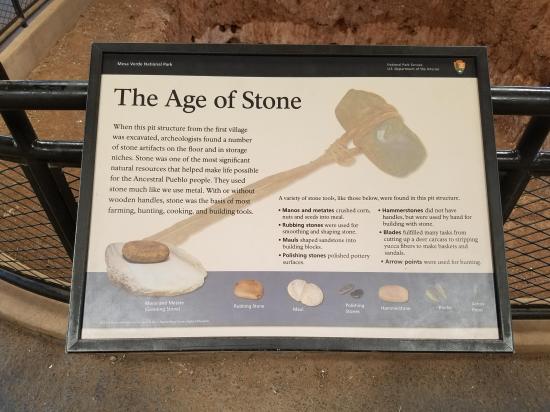
Inside these pithouses, archeologists found things that provide insight into the life of the Ancestral Puebloans. Most basic of tools was a stone mano held in the hand, used to grind seeds and corn on a large flat rock called a metate. Also unearthed were deer bone awls and turkey bones, more than a thousand pottery sherds, a charred piece of someone’s prizes woven cloth sandal, and a bowl filled with tiny seeds.
Both pithouses are D-shaped and dug about four feet down. Deepening of pithouses was a step along the way to a major transformation in the pueblo world – some pithouses would become special rooms when ceremonies were likely held.
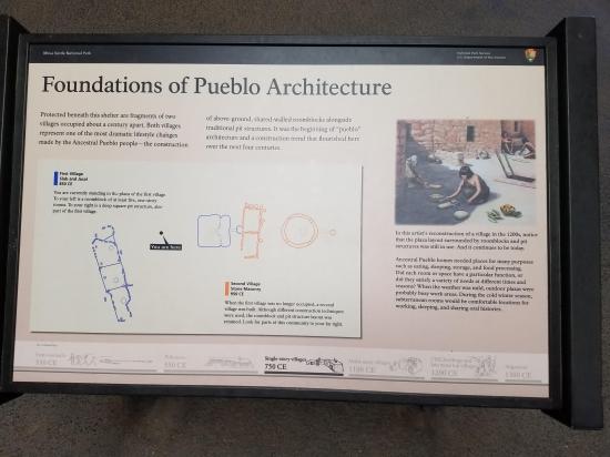
A short distance away are the aboveground dwellings. The earliest were a series of rooms, joined in a crescent shape. From a foundation of shallow slab-lined pits, the walls of these rooms were built up of a lattice of wooden poles plastered over with mud. This village dates to about A.D. 850. The deep pithouse was also part of this slab-lined village.
Beside the pithouse are the low rock walls of two aboveground rooms, part of a small village dating to around A.D. 950. Beyond the two rooms is another deep pit that is assumed to be a kiva because of its similarity to structures in modern pueblos, places where seasonal ceremonies are held.
The simple assemblage of two rooms and kiva, with common space between marks the beginning of the “unit” pueblo. Later, large pueblo dwellings were composed of a series of these basic units.
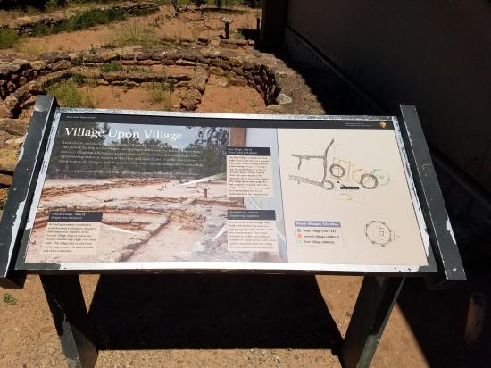
Here amid the sagebrush the Ancestral Puebloans repeatedly chose to build and rebuild their homes over several hundred years.
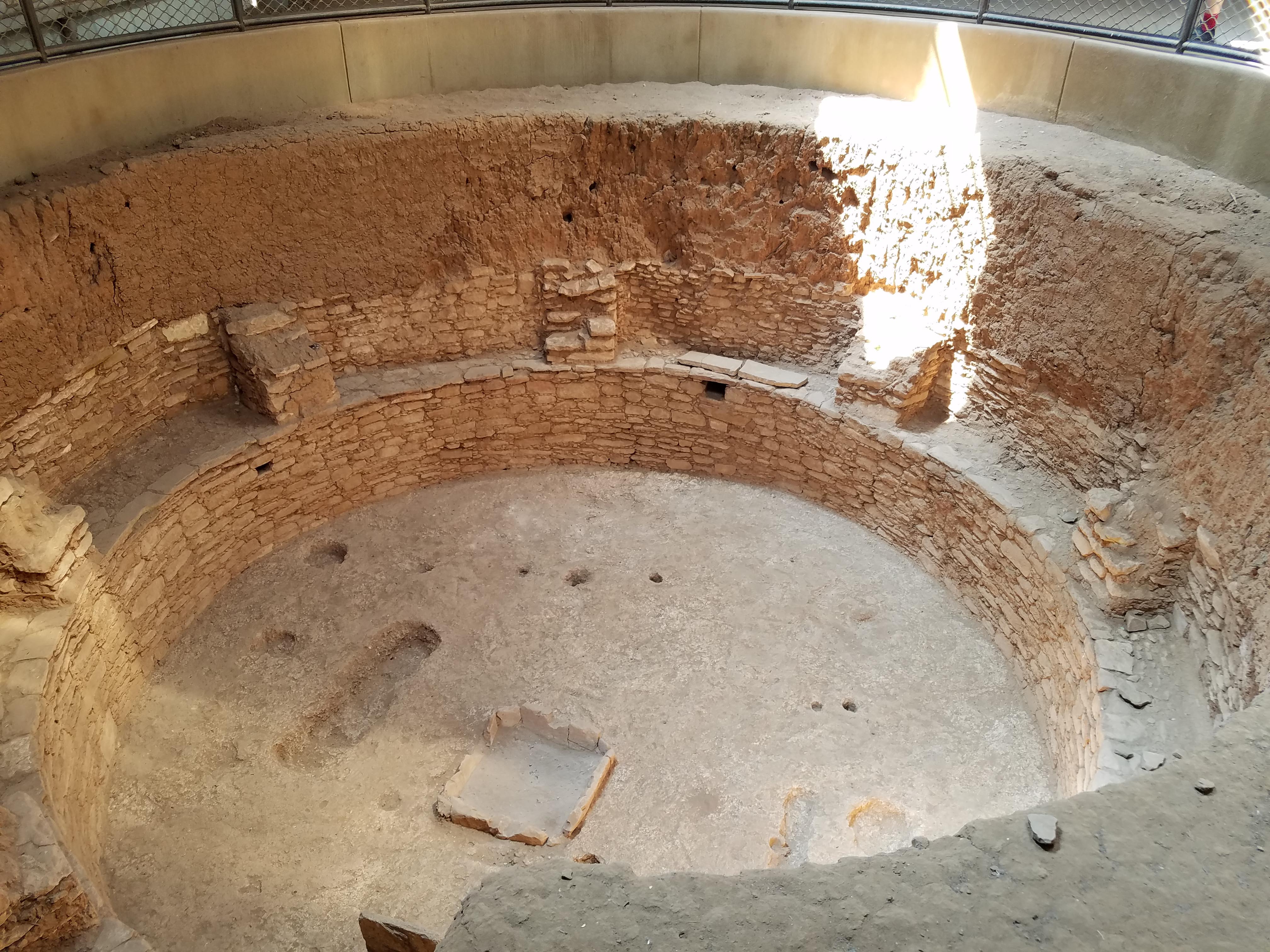
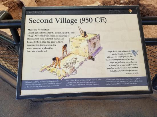
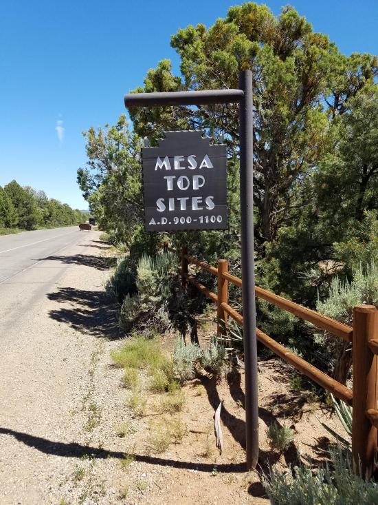
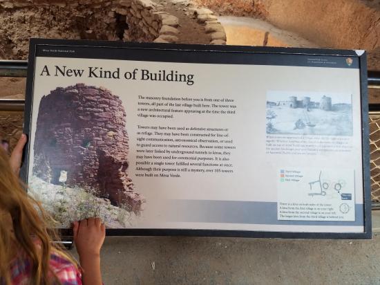
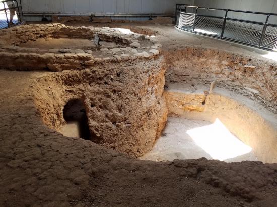
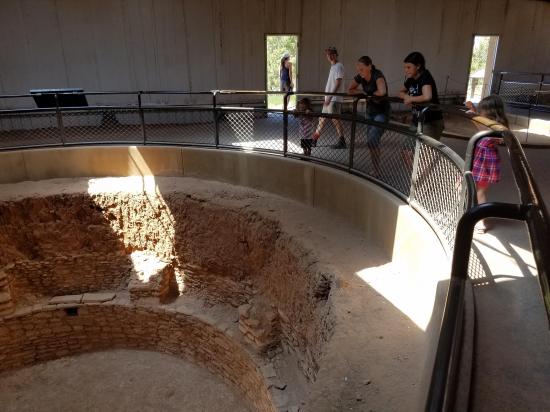
This complex site shows three building sequences and architectural styles. The earliest village had post-and-adobe walls, the second was of single-course masonry, and the third and latest was of stout, double-course masonry. Each village was superimposed on the other, and only a little evidence of each is exposed to view.
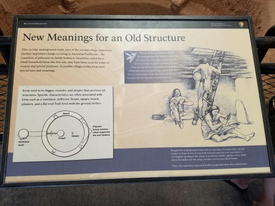
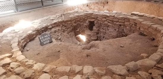
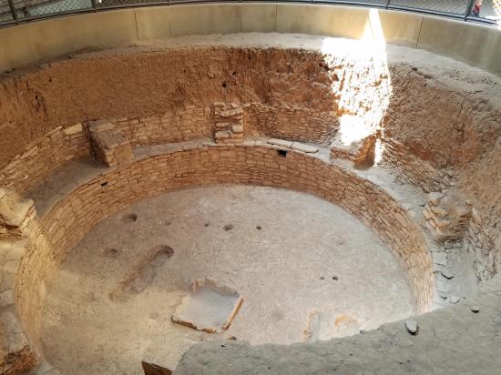
The “Mesa Verde”-style kiva appears at the beginning of this period and is fully developed by the end – round, with benches, ventilator, sipapu, and six pilasters. The large excavated kiva at this site, part of the third village, is a fine example of one, except it has eight rather than six pilasters.
Circular towers also first show up during the third phase. They are a significant but mysterious development. They are often associated with a kiva and connected to the kiva by an underground tunnel. Were these watchtowers or defensive structures? Might thy mark the beginning of troubled times at Mesa Verde? Or did they serve a religious or ceremonial function? Or possible a combination of these?
Few utensils were found at this site. The first village burned. Residents of the second village may have taken their possessions with them. When the last pueblo was deserted, it was razed and the building materials taken elsewhere.
What was found was an unusual collection of jewelry beneath a floor surface – pendants, beads, and four exquisite necklaces, including one with 458 white shell beads. Buried in one kiva was a cache of bird, mammal, and reptile bones.
We can only guess what attracted families to stay at this same location through the centuries. It’s rather exposed and the closest water supply is a quarter mile away. Perhaps good farmland on the mesa top held them here. Or maybe each generation simply followed a penchant to live in the same place where others lived before.
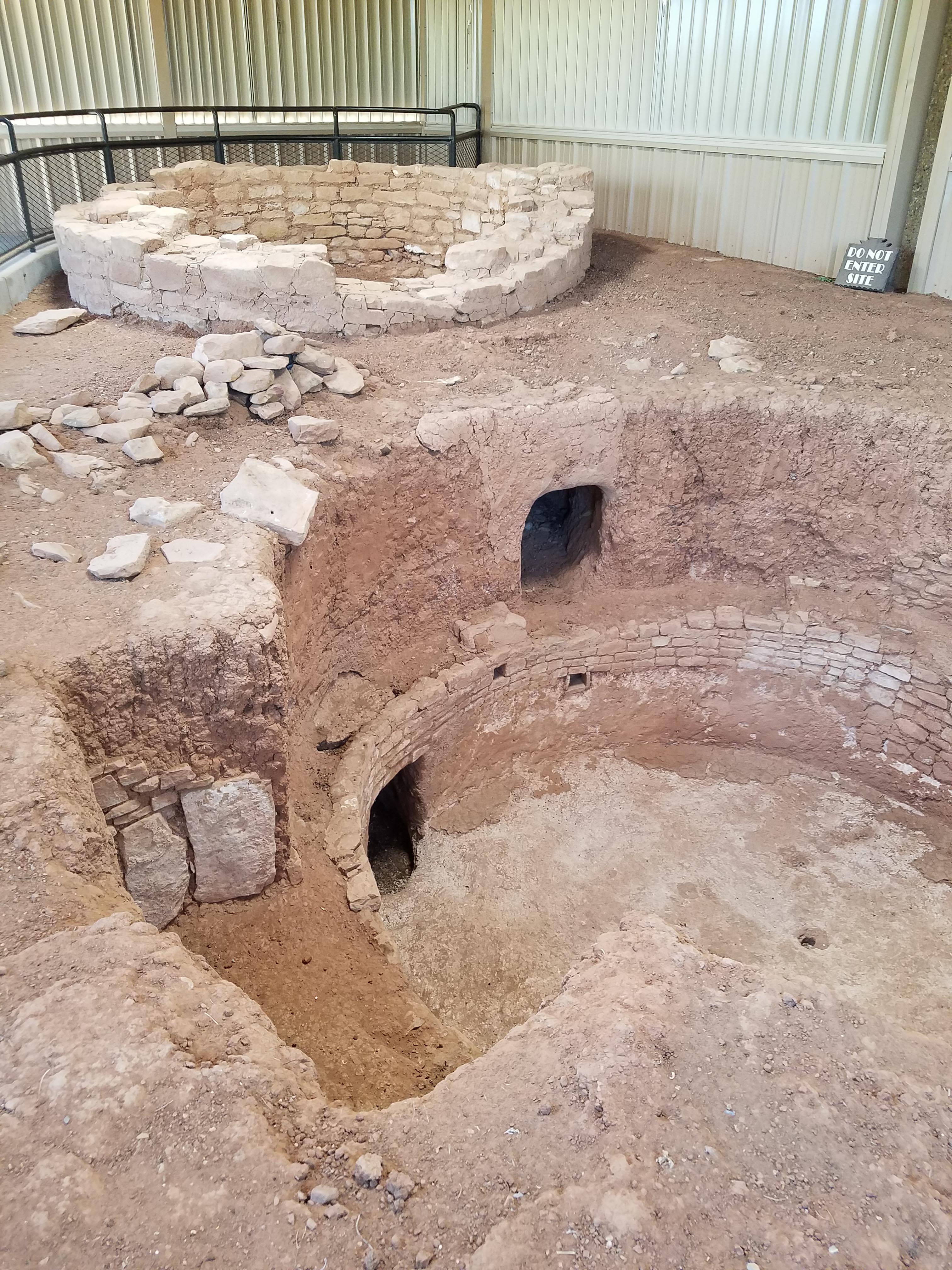
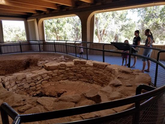
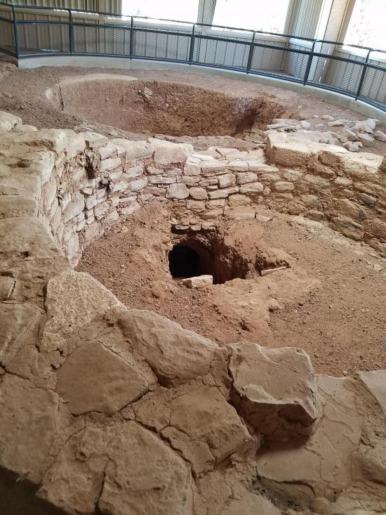
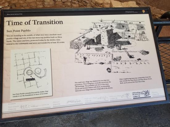
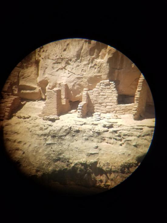
Sun Point Pueblo is one of the last mesa-top pueblos built at Mesa Verde, part of a cluster of sites in the Cliff Palace-Fewkes Canyon group.
The pueblo’s rooms enclosed an intriguing kiva-tower complex. This kiva, more than twelve feet in diameter, has a banquette, firepit, ventilator, and sipapu, which represents the entrance from the underworld. The plastered walls contained small niches. A tunnel was dug into the soil to connect the kiva with the round tower. At some point the tunnel was filled with debris, and the tower was largely dismantled. The “dimpled” marks pecked into the stones if the kiva and tower were a technique that began to show up in the A.D. 1200s.
But people lived in Sun Point Pueblo for only about ten years. Some unforeseen conditions may have arisen, causing them to depart and sacrifice a considerable investment of time and effort.

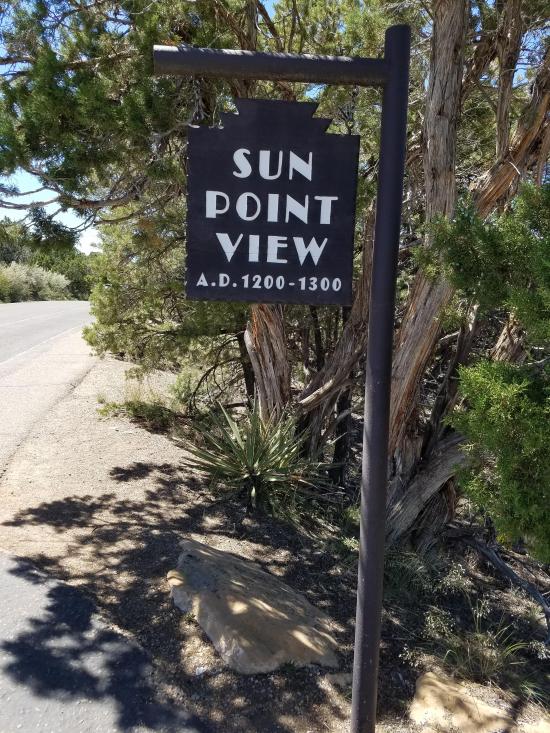
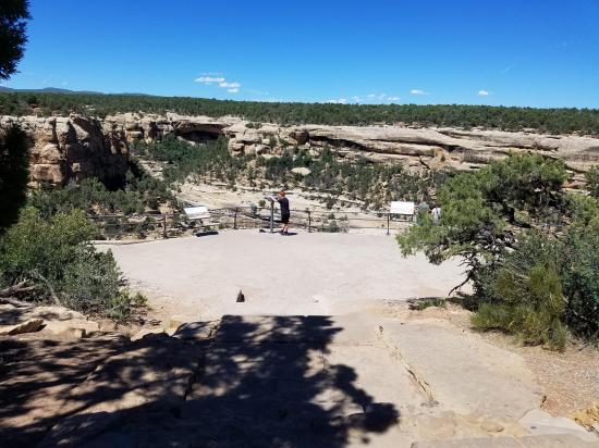
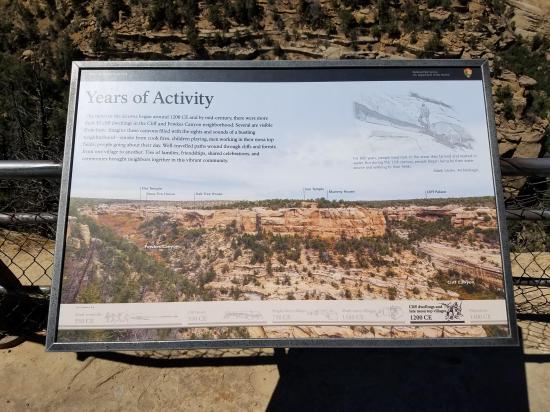
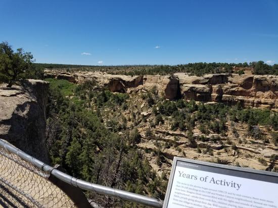
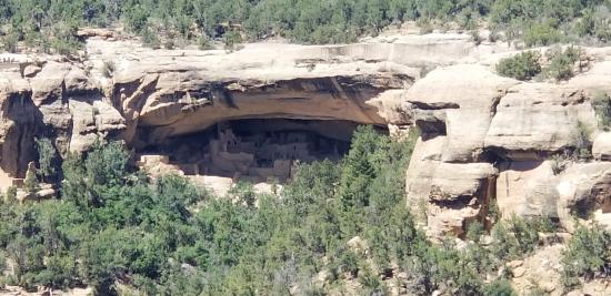
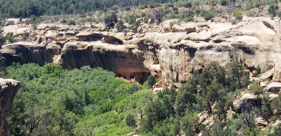
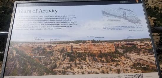
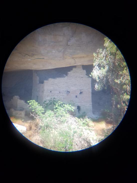
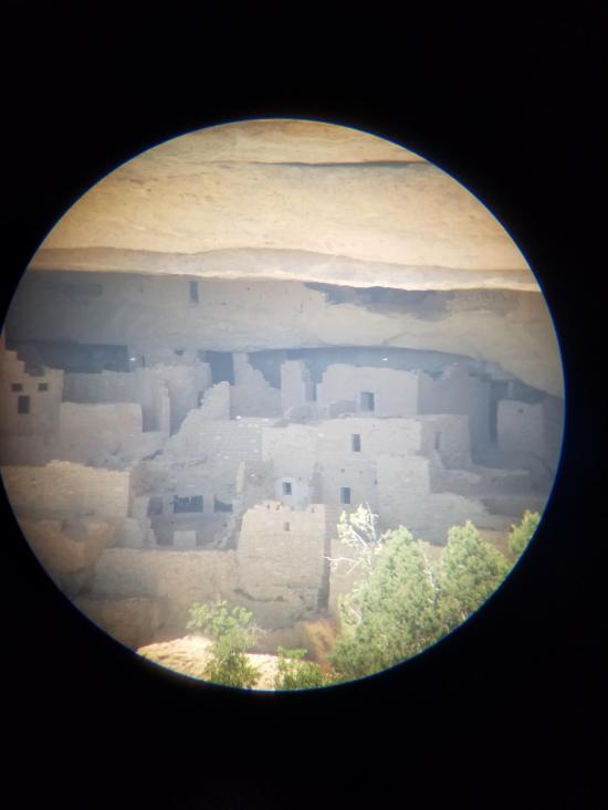
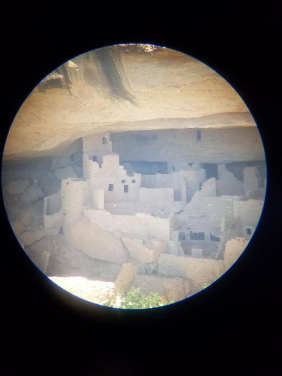
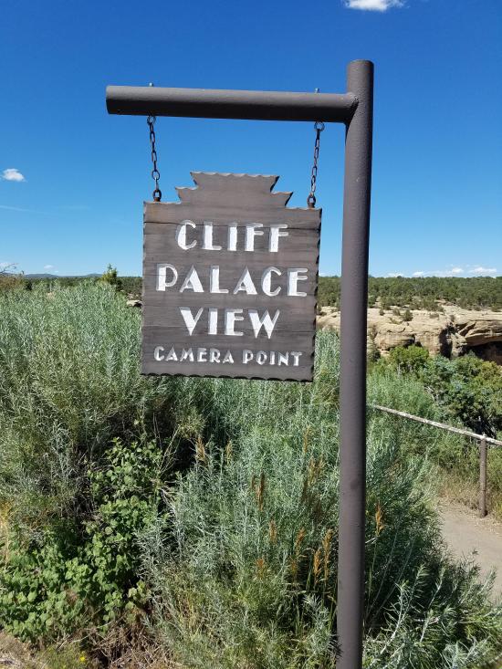
The view at Sun Point is one of the best in Mesa Verde. Visible from this spot are a dozen cliff dwellings set in alcoves high up in Cliff and Fewkes Canyons, along with the intriguing mesa-top building called Sun Temple across the canyon.
Between the years A.D. 1200 to 1300, half the population of Chapin Mesa was concentrated here in these dwellings. Meanwhile, many more thousands of people were living to the north of Mesa Verde along the Dolores River and in Montezuma Valley.

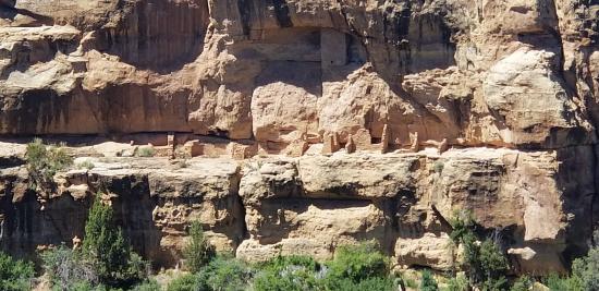
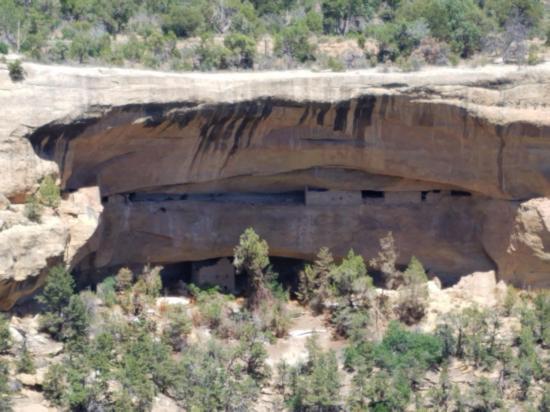
During his investigations at Mesa Verde, archeologist Jesse Walter Fewkes excavated in the 50-room cliff dwelling called Oak Tree House. In addition to four known kivas, he excavated three more which showed fine masonry. Five metates, or stone grinding bins, had been set in the floor of one kiva. A bundle of grass was found on one metate, perhaps used to sweep away meal once it was ground. No doubt, Ancestral Puebloans spent many hours each day turning corn kernels into soft cornmeal, the staple of their diet.
An exceptional feature of Oak Tree House was part of a circular wall in the rear of the alcove, made of willow and other sticks set in mortar.

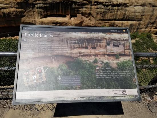
Fire Temple, near the head of Fewkes Canyon, was probably not a place where people lived. Its large plaza or open courtyard may have been a “stage” for ceremonial dances, attended by people from all over the mesa. When the Smithsonian’s Jesse Walter Fewkes excavated the site in the early 1900s, he noted a rectangular floor plan, a high banquette or bench, and a band of white plaster across the back wall. This was once called Painted House for figures of rain clouds, cactus, humans, and animals painted on the wall. There was also a large floor cist and a slot cut across the floor.
Some waterworks were associated with Fire Temple too. An artificial reservoir was built above a spring, helping recharge the spring’s flow.
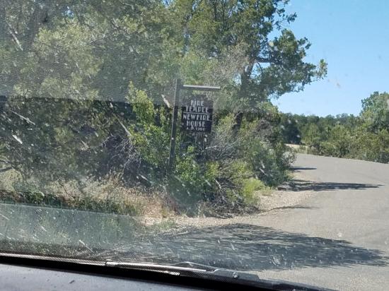
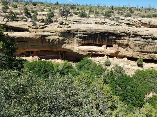
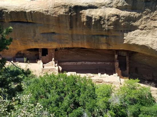
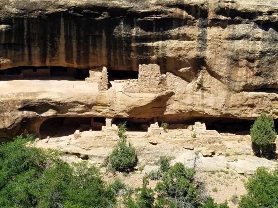
Just to the right of Fire Temple is New Fire House, a cliff dwelling in upper and lower alcoves connected by a hand-and-toe hold trail chipped into the rock.
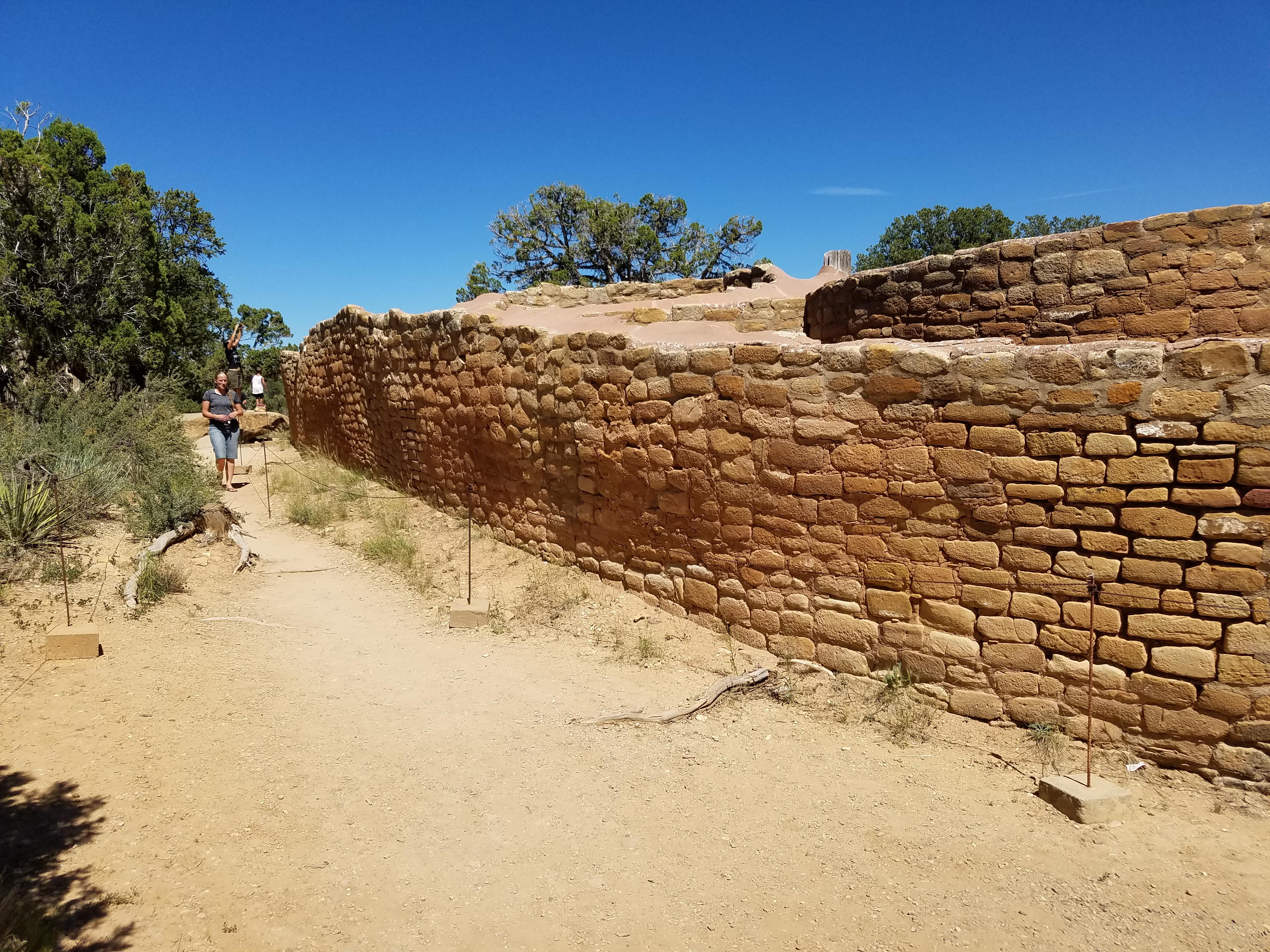
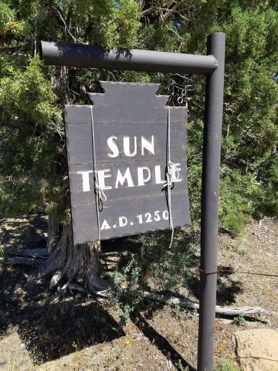
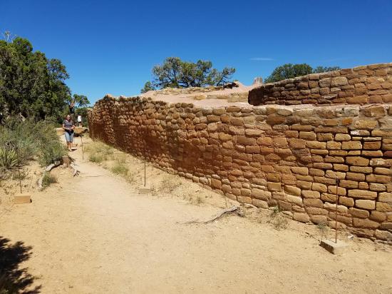
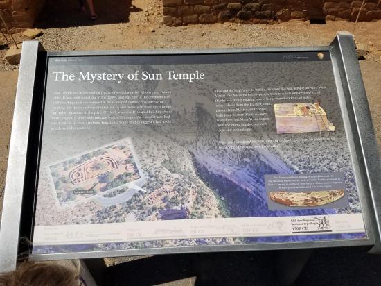
Sun Temple is an ever-fascinating structure at Mesa Verde. Excavations in 1915 let Dr. Jess Walter Fewkes to conclude that “This building was constructed for worship, and its size is such that we may practically call it a temple.”
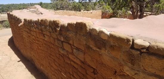
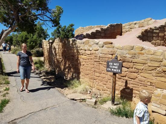
Fewkes believed Sun Temple’s D-shaped floor plan was intentional from the beginning of construction. Nearly every stone in the thousand feet of finely masoned walls was carefully pecked on the surface. Geometric designs were inscribed on the face of some. The four-foot-thick walls were double coursed and filled with a rubble core.
Neither household goods nor roof beams were found, indicating the structure of nearly 30 rooms was probably never finished. Why would Sun Temple have been so carefully thought out, but never completed?
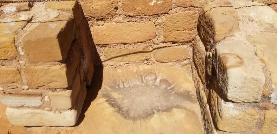
The existence of a natural rock basin in the southwestern corner led Fewkes to speculate that it served as a “solar marker,” and that people from the surrounding cliff dwellings attended ceremonies here.
Closest City or Region: Mesa Verde National Park
Coordinates: 37.174549, -108.485485
By Jeremy Dye
Jeremy Dye, Tara Dye, Savannah Dye, Madilyn Dye, Cooper Dye, Ondylyn Wagner, Killian Wagner,
I hadn't done enough research about Mesa Verde ahead of time to know what things there were to do or how long to spend in Mesa Verde, so we stopped at the visitor center first to get their recommendations. We walked through the gift shop and picked out some magnets, then we hopped in line to get tickets for one of the ranger-led tours through the ruins. I got the impression that on most days, they sell out of their ranger-led tours early in the day, but we were there on the 4th of July, and there were lots of available tours still. We chose to do the Cliff Palace Tour and purchased our tickets. We also picked up Junior Ranger packets for the kids to work on.
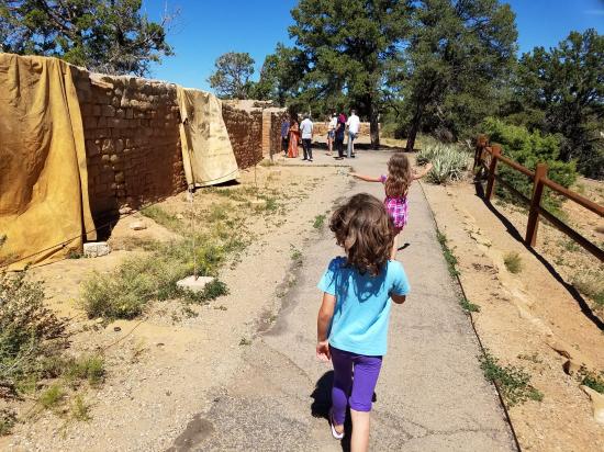
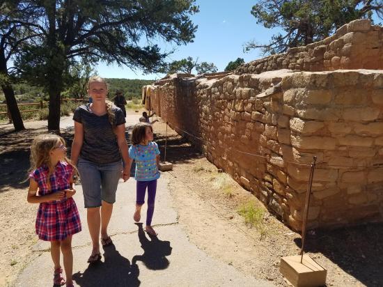
After the visitor center, our first stop was Mesa Top Loop Drive. We got out at all of the stops and explored the ruins and overlooks. We stopped at the pithouse then at the Navajo Canyon View. We then took the short hike to Square Tower House overlook. Square Tower House was very impressive. Next was Pithouses & Early Pueblo Villages. We walked through both buildings and read the interpretive signs and took a bunch of pictures. We then continued on to First, Second, & Third Villages, where there were multiple villages built on top of each other over the years. After that was we stopped at Point Pueblo then continued on to Sun Point View. At Sun Point View, they had some observation telescopes, and I took some pictures through the telescope, which actually turned out a lot better than I was expecting. After Sun Point View, we stopped briefly at the Oak Gree House overlook and the Fire Temple & New Fire House overlook. It's crazy how many large cliff dwellings were in the one canyon. Our last stop on the Mesa Top Loop Drive was Sun Temple. Because this ruin was on the rim and not sheltered, the park cemented a lot of the rocks together to prevent further damage.
We still had a bit of time before our Cliff Palace tour, so we stopped at the Chapin Mesa Archaeological Museum and walked through the exhibits there. They had some really impressive dioramas and some fun displays. We worked on the Junior Ranger packets.
Our Cliff Palace Tour started at 5:00. We met at the trailhead where our ranger gave us all a "be respectful" speech, then we headed down the trail to the ruins. At the west end of the alcove, we waited for about 20 minutes while the group in front of us had their turn in the ruins, then we got to take our turn. It was pretty crowded and the kids were restless, but it was still fun. Honestly though, we didn't think it was worth the extra hassle, money, and time to take the ranger-guided tour. We thought the ruins were just as impressive from the canyon rim.
After the tour, we went back to the Chapin Mesa Archaeological Museum so the kids could turn in their Junior Ranger packets and get their pins. We got there just a couple minutes before they closed at 6:30, and the rangers were kind enough to stay after and give the kids their swearing in ceremony.
On our way out of the park, we stopped at the Far View Sites. Ondy stayed at the Far View House with the kids while Tara and I walked around the loop to Pipe Shrine House, Coyote Village, Far View Reservoir, Megalithic House, and Far View Tower. My phone battery lasted just long enough to get a couple pictures of each stop before it died.
After our very full day in Mesa Verde National Park, we went back to Cortez and saw their 4th of July fireworks.


 County Road 227A Primitive Camping
 Natural Bridges National Monument
 Horsecollar Ruin Overlook Trail
 Natural Bridges National Monument Visitor Center
Natural Bridges National Monument
Edge of the Cedars State Park Museum
Edge of the Cedars State Park Interpretive Trail
 San Juan River from Sand Island to Mexican Hat
Recapture Pocket Primitive Camping
Mesa Verde National Park Visitor and Research Center
Chapin Mesa Archaeological Museum
Hovenweep National Monument Visitor Center
Canyons of the Ancients National Monument Visitor Center and Museum
Canyon Country Discovery Center
 Artifacts
 Structures, Ruins, Dwellings
 Marked Trails
 Road Access is Paved
 Access Road is 2WD Accessible
 Viewpoint, Overlooks, Vistas
 Interpretive Signs
 Walking Trails
 Wildflowers and Vegitation
 Wildlife and Birding