 Canyoneering | Gravel Canyon


Hype:
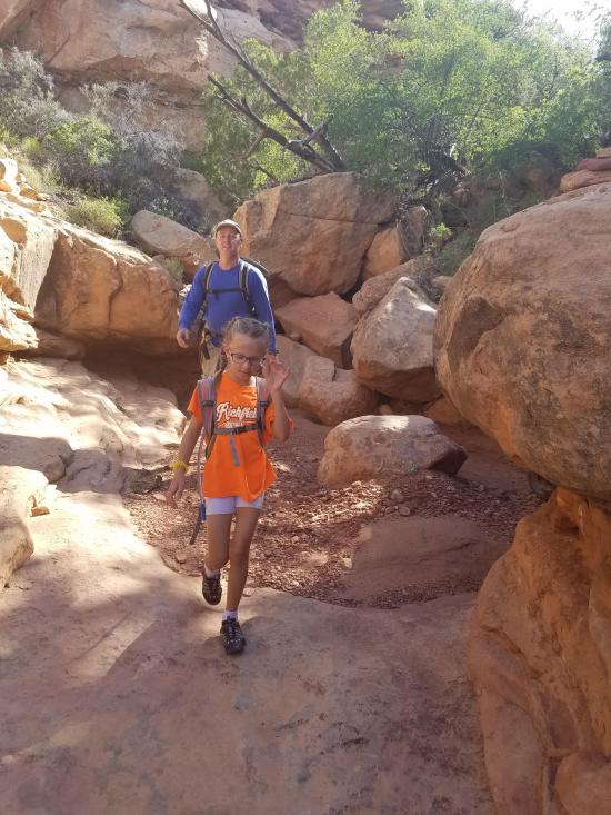
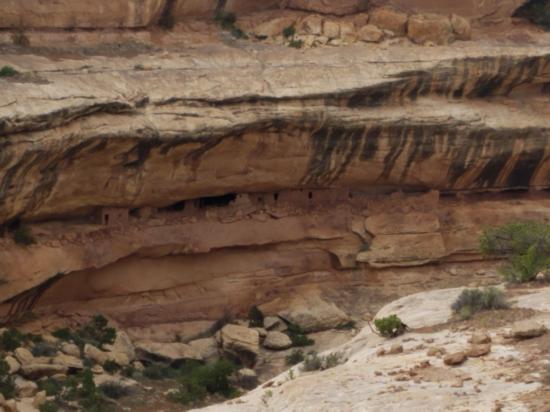
Gravel Canyon is a decent canyon in Cedar Mesa. The approach and exit are quite long compared to the fun part of the canyon, which puts the canyon pretty low on my list of favorites. The canyon has several rappels and swims and a few downclimbs. There is also a really extensive Indian ruin that is visible from the exit trail.
Canyon Rating: 3B 
Time: 6-8 hours
Length: 7.7 miles round trip
Longest Rappel: 20 ft
Gear: 50 foot rope. Fiddlestick. Standard rappelling gear. A wetsuit is recommended. Bring a dry bag for anything you don't want wet.
Fees: None
Recommended Ages:
 | 0-3 |
 | 4-11 |
 | 12-19 |
 | 20-49 |
 | 50-69 |
 | 70+ |
Recommended Months to Visit:
| Jan |
| Feb |
| Mar |
| Apr |
| May |
| Jun |
| Jul |
| Aug |
| Sep |
| Oct |
| Nov |
| Dec |
Navigate to 37.716102, -110.060047.
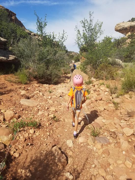
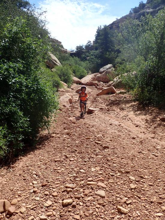
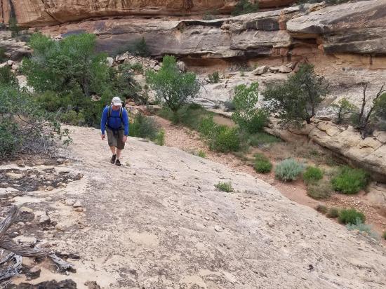
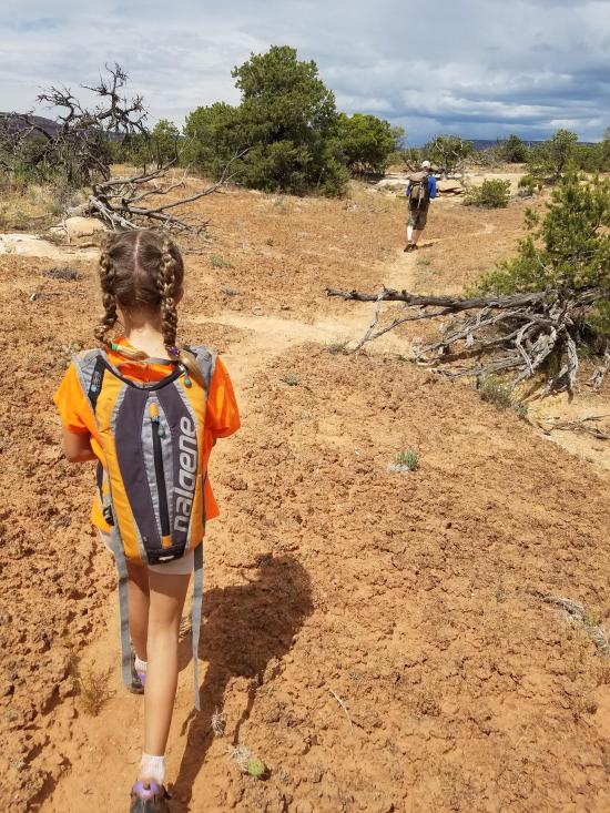
From the parking area, hike northeast along the road for about a quarter mile. When you get to a small drainage, follow the drainage northwest until you drop into Gravel Canyon. It is an easy scramble down to the canyon floor.
Follow the canyon west until you get to the top of a big drop. You can rappel down these two nuissance drops, or you can take a well-traveled trail along the north rim of the canyon and hike down to the canyon floor. This is near the confluence of the fork you just came down and the main canyon.
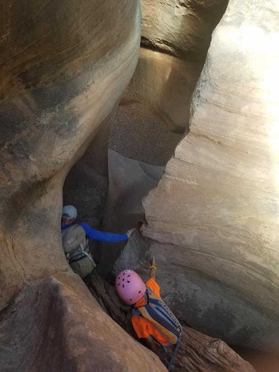
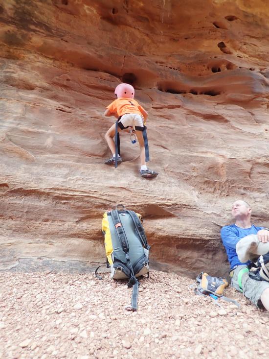
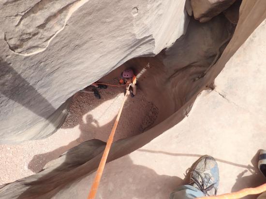
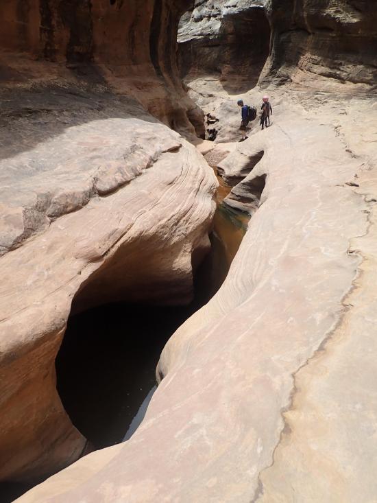
From the confluence with the main fork, continue down canyon for about a quarter mile until you reach the first major drop. We didn't see any bolted anchors or obvious trees or rocks to anchor from. It was also basically impossible to downclimb because it is a lip that is underhung and drops about 10 feet. We had the first two people rappel down the drop from a meat anchor, then the last person slid over the edge to a partner capture below.
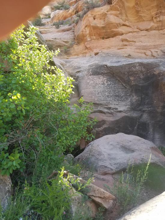
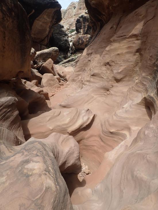
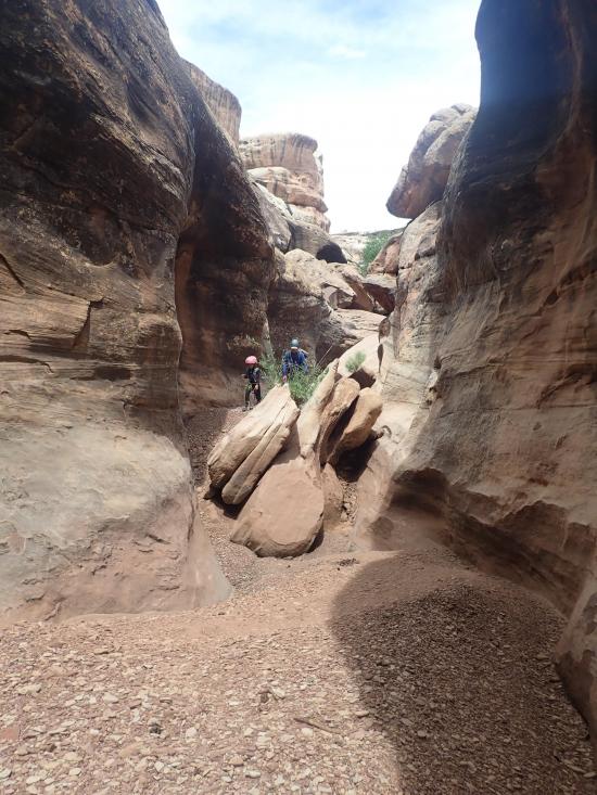
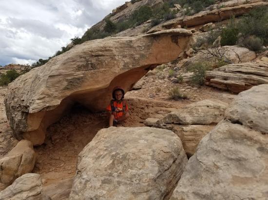
From the drop, there is about 2 miles of canyon walking before you get to any more fun stuff. This canyon walking section is littered with giant boulders, some of which make tunnels and caves you have to crawl through.
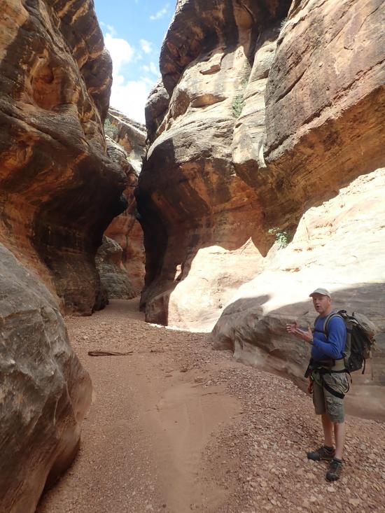
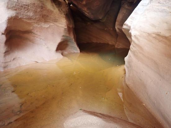
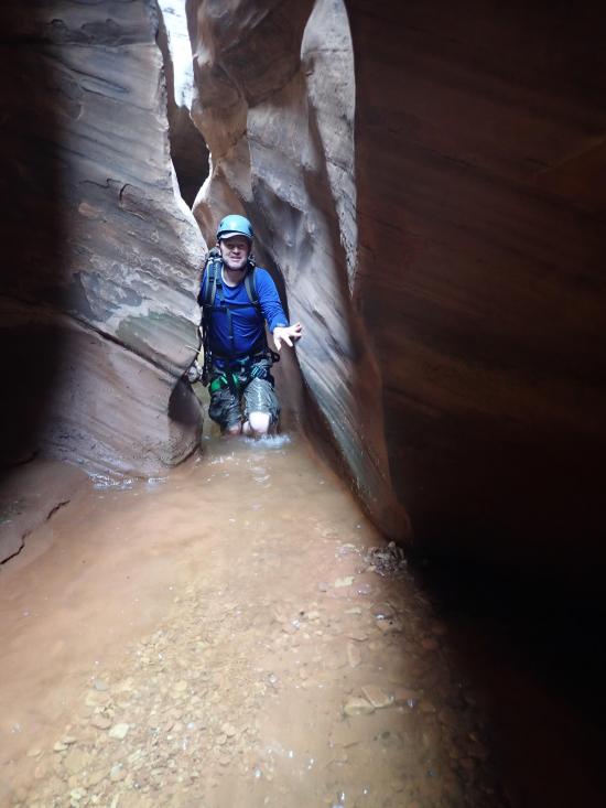
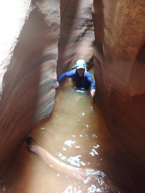
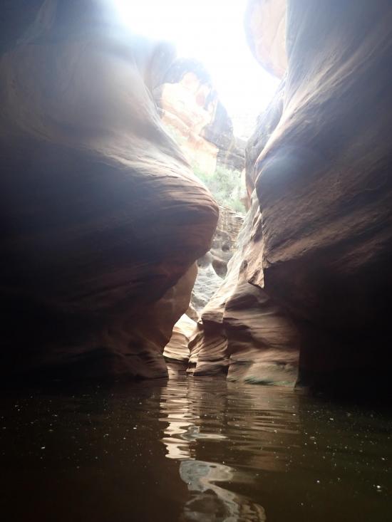
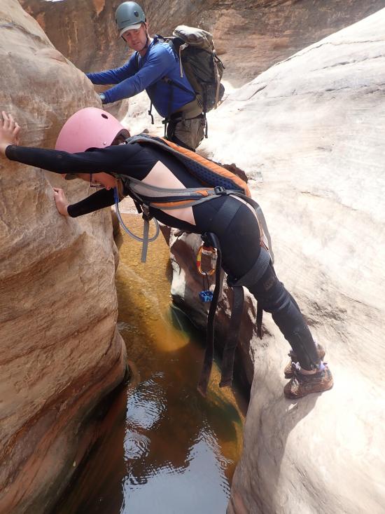
The next obstacle is a 10-foot drop. This can be rappelled or chimneyed down. All of the good stuff is in the next quarter mile of canyon. The canyon gets very narrow. There is a short drop that is easily downclimbed into the first real pool or it can be bridged over. Don't bother trying to stay dry though because this section holds quite a bit of water, including a couple of swimmers.
You'll soon come to a drop above a pool of water. Rappel off a meat anchor to check the water depth, then the rest of the group can just jump into the water. The jump is about 6 feet.
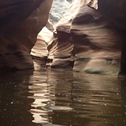
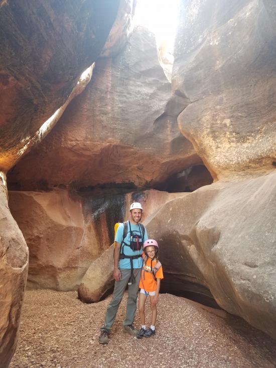
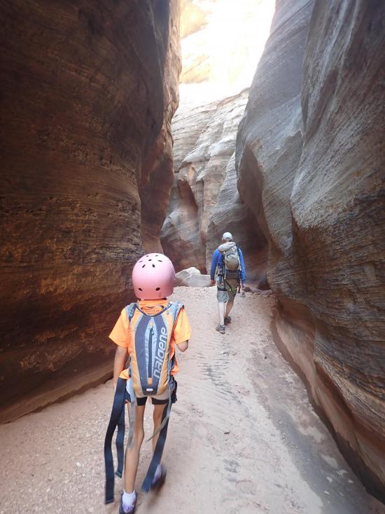
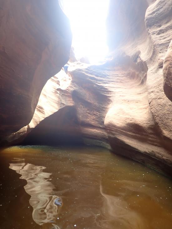
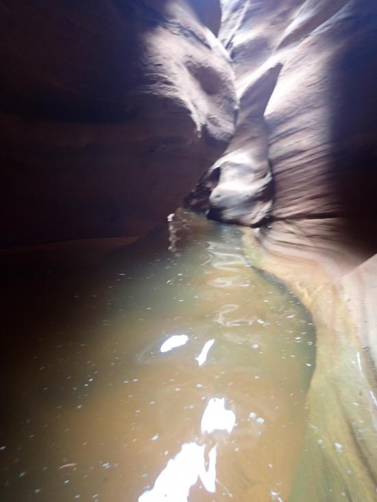
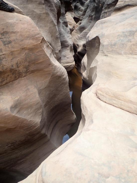
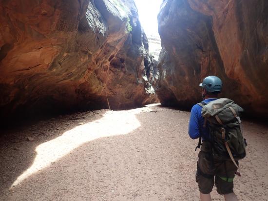
Up next is an amazing section of narrows. The canyon walls are twisty and curvy and very pretty. This section can hold water but is mostly wading.
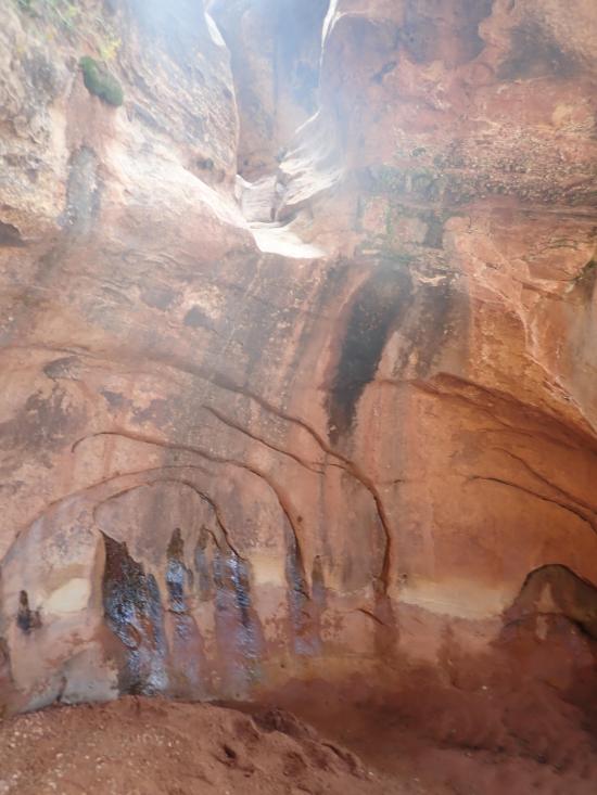
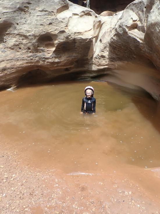
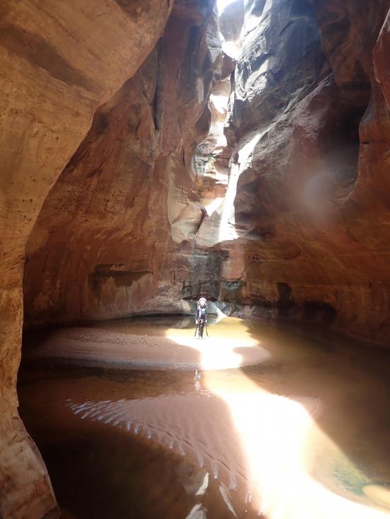
When the narrows open up, there is a side canyon that joins in from the north. Take a minute to explore from the bottom. It is an amazing echo chamber with swirling walls and a shallow pond.
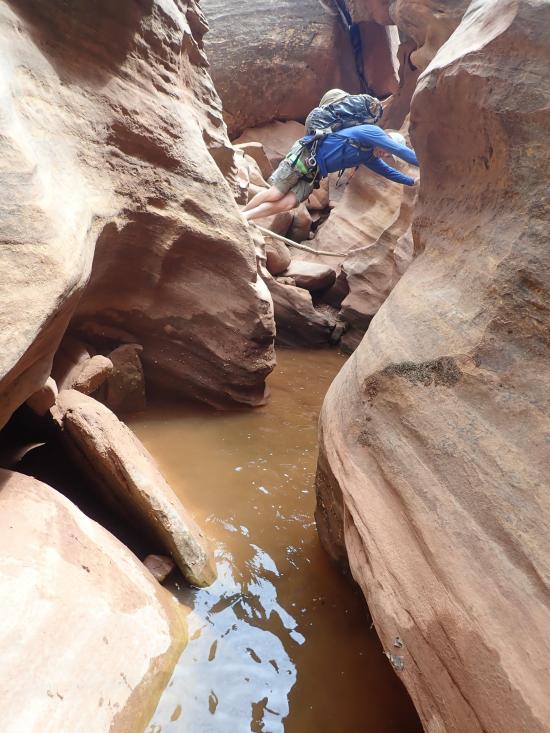
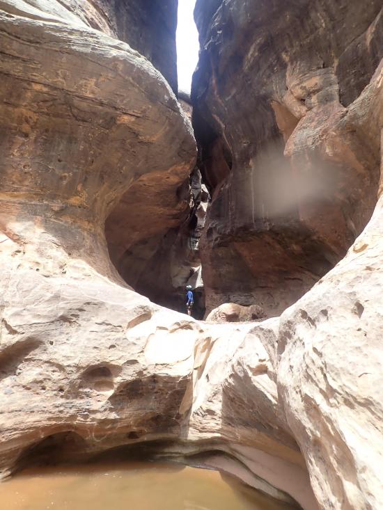
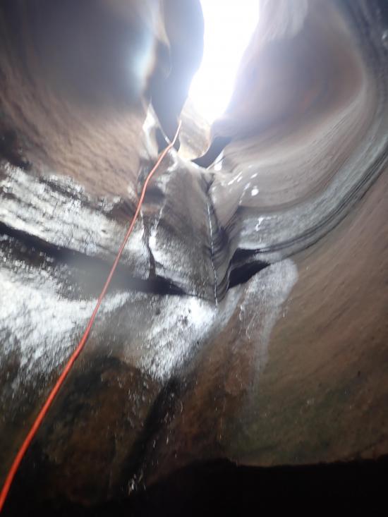
Just down canyon of the echo chamber is the only major drop in the canyon and is the last major obstacle. Most will choose to rappel this drop, but we didn't see any fixed anchors. We meat anchored the first person to check the water level, then the last person slid down the chute and dropped into the pool. The drop is about 10-15 feet.
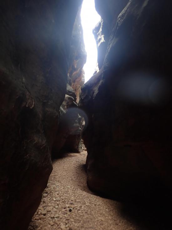
The last section of the canyon is a very narrow slot with a gravel bottom. I can only assume this section is what gives the canyon its name because up to this point its all boulders. Continue down canyon until the canyon opens up and there is an escape up the south edge.
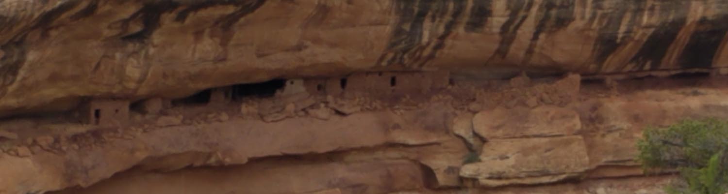
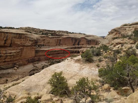
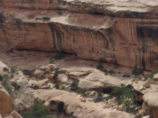
From the bottom of Gravel Canyon, climb up the south rim and follow the ledge northeast. There are several cairns marking the most-used trail. When you're most up the way up the rim, keep an eye out for the cliff dwelling Indian ruin that is located in a rock alcove across the canyon.
Once up on the rim, take any number of cow trails northeast back to your car.
Closest City or Region: Cedar Mesa, Utah
Coordinates: 37.722210, -110.060037
By Jeremy Dye
Jeremy Dye, Savannah Dye, Jared Barrett,
Start: 9:00 a.m.
End: 5:00 p.m.
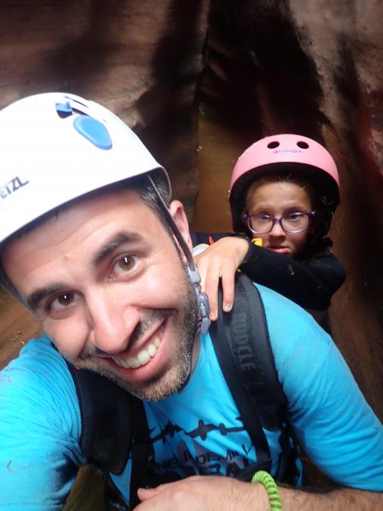
Aparently this was the year of the cicadas because they were everywhere! We hiked the approach quite quickly and took the side trail around the nuisance rappels at the top of the canyon. At the first mandatory drop, I was meat anchor while Jared and Savannah rappelled down. Then I attempted to scootch over the lip. Jared tried to catch me, but I ended up falling into the sandy bottom. It was a bit ungraceful. We lowered Savannah at the next drop then both chimneyed down. At the next drop, Jared was the meat anchor while Savannah and I went down. Then Jared jumped into the pool. The narrows were awesome with quite a bit of wading. I carried Savannah on my back because she was scared of the cold water, despite having a wetsuit on. We explored the echo chamber then tackled the last drop. I rappelled first the check the water depth. It was plenty deep. Rather than having Savannah swim from the rappel to high ground, Jared and Savannah went down canyon a bit, and Savannah rappelled down the side to me where it was high ground. After we got Savannah down, Jared went back to the main water course and slid down the rock before dropping into the water. We hiked through the narrows a bit then stopped for lunch in a sunny spot. After lunch, we walked the rest of the way down the canyon and then exited back to the car.
 County Road 227A Primitive Camping
 Natural Bridges National Monument
 Horsecollar Ruin Overlook Trail
 Natural Bridges National Monument Visitor Center
Natural Bridges National Monument
Edge of the Cedars State Park Museum
Edge of the Cedars State Park Interpretive Trail
 San Juan River from Sand Island to Mexican Hat
Recapture Pocket Primitive Camping
Mesa Verde National Park Visitor and Research Center
Chapin Mesa Archaeological Museum
Hovenweep National Monument Visitor Center
Canyons of the Ancients National Monument Visitor Center and Museum
Canyon Country Discovery Center
County Road 227A Primitive Camping
Grotto Trailhead Primitive Camping
Natural Bridges National Monument
Horsecollar Ruin Overlook Trail
County Road 227A Primitive Camping
Grotto Trailhead Primitive Camping
 Rappels
 Downclimbs
 Swimming
 Wading
 Anchor Building - Fiddlestick
 Fixed Anchors
 Wetsuit Recommended
 Non-potable Water - not filterable
 Wayfinding
 Road Access is Dirt - High Clearance
 Access Road is 4WD
 Wildflowers and Vegitation
 Wildlife and Birding
 Structures, Ruins, Dwellings