 Hiking | Waterfall Trail


Hype:
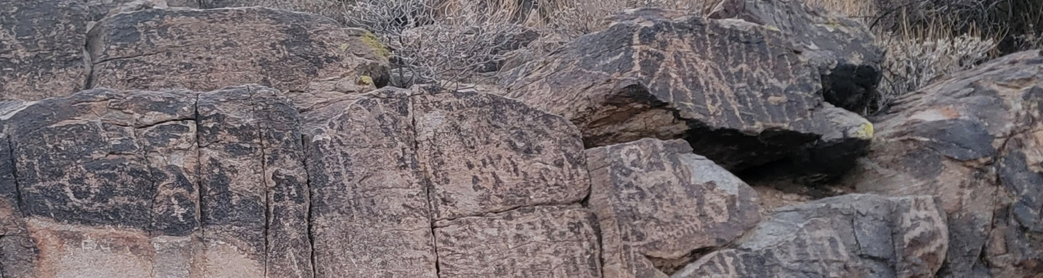
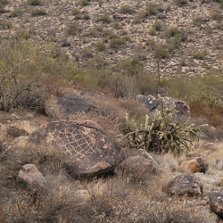
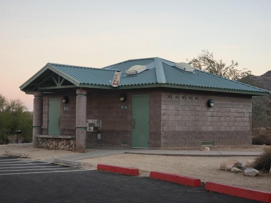
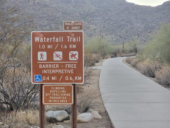
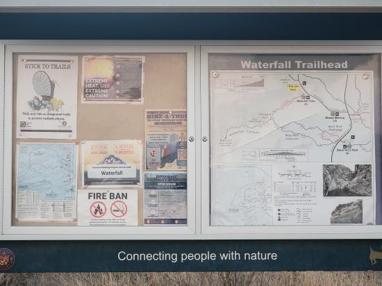
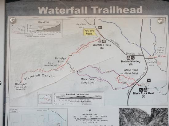
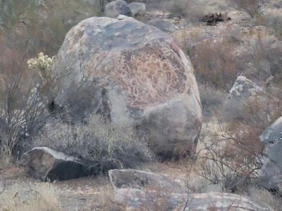
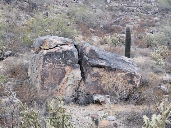
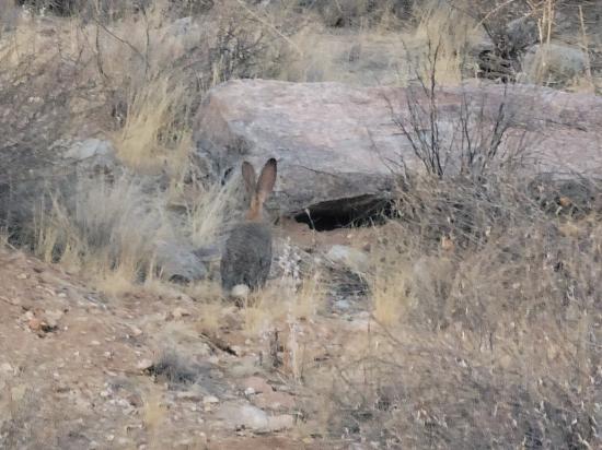
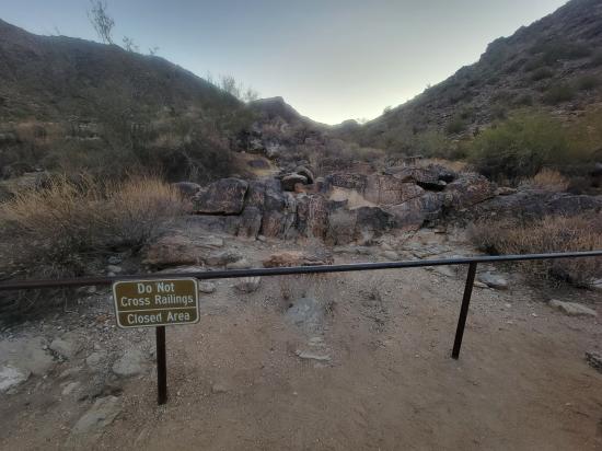
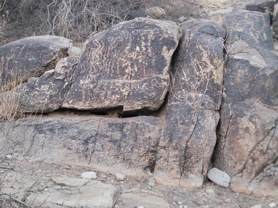
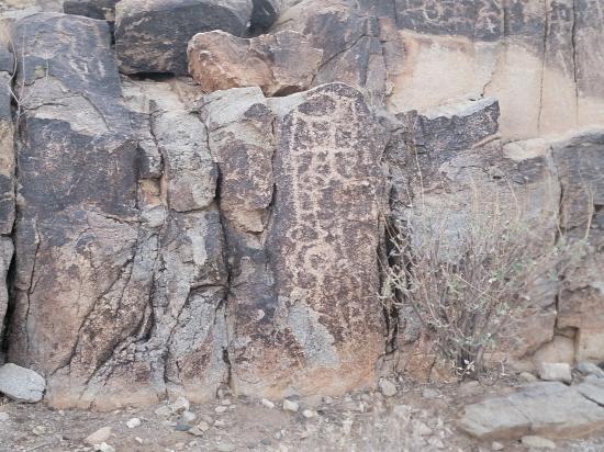
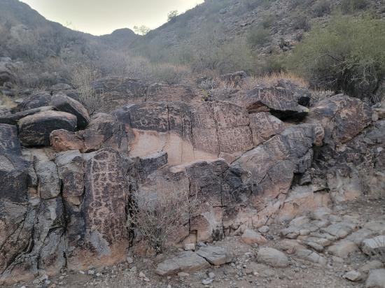
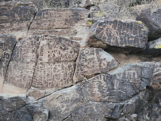
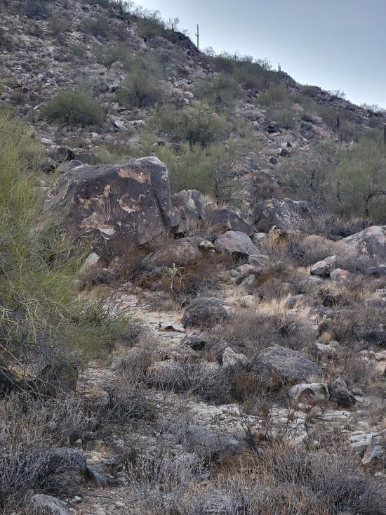
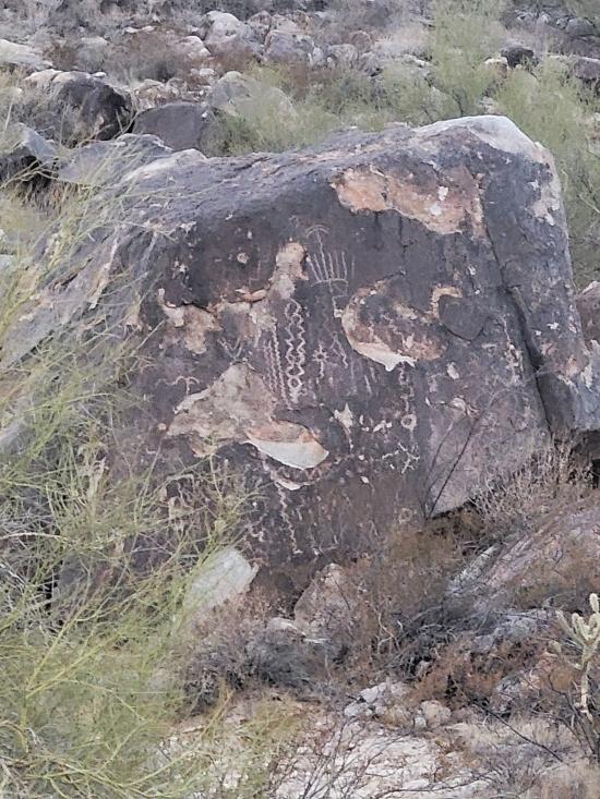
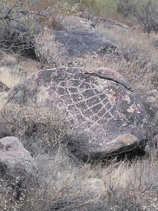
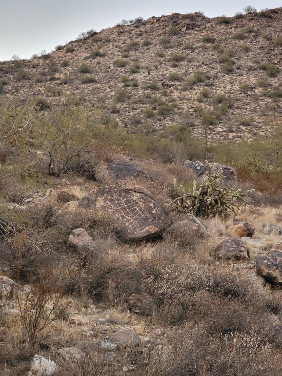
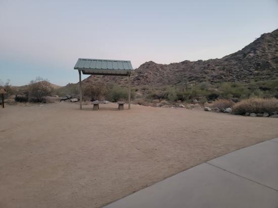
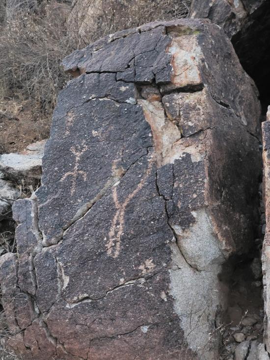
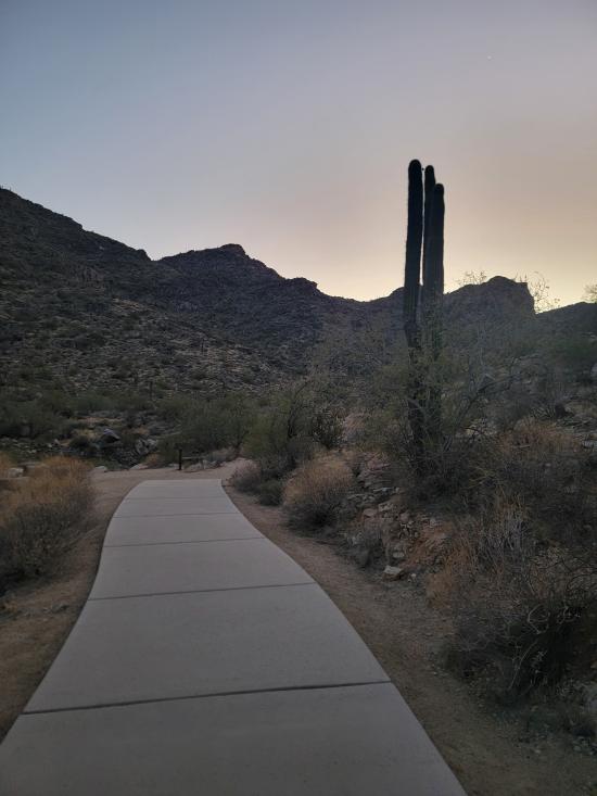
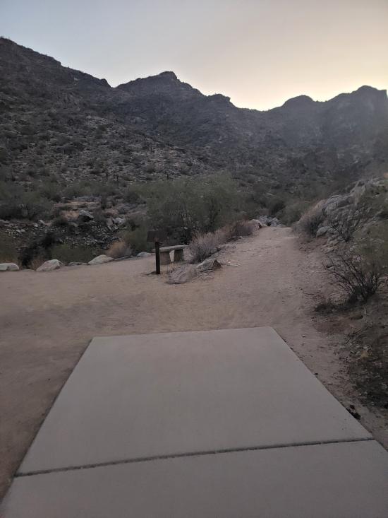
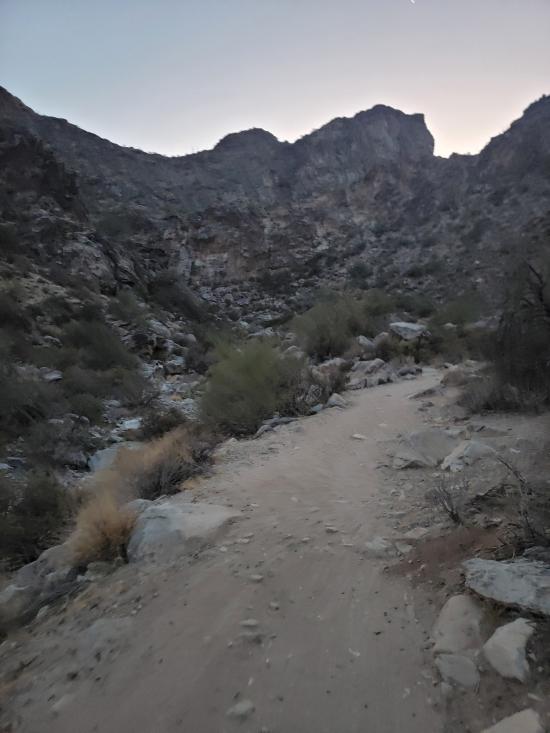
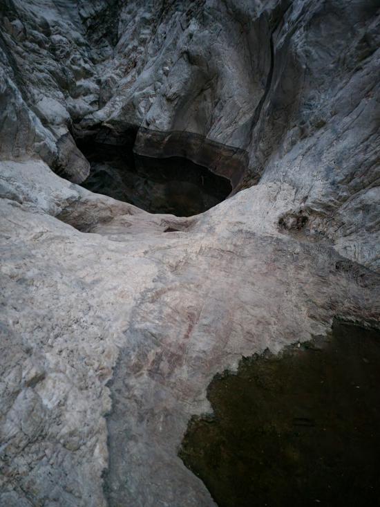
The Waterfall Trail in White Tank Mountain Regional Park is a 1.8-mile out-and-back hike that offers an accessible and educational experience in the Sonoran Desert. The first half-mile of the trail is paved and barrier-free, accommodating strollers and wheelchairs, and leads to Petroglyph Plaza, where visitors can view ancient Hohokam rock carvings. Beyond this point, the trail becomes a natural dirt path that gently ascends into a narrow canyon, culminating at a seasonal waterfall that flows after significant rainfall. The trail is well-marked and considered easy, making it suitable for hikers of all ages and skill levels. Amenities at the trailhead include restrooms and picnic areas, and the trail is dog-friendly, provided pets are kept on a leash. For those interested in extending their hike, the nearby Black Rock Loop offers additional scenic views and opportunities to observe desert wildlife.
Trail Condition: Class 1 (Trail is either paved or gravel. Navigation skills are not needed because there is only one trail or because there are signs. Elevation gains are gradual or there are stairs.)
Time: 1 hour
Length: 1.8 miles round trip
Elevation Gain: Negligible
Fees: Park Admission
Recommended Ages:
 | 0-3 |
 | 4-11 |
 | 12-19 |
 | 20-49 |
 | 50-69 |
 | 70+ |
Recommended Months to Visit:
| Jan |
| Feb |
| Mar |
| Apr |
| May |
| Jun |
| Jul |
| Aug |
| Sep |
| Oct |
| Nov |
| Dec |
Links: https://www.maricopacountyparks.net/park-locator/white-tank-mountain-regional-park/https://maricopa.maps.arcgis.com/apps/MapTour/index.html?appid=06597c30a3de4eae94ed114544dca8c8
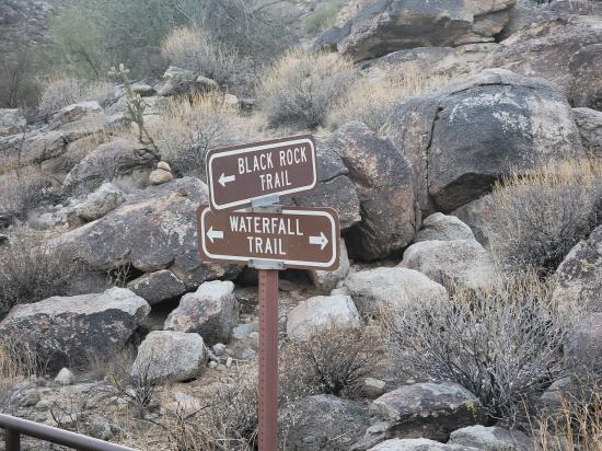
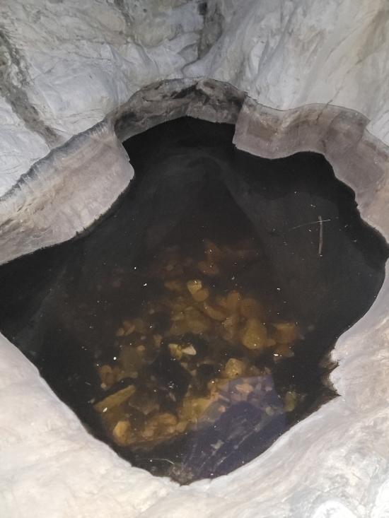
From the trailhead, follow the paved trail southwest for 0.5 miles to a junction with the Black Rock Loop Trail. At this junction is Petroglyph Plaza, where visitors can view ancient Hohokam rock carvings. 0.1 miles beyond this point, the trail becomes a natural dirt path that gently ascends into a narrow canyon, culminating at a seasonal waterfall that flows after significant rainfall. The trail is well-marked and considered easy, making it suitable for hikers of all ages and skill levels.
Closest City or Region: White Tank Mountain Regional Park, Arizona
Coordinates: 33.583954, -112.519504
By Jeremy Dye
I went down for a work training entitled PSMJ Principals Boot Camp. I flew out at 11:30, picked up my rental car, went grocery shopping, drove to my hotel, checked in, and jumped on a work video call until about 5:30. After I was done with work, I drove over to White Tank Mountain Regional Park and hiked the Waterfall Trail. It was getting late in the evening, and the sun was setting, so I half jogged the trail. I stopped at the petroglyphs and took a bunch of pictures. I was pretty proud of myself for hiking fast enough to pass several other groups. I got to the potholes at the top just as it was getting too dark to see.

 Mystery Castle by Boyce Luther Gulley [CLOSED]
 Holbert Trail to Dobbins Lookout
Red Tailed Hawk Interpretive Trail
Historic Heritage Square Audio Tour
 Hiking Trails
 Marked Trails
 Petroglyphs and Pictographs
 No Drinking Water
 Desert
 Mountains
 Slot Canyon
 Restrooms - Flush
 Picnic Tables
 Road Access is Paved
 Access Road is 2WD Accessible
 Viewpoint, Overlooks, Vistas
 Pets Allowed
 Wildflowers and Vegitation
 Wildlife and Birding