 Canyoneering | Cascading Stewart Falls


Hype:
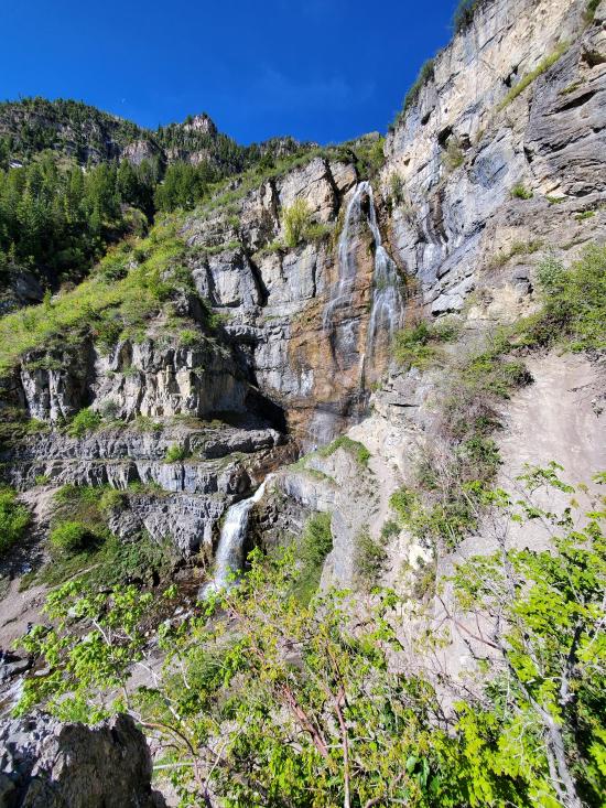
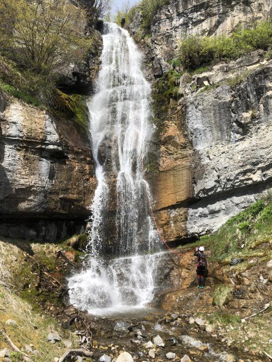
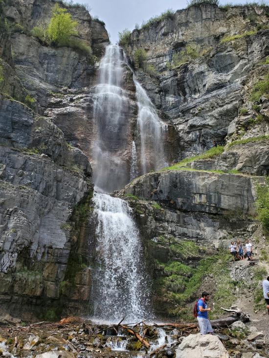
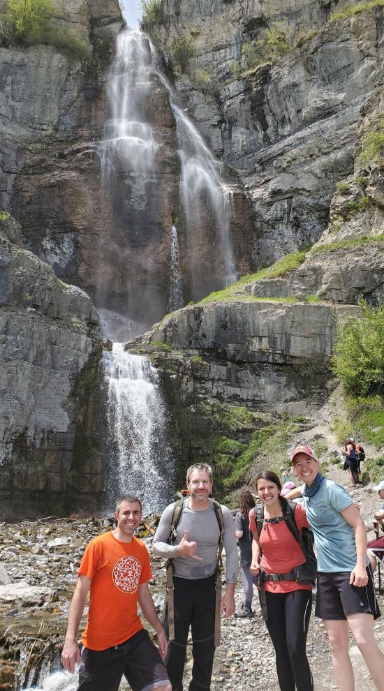
Cascading Stewart Falls is an adventure only for those with technical canyoneering experience. Stewart Falls, officially known as Stewarts Cascades, is a popular hiking destination for people of all ages because the hike is about 3.5 miles round trip and is well maintained. For those looking to take the adventure level up a couple of notches, this cascading route does just that. This route takes you down 4 amazing waterfalls, 3 of which are not visible except to canyoneers.
Canyon Rating: 3C 
Time: 4-6 hours
Length: 1.8 miles to the base of Stewart Falls, 0.13 mile bushwhack straight up, 0.1 mile cascading route, 1.8 mile return
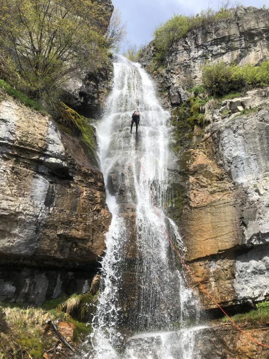
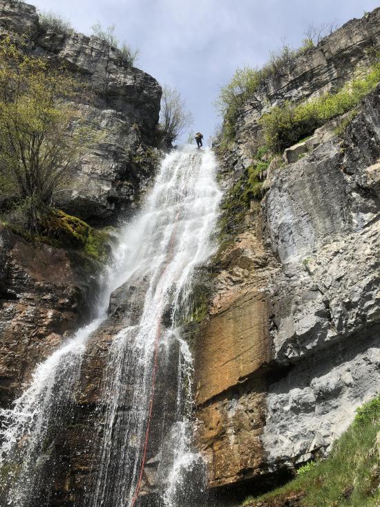
Longest Rappel: 230 ft
Gear: 250 foot rope, 250 foot pull cord, anchor building material, wetsuit, drybag.
Fees: Day use
Recommended Ages:
 | 0-3 |
 | 4-11 |
 | 12-19 |
 | 20-49 |
 | 50-69 |
 | 70+ |
Recommended Months to Visit:
| Jan |
| Feb |
| Mar |
| Apr |
| May |
| Jun |
| Jul |
| Aug |
| Sep |
| Oct |
| Nov |
| Dec |
Navigate to 40.404444, -111.605136.
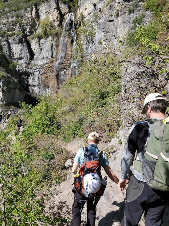
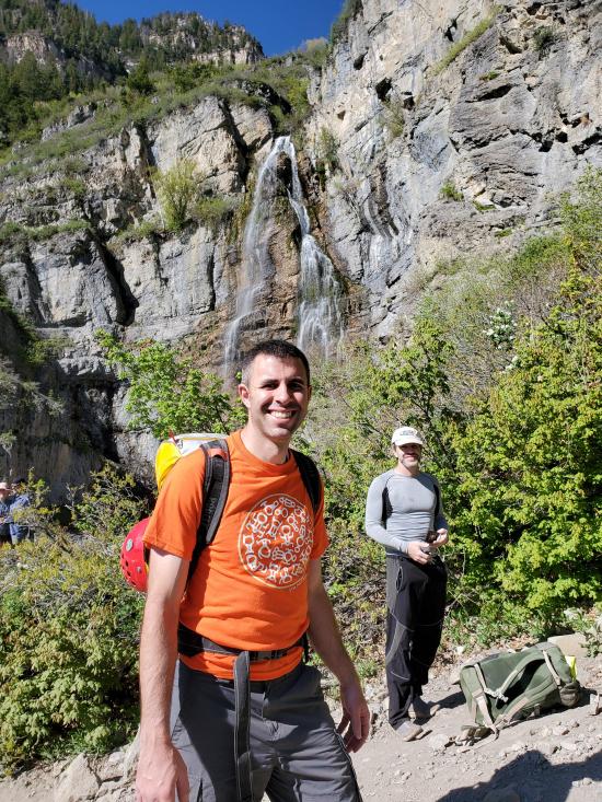
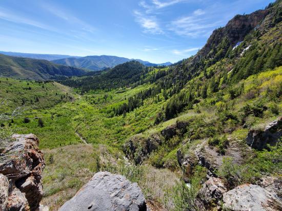
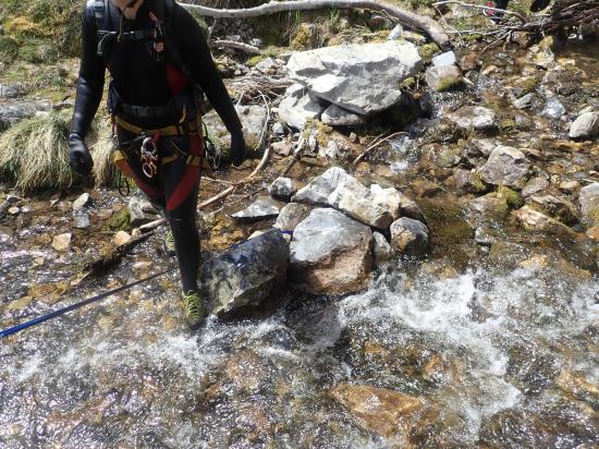
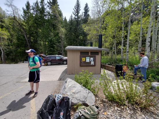
From the parking area, make sure to take the south trailhead that starts near the restrooms. This is signed "Stewart Cascades". If you're on the trail that says "Mt Timpanogos Trailhead" you're going to be in for a completely different adventure. Once you're on the right trail, it would be nearly impossible to get lost. Follow the trail southwest for about 1.8 miles to where the trail overlooks Stewart Falls. Don't go all the way down to the river.
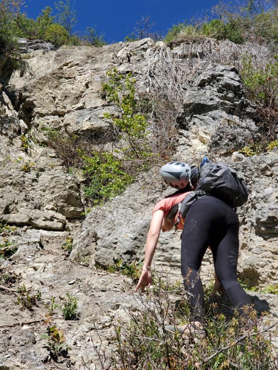
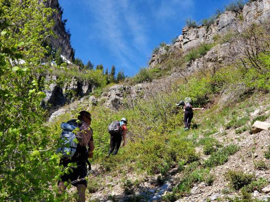
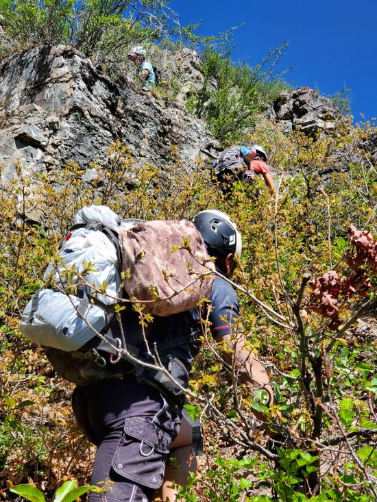
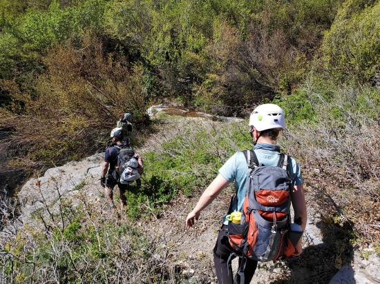
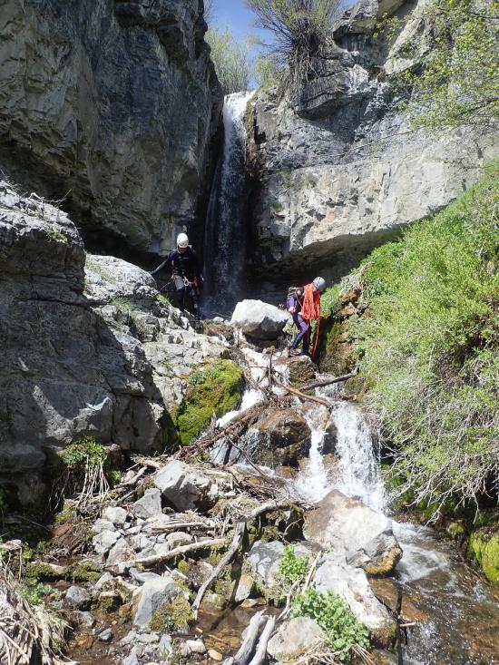
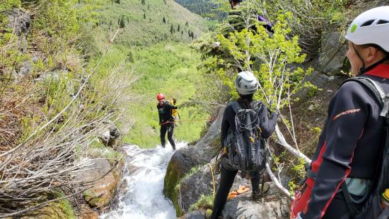
This is where the maintainted trail ends and you have to turn on your navigation skills. Turn northwest and scramble up the gravel scree slope. This is extremely steep and loose, so pick your footing well. You'll soon reach the base of a cliff face. This would be a good place to put on your helmets because you're likely to knock rocks loose or have someone else send rocks down on you. Route find your way up the cliff. This is about a 5.3 climb for about 15 feet. Once at the top of the cliff band, work your way south, avoiding the worst of the bushwhacking. There is a social trail emerging here. Fight your way through the underbrush, heading generally southwest. Work your way up through two more cliff bands until you reach a flat area above the waterfall. The upper-most cliff band has some exposed climbing as well.
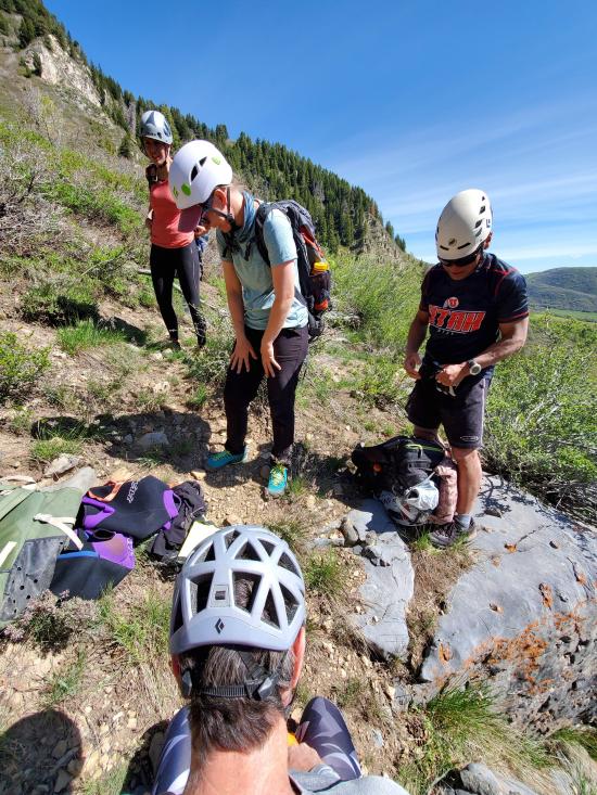
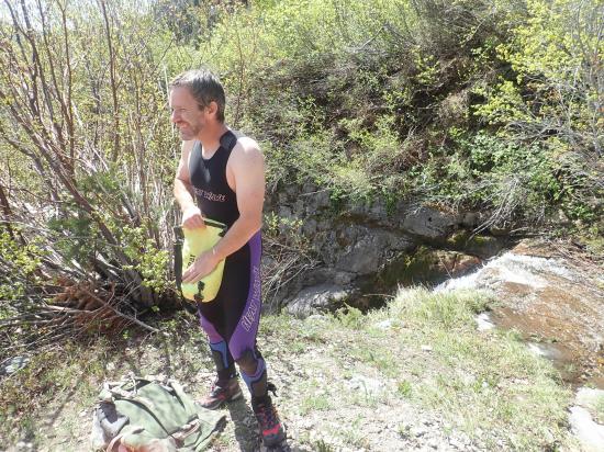
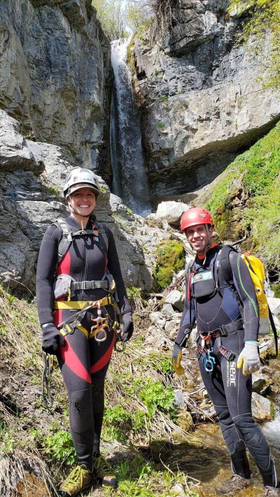
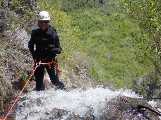
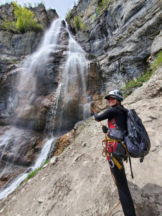
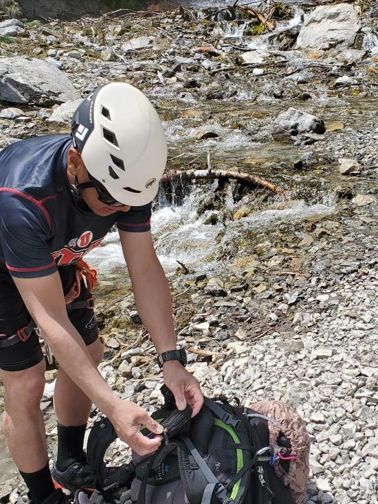
Put your wet suit on, and dry bag your gear.
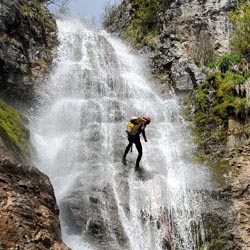
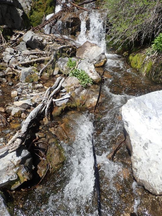
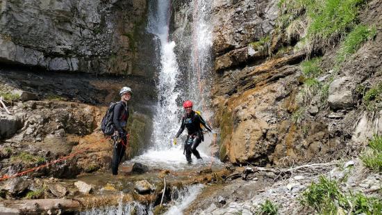
This canyon route consists of 4 waterfalls in quick succession. There are additional waterfalls higher up that can also be dropped. For this reason, I'm numbering the waterfalls with waterfall #1 being at the bottom and #4 being the first one you arrive at.
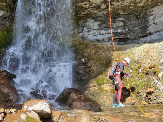
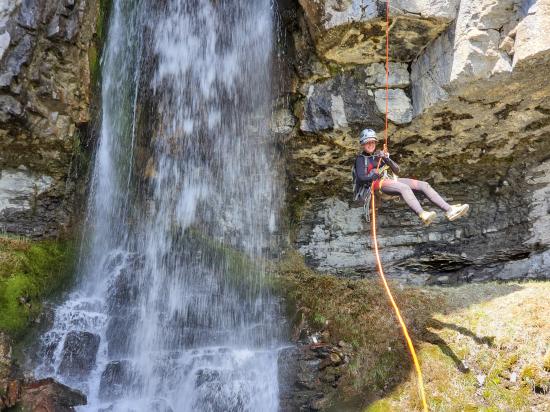
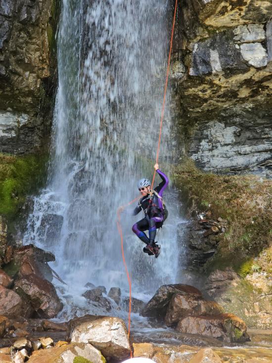
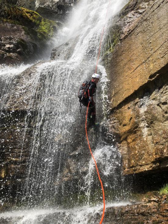
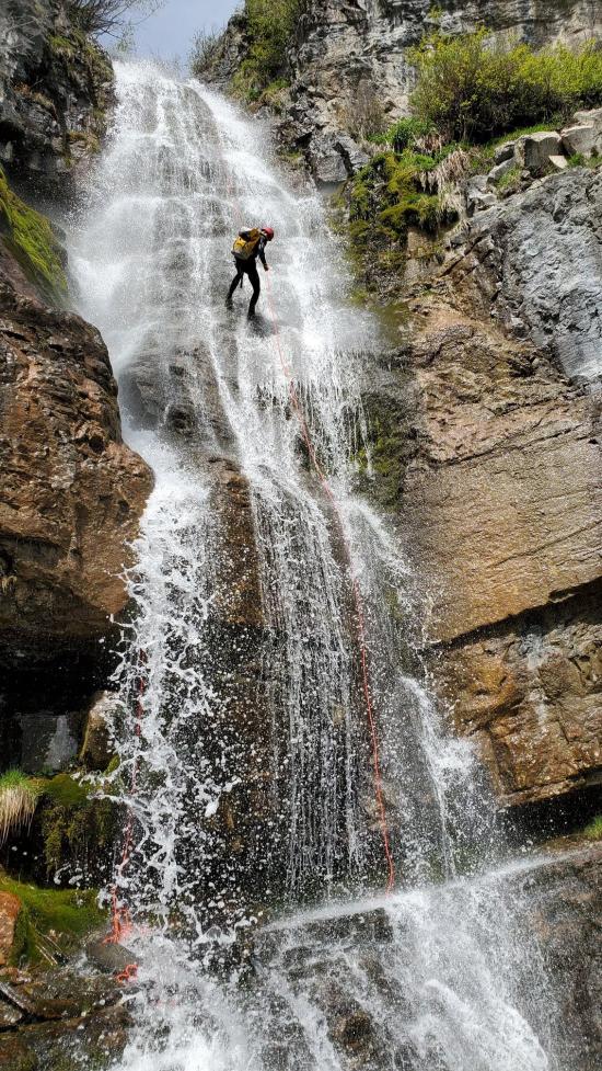
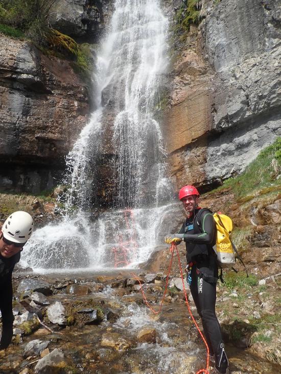
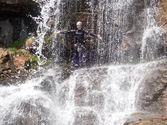
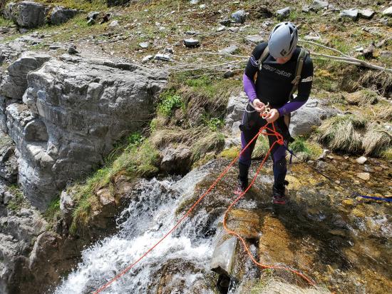
Waterfall #4: 60-foot rappel from a tree anchor on the north side or from a tree on the south side. The south option puts you directly in the waterfall. The north option puts you next to the waterfall.
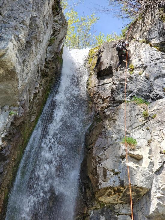
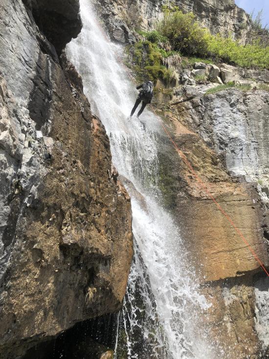
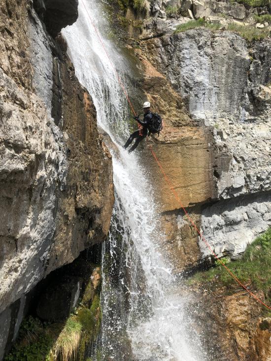
Waterfall #3: 110-foot rappel from a boulder anchor. The boulder is quite a ways from the lip, so bring plenty of webbing to extend the anchor if it needs to be replaced.
Waterfall #2: 50-foot rappel from a boulder anchor. The boulder is quite a ways from the lip, so bring plenty of webbing to extend the anchor if it needs to be replaced.
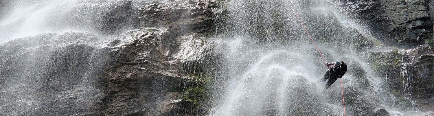
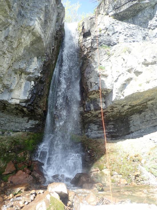
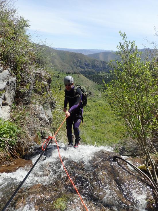
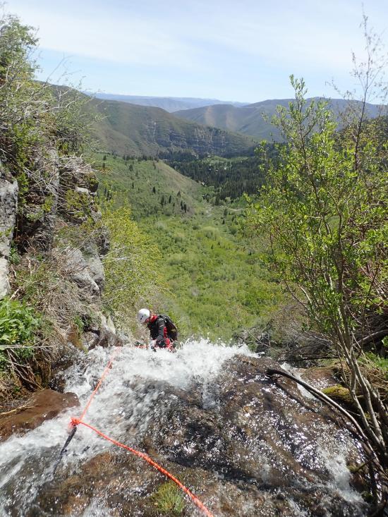
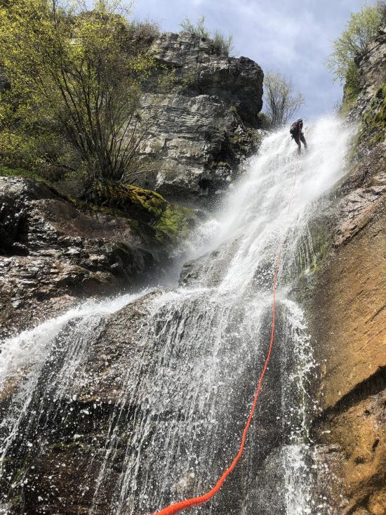
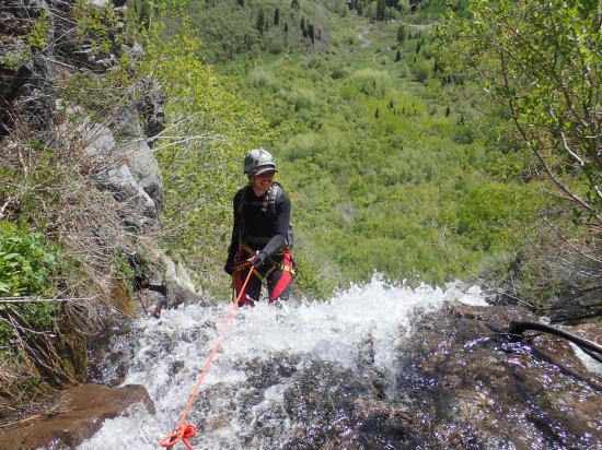
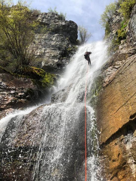
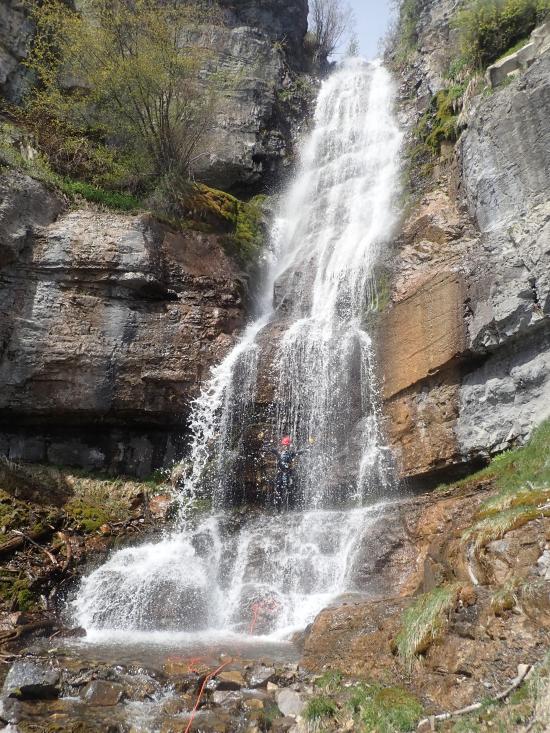
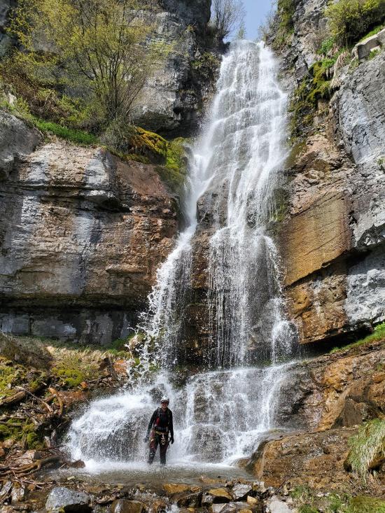
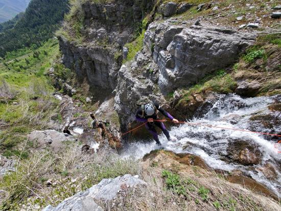
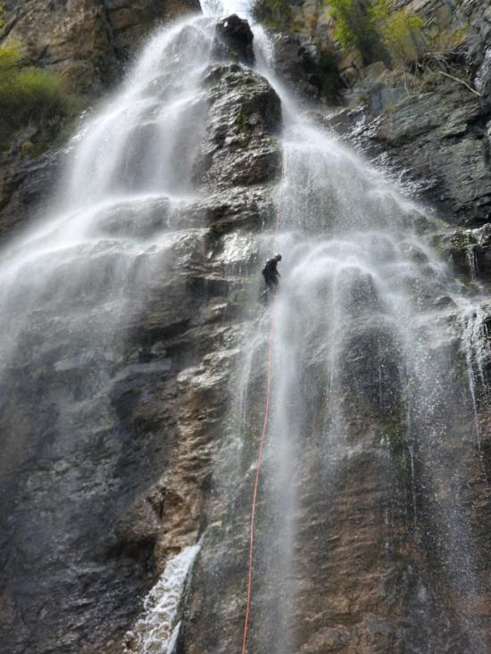
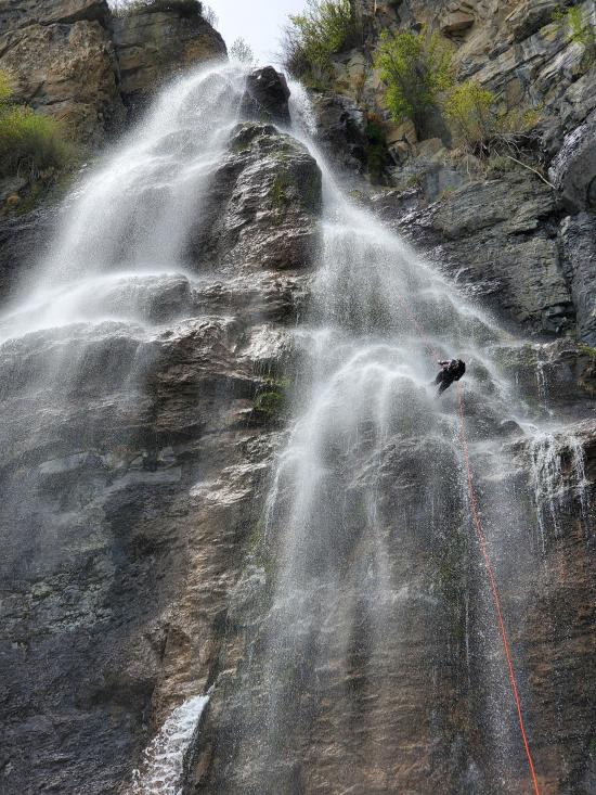
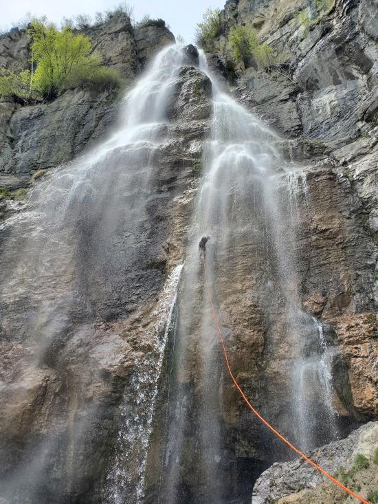
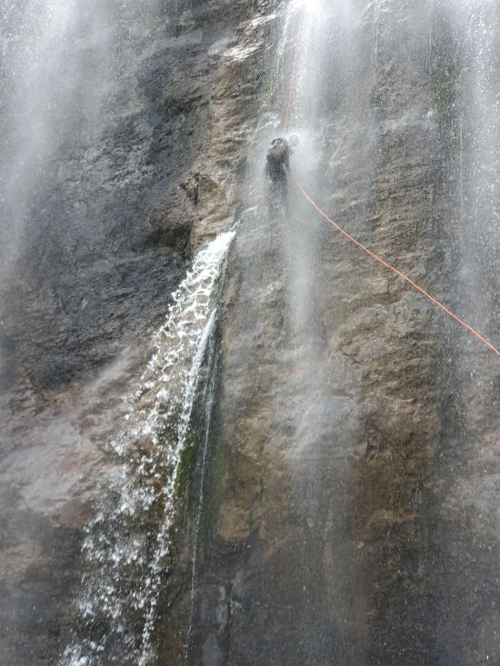
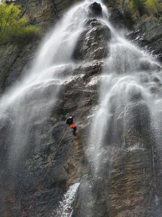
Waterfall #1: 230-foot rappel from a tree anchor. A couple of things to note: DON'T THROW YOUR ROPE! There are lots of people at the bottom, and you don't want to hurt anyone. On a similar note, be very careful not to dislodge any rocks that might hit someone down below. Another thing to note is that it is very easy to get your rope stuck when you're pulling it down. Once at the bottom, pull to the north for the cleanest pull direction.
Strip off your wetsuite and take the Stewart Falls Trail back to your car.
By Jeremy Dye
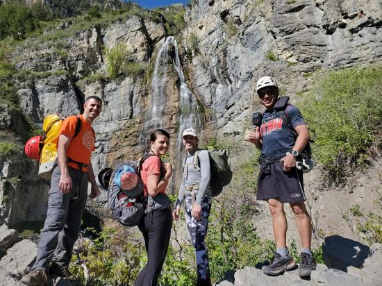
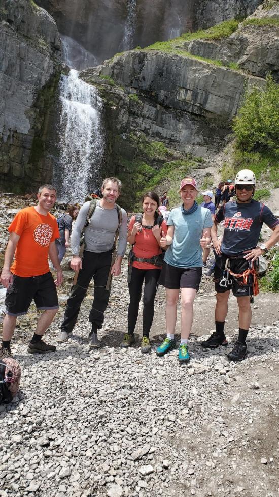
Jeremy Dye, Ondylyn Wagner, J.J. Fernandez, Roy Stevens, Jaime Jones,
Start: 9:05 a.m.
Bottom of Stewart Falls: 9:45 a.m.
Top of Canyon: 10:35 a.m.
Bottom of Canyon: 1:00 p.m.
Finish: 2:00 p.m.
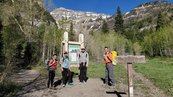
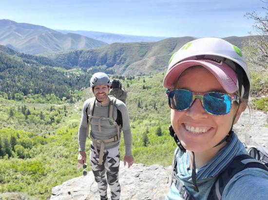
J.J. put this trip together for us. I wasn't sure if I was going to make it because of scheduling with the masons working on our garden beds, but the masons cancelled on Friday night, so I ended up being able to go. On Saturday morning, I left home and picked up Ondy on the way. We met Jaime, Roy, and J.J. at the trailhead at 8:30. After we got the group gear figured out, we started hiking shortly after 9:00. For rope lengths, we used a single 250-foot rope and a 200-foot pull cord.
We made pretty good hiking time up to the falls, arriving in about 40 minutes. We snapped a couple of pictures then scrambled up the scree slope. At the first cliff band, we used a length of webbing for a handline. At the second cliff band, we used a handline, and at the last cliff band, we also used a handline.
Once we got to the top of Waterfall #4, we changed into wetsuits and drybagged our gear. The canyoneering aspect was very straightforward. The only thing that was a bit annoying was that on the last waterfall, the rope got hung up on a few different ledges. I had to lift the rope up from a few ledges so that I could re-lower it.
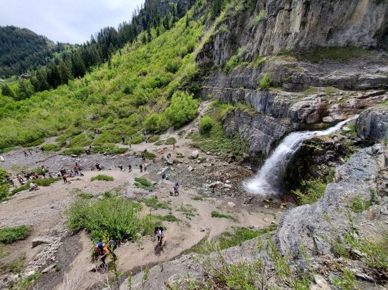
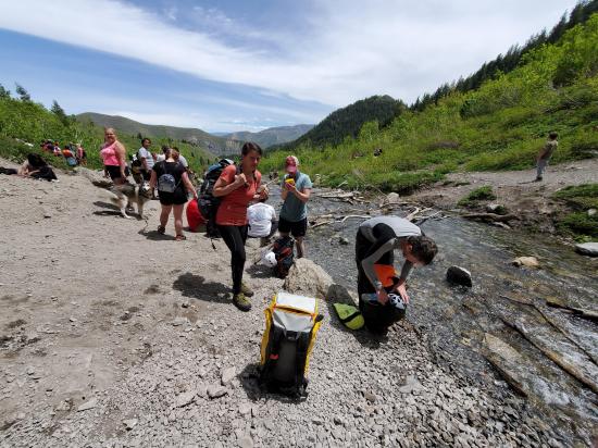
When we got down to the bottom of Stewart Falls, the place was a zoo. There were so many people. And on the hike down from the falls, it was a constant line of people going both directions. When we got to the parking lot and started driving home, we were surprised to see that not only was the parking lot full, but cars were parked along the side of the road for about a mile.
We stopped for burgers on the way home. The restaurant lobby was open and not quarantined, so we dined inside, and it was really strange for everyone. We all felt like rule breakers.
We all had a great trip; it was a lot of fun.


East Portal Dispersed Campground
Mount Timpanogos Trail from Aspen Grove
Timpooneke Trail to Mount Timpanogos
Logan Ranger District Visitor Information Center
 Rappels
 Wading
 Fixed Anchors
 Wetsuit Generally Required
 Non-potable Water - filterable
 Waterfalls
 Rivers and Streams
 Mountains
 Marked Trails
 Bushwhacking
 Restrooms - Vault
 Road Access is Paved
 Access Road is 2WD Accessible
 Hiking Trails
 Wildflowers and Vegitation
 Wildlife and Birding