 Canyoneering | Wildcat Tank Canyon


Hype:
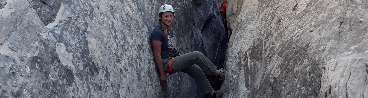
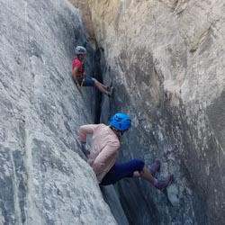
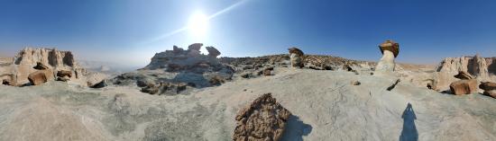
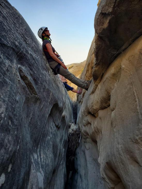
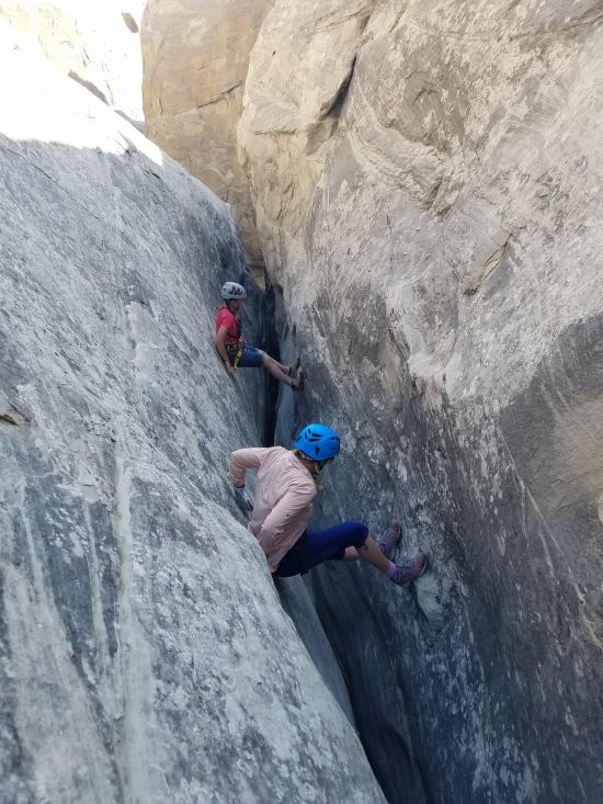
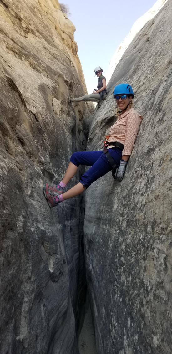
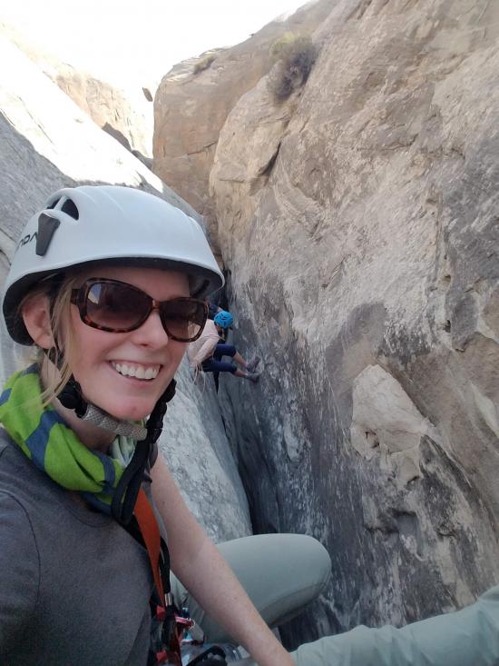
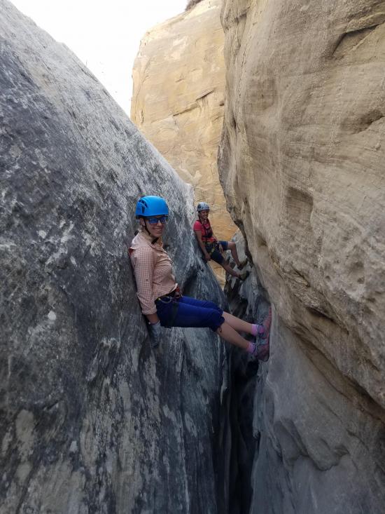
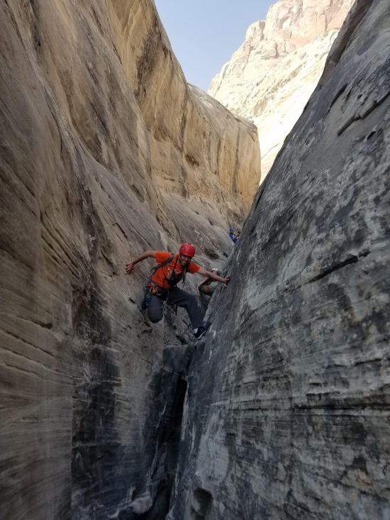
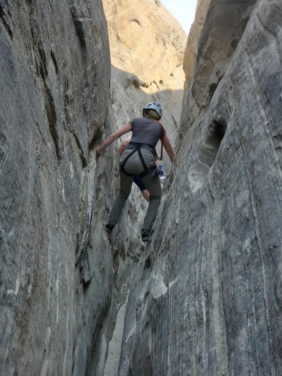
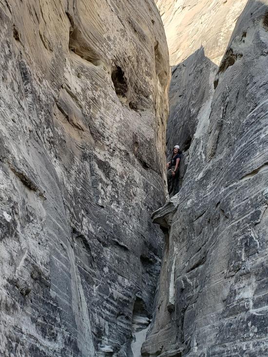
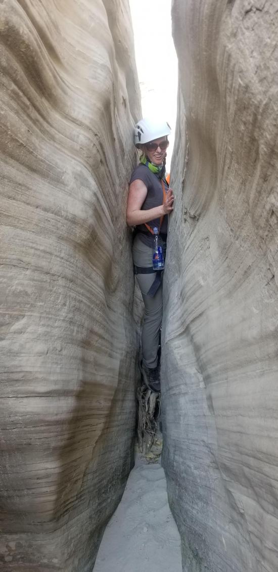
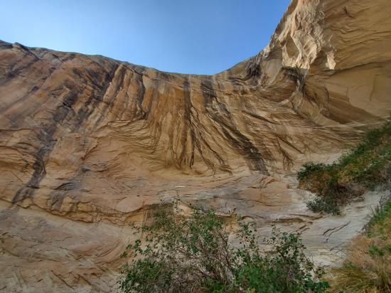
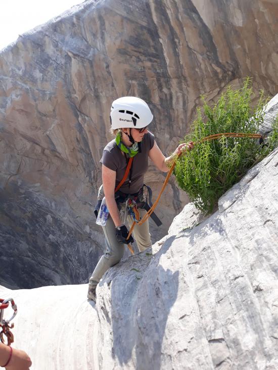
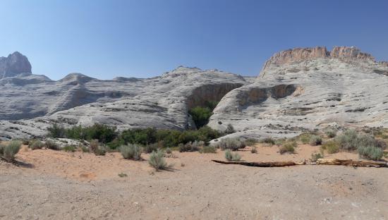
A short,fun and scenic high-stemming canyon with two rappels just north of Page, AZ. Wildcat Tank Canyon is a true high-stemming canyon, but the moves are relatively easy and you're never higher than about 30 feet above the canyon floor. The stemming is continuous for the majority of the canyon. Hang packs and wear knee pads. Between the short, easy approach (about 30 minutes), the cool toadstool formations and beautiful views at the top, the fun moves in the canyon and zero exit hike, this is a great little canyon.
Canyon Rating: 3A R- 
Time: 2-3 hours
Length: 1 mile round trip
Longest Rappel: 50 ft
Gear: Standard canyoneering gear. Kneepads. A light pack that you can hang from your harness is best or no pack at all.
Fees: None
Recommended Ages:
 | 0-3 |
 | 4-11 |
 | 12-19 |
 | 20-49 |
 | 50-69 |
 | 70+ |
Recommended Months to Visit:
| Jan |
| Feb |
| Mar |
| Apr |
| May |
| Jun |
| Jul |
| Aug |
| Sep |
| Oct |
| Nov |
| Dec |
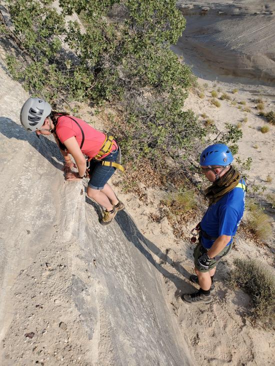
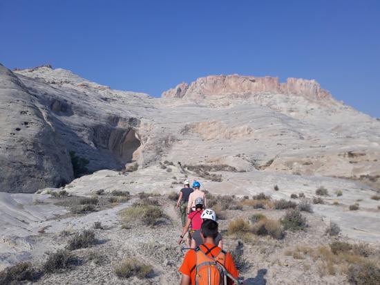
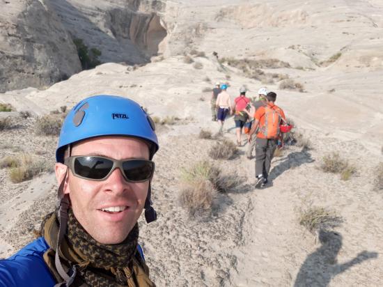
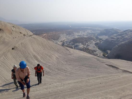
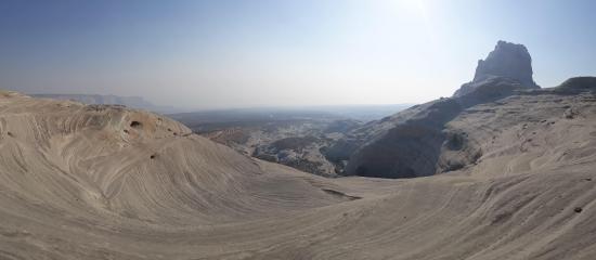
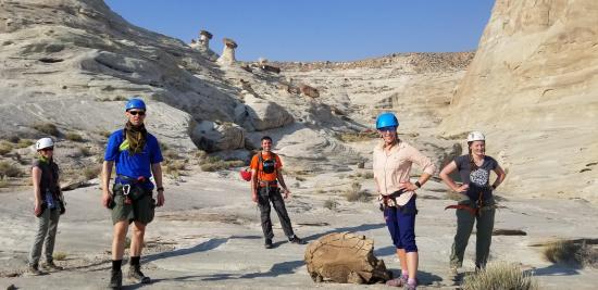
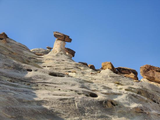
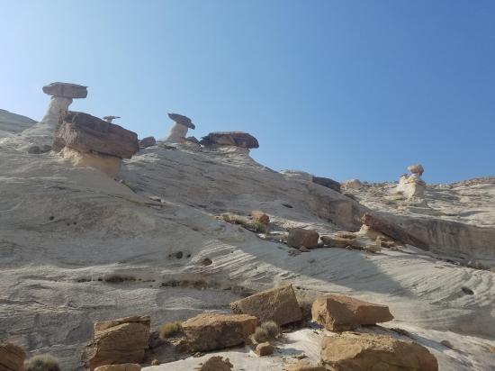
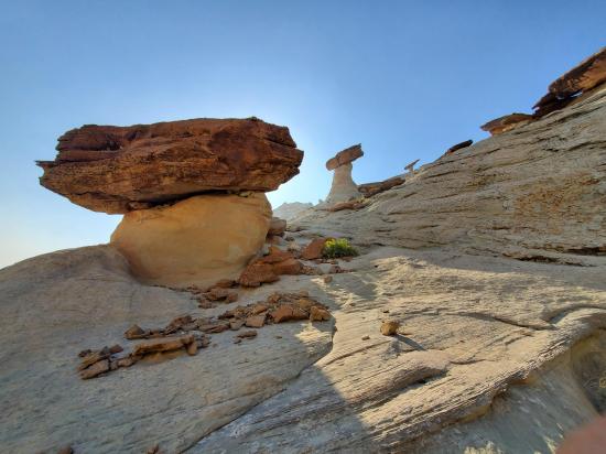
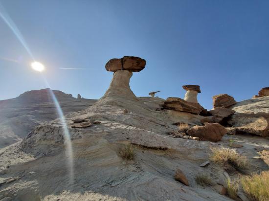
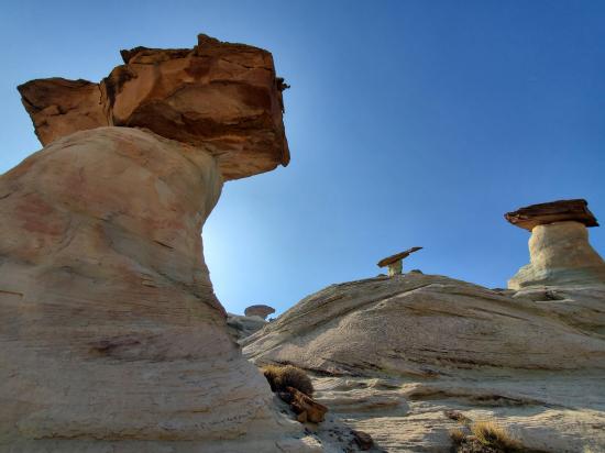
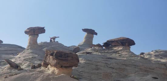
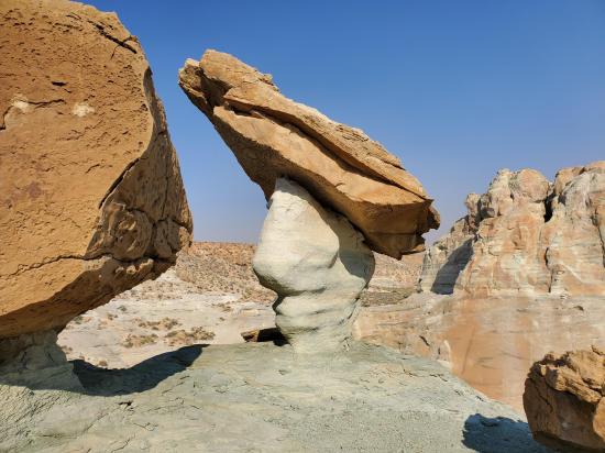
0.6 miles with 380 ft of elevation gain. From the parking area, hike east to where you can cross the wash. Once you cross the wash, turn southwest and hike up the ridge until you get to the top of the canyon. Near the top are the Stud Horse Point Hoodoos. It's definitely worth taking a few minutes to explore them up close.
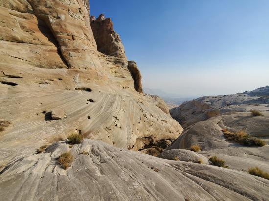
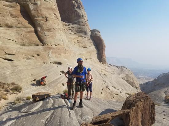
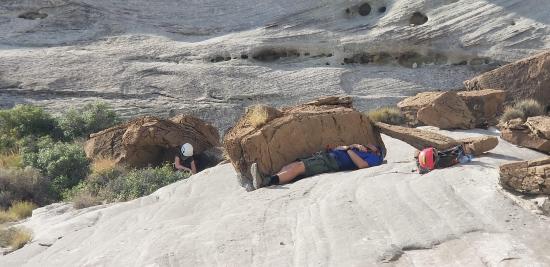
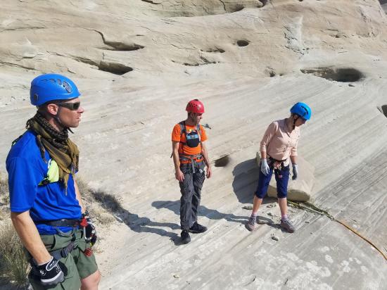
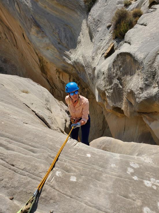
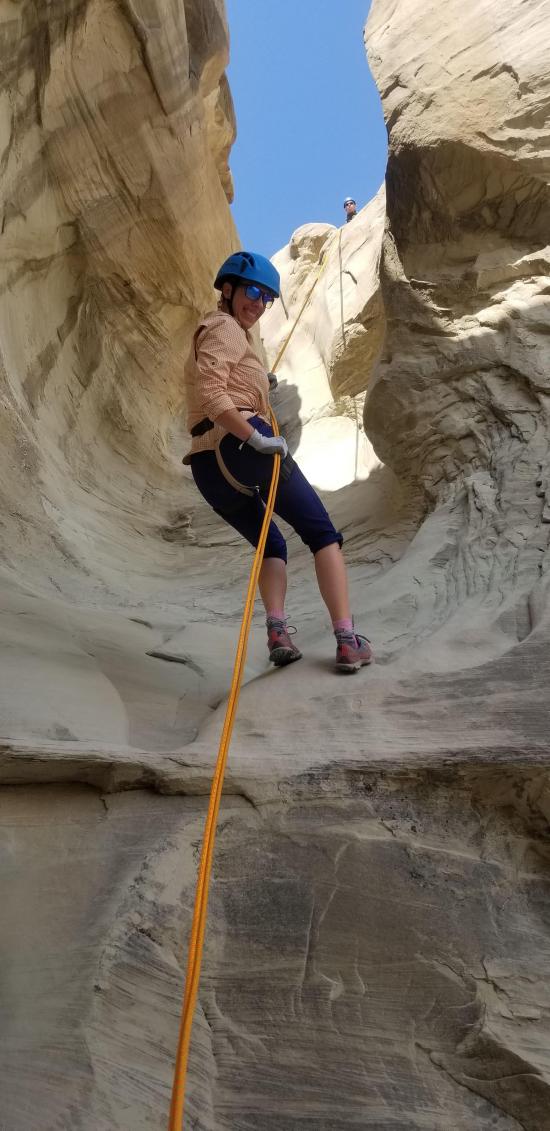
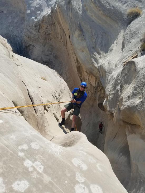
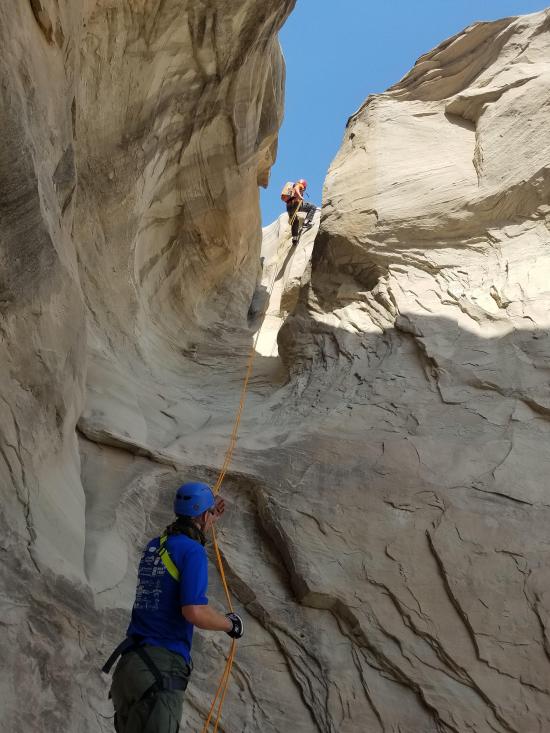
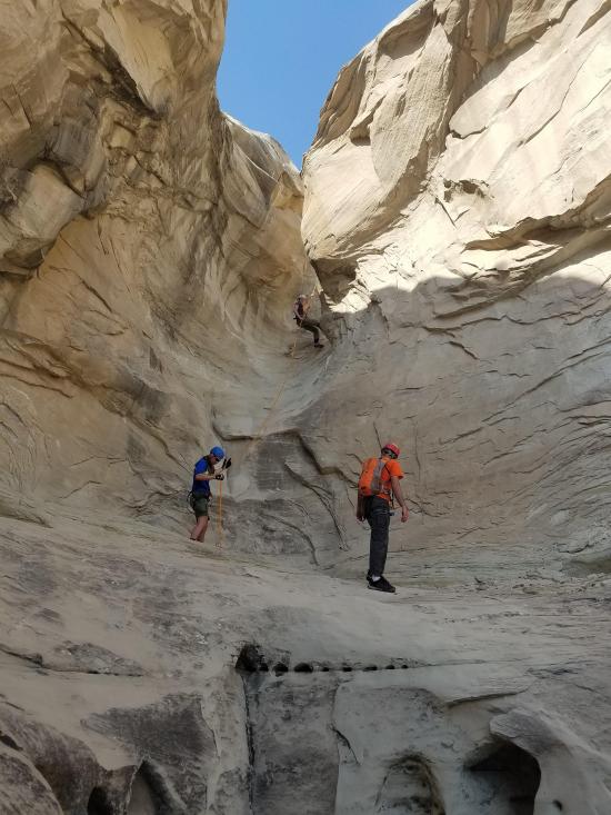
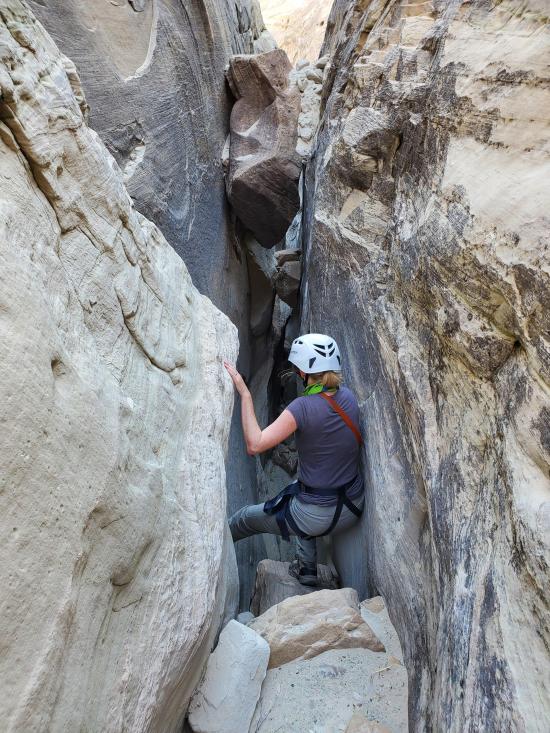
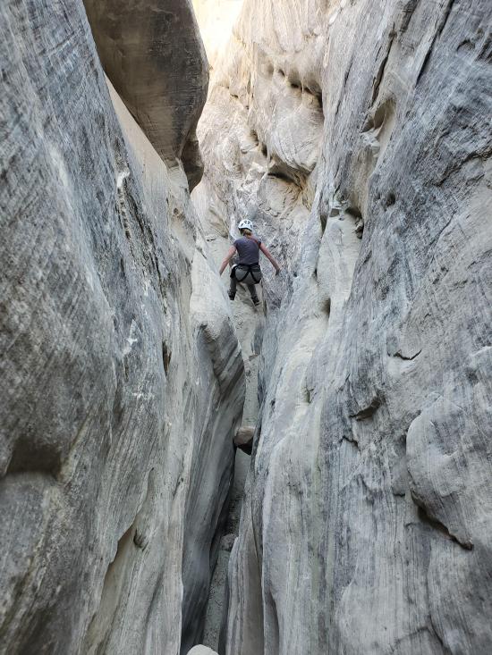
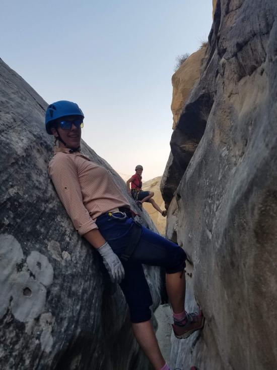
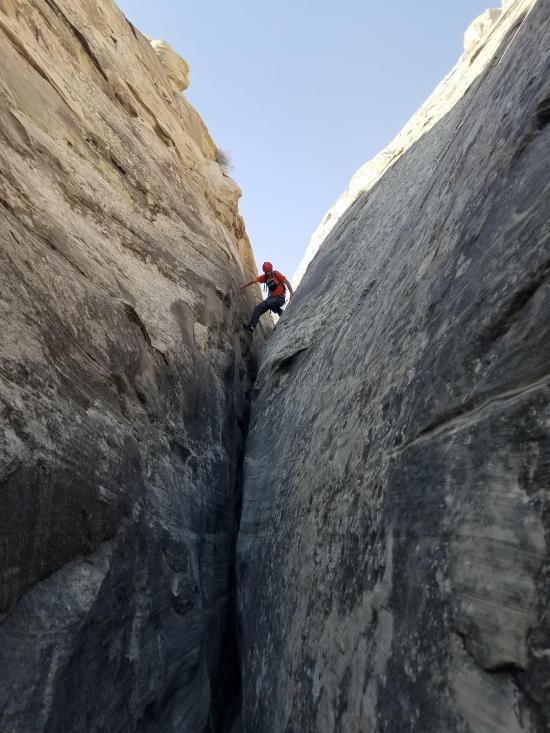
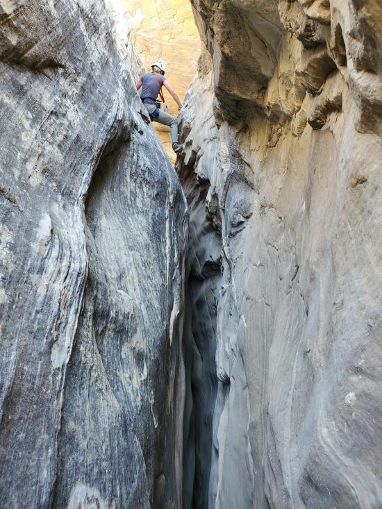
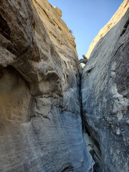
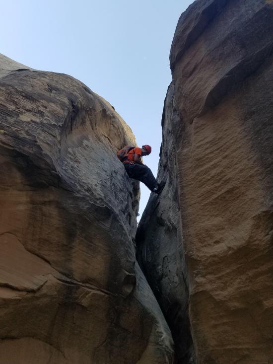
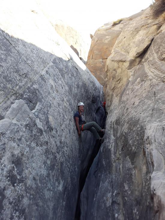
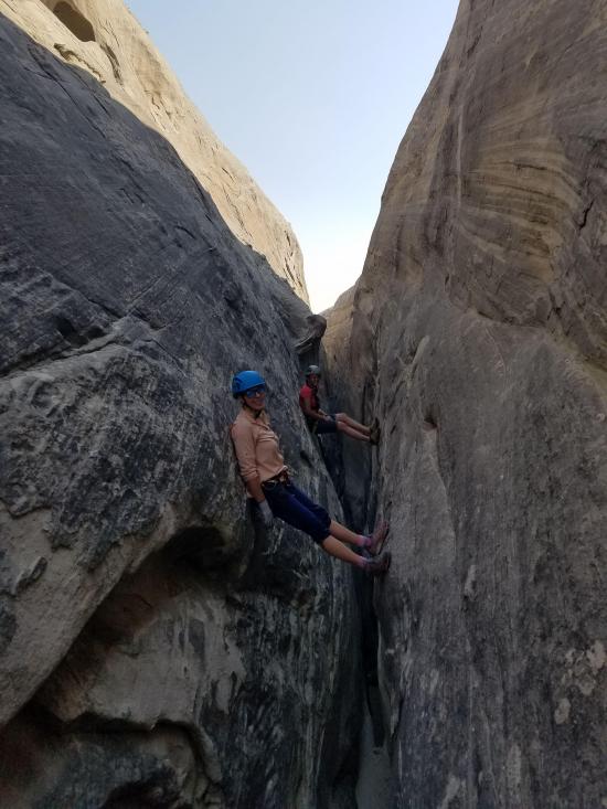
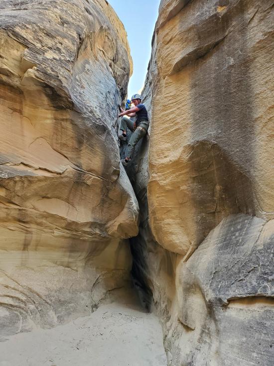
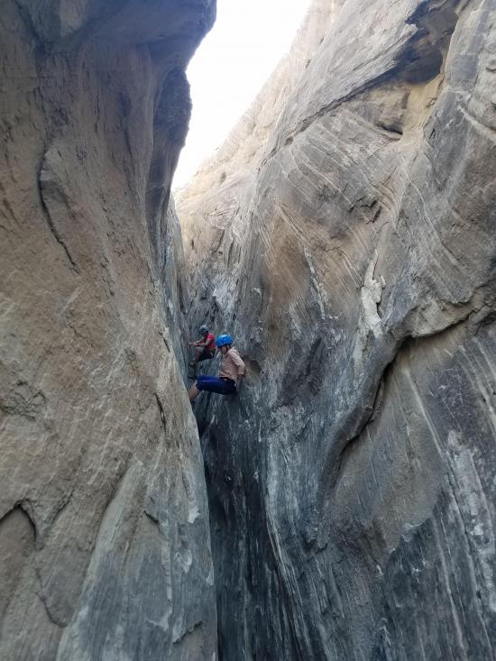
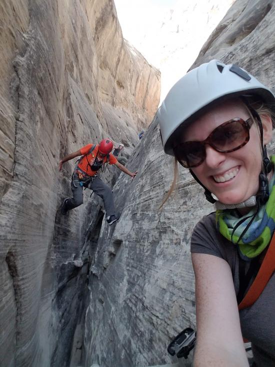
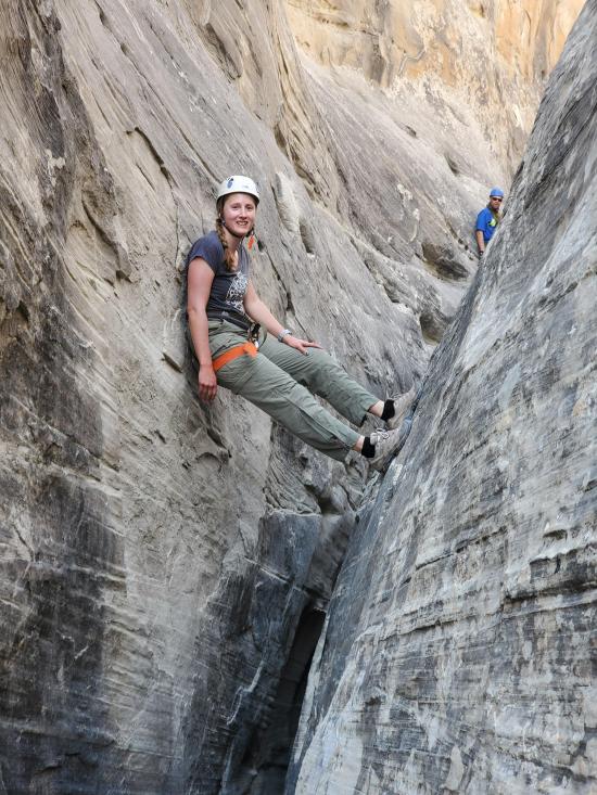
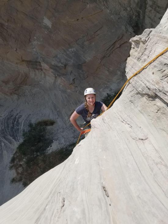
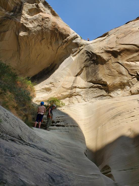
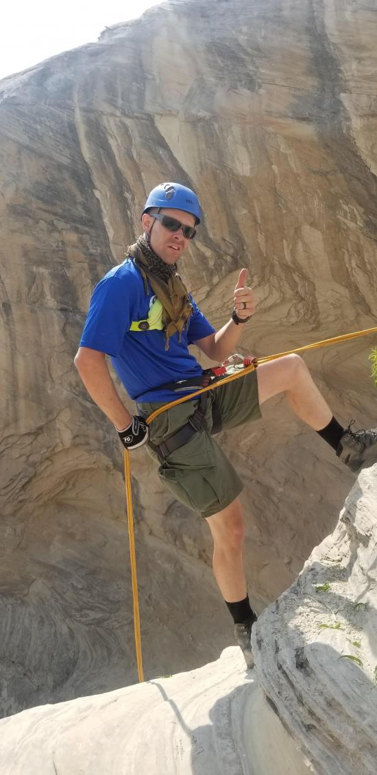
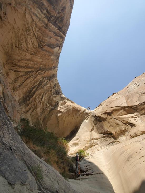
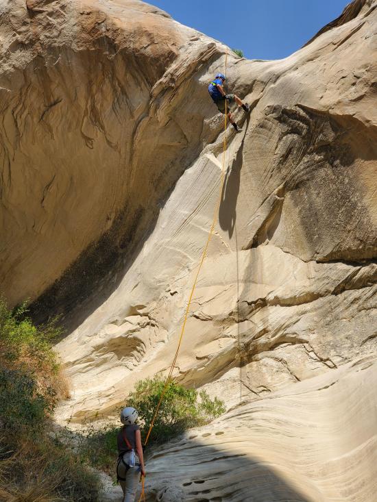
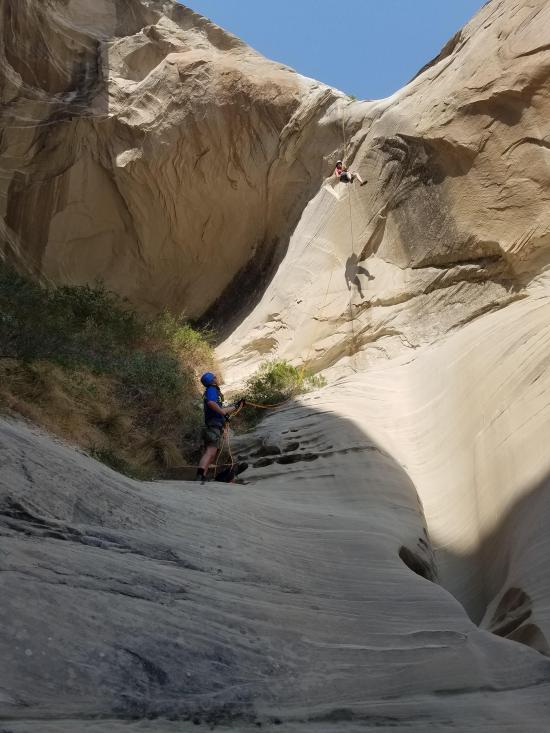
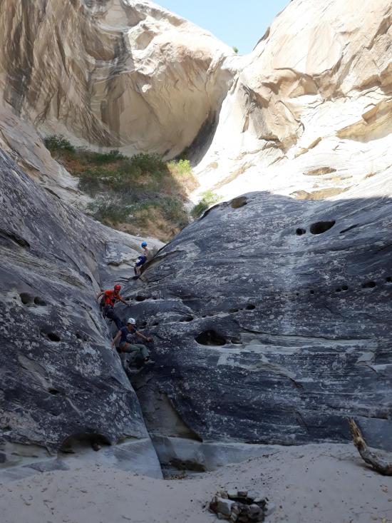
0.25 miles. Once you reach the top of Wildcat Tank Canyon, rappel 30 feet from a boulder anchor. For the majority of the canyon, you will be stemming above the ground. The canyon is shaped like a funnel with a long skinny section near the ground and an open "V" shape at the top of the crack. This "V" shape makes the stemming easy because the walls are angled and not vertical. Although you're up to 30 feet above the ground, the moves are easy and not overly risky. There is one part in the canyon where the crack ends and you have to transition from stemming to walking. It's a bit of a tricky downclimb, but a partner assist can help those who are less capable.
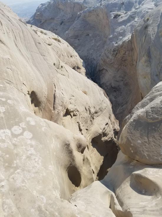
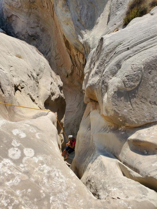
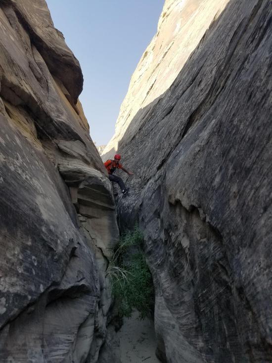
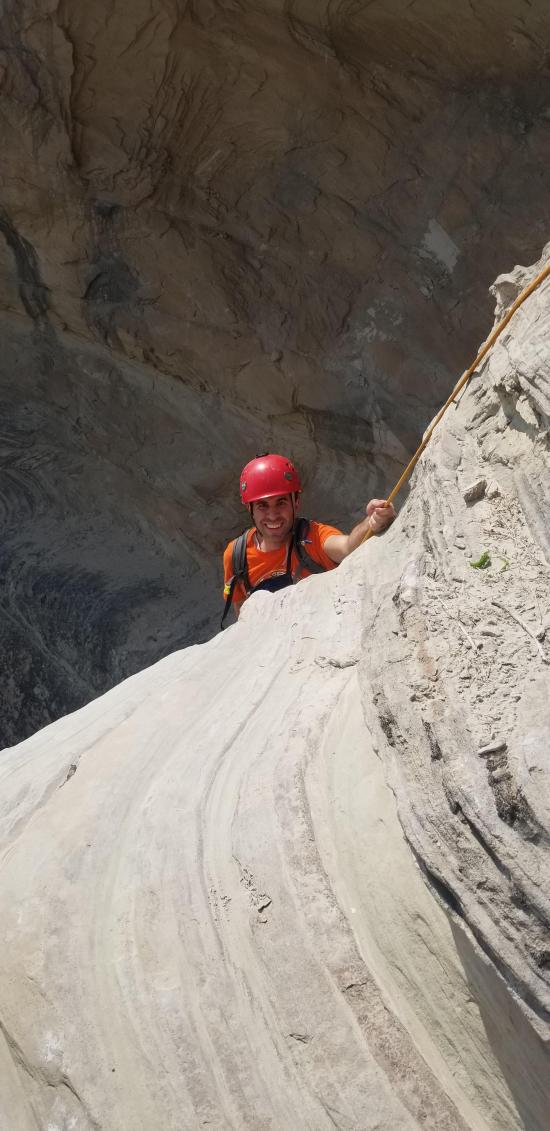
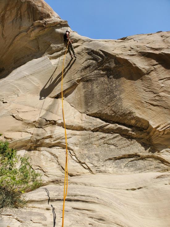
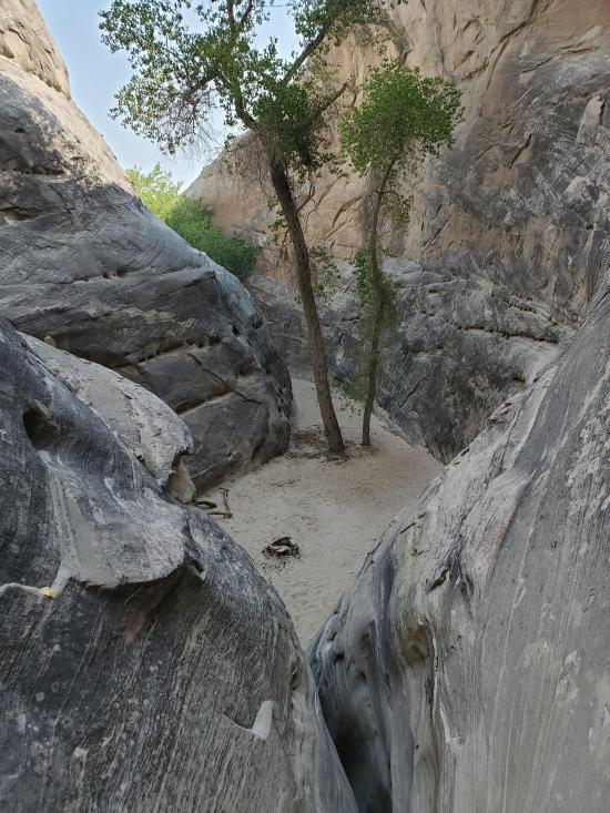
At the bottom of the canyon, there is a final rappel of 50 feet. This rappel is anchored from a knot chock wedged in a rock crack. Inspect the anchor well before rappelling. A sand trap could also be used at this drop. Once you finish the last rappel, there is a quick climb down into a shady room.
0.1 miles. From the bottom of the canyon, a short walk takes you up to your vehicle.
Closest City or Region: Glen Canyon National Recreation Area
Coordinates: 36.990364, -111.603057
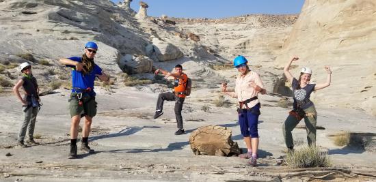
By Jeremy Dye
Jeremy Dye, Tara Dye, Ondylyn Wagner, Shawn Parker, Marci Parker, Becca Bevan,
Wildcat Tank Canyon was surprisingly fun. We parked at the end of the road near the bottom of the canyon. The approach was short, and it was still early in the morning, so it wasn't too hot. We knew it was short and that there was lots of stemming, so I forced everyone in the group except for me to leave all of their packs at the car. I had a pack with water for everyone, and we had the rope bag, and everyone wore their harnesses, and that was it. Shawn and Becca are both the cautious type that like to be prepared for every situation, so it went against their nature to travel so empty-handed, but after they started stemming in the canyon, they were glad to be able to move easily. After the first rappel, we stemmed and galumphed down canyon quite quickly. This was the first R-rated canyon for everyone in the group except for me, and everyone did great. I would definitely recommend this as an introduction to R-rated canyons because even though you're fairly high off the ground, the angles of the canyon walls make it very easy to stem.
Camping at Halls Creek and Millers Creek Confluence
Escalante River Primitive Camp 1
Escalante River Primitive Camp 2
Fence Canyon Primitive Camping
Iceberg Canyon Primitive Camping
Navajo Canyon Primitive Camping
Stud Horse Point Primitive Camping
West Canyon Primitive Camping 1
West Canyon Primitive Camping 2
Baboon Laughs Canyon (aka Laughing Baboon Canyon)
Poe Canyon (aka Smiling Cricket Canyon)
Early Weed Bench to Escalante River
Escalante River to Early Weed Bench
Lee's Ferry Historic District River Trail
Navajo Bridge Interpretive Center
 Rappels
 Downclimbs
 Stemming
 High Stemming
 Fixed Anchors
 Tight Squeezes
 Wetsuit Generally Not Required
 No Drinking Water
 Slot Canyon
 Wayfinding
 No Restrooms
 Road Access is Dirt - Low Clearance
 Access Road is 2WD Accessible
 Hoodoos