 Hiking | Nature Center Trail


Hype:
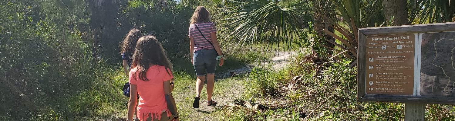
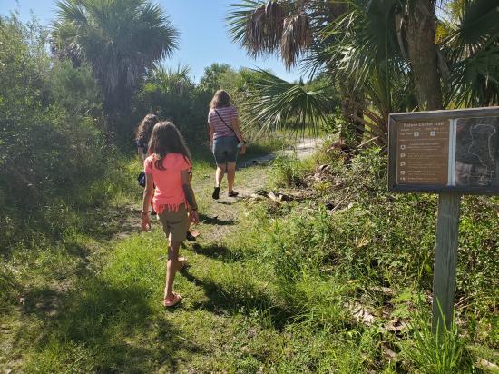
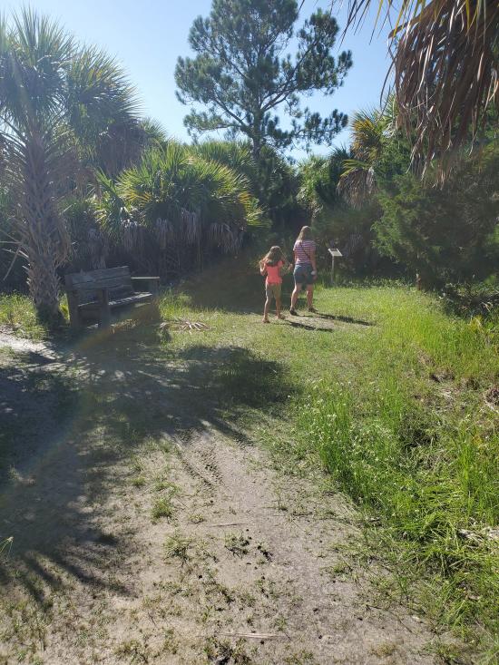
If your time is limited, consider a brief hike on this easy trail which begins and ends behind the Nature Center.
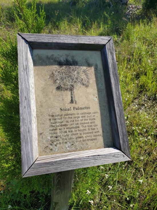
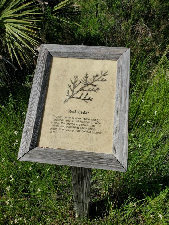
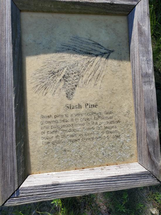
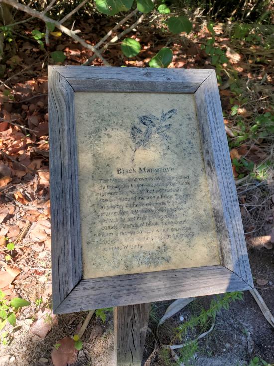
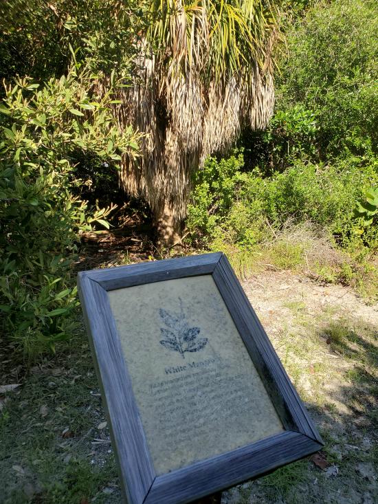
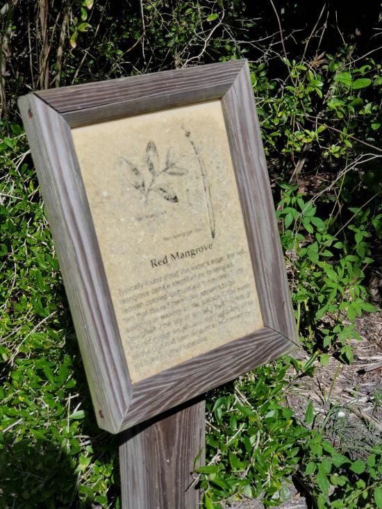
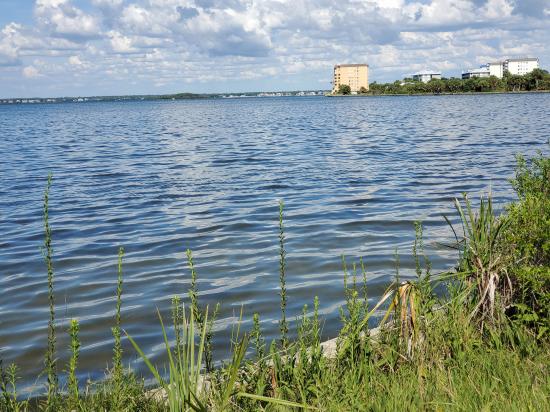
Here you will see Sabal “Cabbage” Palms, old Southern Red Cedar trees, Sea Grapes, and a few young slash pines. Wildflowers and native plants are fun to identify. The trail takes you alongside a healthy mangrove outcropping near the seawall overlooking St. Joseph Sound. At the seawall, observe a variety of seabirds and shorebirds, especially on the oyster beds in the distance at low tide. Watch for Osprey diving for fish, and the occasional shark, dolphin or manatee in the quiet waters.
This area of the park was filled with dredged material by a developer in the 1960s before becoming protected. Despite this, observe the resilience of Florida plants and animals as they take back the land.
If you plan on spending time on this trail, apply sunscreen. During late summer and early autumn, insect repellent is recommended. Dogs are welcome on a 6’ hand-held leash. If you have questions, stop in the Nature Center where there is always someone to help.
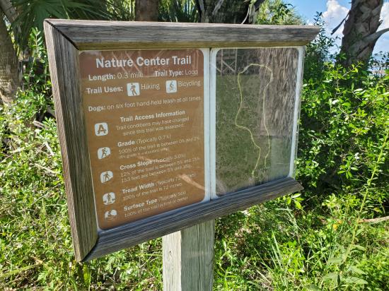
Trail Condition: Class 1 (Trail is either paved or gravel. Navigation skills are not needed because there is only one trail or because there are signs. Elevation gains are gradual or there are stairs.)
Time: 15 minutes
Length: 0.25 mile loop
Elevation Gain: Negligible
Fees: Park Entrance
Recommended Ages:
 | 0-3 |
 | 4-11 |
 | 12-19 |
 | 20-49 |
 | 50-69 |
 | 70+ |
Recommended Months to Visit:
| Jan |
| Feb |
| Mar |
| Apr |
| May |
| Jun |
| Jul |
| Aug |
| Sep |
| Oct |
| Nov |
| Dec |
Navigate to 28.060653, -82.823155.
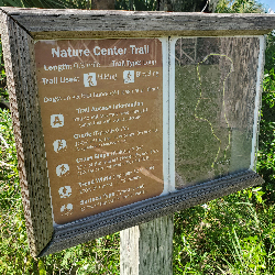
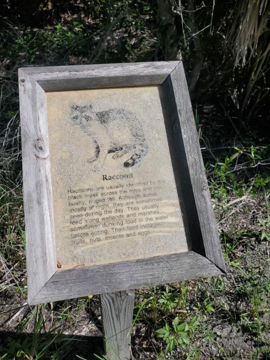
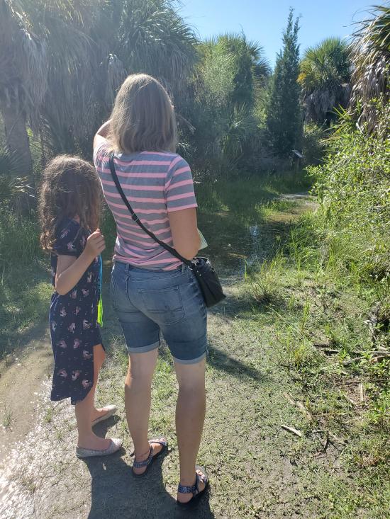
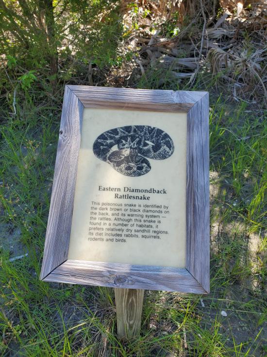
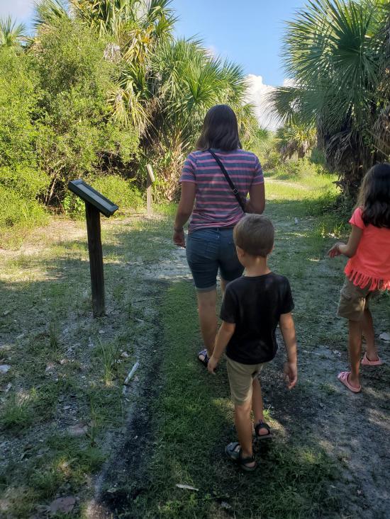
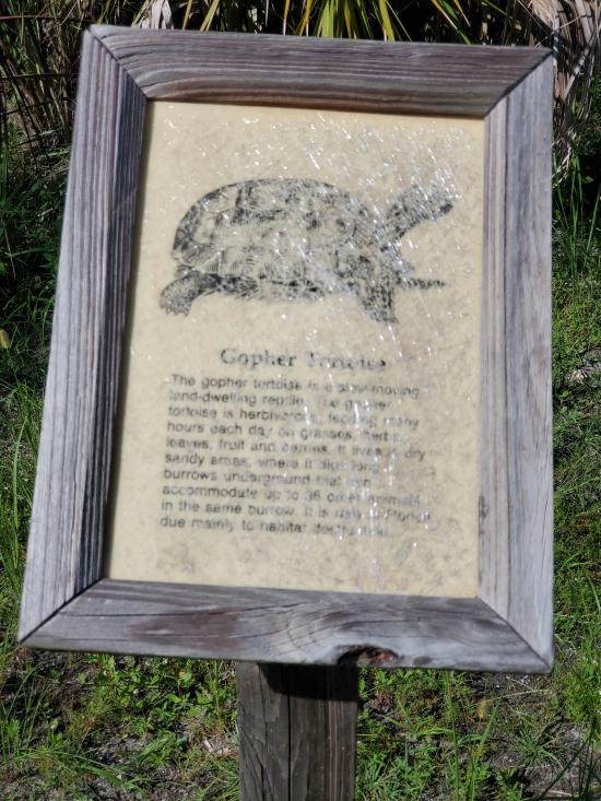
Follow the well-marked trail through the native vegitation. Along the way are several interpretive signs highlighting local plant and animal species. The signes are very old and hard to read. The trail is flooded in spots.
Closest City or Region: Honeymoon Island State Park, Florida
Coordinates: 28.060653, -82.823155
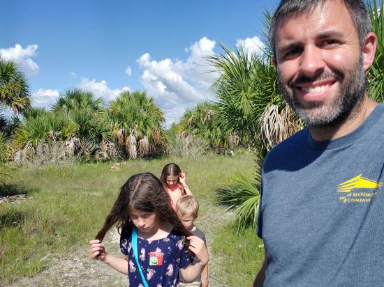
By Jeremy Dye
Jeremy Dye, Tara Dye, Savannah Dye, Madilyn Dye, Cooper Dye,
We stopped first at the Rotary Centennial Nature Center. The volunteers there were extremely nice, and they had the kids complete a scavenger hunt in the visitor centor to earn a prize bag of shells. After looking at the exhibits, we went outside and walked around the Florida Native Plants Garden and then the Nature Center Trail. Both were not that good. Then we drove up to North Beach and swam in the water, watched the birds, and collected some shells.
 Alligator and Wildlife Discovery Center
Great Explorations Childrens Museum
Dunedin Historical Society Museum
 Hiking Trails
 Marked Trails
 Interpretive Signs
 Ocean
Ocean Potable Water
 Restrooms - Flush
 Road Access is Paved
 Access Road is 2WD Accessible
 Wildflowers and Vegitation
 Wildlife and Birding
 Pets Allowed
