 Canyoneering | Munchkin Canyon


Hype:
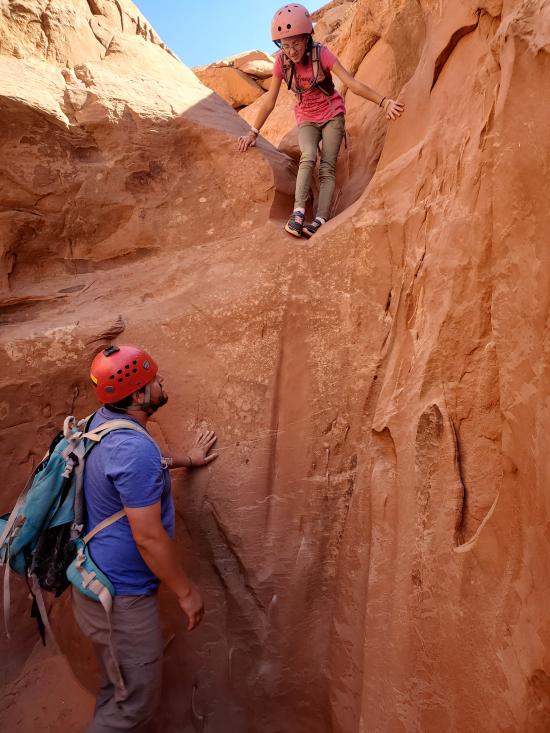
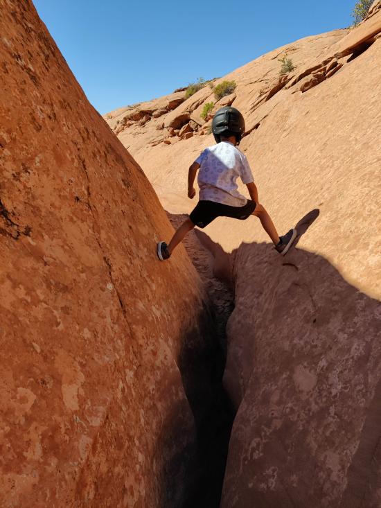
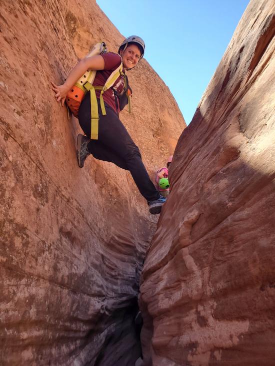
Munchkin has some pretty slot sections that are narrow and some sections that require easy stemming up to 20 feet above the ground. The narrows are short and spread out with a lot of wash walking between narrows. Rappelling is not required. The exit is a slog, especially for kids.
Canyon Rating: 2A, PG 
Time: 6-8 hours for full route, can be shortened
Length: up to 8 miles with many optional exits to shorten the trip
Longest Rappel: None
Gear: Small pack for squeezing and stemming, optional handline for some people
Fees: None
Recommended Ages:
 | 0-3 |
 | 4-11 |
 | 12-19 |
 | 20-49 |
 | 50-69 |
 | 70+ |
Recommended Months to Visit:
| Jan |
| Feb |
| Mar |
| Apr |
| May |
| Jun |
| Jul |
| Aug |
| Sep |
| Oct |
| Nov |
| Dec |
Links: https://www.roadtripryan.com/go/t/utah/north-wash/munchkin
From the road, hike abotu 100 ft to the top of Munchkin Canyon.
Munchkin Canyon starts off with about a half-mile of wash walking.
An easy downclimb followed by 400 ft of shallow, V-shaped canyon.
The canyon opens up for 700 ft.
An easy downclimb into a pothole followed by 500 ft of wash-walking.
An 8-ft pouroff downclimb or partner assist.
0.3 miles of wash walking.
400 ft of easy stemming up to 10 ft above the ground.
0.3 miles of wash walking.
300 ft section of narrow narrows. Small kids can fit at ground level through most of it, but larger people will need to stem. The stemming is about 20 ft off the deck, but the walls are mostly flared in an easy funnel shape. A few moves are more difficult.
300 ft V-shaped canyon
0.25 miles of wash walking.
At this point, we bailed because it was taking us considerably longer than our beta suggested it would. I'm not sure what the last 1.0 miles of canyon involves.
Long, boring slog.
Hike up the slickrock to the plateau top, gaining about 400 vertical feet. Then hike northeast on flat, sandy ground back to the car.
By Jeremy Dye
Jeremy Dye, Savannah Dye, Cooper Dye, Anthony Dye, Miller Dye, Ondylyn Wagner, Killian Wagner,
10:45 - Start
1:30 - Exit early
3:00 - Back at car
Our beta said the canyon would take 2-5 hours, but I think the 2 hours is only possible if you bail early. We descended the canyon for about 2.75 hours and only made it 2/3 down. The hike out was miserable for the kids. We made it up to the plateau top OK, but the long, straight, boring hike from there was torture on Cooper and Killian especially. Cooper had a stick that he wanted to take home, so I held one end of the stick and he held the other and I used that to tow him along. Eventually he just gave up and I told him I would give him a shoulder ride only if he didn't carry his stick. He walked for another 15 minutes before deciding the stick wasn't worth it. He dropped the stick and I gave him a shoulder ride for the rest of the hike out.


Butler Canyon Primitive Camping
Maidenwater Canyon, Middle Fork
 Slot Canyon
 Downclimbs
 Stemming
 Tight Squeezes
 Wetsuit Generally Not Required
 Wayfinding
 No Restrooms
 Road Access is Dirt - High Clearance
 Access Road is 2WD Accessible
