 Hiking | Hog Canyon Trail


Hype:
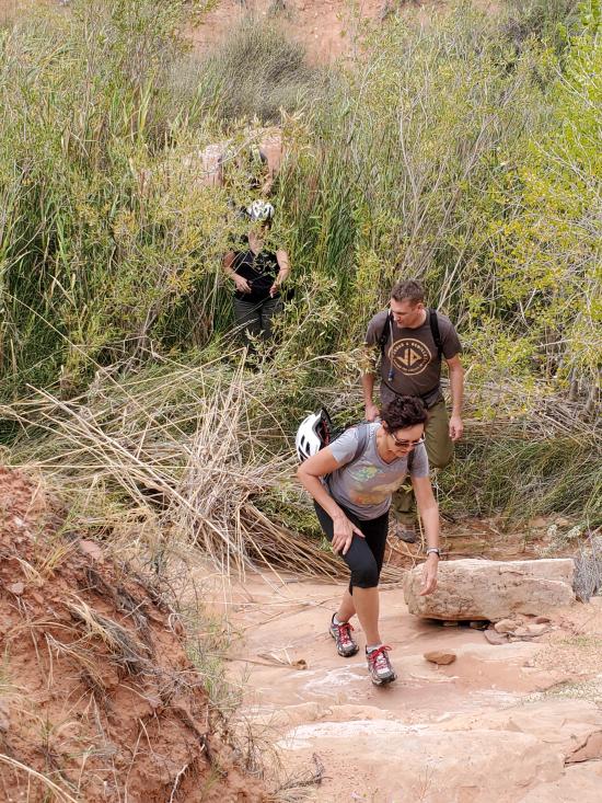
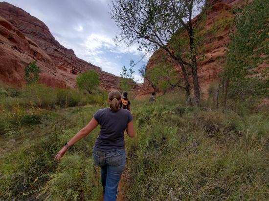
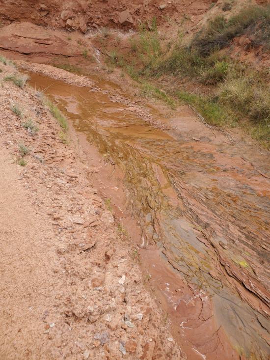
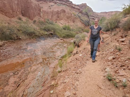
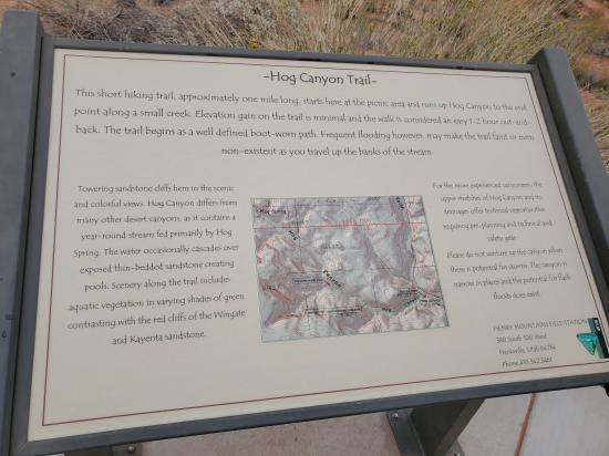
This short hiking trail, approximately one mile long, starts here at the picnic area and runs up Hog Canyon to the end point along a small creek. Elevation gain on the trail is minimal and the walk is considered an easy 1-2 hour out-and-back. The trail begins as a well defined boot-worn path. Frequent flooding however, may make the trail faint or even non-existent as you travel up the banks of the stream.
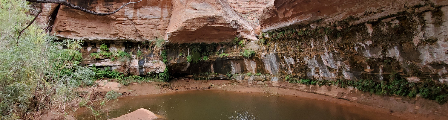
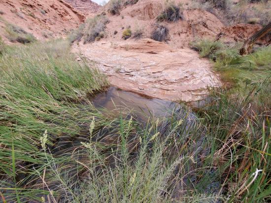
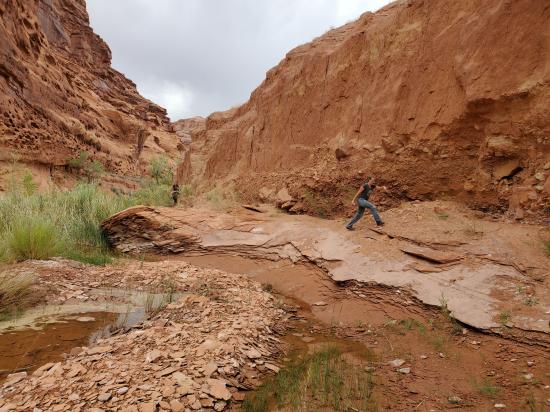
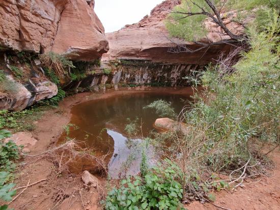
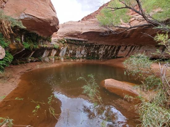
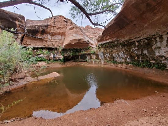
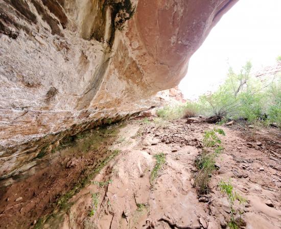
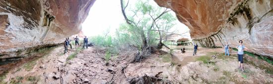
Towering sandstone cliffs hem in the scenic and colorful views. Hog Canyon differs from many other desert canyons, as it contains a year-round stream fed primarily by Hog Spring. The water occasionally cascades over exposed thin-bedded sandstone creating pools. Scenery along the trail includes aquatic vegetation in varying shades of green contrasting with the red cliffs of the Wingate and Kayenta sandstone.
For the more experienced canyoneers, the upper stretches of Hog Canyon and its drainages offer technical opportunities requiring pre-planning and technical and safety gear.
Please do not venture up the canyon when there is potential for storms. The canyon is narrow in places and the potential for flash floods does exist.
Trail Condition: Class 2 (Trail may have tree roots or rocks jutting out. Navigation skills may consist of following rock cairns and choosing turns at junctions. Elevation gains may be more substantial.)
Time: 1-2 hours
Length: 2 miles round trip
Elevation Gain: Negligible
Fees: None
Recommended Ages:
 | 0-3 |
 | 4-11 |
 | 12-19 |
 | 20-49 |
 | 50-69 |
 | 70+ |
Recommended Months to Visit:
| Jan |
| Feb |
| Mar |
| Apr |
| May |
| Jun |
| Jul |
| Aug |
| Sep |
| Oct |
| Nov |
| Dec |
Navigate to 37.962782, -110.491219.
CAUTION: Watch out for POISON IVY! There is quite a bit at the alcove, but it's easy to avoid if you know what you're looking for.
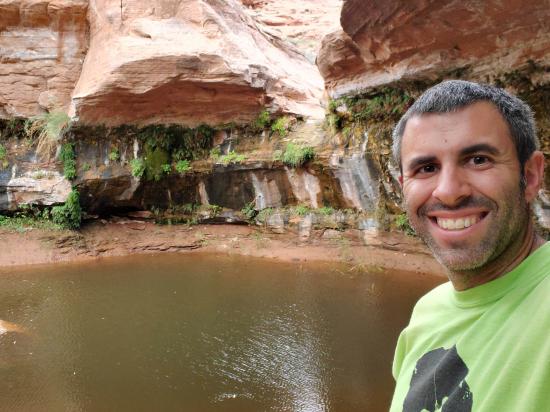
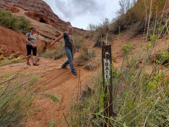
Start at the stairs between the two pavilions and follow the well-worn foot path north across the stream. Continue southwest along the bank of the stream. The beginning portions of the trail are easy to follow, but as you get farther up the canyon, the trail starts to become harder to find and splits into multiple social trails in spots. Follow the most traveled trail. You may get your feet wet in spots as there are multiple stream crossings. After 1 mile you will arive at an alcove with a dryfall and a pond. Enjoy the view then return the way you came.
Closest City or Region: North Wash, Utah
Coordinates: 37.964959, -110.507380
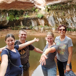
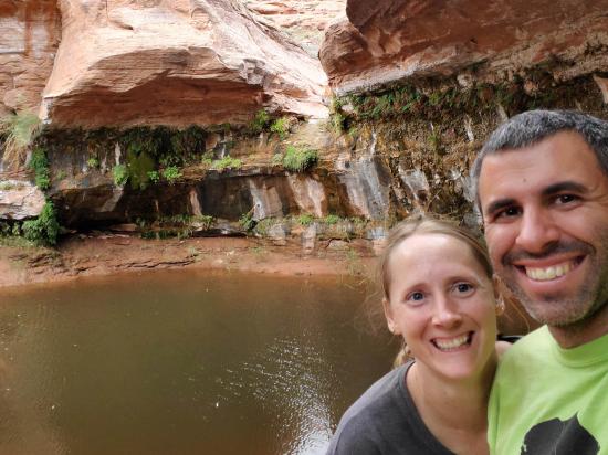
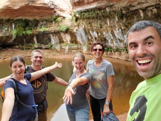
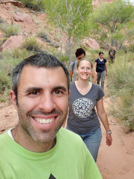
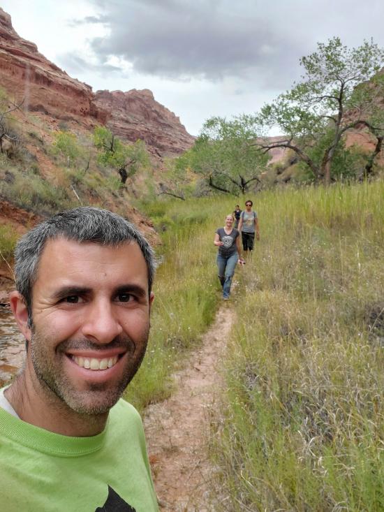
By Jeremy Dye
Jeremy Dye, Tara Dye, Matt Laurendeau, Amanda Laurendeau, Linda Goddard,
Start: 3:30 (after attempting Hogwarts and then hiking back to the picnic area)
Pool: 4:00
Finish: 4:30
We finished Leprachaun Canyon and still had some daylight left, so we decided to tag on Hogwarts Canyon. Kelly wasn't feeling up for a second canyon in the same day, so she stayed at the picnic area and read a book while the rest of us went without her. We made it part way up the approach to Hogwarts, and the weather turned really sour. The wind picked up, blowing so much sand around that you couldn't keep your eyes open. It started sprinkling, and there were some ominious storm clouds approaching. So we decided to save the canyon for another day and to hike the Hog Canyon Trail instead. I ran back to the trailhead to let Kelly know our updated plans. We didn't have any beta and hadn't paid attention to the sign at the trailhead because we weren't planning on hiking the trail, so we didn't really know what to expect. I remembered reading somewhere that there was a waterfall grotto up the canyon some ways, but that's all we knew. We hiked a lot further than we expected the trail to be. After hiking for a while, we decided that if we didn't see anything cool by 4:00 that we would turn around and start hiking back. Well, it turns out that time cutoff was not a minute too long because we arrived at the pool and dryfall at exactly 4:00. We took some pictures then started hiking back.
Butler Canyon Primitive Camping
Maidenwater Canyon, Middle Fork
 Hiking Trails
 Viewpoint, Overlooks, Vistas
 Non-potable Water - filterable
 Mountains
 Rivers and Streams
 Wayfinding
 Marked Trails
 Bushwhacking
 Restrooms - Vault
 Road Access is Paved
 Access Road is 2WD Accessible
 Wildflowers and Vegitation
 Wildlife and Birding

