 Canyoneering | Shillelagh Canyon, East Fork


Hype:
The East Fork of Shillelagh Canyon has two larger rappel and some decent narrows. With no major obstacles other than the two rappels, this canyon goes pretty quickly. The canyon is more open than the neighboring canyons, which makes for more direct sunlight. Shillelagh is generally dry.
Canyon Rating: 3A 
Time: 2-3 hours
Length: 2.4 miles round trip
Longest Rappel: 100 ft
Gear: Standard canyoneering gear.
Fees: None
Recommended Ages:
 | 0-3 |
 | 4-11 |
 | 12-19 |
 | 20-49 |
 | 50-69 |
 | 70+ |
Recommended Months to Visit:
| Jan |
| Feb |
| Mar |
| Apr |
| May |
| Jun |
| Jul |
| Aug |
| Sep |
| Oct |
| Nov |
| Dec |
Links: https://www.roadtripryan.com/go/t/utah/north-wash/shillelagh
1 mile with 500 ft of elevation gain. From the parking area, head northwest. When you get to the base of the slickrock, turn north and hike up the nose of the slickrock. Stay left of the spire. You'll gain almost all of the elevation in the first half mile of the approach. Once you scramble up to the plateau top, a very obvious trail is visible. The approach trail leads to the Shillelaghs and the Blarneys. Where the trail splits, take the north fork.
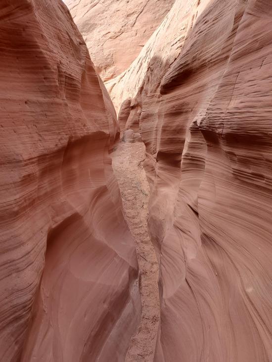
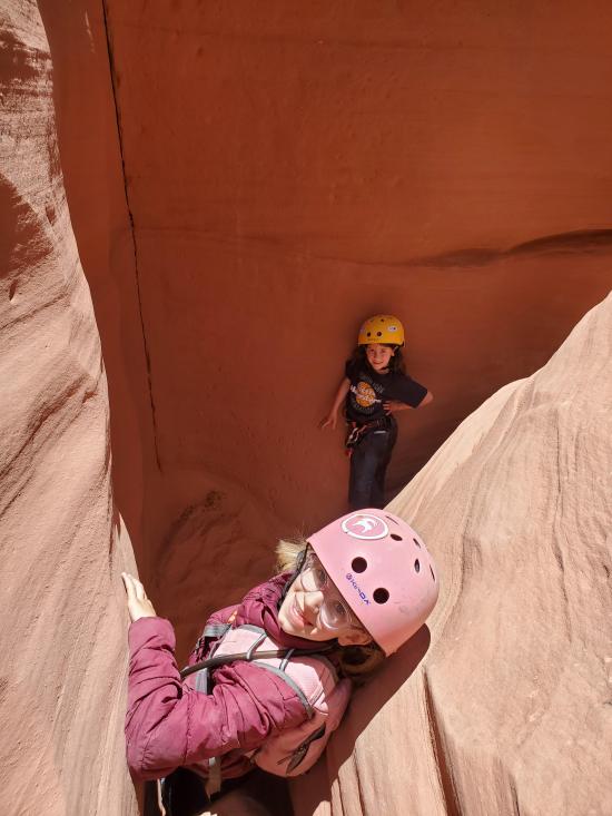
The East Fork of Shillelagh starts off with a short section of shallow, open narrows. After a few minutes, you'll come to a sequence of two rappels. The first rappel is about 50 feet tall while the second rappel is almost exactly 100 feet tall. The second rappel has some pretty striations and flutes.
The next section of narrows are the best in the canyon. There are a couple of minor downclimbs but nothing very big. The canyon soon opens up into a wash and joins up with the West Fork of Shillelagh.
0.6 miles. From the confluence, follow the wash down to the highway then follow the highway to your car.
Closest City or Region: North Wash, Utah
Coordinates: 38.033271, -110.541911
By Jeremy Dye
Jeremy Dye, Tara Dye, Savannah Dye, Madilyn Dye, Cooper Dye, Ondylyn Wagner, Killian Wagner, Matt Laurendeau, Amanda Laurendeau, Alex Laurendeau, Caleb Laurendeau, Rose Laurendeau,
Start: 9:10 a.m.
End: 12:05 p.m.
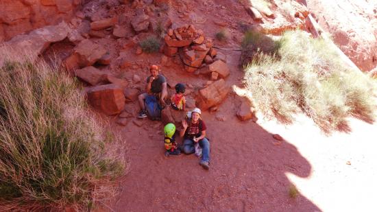
This was the Laurendeau's second canyon, and it was closer to what they were expecting. The easy rappels and walking style canyon made for a fun romp before driving home.


By Jeremy Dye
Jeremy Dye, Tara Dye, Savannah Dye, Madilyn Dye, Cooper Dye, Ondylyn Wagner, Jaren Wagner, Killian Wagner,
Start: 10:00
Top of Canyon: 10:45
End: 1:15
Shillelagh was the last canyon we did over Memorial Day weekend. Everyone was pretty tired, especially the kids. I carried Cooper up the first half of the approach, then once we reached the plateau rim, I carried Killian as well. It was kind of fun actually because I emptied out my pack and carried Cooper in my pack and Killian on my shoulders. Once we got to the top of the canyon, I pulled out the drone and took some fun videos of everyone rappelling down the two rappels. The canyon was open enough that I could get some good pull-away shots. The rest of the canyon went pretty quickly then we packed everything up and headed home.


Butler Canyon Primitive Camping
Maidenwater Canyon, Middle Fork
 Rappels
 Fixed Anchors
 Wetsuit Generally Not Required
 No Drinking Water
 Slot Canyon
 Wayfinding
 No Restrooms
 Road Access is Paved
 Access Road is 2WD Accessible
 Wildflowers and Vegitation
 Wildlife and Birding