 Caving | Big Brush Creek Cave


Hype:
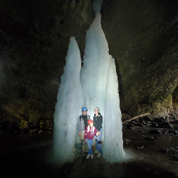
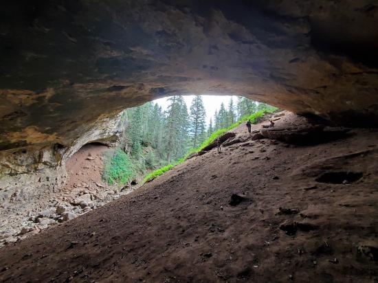
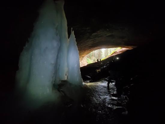
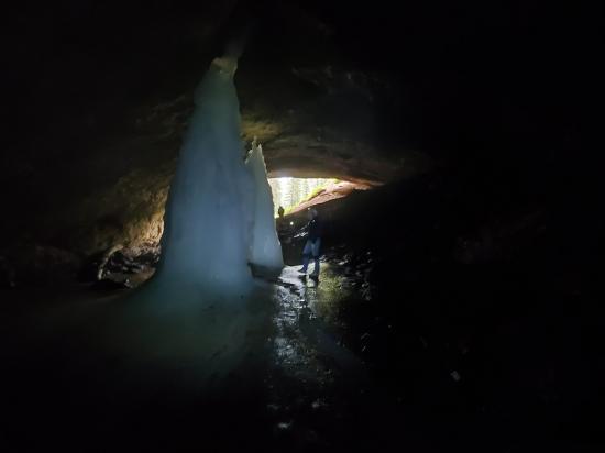
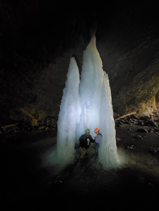
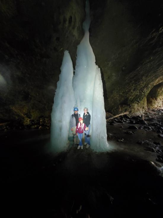
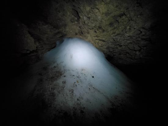
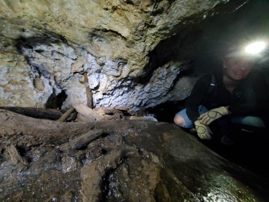
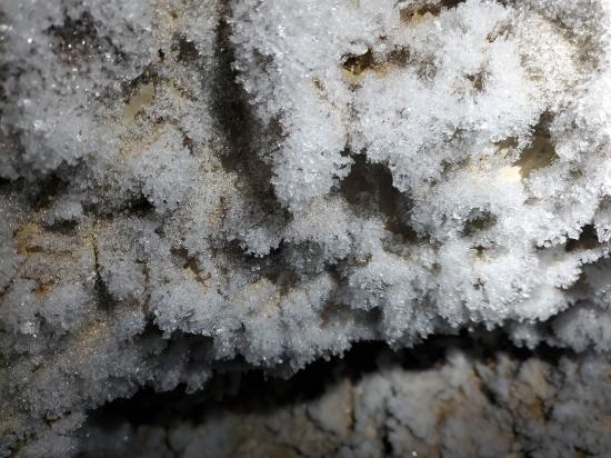
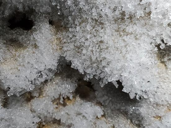
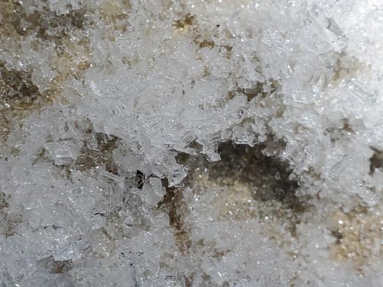
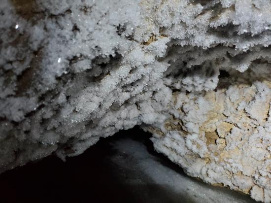
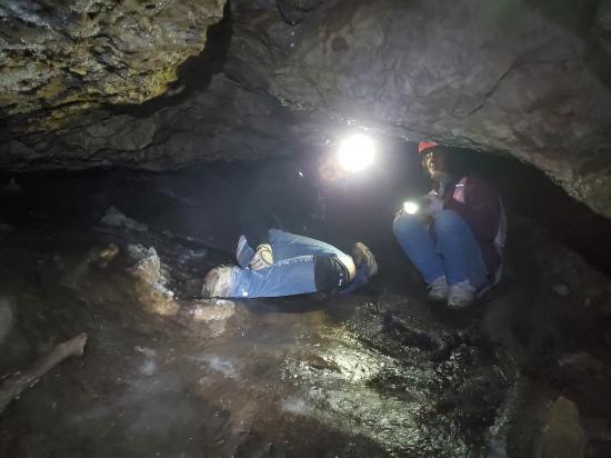
At almost 5 miles of passages, Big Brush Cave is the second longest cave in Utah. The cave is amazing, and you can drive to within a half-mile of the cave, which makes this cave very popular for both cavers and the casual visitor. The entrance room has amazing ice columns year round. If you decide to explore deeper into the cave, be prepared for long sections of tight belly crawling and scrambling around and through log jams. Big Brush Creek Cave gets its name from Big Brush Creek, which flows into and through the cave. Do no enter the cave when the stream is flowing or when rain is in the forecast.
Cave Type: Horizontal
Time: 1 hour to a full day, depending on how deep you go
Length: 4.92 miles
Depth: 858 ft
Gear: Helmet, headlamp, kneepads, gloves, warm synthetic clothes, rope and vertical gear if going deep, cave map, first aid kit, food, and water.
Fees: None
Recommended Ages:
 | 0-3 |
 | 4-11 |
 | 12-19 |
 | 20-49 |
 | 50-69 |
 | 70+ |
Recommended Months to Visit:
| Jan |
| Feb |
| Mar |
| Apr |
| May |
| Jun |
| Jul |
| Aug |
| Sep |
| Oct |
| Nov |
| Dec |
Permits: Open
Links: https://utahcaving.wordpress.com/2014/03/18/big-brush-creek-cave/https://adamhaydock.blogspot.com/2016/02/big-brush-creek-cave.html
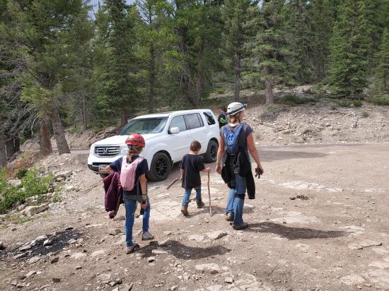
Navigate to 40.700362, -109.585990.
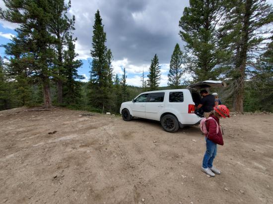
Park in the unmarked pullout on the south side of the road.
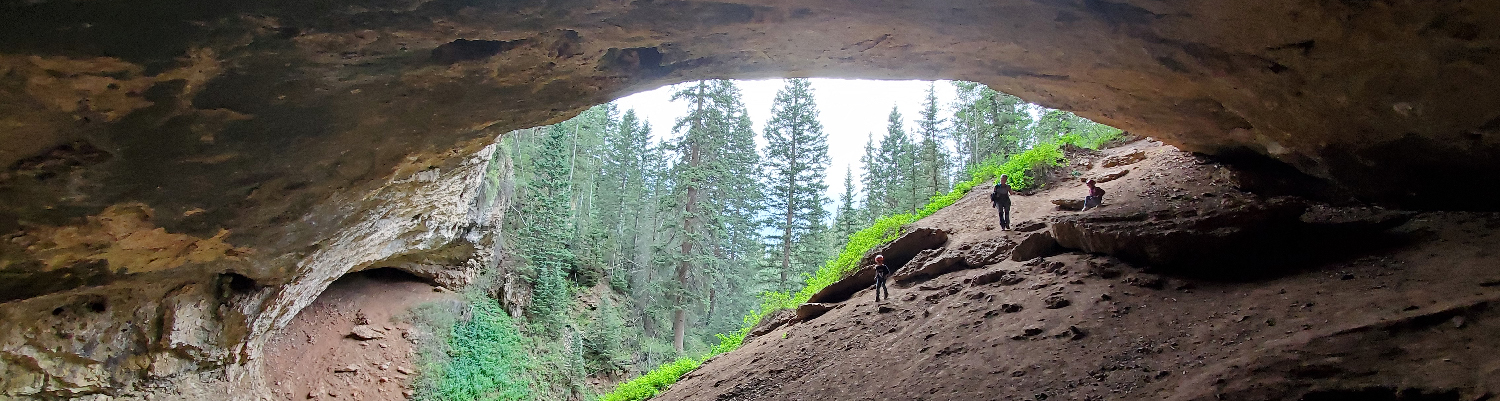
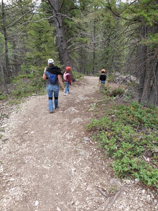
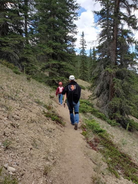
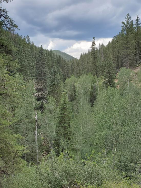
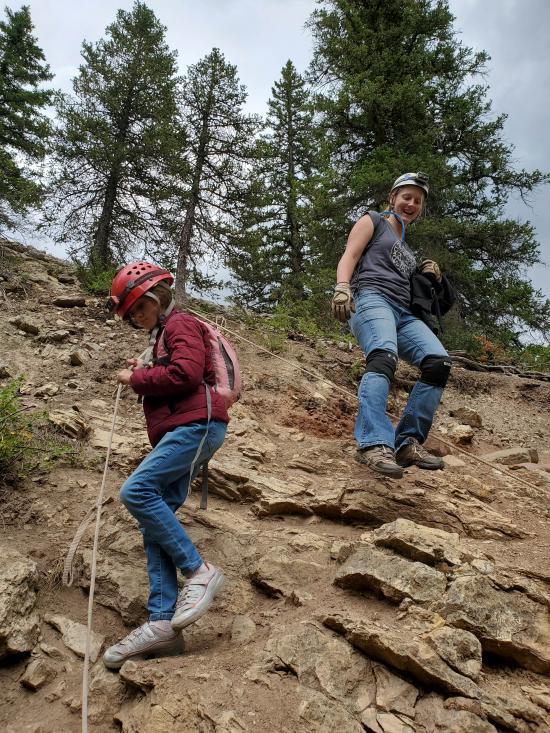
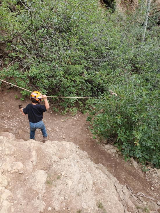
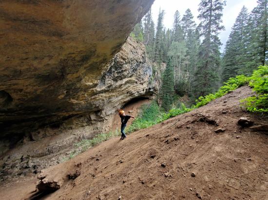
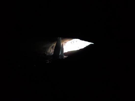
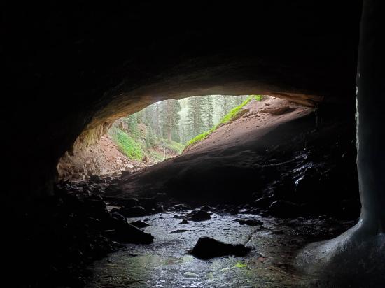
From the unmarked trailhead, start hiking south. Follow the well-traveled trail sotheast for about 0.4 miles. As you approach the cave, you'll be able to see the giant cave entrance on your right. When the trail gets close to the cave entrance, it switches back and drops down a steep hillside. There is a fixed rope for people to use as a handline.
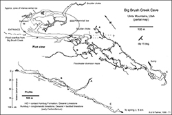
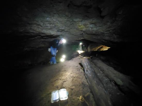
The large entrance room is spectacular with ice columns and other features. Inside the cave, passageways are narrow and cold. Many tunnels are plugged with debris forced in from past floods. Much of the cave is spent crawling and winding over very tight passages. Further into the cave it opens up into a canyon that takes you all the way to the bathrub room and to dead air passage. Along the way, there are several side passages, so make sure you take a map and know how to use it.
Return the way you came.
Closest City or Region: Vernal, Utah
Coordinates: 40.697227, -109.583954
By Jeremy Dye
Jeremy Dye, Tara Dye, Savannah Dye, Anthony Dye, Miller Dye,
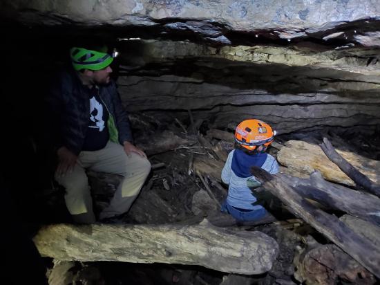
The 5 of us drove out to Big Brush Creek Cave to check it out. As we were getting our gear on at the trailhead, another group was coming back to their cars. They had just explored the entrance room and hadn't got any deeper. We hiked down to the cave and saw some nasty storm clouds in the distance. We didn't want to get caught in the cave during a flash flood, so we modified our plans. We explored the entrance room and the higher side passages but didn't go down the main passages more than a couple minutes. We figured it was better to not risk it. The cave will still be there when we go again. We got some cool pictures of the entrance room and the giant ice column, Anthony and Miller explored a short ways down the main passage, and I explored the ice-filled passages that branch off from the entrance room to the left (northeast).
 Utah Field House of Natural History State Park Museum
 Caves
Caves Tight Squeezes
 Rappels
 Water
Water Temperature
 Headlamps required
 Crawls
 Mountains
 Wayfinding
 No Restrooms
 Road Access is Dirt - Low Clearance
 Access Road is 2WD Accessible
 Wildflowers and Vegitation
 Wildlife and Birding


