 Fun Places | Tour of the Tilted Rocks


Hype:
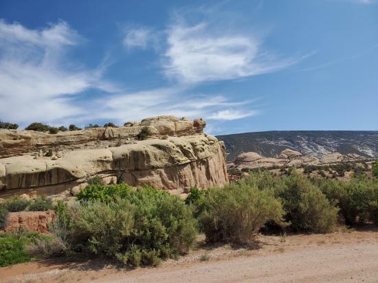
Tour of the Tilted Rocks is an 10 mile (one-way) auto tour route along Cub Creek Road, starting at the Quarry Visitor Center north of Jensen, Utah. Guidebooks are available for a small fee at either visitor center, or at a self-service post near the monument's entrance station. Features along the route include petroglyph and pictograph panels, Josie Bassett's cabin built in 1913, and fantastic views of geologic layers. A short spur road takes you to the Split Mountain Boat Launch where you can see the Green River leaving Split Mountain Canyon or watch river rafters arriving after a several day journey through the monument.
Wildlife may occasionally be seen, including mule deer, bighorn sheep, pronghorn, prairie dogs, and many bird species.
The last two miles of the route are unpaved but well maintained. The last four miles are unplowed in the winter and may not be passable by car December to March.
Fuel, food, and other services are not available along this route. The nearest services are in Jensen, Utah, seven miles south of the Quarry Visitor Center.
Time:
Fees: Park Entrance
Recommended Ages:
 | 0-3 |
 | 4-11 |
 | 12-19 |
 | 20-49 |
 | 50-69 |
 | 70+ |
Recommended Months to Visit:
| Jan |
| Feb |
| Mar |
| Apr |
| May |
| Jun |
| Jul |
| Aug |
| Sep |
| Oct |
| Nov |
| Dec |
Links: https://www.nps.gov/dino/planyourvisit/tour-of-tilted-rocks.htm
Navigate to 40.437093, -109.307675.
This driving tour begins at the Quarry Visitor Center.
While Dinosaur National Monument is known for its impressive display of dinosaur bones, there is much more to discover in the monument. The original monument was established in 1915 to preserve just the quarry and 80 acres around it. Many visitors to the area found beauty in the river canyons and high country near the quarry and wanted to see them preserved. In 1938 President Franklin D. Roosevelt increased the monument's size by over 210,000 acres. This protected not only the deep, colorful canyons of the Green and Yampa Rivers, but also the many cultural features left by ancient cultures, settlers, and homesteaders.
The Green and Yampa Rivers are responsible for most of the size and shape of the monument. Besides creating dramatic scenery, the rivers support a greater variety of life than could otherwise exist in this high desert.
Allow at least an hour for this 24 mile round-trip. Watch for wildlife in the road and stop only in parking areas or where there is ample space on the shoulder. The desert soil is soft and plant roots will die if driven on. The route includes a two mile stretch of well-maintained but unpaved road at the end which may be inadvisable for large recreational vehicles.
Several trails are located along the tour. Ask at the visitor center for a hiking pamphlet that will give you more information on these trails.
Remember that the national monument is a home for all plants and animals. To protect the monument, please leave all rocks, flowers, artifacts, and other objects where you found them.
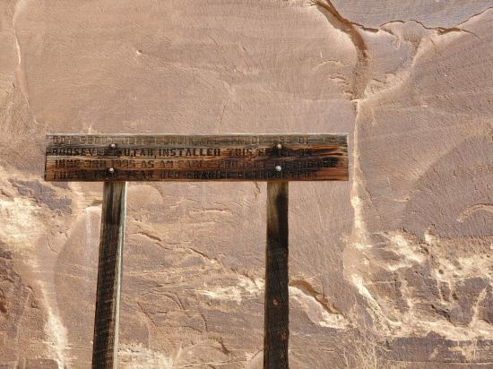
Now that you are ready to begin, set your vehicle trip odometer to zero. The mileage/kilometer distances indicated for all stops in this guide book will indicate when a stop is coming up.
Look for the marker with this symbol on it along the road for the stop.
To begin the tour, head east on the Cub Creek Road by the Visitor Center. Your first stop will be in one mile.
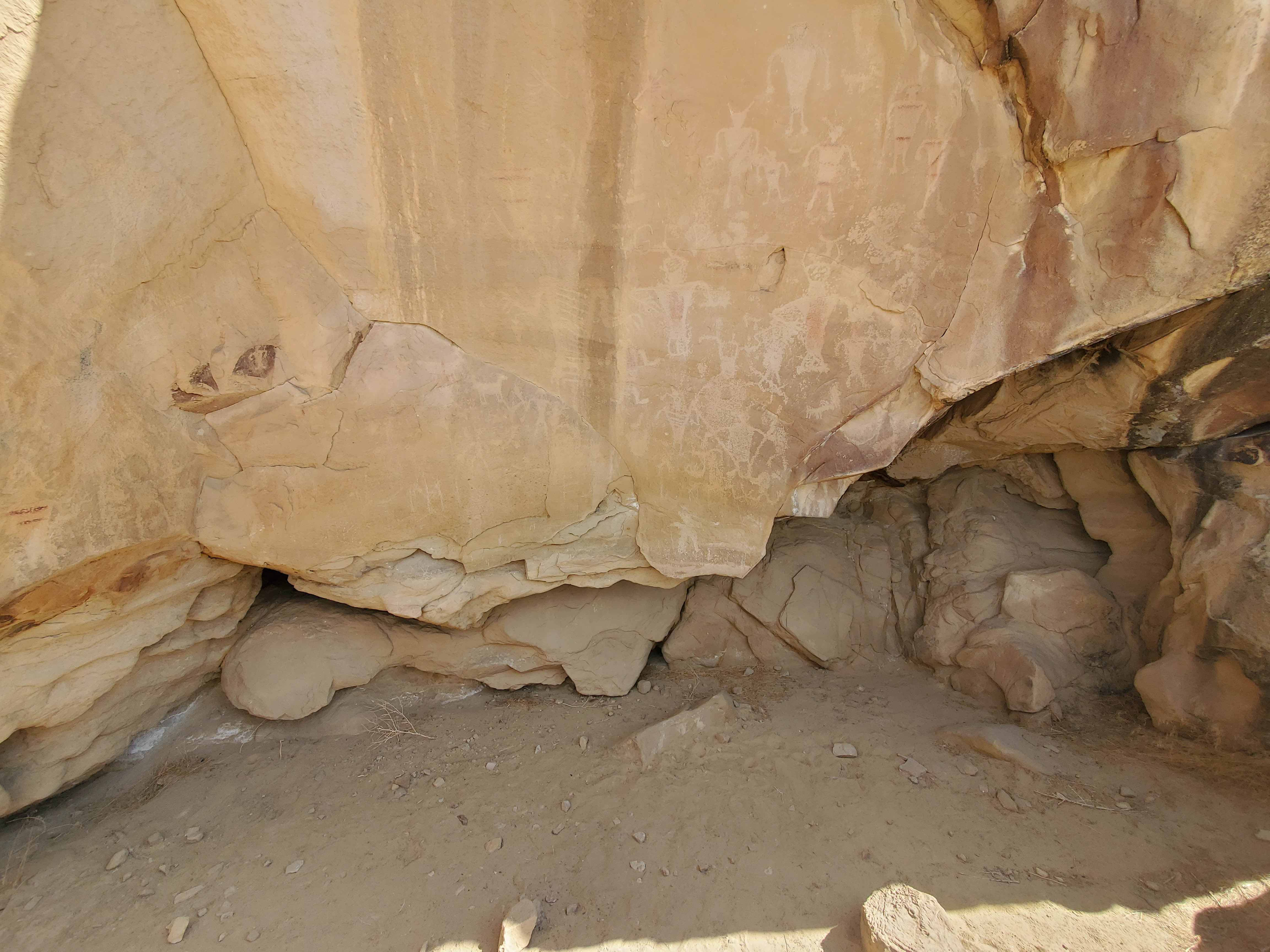
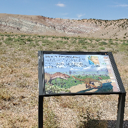
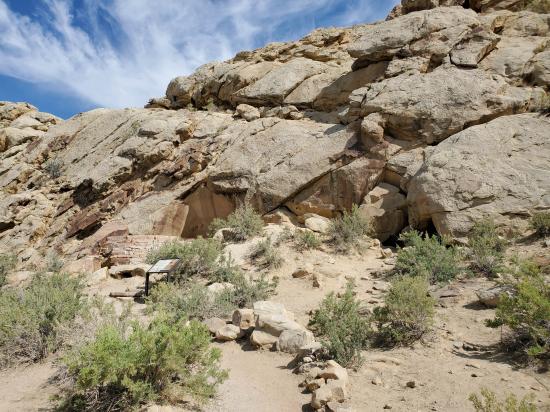
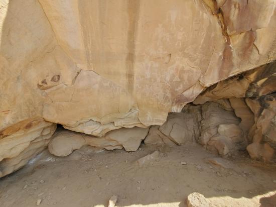
After you pull off on the shoulder, look for a sheltered area at the base of the rocky cliff to your left. It is one of the monument's oldest known sites of human occupation. Stone tools found at 'Swelter Shelter' (named by the researchers who excavated it in the blazing heat of summer), are up to 7,000 years old. Little is known of the long-vanished makers of these artifacts. These ancient people are referred to as the Desert Archaic culture.
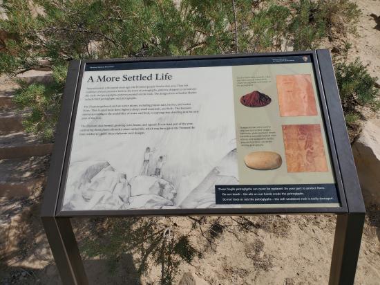
The pictographs (paintings) and petroglyphs (scratched or carved designs) on the shelter's walls are not quite so ancient. They were made about1,000 years ago by the people of the Fremont Culture (named for the Fremont River in southern Utah), whose rock art appears on many cliffs and canyon walls, including more sites farther along this road.
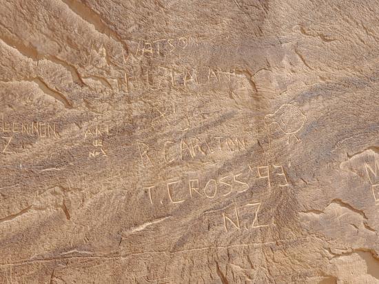
This ancient art is very fragile and must not be touched. If you see someone vandalizing petroglyphs or chipping their own name in the cliff, please notify a ranger.
The Sound of Silence hiking trail begins at this pullout, promising a little bit of adventure and plenty of inspiration. This is a moderate-to-difficult, three mile route that will take you into an arid landscape of towering stone walls, dark red paths, and solitude.
This route is best enjoyed in the morning or early evening when temperatures are cooler. Do not start this hike without good hiking boots. This trail is easy at first but gets more difficult the further you walk. Take at least a half-gallon of water, a hat, and sunblock on this hike.
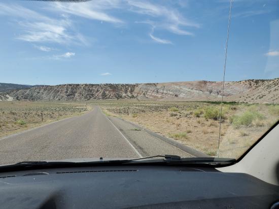
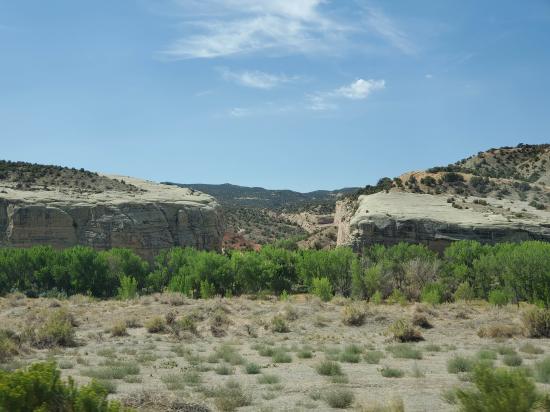
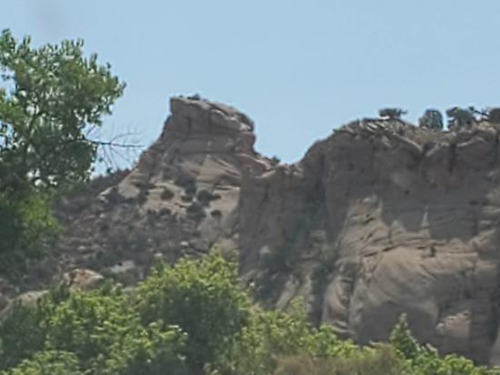
The impressive skyline ahead is the rugged ridge of Split Mountain which is named because the Green River has split it in half. The river produced a spectacular canyon and a geological mystery: how and why did the river cut through the center of a mountain instead of taking an easier course around it? The next two stops will look into the mountain and its mystery and more detail.
Why are all the rocks tilted here? The rock layers were once level but forces deep underground warped them upward into an irregular dome shape. The 'hogback' ridges of stone are all that remain of rock layers that once crossed Split Mountain. Today, much has eroded away. As for the Green River, the seemingly logical course would be around this dome to the west. Instead, the river cuts through the center of the dome. Early geologists suggested that to be able to do this the river must have been flowing in its present course before the upwarping occurred. Then, as the rocks began to rise, the river held its course by cutting through them. A newly discovered sequence of geologic events provides strong evidence that the Green River did not establish its present course until long after the upwarping of Split Mountain took place. Surprisingly, it turns out Split Mountain is much older than the Green River.
To understand this geologic sequence, we have to look beyond what we see in front of us and imagine a foreign landscape that once existed here millions of years ago.
Geologists explain that when the Rocky Mountains uplifted 50-60 million years ago, the nearby Uinta Mountains were also created. (Split Mountain and Blue Mountain are foothills of the Uintas.) The Uintas were once much higher than they are today. For tens of millions of years the mighty Uintas shed rock and dirt. Some of that material was deposited here by ancient rivers. The volume of sediment from the Uintas completely buried Blue and Split Mountain. Eventually deposition ended and the ancient rivers gave way to the Green River. It began to downcut into the old sediment and would eventually remove the dirt that buried the two mountains.
For evidence of the Green River's activity, look ahead to the road cut and take note of the fist-sized round rocks in the dirt. Only the turbulent action of river water carrying abrasive sand can smooth and polish stone like that. The rocks were deposited here when the Green River was at this elevation and not down where it is now. In fact, smooth rocks like these are found on top of Blue Mountain to the east of this stop (look for the mountain with the radio towers on top). Rounded stones on the mountaintop is evidence that the Green River used to be much higher than its current elevation. It has down cut through thousands of feet of ancient sediment. Almost all of that material is now gone, washed into the ocean or blown away by the wind.
So how exactly did the Green River 'split' Split Mountain? As geologists explain, the ancient Green River sat in a riverbed thousands of feet above where it is today. It flowed high above Split Mountain when that mountain was still buried in dirt. Over time the Green River cut through the soft dirt and eventually struck the rocky erosion-resistant top of Split Mountain. By then, however, the river was held in place by its banks. It could not change course when it hit the top of Split Mountain. It cut through the mountain instead of diverting around it.
Over time, erosion from water and wind removed much of the sediment that buried this area, leaving us with this scenic landscape. Today the river and wind are still at work and this landscape continues to evolve.
If you have the time, explore the Split Mountain area before continuing the tour. The trailhead for the Desert Voices Trail is near the boat ramp.
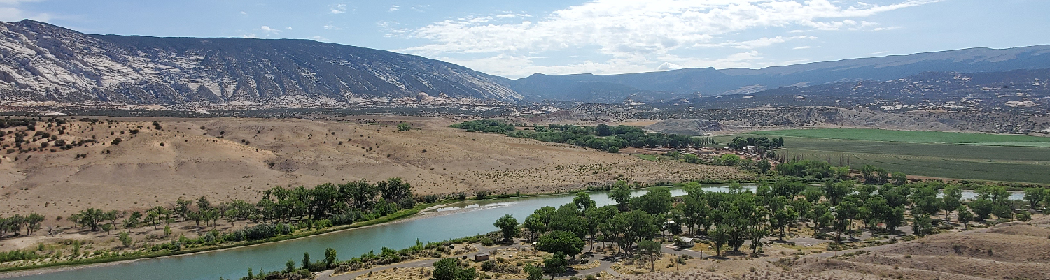
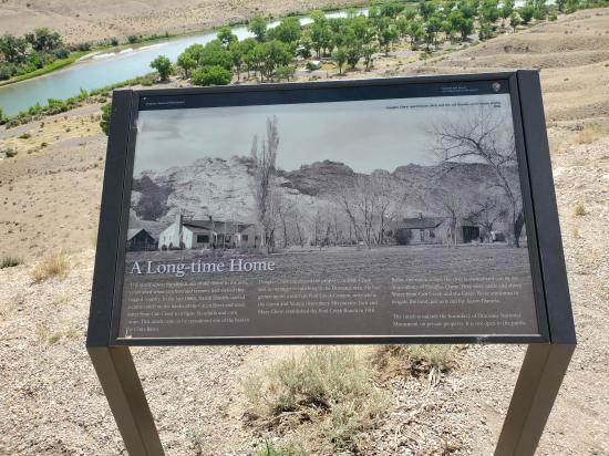
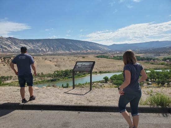
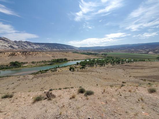
This overlook provides a panoramic view of the Cub Creek Valley, which lies between Split Mountain on the left and Blue Mountain on the right.
The influence of water in this dry environment is easy to see. The native cottonwood trees shading the campground below depend on the Green River, as do the irrigated crops in the field outside the monument across the river. Just a short distance away from the river's life-giving waters, sparse grasses, shrubs such as sagebrush and greasewood, and a few small juniper trees reveal the true desert nature of this land. Here, at an elevation of 5,000 feet, rain and snow provide less than 10 inches of water a year. Plants must conserve water or perish. Few cacti species can tolerate subzero winter temperatures, but prickly pear cacti are found here, though they are small and scarce.
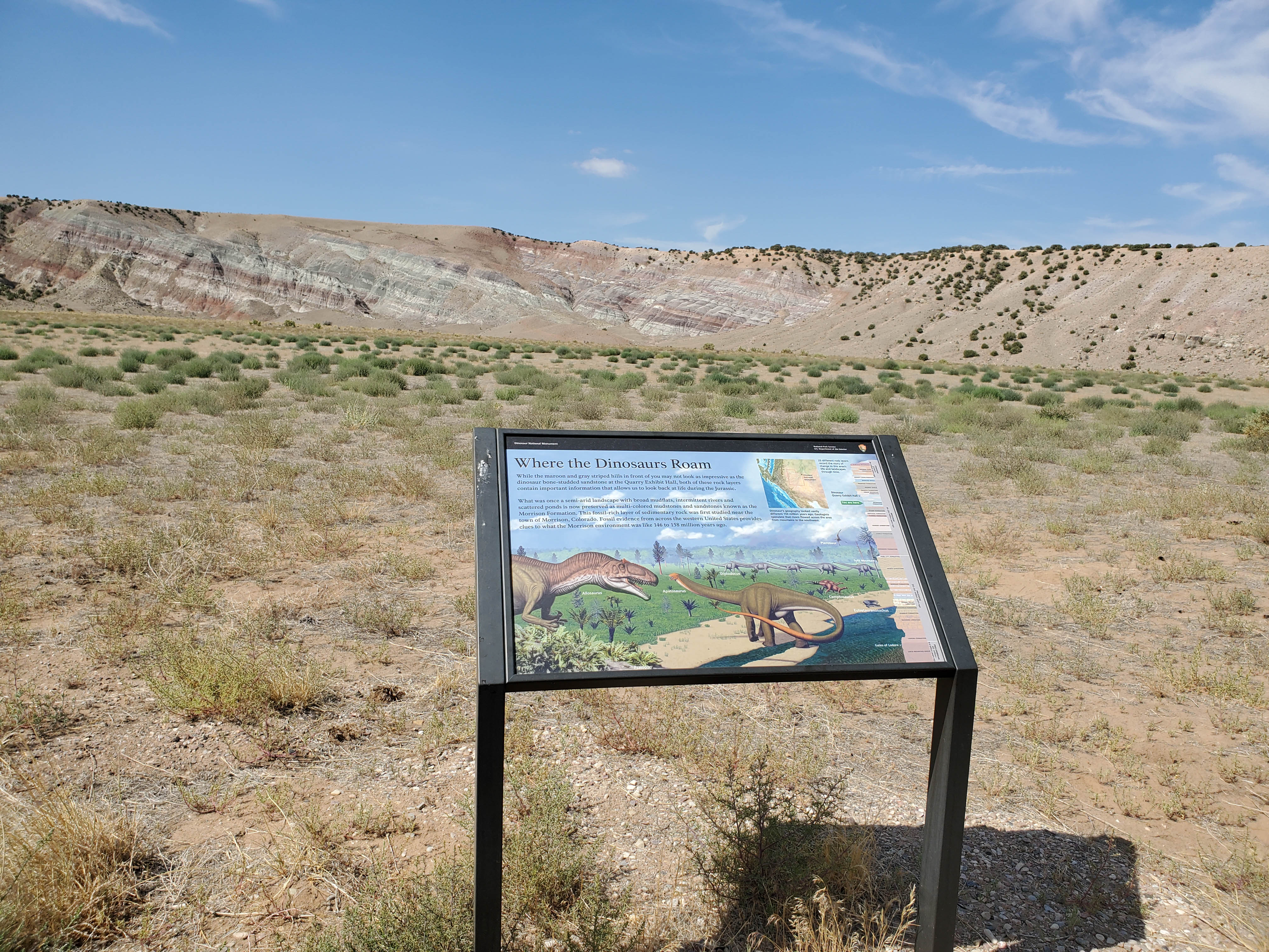
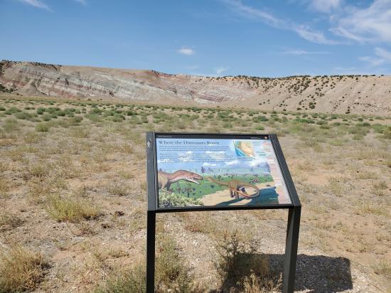
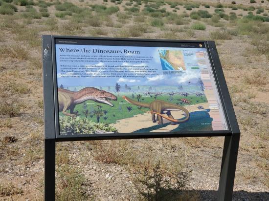
Ahead and to the right are hills banded with shades of gray, red, purple, and brown. The distinctively colorful layers help to identify the Morrison Formation, a group of rock layers that occur throughout this region. Paleontologists find this rock attractive for more than its colors; a few of its outcrops contain 149-million-year-old dinosaur fossils like those found at the Dinosaur Quarry. The formation originated as muds and sands laid down by a network of ancient rivers whose water nourished an abundance of plants, dinosaurs, and other animals. It is thought that during times of drought the river would dry up and there would be massive die-offs. Dinosaur carcasses collected in the riverbed. When the rains returned, the river flowed again and buried the bones in sand and mud where they were preserved.

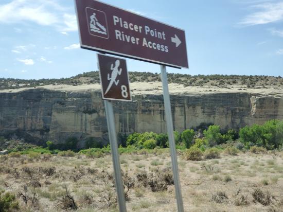
A short side road leads to a bend in the Green River called Placer Point. The name refers to an effort in the 1930s to dredge and sluice gold from the river bottom. The gold particles were too fine to extract profitably, and the operation eventually folded.
Although gold did not play a leading role in this area's history, the Green River did. Its canyons made the land so rugged that European explorers and settlers largely bypassed the area.
In the summer of 1869 John Wesley Powell launched an expedition in Green River, Wyoming. He and a troop of men set out to make the first maps of the Green and Colorado Rivers for the US Government. Stories of deadly rapids and hostile native peoples did not deter Powell. Even though he lost boats, equipment, and even a few men to desertion, Powell was ultimately successful on his journey from Wyoming through the Grand Canyon. Many books chronicle his adventures, and his journal makes for an entertaining read. Books about Powell's trip are available for purchase at monument visitor centers.
River-running is now a popular sport. With modern safety equipment, thousands of people each year delight in running the same rapids in the monument that challenged and sometimes terrified John Wesley Powell.
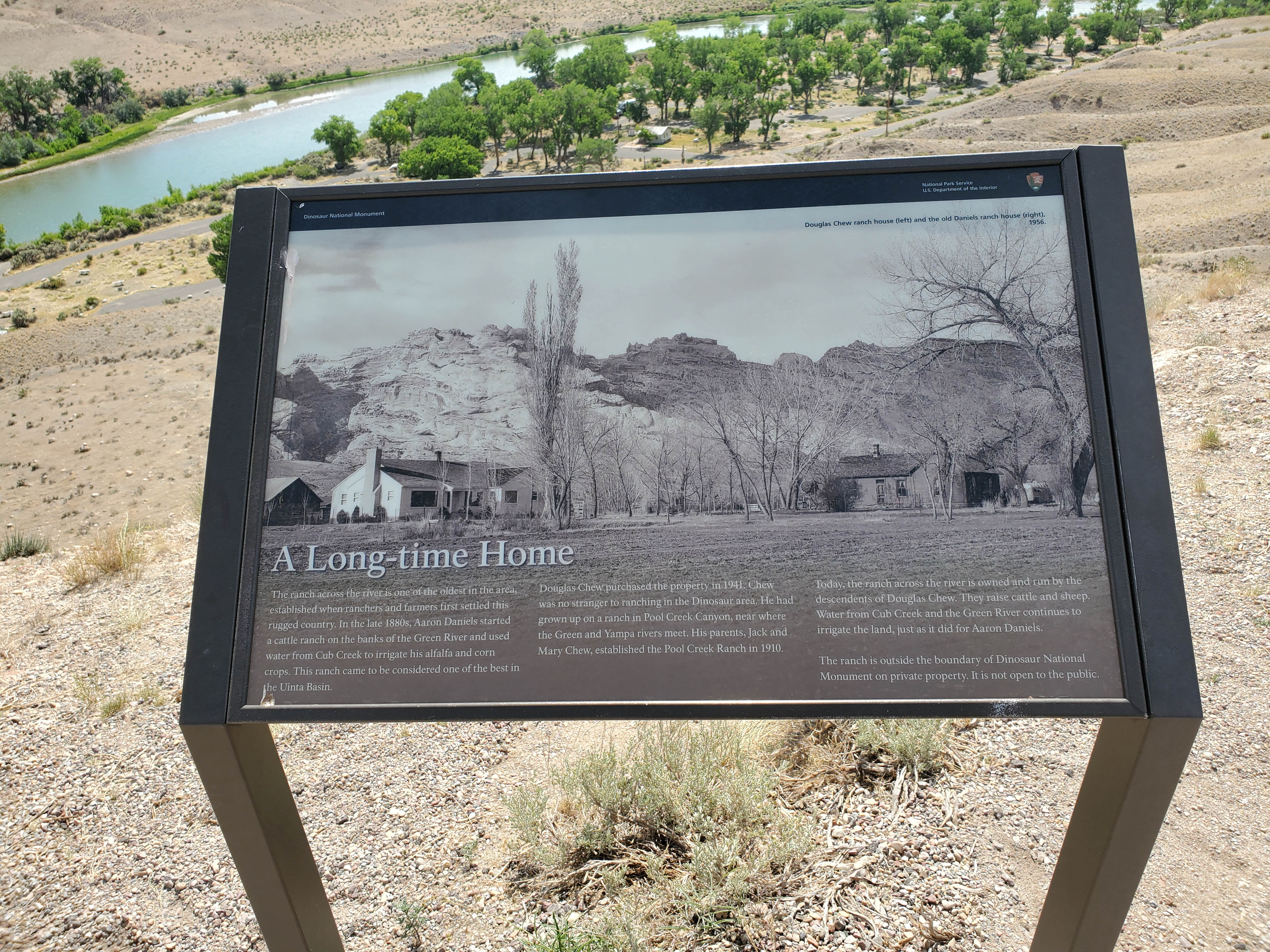
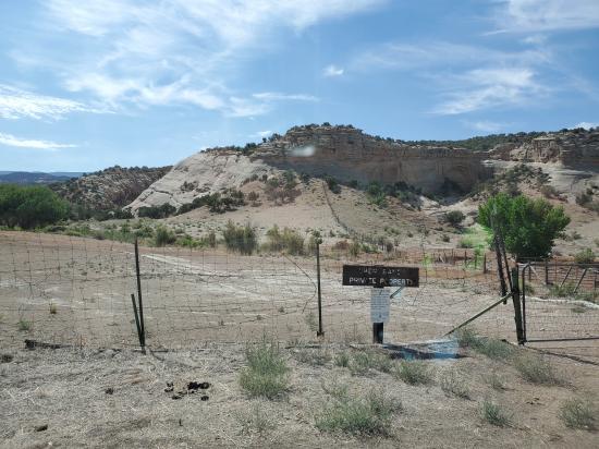
For the next 2 ½ miles the road passes outside the monument through land ranched by the Chew family who have lived in this region since the early 1900s. Here the Chews raise alfalfa, corn and other crops, as well as sheep and cattle which graze on higher rangeland to the east of here in the summer.

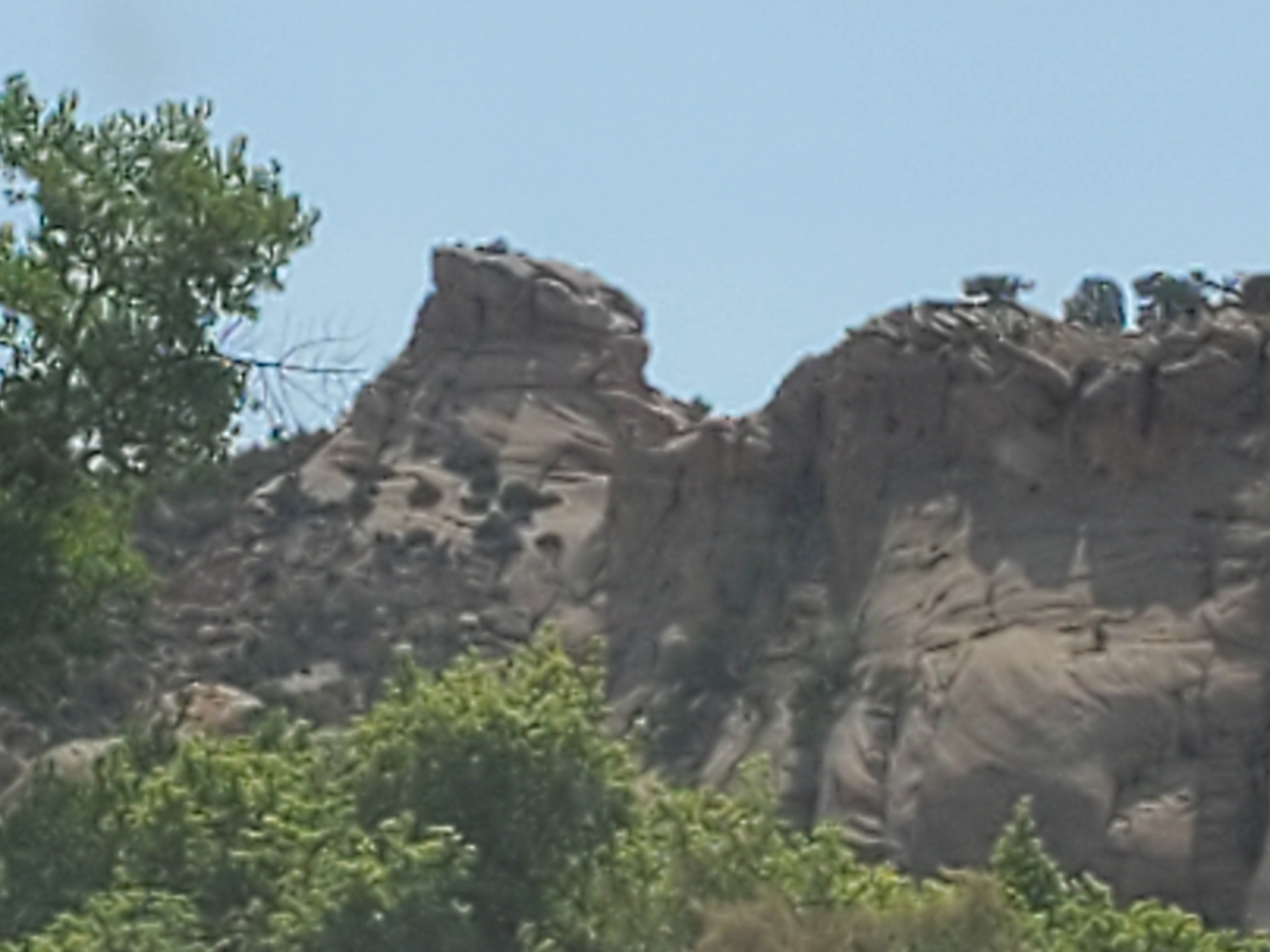
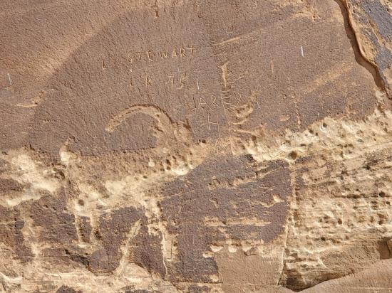
From long-time settlers to brief passers-by, many of us like to name what we see around us. The rock on the left has gone by many names depending on who was looking at it and how far they let their imagination go. 'Turtle Rock' is the name most often suggested for this rock. The many holes result from more rapid weathering of weaker parts of the rock. This is Entrada Sandstone, the same type of rock which forms arches in Arches National Park.
The tour continues to the left here. The Blue Mountain Road on the right leaves the Monument. It is steep, rough, and suitable only for 4-wheel drive vehicles with off-road tires. It climbs about 3000 feet to the top of Blue Mountain. This mountain offers dramatic views of the area. The summit also harbors a relict woodland called Point of the Pines. Some mountaintops in this area contain small groves of conifers like ponderosa pine only on the very top. During the last ice age these trees were much more widespread in the region. With a warmer and drier climate during the last 10,000 years, these trees are now restricted to mountaintops where they find just enough moisture to survive.
Follow the left fork across Cub Creek, a spring-fed stream that flows all year. Its channel may seem deep for such a small volume of water, but the creek is not always small. Occasional cloudbursts can swell it to a roaring, muddy torrent, and it is then that the creek erodes its banks most rapidly, sometimes cutting right through the road. In big floods the iron-rich sediment from this creek can change the Green River's color to red for a short time.
Across the creek is Elephant Toes Butte, eroded from Nugget Sandstone. Though the sandstone dates back to the time of the dinosaurs, it records a far different environment from that of the dinosaur quarry. The parallel layers in Elephant Toes Butte shows that it originated as tall sand dunes in a desert 200 million years ago. The dunes were later compressed into sandstone.

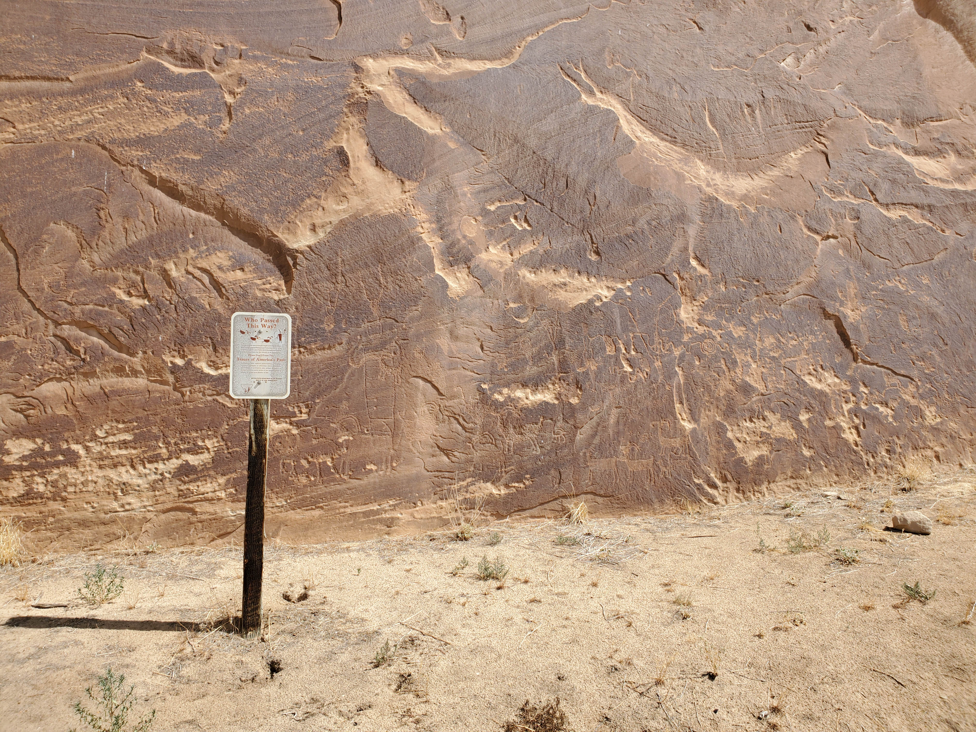
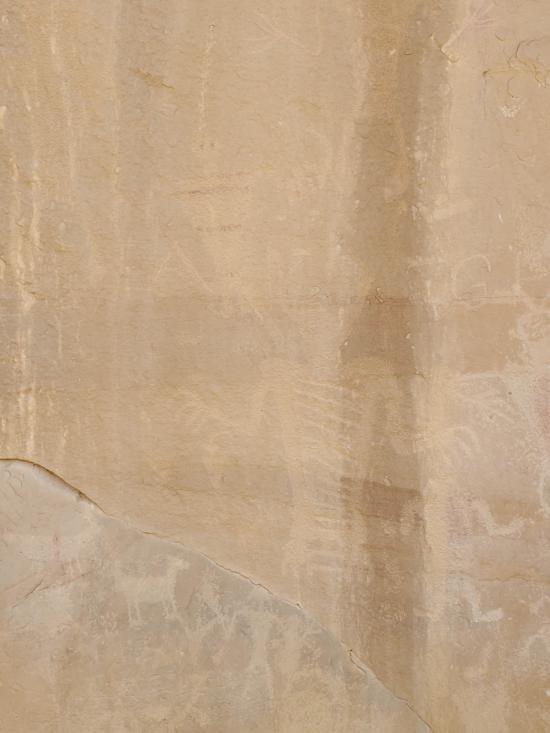
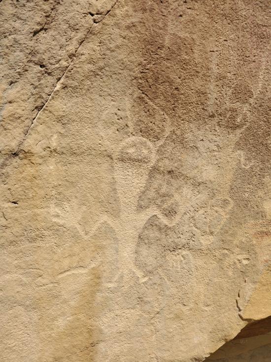
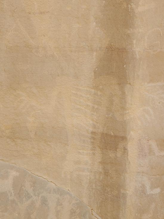
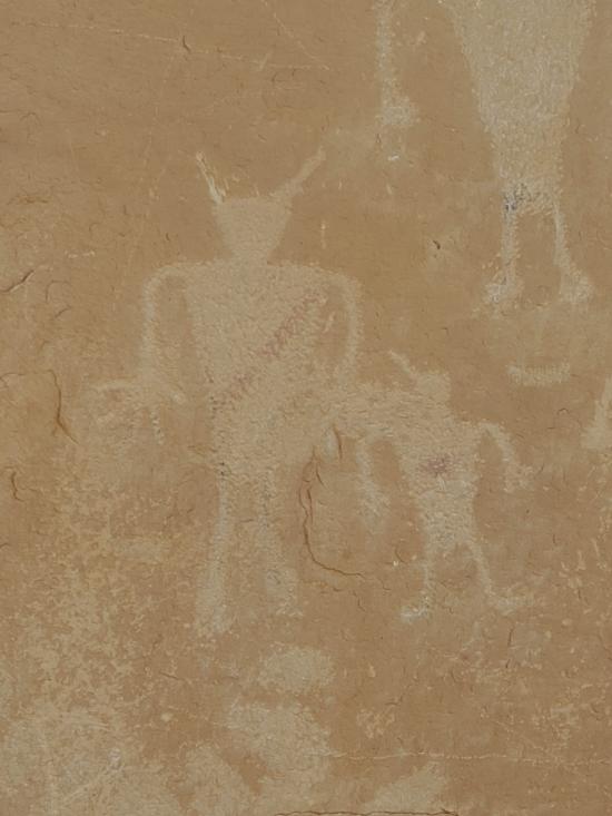
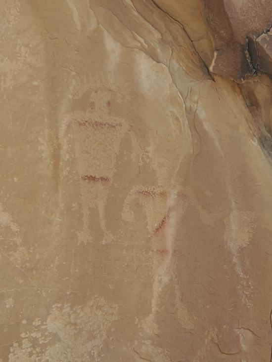
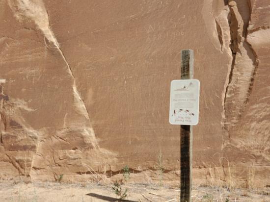
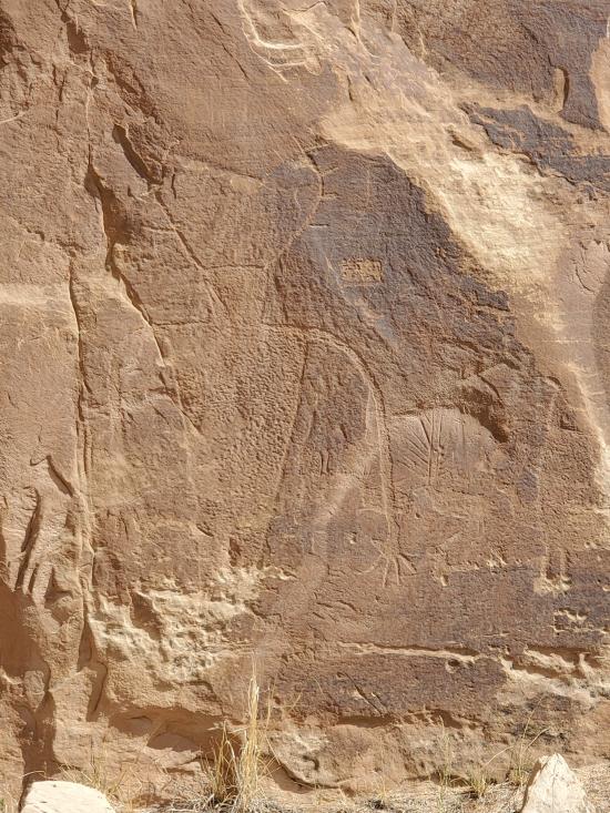
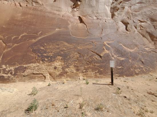
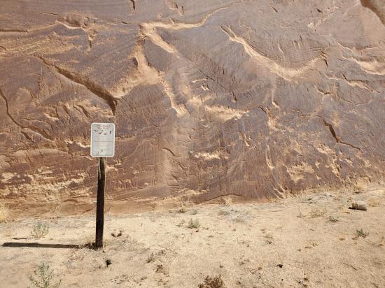
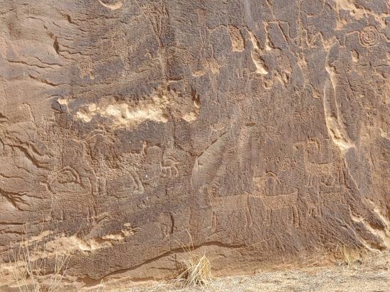
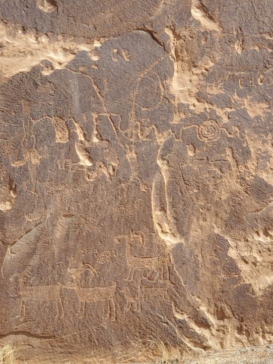
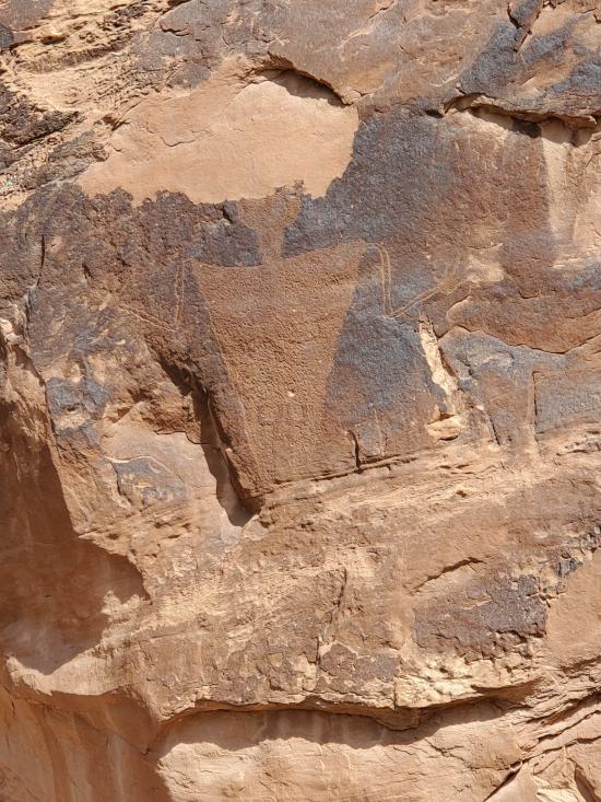
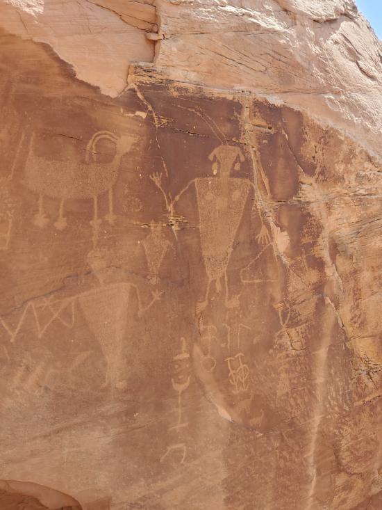
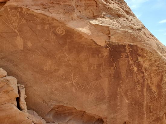
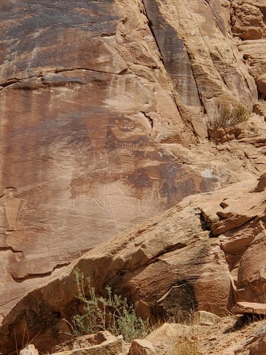
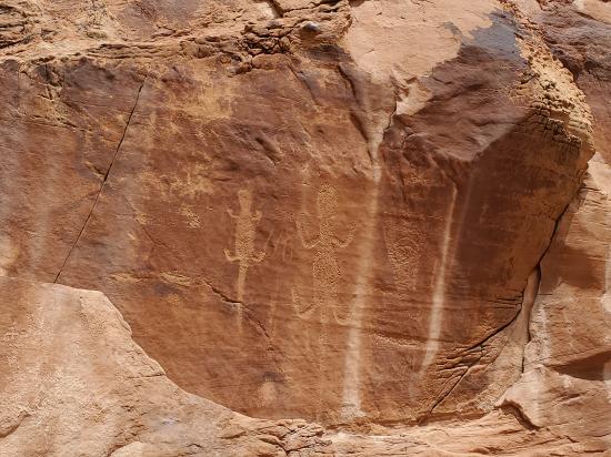
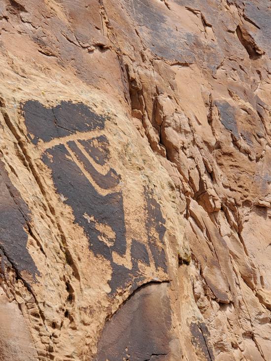
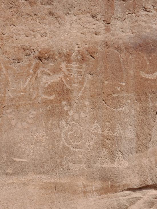
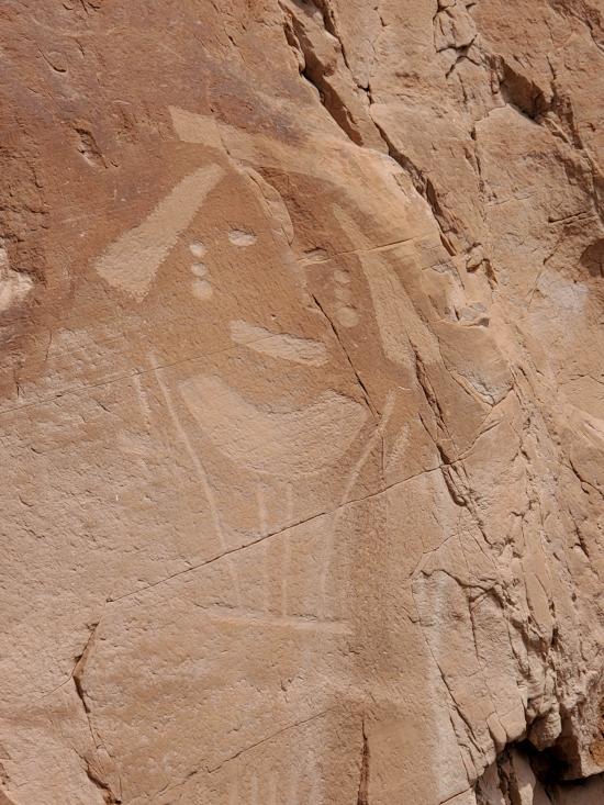
Please remember not to touch this rock art. For your own safety, watch your step if you approach for a closer look. Please do not proceed beyond the End of Trail sign. Stop 14 has a trail that will allow you to access many more petroglyphs along the upper portion of the cliff face.
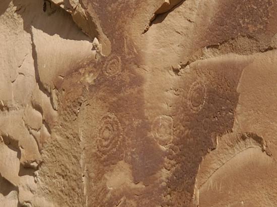
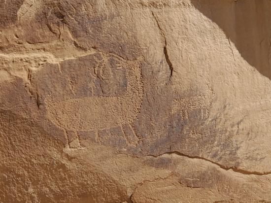
Like those at Swelter Shelter, the Fremont people made these petroglyphs about 1,000 years ago. Using sharp tools, they pecked away at the dark natural stain on the rock surface, called desert varnish, to reveal the light colored sandstone beneath. Some of the designs, such as bighorn sheep and other animals, are easily recognizable, but their meaning is not. Was this religious art, a symbolic language, or simply something created to fill idle moments? No one is sure.
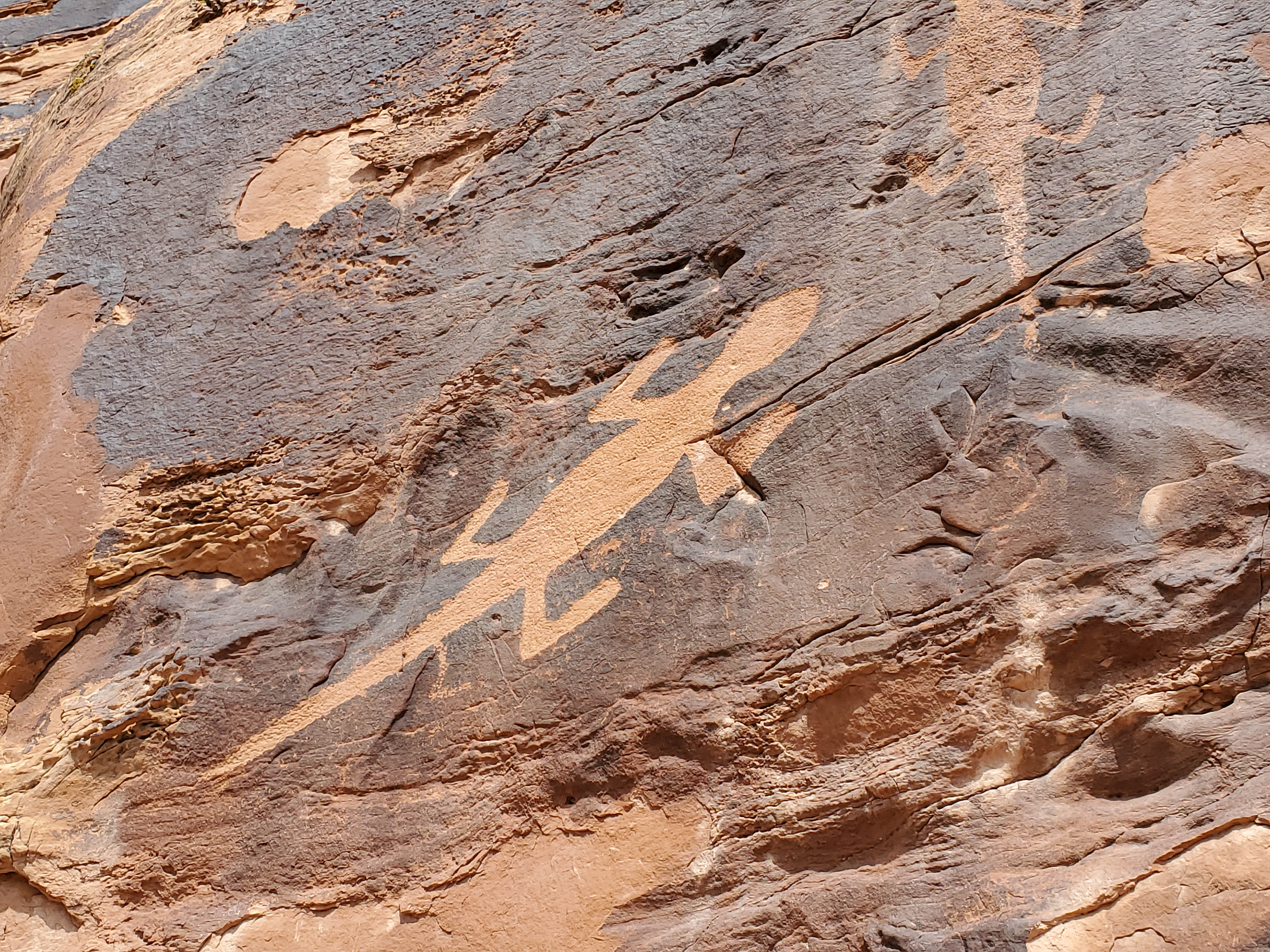
On the rock ledge high above the road is a large concentration of petroglyphs. You can look for petroglyphs from the parking lot if you have binoculars, or hike the steep but short trail to see them up close. If you have a good eye, you may see the giant lizard from the road without binoculars.
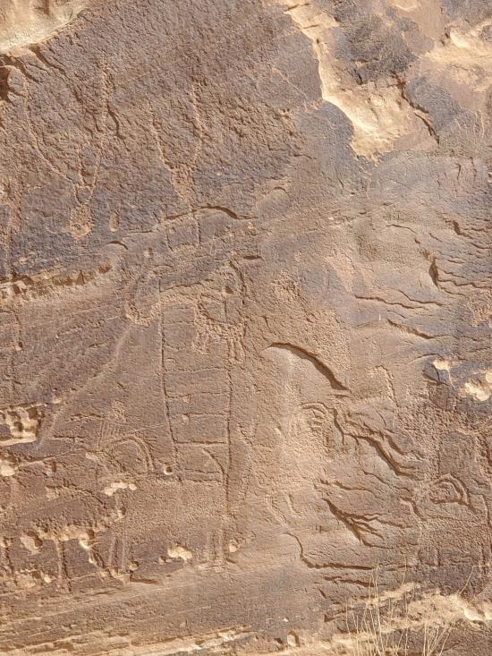
Though we do not know what the petroglyphs mean, one thing that they tell us is that their makers did not have to spend all their time struggling to survive. They could take the time needed to create artwork that—whatever its purpose—has endured. Petroglyphs such as the large lizard likely took months to complete. The people who made this art certainly must have felt it was worth their time and effort.
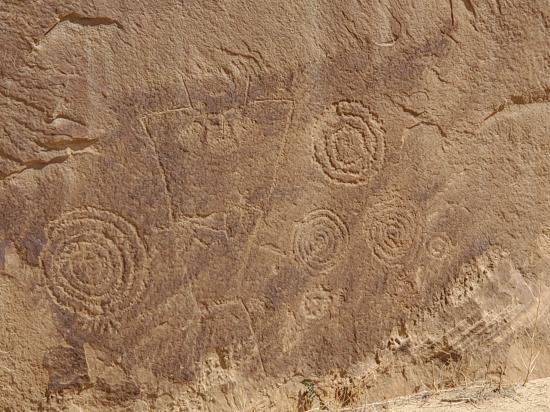
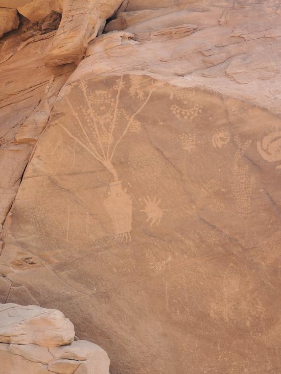
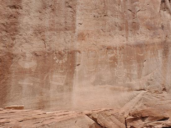
After you leave the parking lot, travel 0.3 miles. There is an overhang of rock where you can see three more large petroglyphs. These are decorative necklace designs. Similar petroglyphs are found near Echo Park.
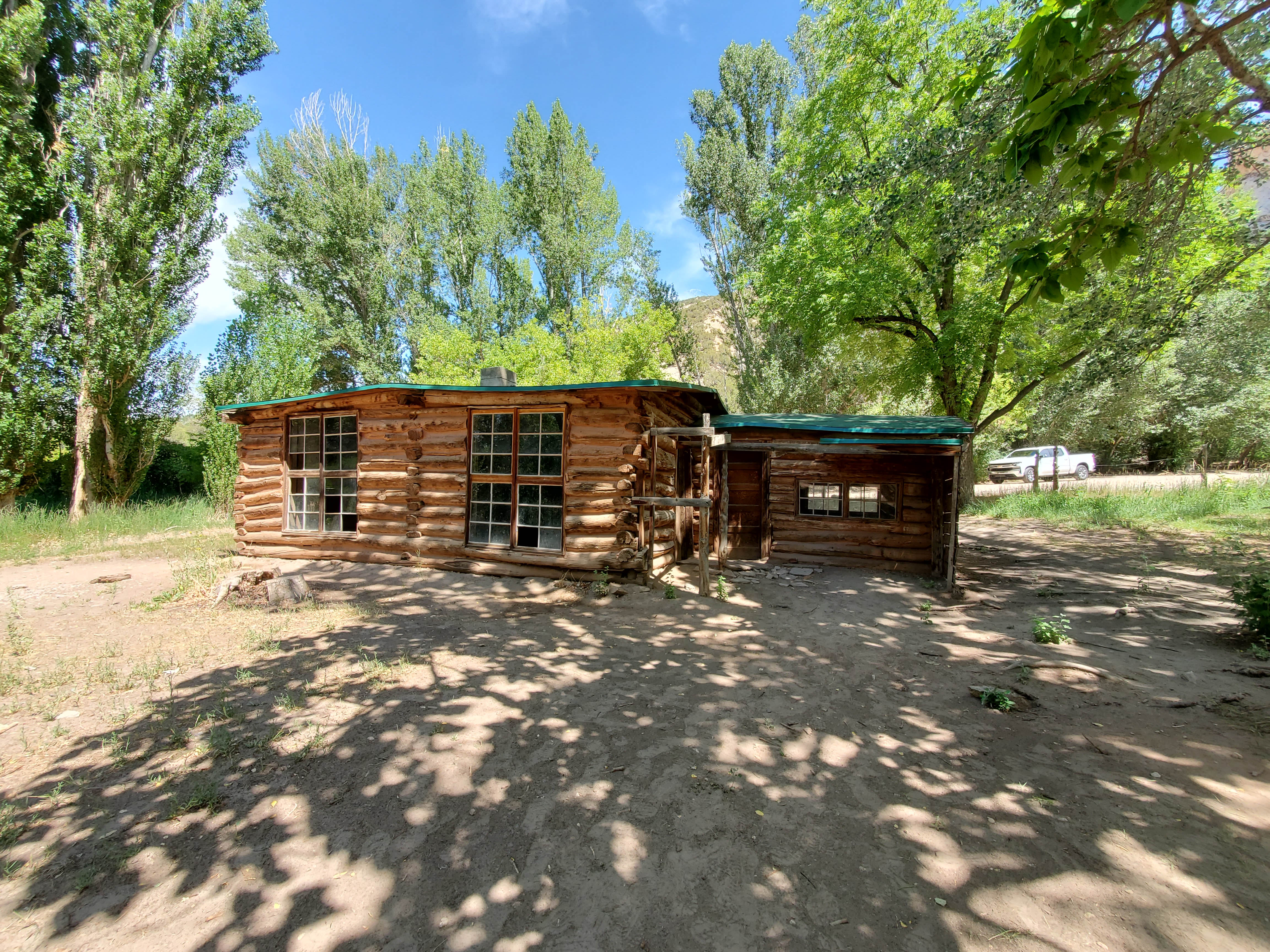
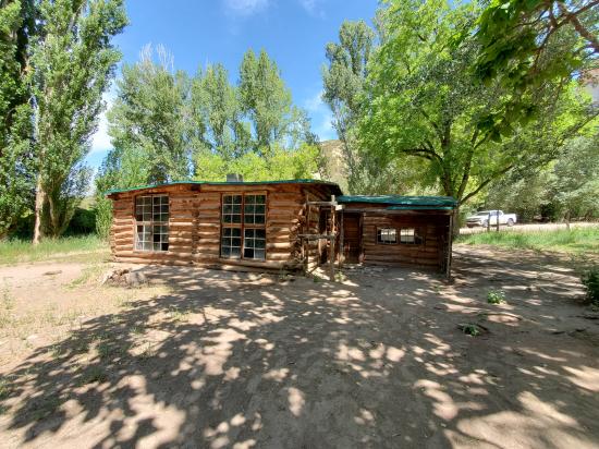
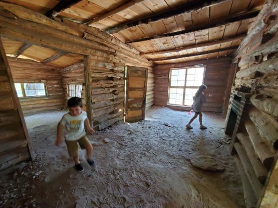
Josephine Bassett Morris is a local legend. Independent in both action and thought, she lived life on her own terms. It is here that she chose to settle in 1914.Josie built several cabins on her homestead, the last being the one you see today, constructed in 1935.
Josie provided for herself. She raised and butchered cattle, pigs, chickens, and geese. She canned the harvest from her large vegetable garden. Josie's source of heat came from wood burning in the fireplace. Her water came from the spring. There was no electricity; her light came from an oil lamp. Josie lived a 19th century lifestyle well into the 20th century. For Josie Bassett Morris, the benefits of the isolation she experienced living here were solitude and beauty.
Josie was accused (though not convicted) of cattle rustling twice and was an alleged associate of the outlaw Butch Cassidy. Married five times, she ultimately chose a single life.
In 1964, while feeding her horse, it nudged her and she slipped on some ice. She suffered a broken hip. Alone, Josie dragged herself into her house where friends found her several days later. She had no phone to call for help. On her trip to the hospital she said that she had a feeling she would never again see the home she built. A rancher to the end, Josie died that spring. She was 89.
Homesteads such as Josie's stand as physical reminders of the pioneers who coped with endless work, solitude, and scant conveniences. Josie experienced challenges few of us face today.
Split Mountain forms a backdrop to Josie's cabin. Made of Weber Sandstone, it is another ancient desert sand dune formation that is even older than the dinosaurs. Two of its features provided resources for Josie. Erosion created deep narrow canyons with nearly vertical walls. They are called box canyons. Josie used two of these as corrals. She simply fenced the narrow open ends and let the canyon walls confine her livestock. Josie also needed water for her livestock. The porous Weber sandstone absorbs rain and snowmelt. The water eventually emerges as springs in the canyons.
While a blessing, the springs from Box and Hog Canyons also gave Josie some headaches because of water use laws. The law stated that any spring that fed a larger stream, like Cub Creek, which another person had rights to, allowed that user to take all the water. Another local rancher owned the rights to Cub Creek. This prevented Josie from using the spring water on her own land. What did Josie do?
Josie knew about a loophole in water rights law: water rights only applied to above-ground perennial tributary springs and streams. She just needed to keep the spring water from reaching Cub Creek on the surface. If you look across the landscape here you may see ponds and dirt impoundments. These structures slowed the flow of the water and gave it time to seep into the ground. Josie's success at channeling and using the water made sure that no surface flow ever reached Cub Creek, thus the water was hers.
There are two trails that lead off from this area. Both are easy. The Box Canyon trail is a 20 minute stroll. The Hog Canyon trail takes about an hour. The canyon floors offer fairly level, easy walking, and have shade even in the middle of the day. Perhaps you can take some time to walk in josie's footsteps.
Now that you've seen one corner of Dinosaur National Monument, you may realize that there is more to the monument than its name implies. This has been just an introduction; this land has even more sights and stories to share. Take some time and explore.
Closest City or Region: Dinosaur National Monument
Coordinates: 40.437093, -109.307675
By Jeremy Dye
Jeremy Dye, Tara Dye, Savannah Dye, Madilyn Dye, Cooper Dye, Greg Dye, Laura Dye, Anthony Dye, Arianne Dye, Miller Dye, Ondylyn Wagner, Jaren Wagner, Killian Wagner,
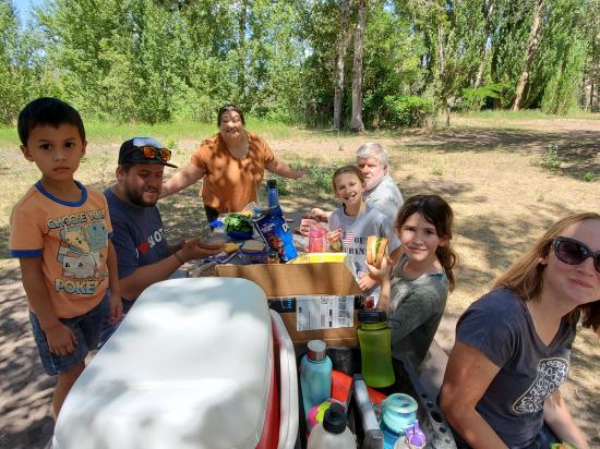
We spent a day in Dinosaur Monument. We stopped at the Quarry Visitor Center first and bought a couple of the trail guides. Then we followed the Tilted Rocks Driving Tour. We didn't stop at all the stops, but we visited most of them. We got out and hiked to Swelter Shelter, stopped at a pullout overlooking the Green River, stopped at a geology pullout, stopped and photographed the Chew Ranch petroglyphs, hiked to the Cub Creek Petroglyphs, and finished at the Josie Morris Cabin. We had a picnic lunch and played a hide-and-go-seek-style game that Savannah learned at Shadow Mountain. Nobody really wanted to hike up Box Canyon or Hog Canyon, so we headed back to the visitor center and caught the shuttle to the Quarry Exhibit Hall. We admired the wall of bones then Tara and I hiked the Fossil Discovery Trail while the others took the shuttle back. The kids finished their Junior Ranger workbooks, and we headed back to the Airbnb.


 Utah Field House of Natural History State Park Museum
 No Drinking Water
 Mountains
 Rivers and Streams
 No Restrooms
 Road Access is Paved
 Road Access is Dirt - Low Clearance
 Access Road is 2WD Accessible
 Viewpoint, Overlooks, Vistas
 Interpretive Signs
 Wildflowers and Vegitation
 Wildlife and Birding


