 Hiking | Fantasy Canyon


Hype:
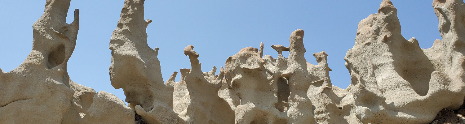
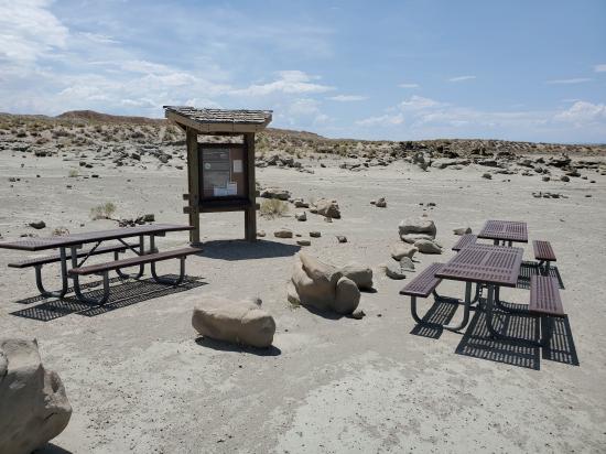
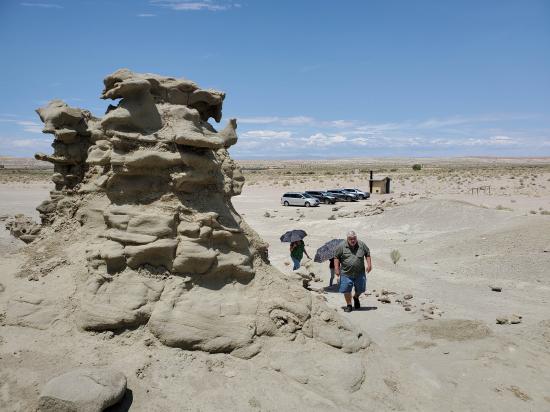
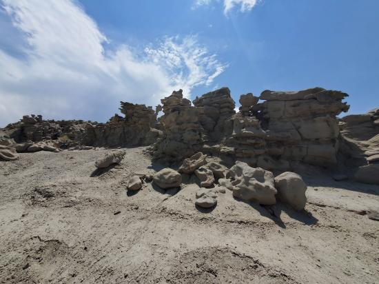
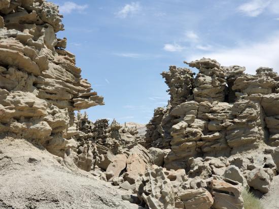
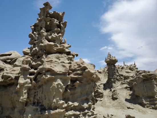
Naturally weathered sandstone rises dramatically from clay beds, exposing fantastically colored and shaped formations 40 miles south of Vernal. A self-guided rock trail is dotted with interpretive signs which educate you about the surrounding natural wonders.
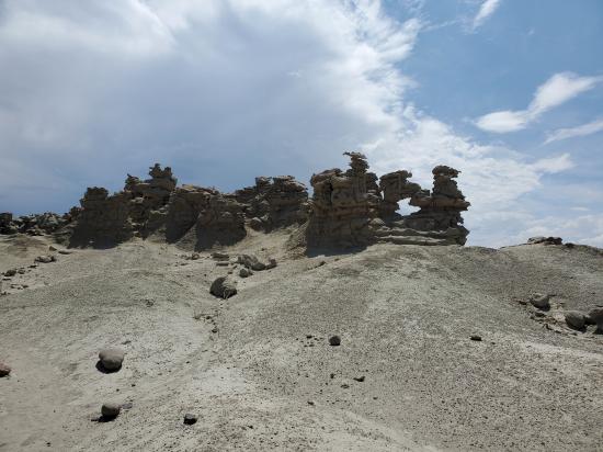
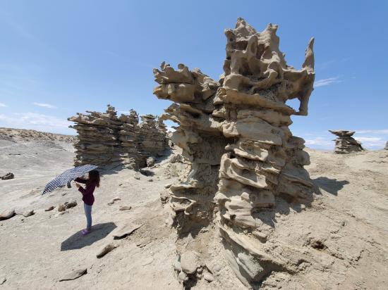
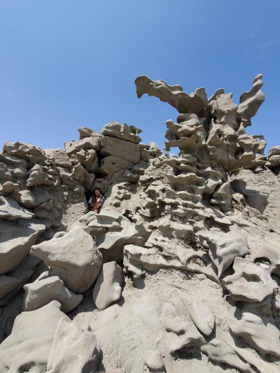
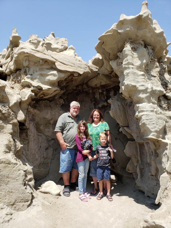
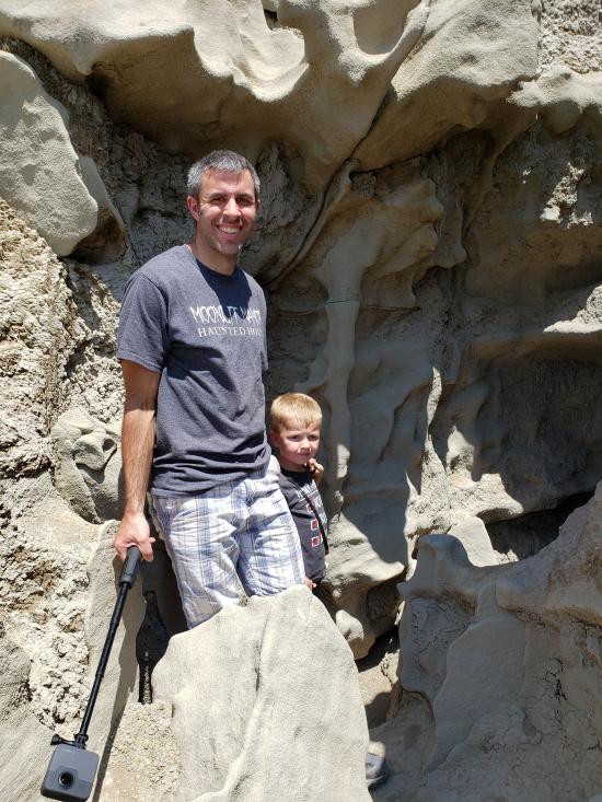
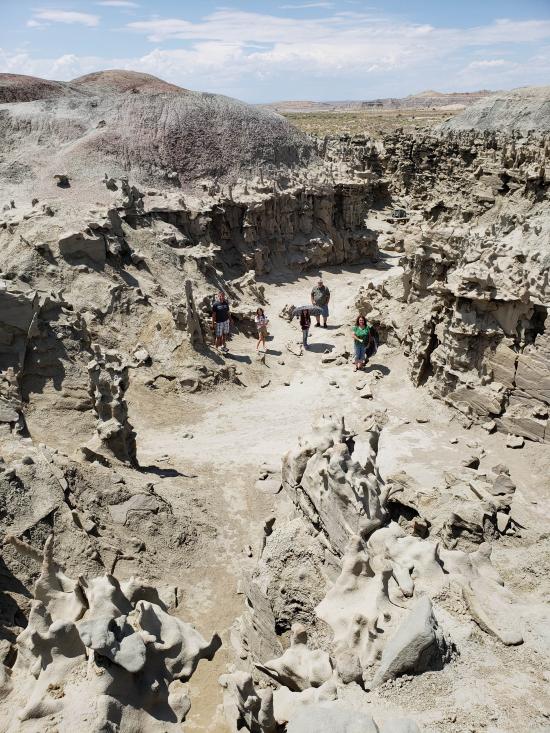
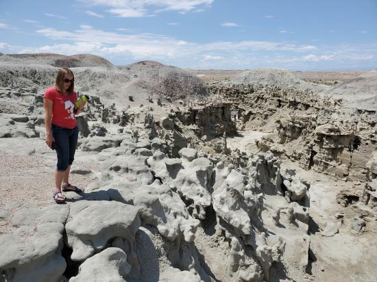
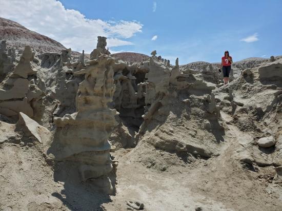
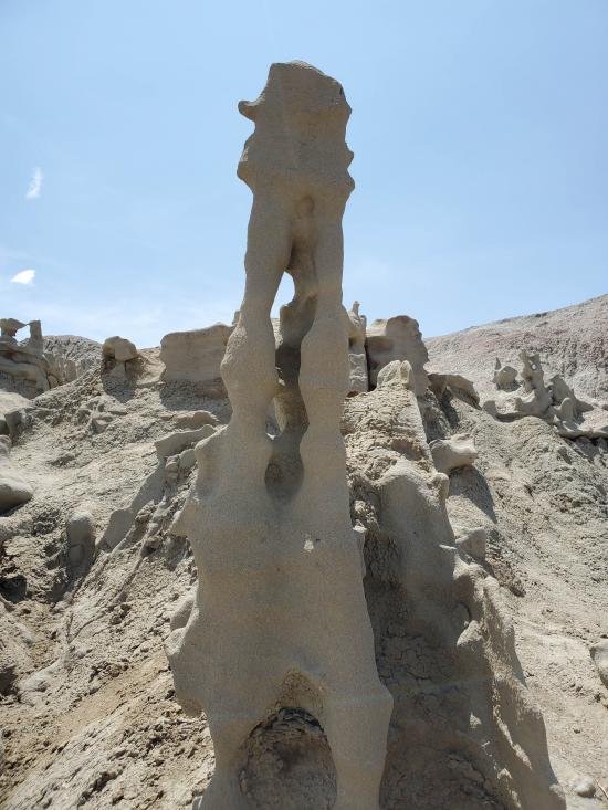
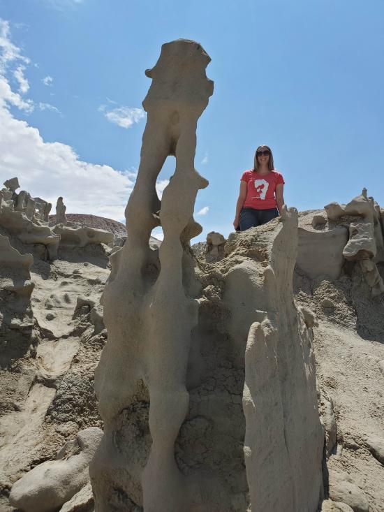
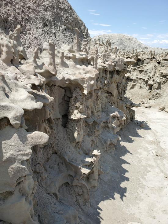
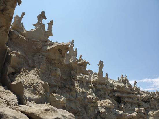
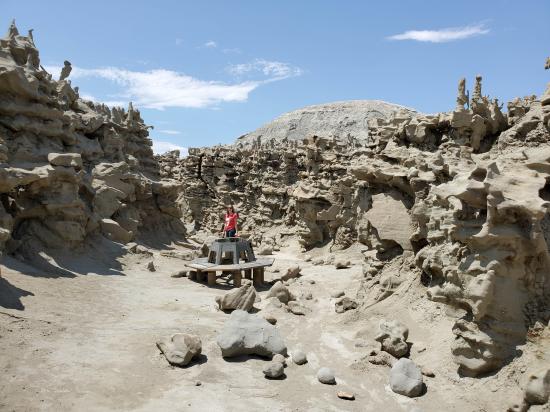
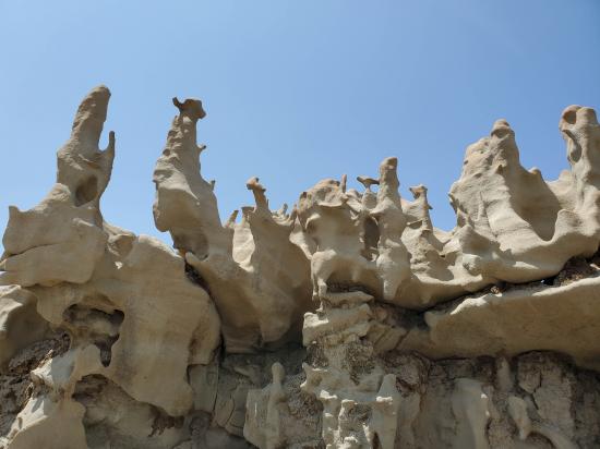
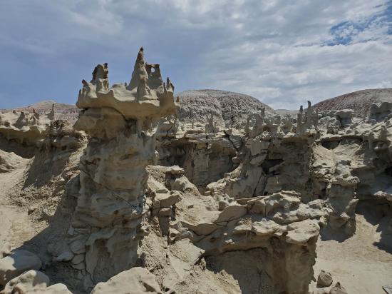
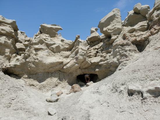
Known for its intricate and peculiar stone figures, Fantasy Canyon is a wonderful place to spend time and explore a unique expression of rock weathering and erosion patterns. Visitors enjoy exploring a miniature canyon packed full of features formed from layers of sandstone sandwiched between underlaying and overlying rock.
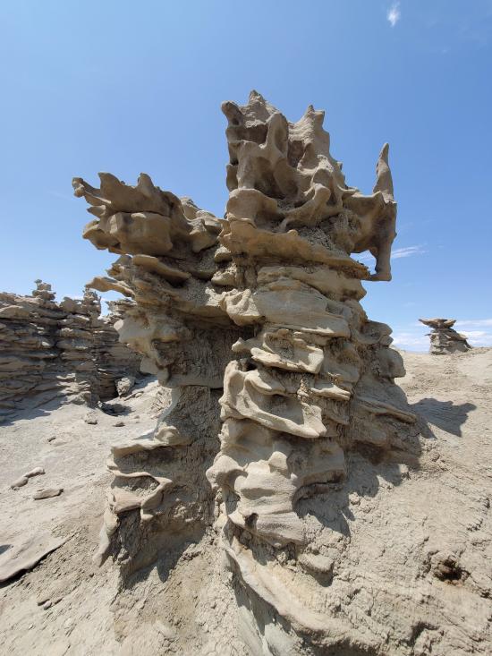
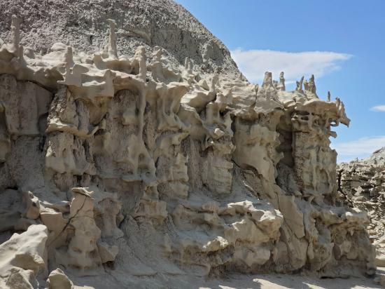
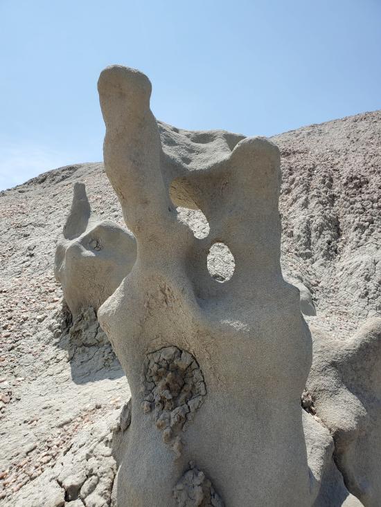
The sandstone that forms Fantasy Canyon consists of ancient river channel sediment. The underlying and overlaying rock layers sandwiching the sandstone layer, and creating scenic badland topography around the canyon, are finer grained floodplain deposits.
During the Eocene Epoch, 55 to 34 million years ago, the Fantasy Canyon area was at the fringe of a vast subtropical lake (Lake Uinta) that at peak level stretched from the Wasatch Plateau to western Colorado. The lake was in the drying phase and retreating westward by the end of the Eocene.
Rivers en route to the dwindling lake deposited sand, silt and clay from nearby mountains. Once buried, these sediments eventually solidified into layers of sandstone, mudstone, and claystone.
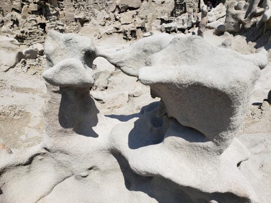
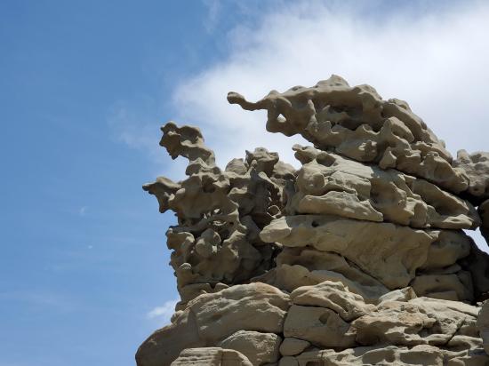
Differences in the rate of weathering and erosion between the rock types ultimately shaped Fantasy Canyon. the mudstone and claystone have been stripped away leaving the sandstone formations.
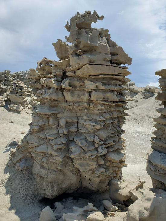
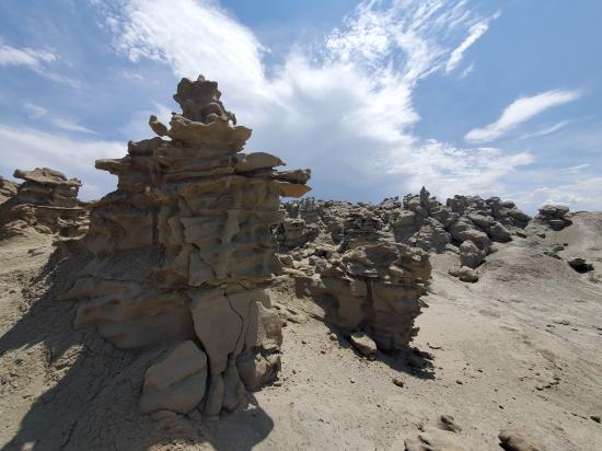
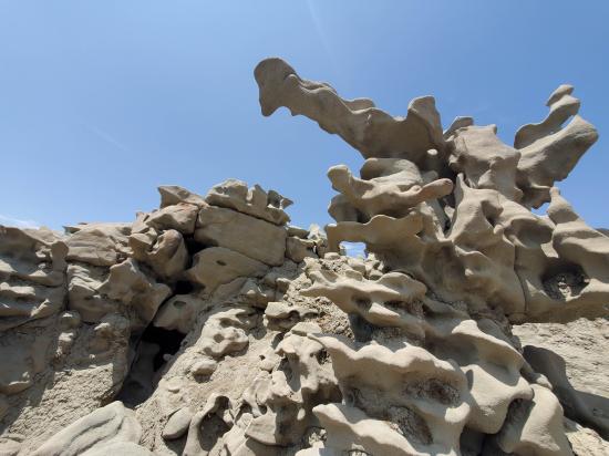
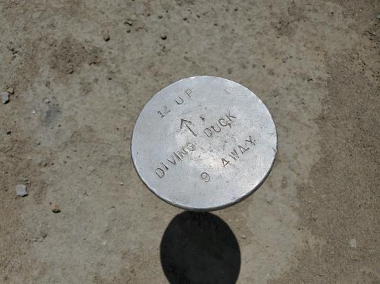
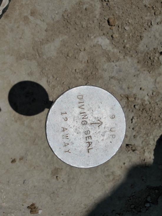
Fantasy Canyon coins its name from its whimsical and sci-fi style landscape. Visitors can look around and imagine image in the sandstone pinnacles. Some of the more common sightings in the stone features include a witch's head, diving seal, and prowling coyote. We encourage you to look around and see what you can imagine.
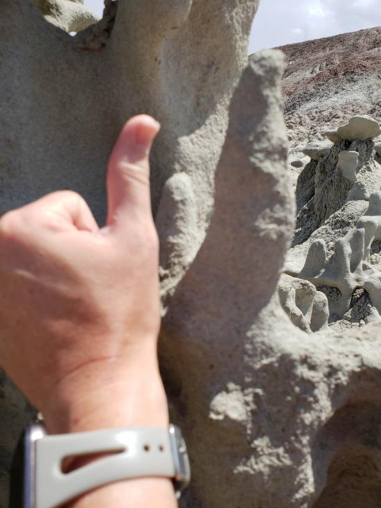
Although the sandstone is more resistant to erosion relative to adjacent rock it is in fact extremely fragile. The sandstone is fined grained, porous, soft, poorly cemented, and brittle. When touched, grains of sand dislodge from the rock surface.
Trail Condition: Class 1 (Trail is either paved or gravel. Navigation skills are not needed because there is only one trail or because there are signs. Elevation gains are gradual or there are stairs.)
Time: 1 hour
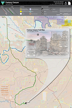
Length: 0.25 miles round trip
Elevation Gain: 30 ft
Fees: None
Recommended Ages:
 | 0-3 |
 | 4-11 |
 | 12-19 |
 | 20-49 |
 | 50-69 |
 | 70+ |
Recommended Months to Visit:
| Jan |
| Feb |
| Mar |
| Apr |
| May |
| Jun |
| Jul |
| Aug |
| Sep |
| Oct |
| Nov |
| Dec |
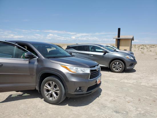
Navigate to 40.058073, -109.394078.
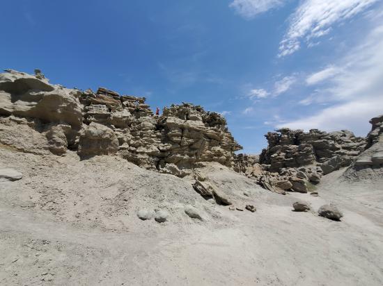
From the trailhead and information sign, follow the cairned trail south then southeast into Fantasy Canyon for about 0.1 miles. Return the way you came.
Closest City or Region: Vernal, Utah
Coordinates: 40.057357, -109.393219
By Jeremy Dye
Jeremy Dye, Tara Dye, Savannah Dye, Madilyn Dye, Cooper Dye, Greg Dye, Laura Dye,
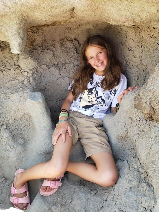
We visited Fantasy Canyon as part of our Dye family reunion in Vernal. Anthony's family and Ondy's family had to work, so they met up with us at the Airbnb later that evening. We explored up and through Fantasy Canyon and had a great time observing the crazy hoodoos and exploring different nooks and crannies.

 Utah Field House of Natural History State Park Museum
 Hoodoos
 No Drinking Water
 No Fires
 Marked Trails
 Picnic Tables
 Restrooms - Vault
 Road Access is Dirt - Low Clearance
 Access Road is 2WD Accessible
 Interpretive Signs
 Viewpoint, Overlooks, Vistas
 Hiking Trails
 Arches


