 Hiking | Waimangu Volcanic Valley


Hype:
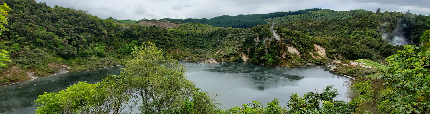
The Waimangu Volcanic Rift Valley is the hydrothermal system created on 10 June 1886 by the volcanic eruption of Mount Tarawera, on the North Island of New Zealand. It encompasses Lake Rotomahana, the site of the Pink and White Terraces, as well as the location of the Waimangu Geyser, which was active from 1900 to 1904. The area has been increasingly accessible as a tourist attraction and contains Frying Pan Lake, which is the largest hot spring in the world, and the steaming and usually pale blue Inferno Crater Lake, the largest geyser-like feature in the world although the geyser itself cannot be seen since it plays at the bottom of the lake.
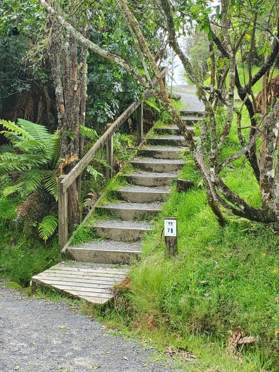
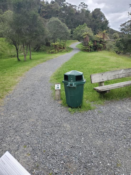
Trail Condition: Class 1 (Trail is either paved or gravel. Navigation skills are not needed because there is only one trail or because there are signs. Elevation gains are gradual or there are stairs.)
Time: 2-5 hours
Length: 2.4 miles one way
Elevation Gain: 300 ft
Fees: Admission
Recommended Ages:
 | 0-3 |
 | 4-11 |
 | 12-19 |
 | 20-49 |
 | 50-69 |
 | 70+ |
Recommended Months to Visit:
| Jan |
| Feb |
| Mar |
| Apr |
| May |
| Jun |
| Jul |
| Aug |
| Sep |
| Oct |
| Nov |
| Dec |
Links: https://www.waimangu.co.nz/https://en.wikipedia.org/wiki/Waimangu_Volcanic_Rift_Valley
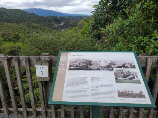
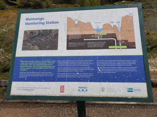
Dominant on the skyline is Tarawera mountain, a restlessly sleeping volcano which has erupted five times in the last 18,000 years. In the foreground is Waimangu. Before the latest eruption on 10 June 1886, this area was rolling scrub-covered hills with no surface hydrothermal activity. Then, during the night of 10 June 1886, a line of craters from the northern end of Tarawera all the way to the Waimangu Valley was formed by violent eruption. This event completely destroyed all plant, animal, and bird life in the whole of the area of country visible from this point. All the vegetation you now see has resulted from plant re-colonisation since that date. Three important dates dominate the history of the valley: 1886, the Tarawera eruption; 1900 -1904 when the worlds largest geyser was active 1 kilometre away, just beyond the hot lakelet visible from here; 1917, the Frying Pan Flat eruption which burst out where you see the hot lakelet and sent a surge of steam and debris up to this very place and destroyed an accommodation house (Waimangu House) at this site.
This southern-most crater formed by the 1886 eruption is about 50 metres deep. It has not been active since immediately after that initial eruption apart from possessing some warm ground and a couple of small mud pools at its north-eastern end. The shallow lake (Emerald Pool) is cold.
A very narrow ridge of land between Southern Crater and the adjoining valley. This walkway dates back to 1917.
The cold water pool occupying the floor of Southern Crater supports huge mats of algae and sphagnum moss when conditions are right. The native red floating fern Azolla also is sometimes present. At various times the lake has hues of blue, brown and emerald, the reason for these colour changes being evidently due to changes in the state of the various plant species. The lakelet seems largely to be rainwater and its level reflects ground water levels in the surrounding country. Normally its maximum depth is about 2m.
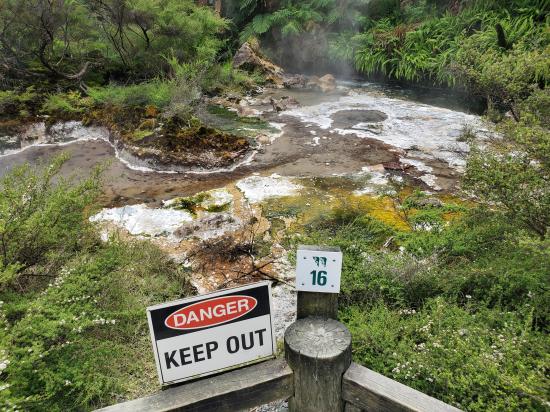
The deposit seen here was formed by the 1917 eruption from Echo Crater. Today Frying Pan Lake occupies the floor of that crater and can be seen steaming behind you. The eruption deposit is typical of those produced by hydrothermal (steam) eruptions containing everything from clay to large boulders. The red discolouration has formed where the deposit is still being warmed. To the left of the path is the first large area of prostrate kanuka growing on heated soils where soil temperature at 5cm depth is about 33°C (91°F).
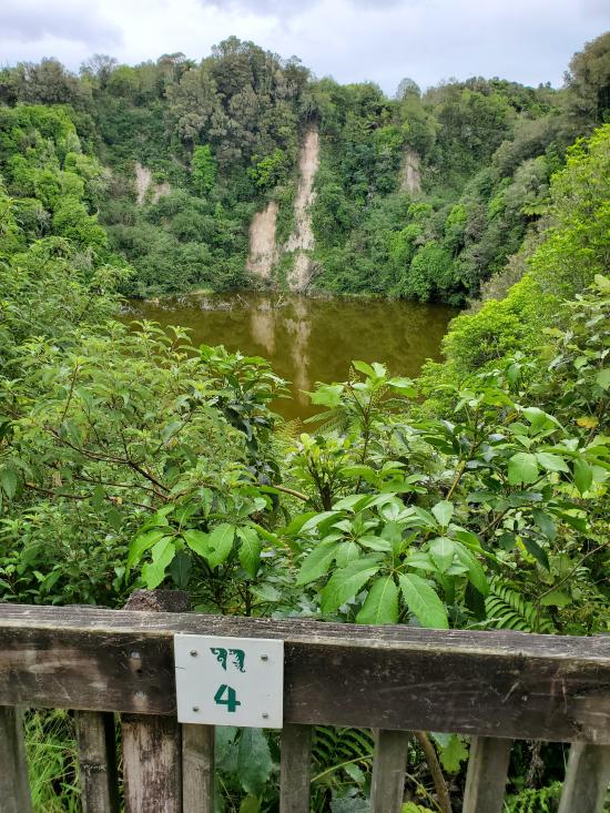
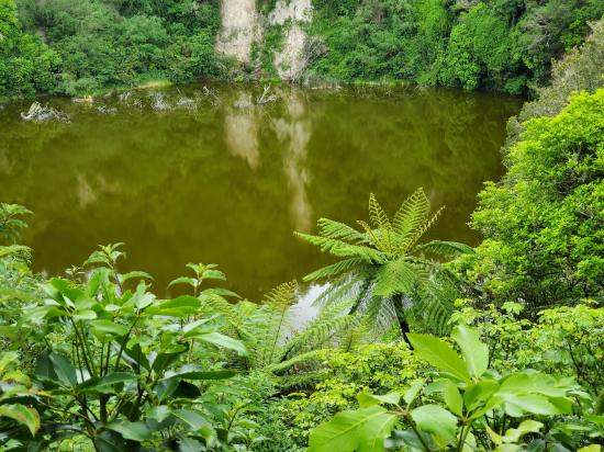
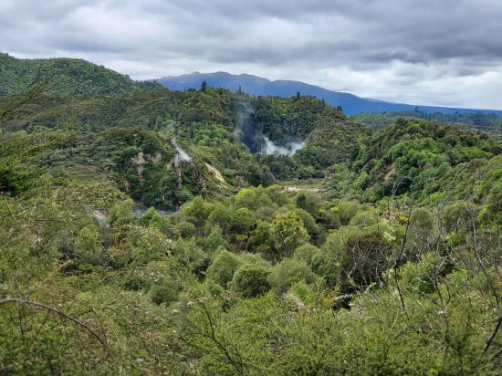
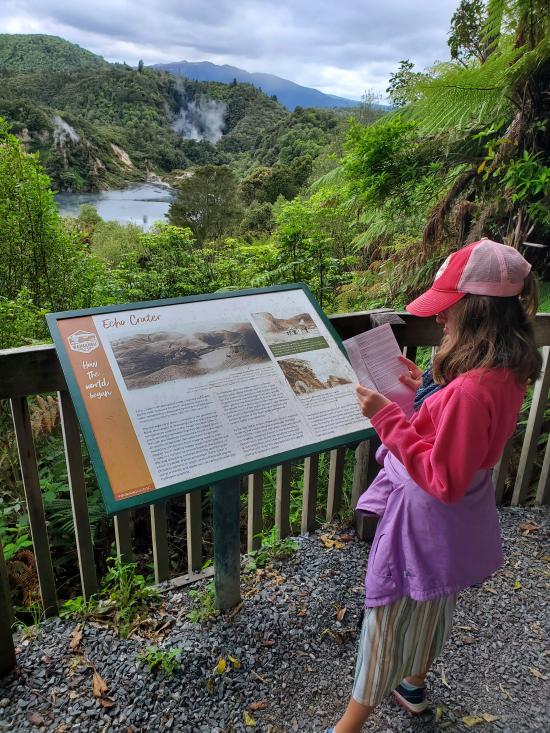
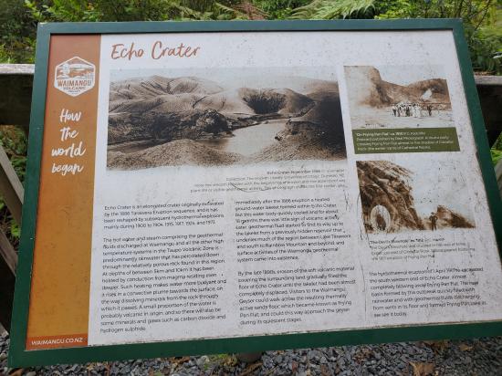
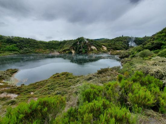
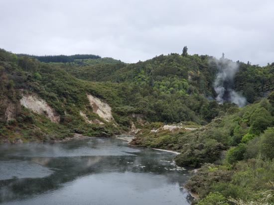
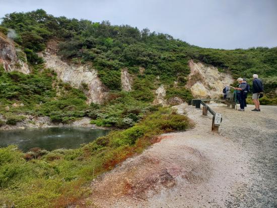
Wonderful views of Echo Crater and Frying Pan Lake. Echo Crater was formed on 10 June 1886 and has been the site of many activities since then. These include the Waimangu Geyser eruptions (1900 to 1904), and April 1915, April 1917, August 1924 and February 1973 hydrothermal eruptions.
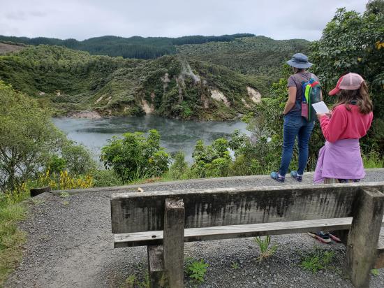
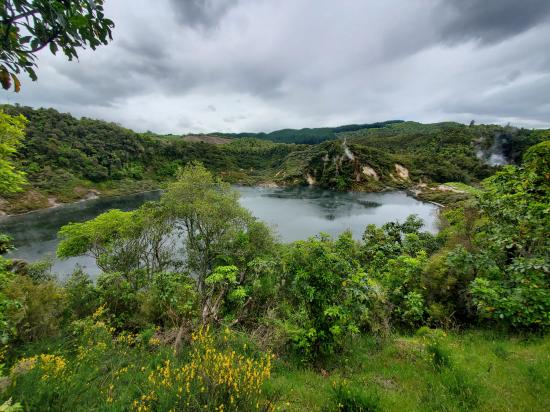
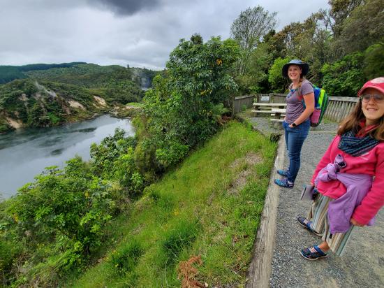
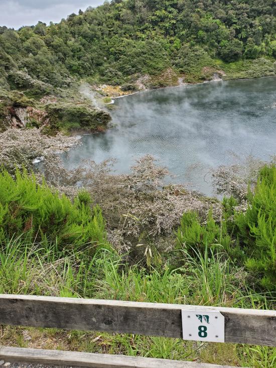
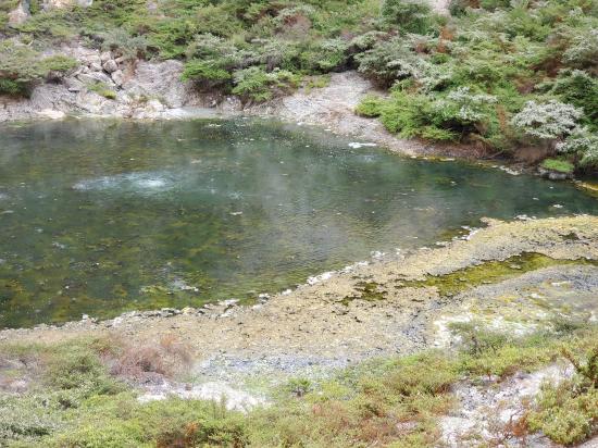
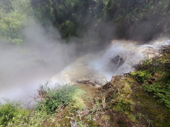
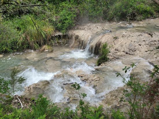
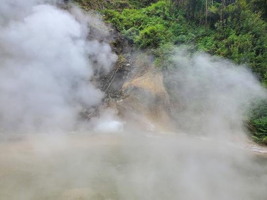
Follow the roadway for 40m to the top of the rise. On 1 April 1917 the western basin of Echo Crater violently erupted, completely destroying an accommodation house located in front of where the Visitor Centre is today and killing two people. The deepened and enlarged crater quickly accumulated water and formed what is now known as Frying Pan Lake. The lake covers 38,000 square metres, being the world’s largest hot spring, with an average depth of six metres (water volume 200,000 cubic metres). The average lake temperature is about 55°C (131°F). Return to the main scenic walkway.
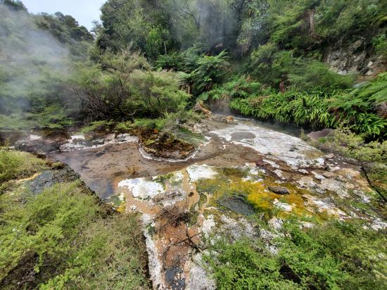
Pause here and listen to the eerie sounds coming from, the hot springs and fumaroles about Echo Crater and Frying Pan Lake. The lake water is.acidic (average pH 3.5), while the carbon dioxide and hydrogen sulphide gas bubbling up gives the appearance of boiling. In fact, in vents on the lake bed real boiling is occurring, but the body of the lake is somewhat cooler because of evaporation, convection and radiation of its heat.
The bubbling area about ten metres from the lake shore (to the right of the point below you) was the site of the Trinity Terrace eruption in February 1973. Mud from this 15 minute eruption, which happened during the night, was sprayed over an area more than 100 metres across, This was one of the largest eruptions at Echo Crater since 1917. It is also the most recent. View the sweep of prostrate kanuka on the terrace below which has been re-colonised since the 1973 eruption.
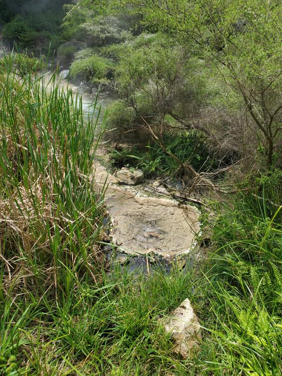
This area of warm ground can grow crystals of sulphur and sulphates (including alum) when conditions are right. The crystals are very fragile and some dissolve in, or are destroyed by, rain.
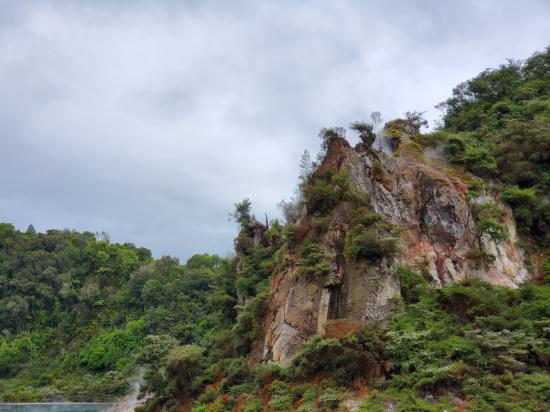
Originally named Gibraltar Rock because of its resemblance to the historic rock at the western entrance to the Mediterranean Sea, this steaming monolith was completely changed in shape by the Frying Pan Flat eruption of 1 April 1917, and its residual pinnacles afterwards deserved a new name. The massive rhyolithic lava composing it is at least 60,000 years old – much older than Tarawera volcano.
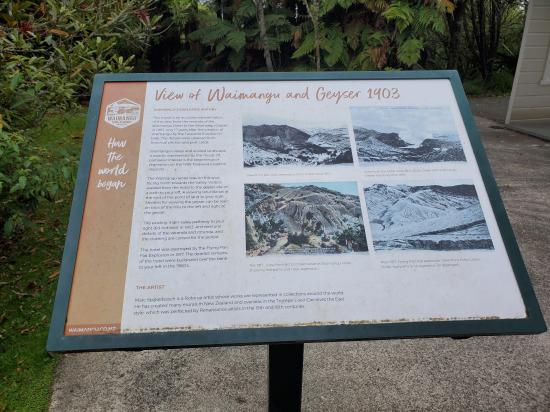
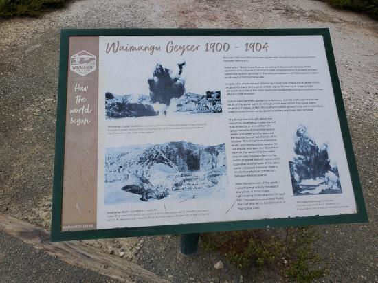
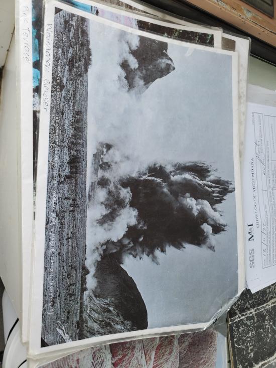
The large basin in front of you, bordered by hills on three sides, was once the basin of Waimangu Geyser. Active between 1900 and 1904, Waimangu was the world’s largest known geyser. Erupting sometimes up to 400 metres (1300ft.) high, and hurling black sand, mud and rocks into the air, Waimangu Geyser followed a 36 hour cycle of activity. In August 1903, tourist guide Alf Warbrick
launched a rowboat on the geyser’s lake as the result of a dare. He and his companion measured the lake depth at only 48 feet (14.6m), but this unexpectedly shallow result evidently came about because the solid material ejected in the eruptions largely fell back into the vent each time. The geyser lake covered an area 80m x 130m.
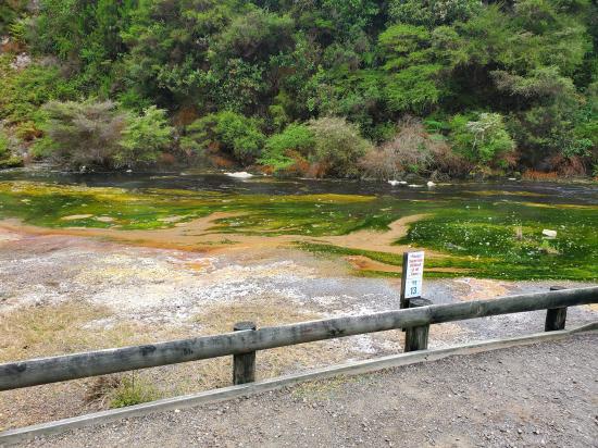
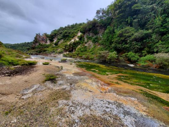
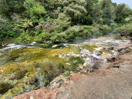
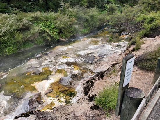
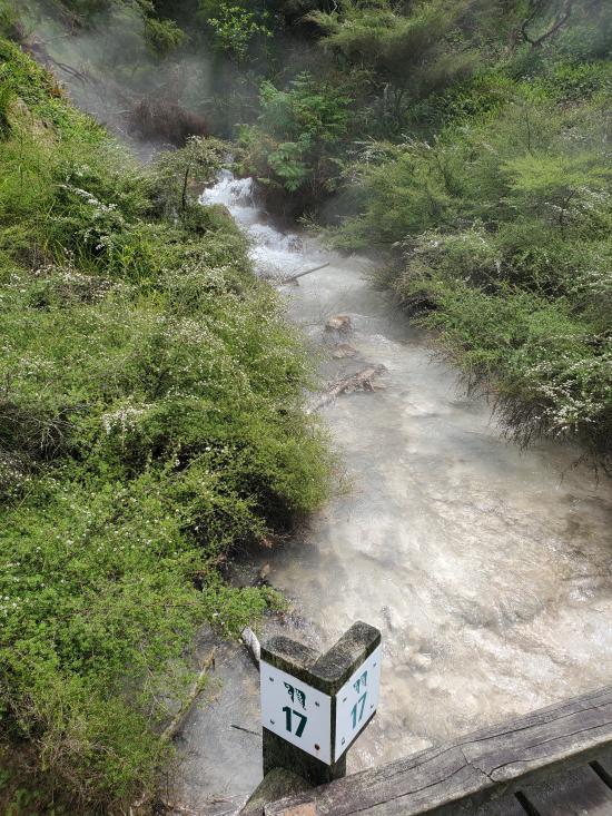
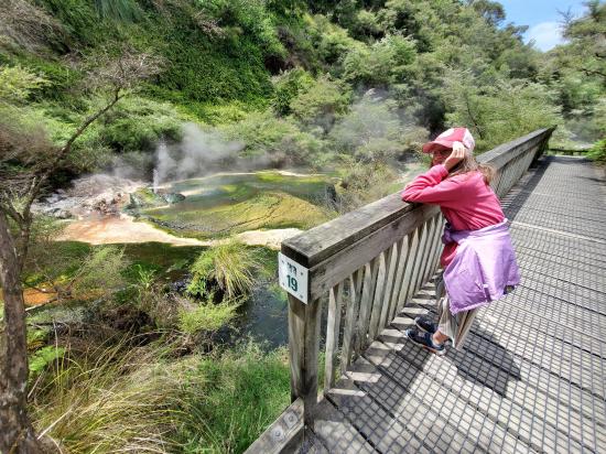
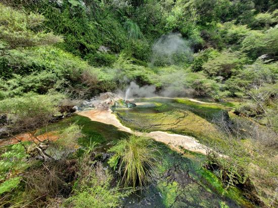
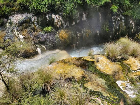
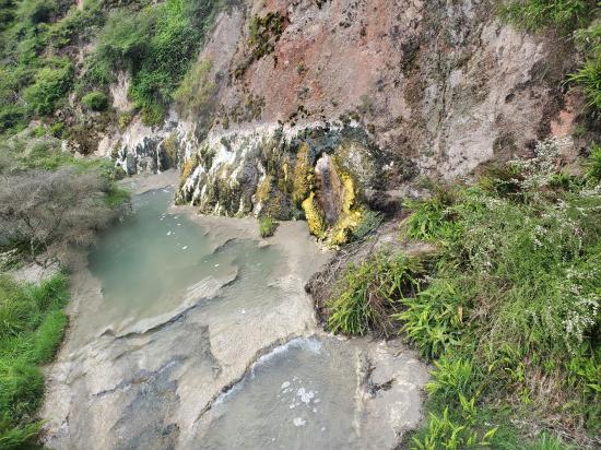
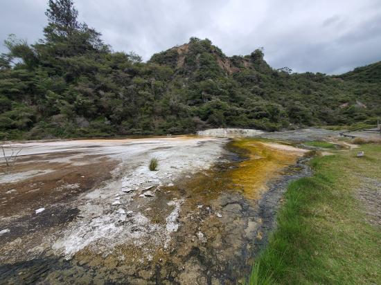
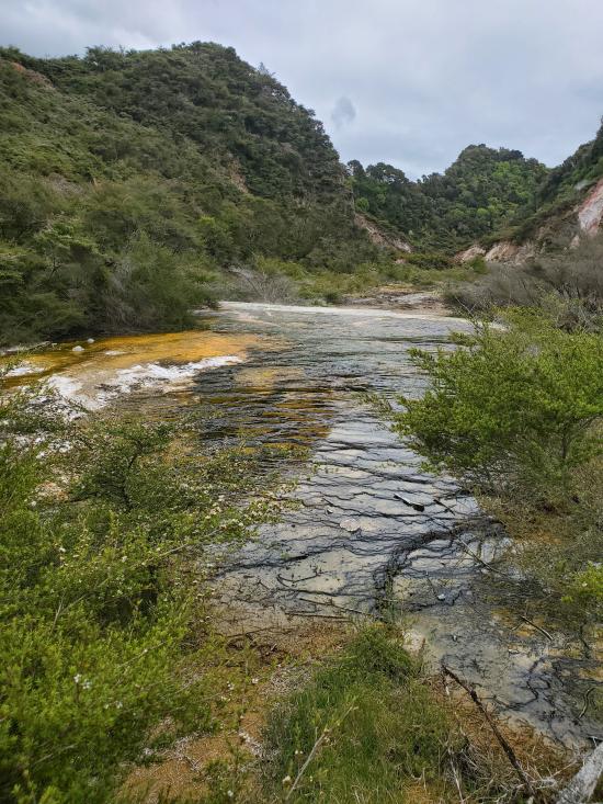
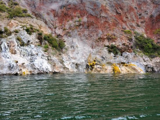
Frying Pan Lake overflows through this notch at a temperature of about 50°C with a flow of about 110 litres per second. Along its margin the stream forms deposits which contain traces of elements such as antimony, molybdenum, arsenic and tungsten. These minerals, along with blue-green algae, form the spectacular orange, brown, green and yellow colours seen along the edge and about the hot springs.
A cluster of vigorously boiling hot springs building intricate and strikingly coloured miniature silica formations.
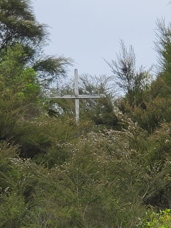
The white cross on the lowest point of the crater rim to the east marks the site from where four tourists, standing at a place which they had been warned was dangerous, were washed to their deaths on 30 August 1903, when the Waimangu Geyser suddenly erupted.
These silica terraces have been built by ‘Spring N’ which suddenly started life in 1975 as a small erupting spring. At the time, because of its site within the old Waimangu Geyser basin, it was felt by scientists that it might be the forerunner to larger events and visitor access to the crater was restricted for a short time. The name of this spring group, bestowed by former guide the late A. Stan Marx, may have been chosen by him to reflect the scientists’ attempts to understand nature here.
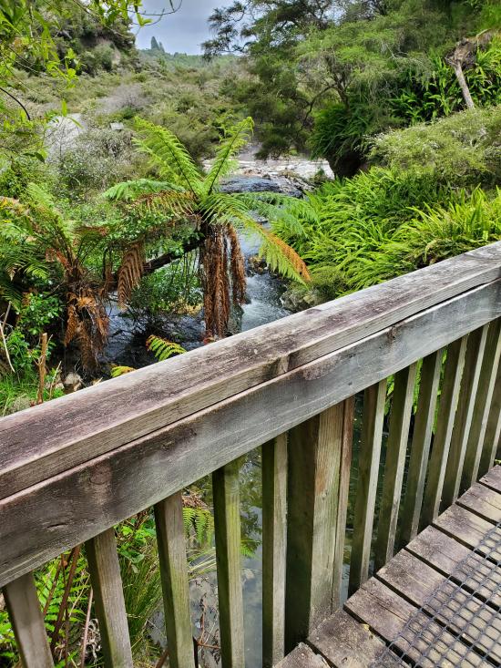
When Inferno crater (see 18) overflows, near-boiling water cascades down this small valley, swelling the hot stream from Frying Pan Lake and killing blue-green algae which grows on the sinter floor of the channel between times of overflow.
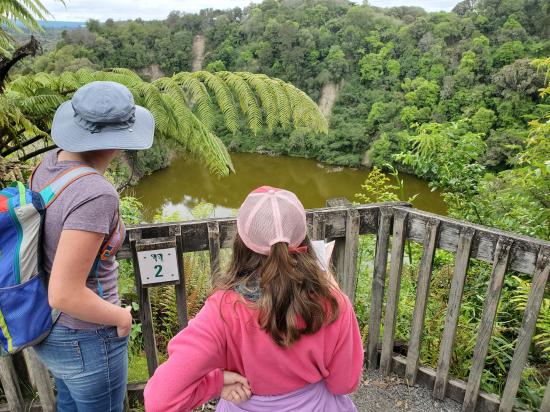
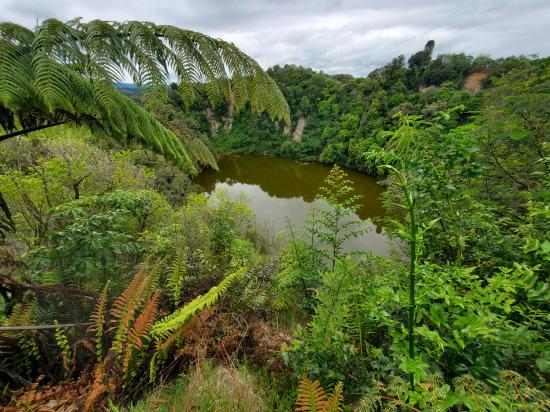
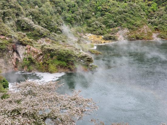
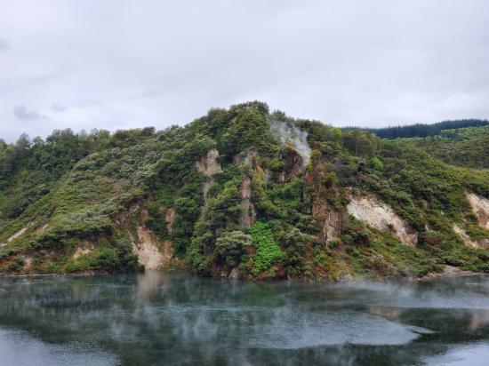
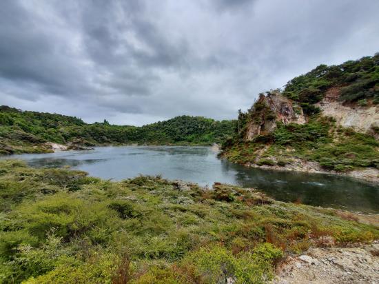
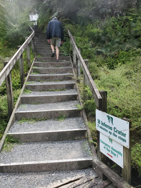
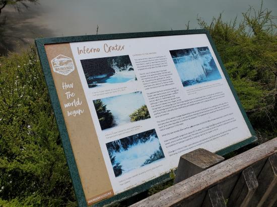
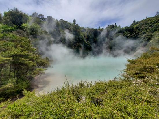
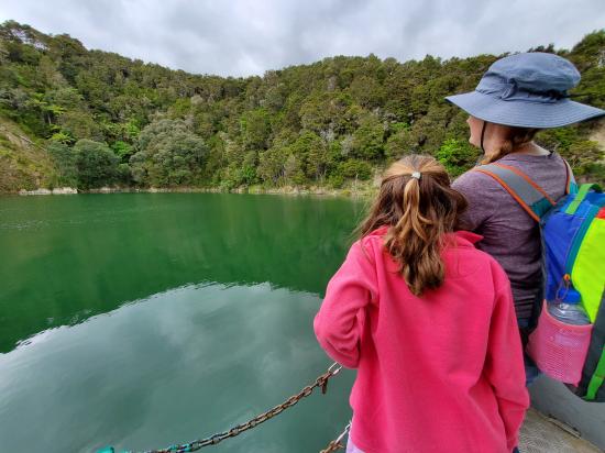
This steaming and usually pale blue jewel of Waimangu lies in an 1886 crater blown in the side of Mt Haszard. Lake level follows complicated rhythmic cycles with shallow recessions occurring every few days and/or deeper recessions at longer intervals. The top of the white silica deposit marks overflow level. Its most common behaviour is to overflow for two to three days, recede about eight metres during some 15 days, partly refill over three to four weeks, oscillate for a while, and then overflow again. The lake bed is roughly trumpet-shaped. Its depth when full is 30 metres, and overflow températures can reach 80°C (176°F). The water is highly acidic with a pH sometimes of 2.1.
Inferno crater is the largest geyser-like feature in the world, although the geyser itself cannot be seen since it plays at the bottom of the lake. It has a unique relationship with Frying Pan Lake (No. 8) when Inferno Crater Lake is overflowing, there is a decrease in the discharge from Frying Pan Lake and when Inferno Crater is receding the discharge from Frying Pan Lake is greater than usual.
Striking multi-coloured algae adhere to the delicate miniature silica terraces formed by these boiling springs. The different colours are caused by the varying temperature in the outflow from these springs. Blue-green algae cannot survive at more than 75°C (167°F).
The silica rich waters of this boiling spring form an unusual shell-shaped terrace and help maintain the adjacent stream temperatures. Springs such as this are home to thermophilic bacteria. Similar simple organisms are believed by many scientists to have been present at the beginnings of life on Earth.
These have formed from dripping and trickling mineral rich water in a similar way to limestone stalactites. These examples have been able to form from hot water percolating out of Mt. Haszard in the time that has elapsed since Waimangu Geyser stopped its eruptions.
The prominent black band through this bank marks the soil buried by the material erupted from Lake Rotomahana and Mt. Tarawera on 10 June 1886. The white pumice layer below the buried soil is nearly 2000 years old and was erupted from Lake Taupo by the world’s most violent volcanic eruption in recent millennia the Taupo Pumice eruption.
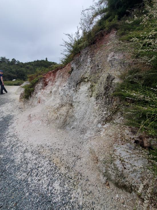
The fine white kaolin clay evident here is the type used in porcelain production, being formed when the heat and gases in the steam gradually alter the solid rock of the hill. The hot springs playing out of the bank share the same water source as steam vents within craters on the hill.
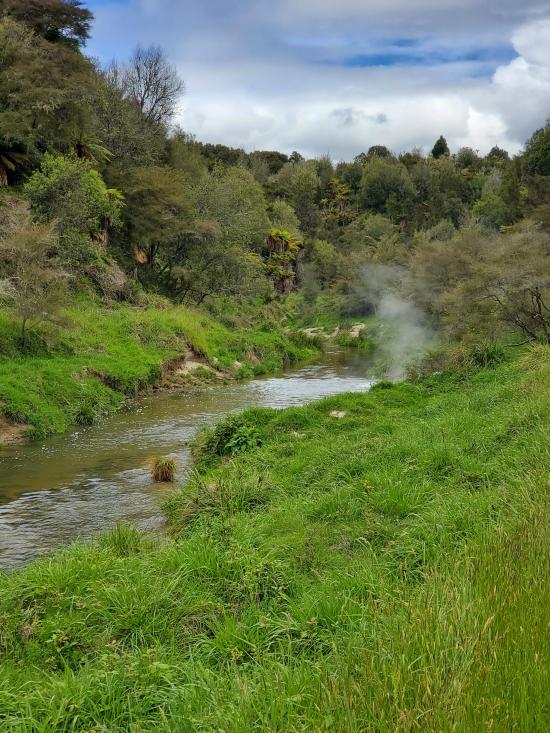
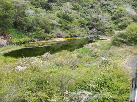
The cold water Haumi stream flowing out of Lake Okaro, a cold crater lake south of Waimangu, here joins Hot Water Creek, formed by the outflow from Echo and Inferno Craters and numerous hot springs above here.
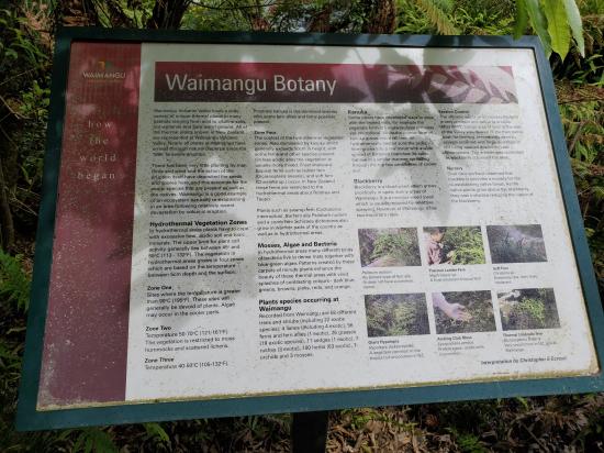
This road cutting displays a succession of old soil and pumice beds that indie; recent geological history of the Waimangu-Tarawera area. Refer to afagram above.
Across the stream is an unusual combination of steam vents, a large hot spring and plants. An assortment of mosses, ferns and lichens thrive in the warm, humid and shadowy conditions.
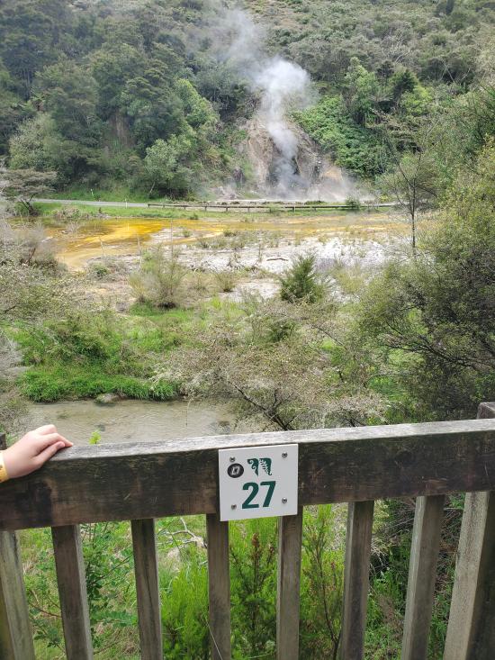
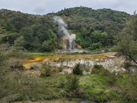
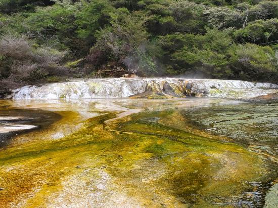
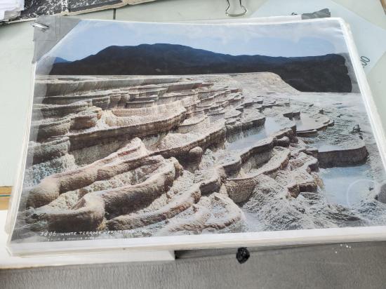
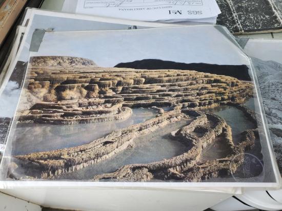
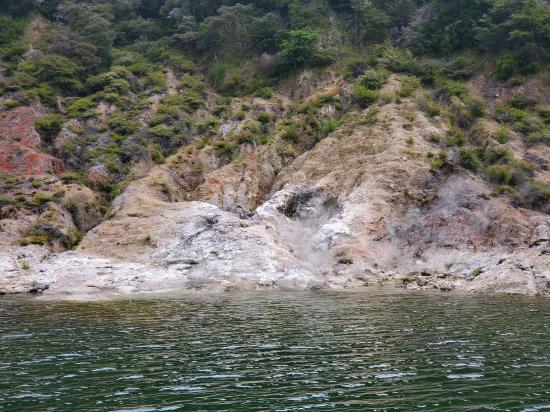
The buttresses in front of you and the sinter flat beyond are composed of a similar material to the Pink and White Terraces that were situated on Lake Rotomahana, but destroyed by the 1886 Tarawera Eruption. These terrace buttresses are formed by silica depositing out of solution and building in successive layers over time. The silica rich water is supplied from a large hot spring in lodine Pool (so named for the brown colouring on rocks and banks). The water leaves Iodine Pool at an average 97°C (208°F) to flow across Marble Terrace in shallow waves. Marble Terrace and its buttresses are growing over a stream terrace formed when Lake Rotomahana was at a higher level in the 1970s and the stream frequently flooded this area. The large hot spring which flows into lodine Pool can be seen at the apex of the Terrace (across the road).
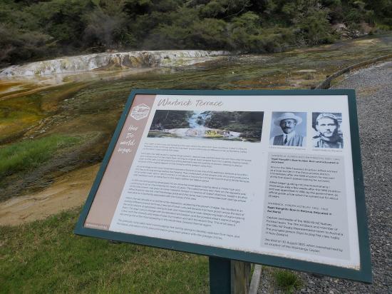
Take the path past Bus Stop #2 into Rainbow Crater, formed by the 1886 eruption. Warbrick Terrace is a set of multi-coloured fast growing silica platforms forming over an old stream terrace in a similar way to Marble Terrace. (27) In addition algae in recent years have assisted in the silica deposition to build a dam across the warm stream draining through the crater. A further series of ripple terraces are now forming at right angles to the original ones. The name commemorates members of the Warbrick family who were intimately connected with the history of this area. Alfred Patchet Warbrick, who was reputed to have been born on the shores of old Lake Rotomahana, spent 45 years guiding thousands of people and exploring the Rotorua hydrothermal and volcanic region, climbing, camping and path-finding. He was involved in the first rescue expedition across Lake Tarawera a few days after the 1886 eruption. After Waimangu Geyser broke out he became an employee of the Government Department of Tourist and Health Resorts as Chief Guide in the Waimangu, Rotomahana, and Tarawera region and assisted in developing and expanding a system of land and lake tours in the geyser country of Rotorua. A brother Joseph was one of the victims of the Waimangu Geyser eruption of 30 August 1903. The Warbricks were members of the first Maori rugby team to tour England and belonged to the Ngati Rangitihi Tribe.
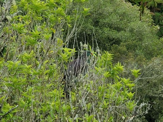
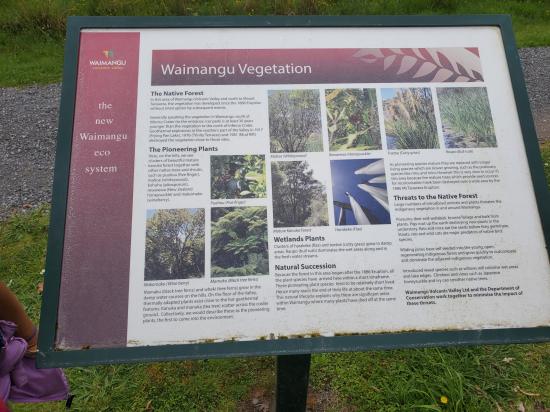
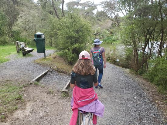
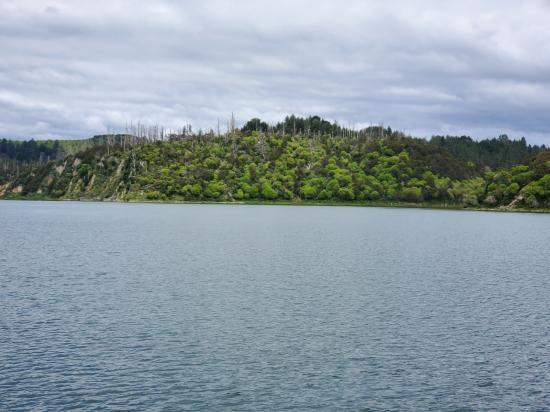
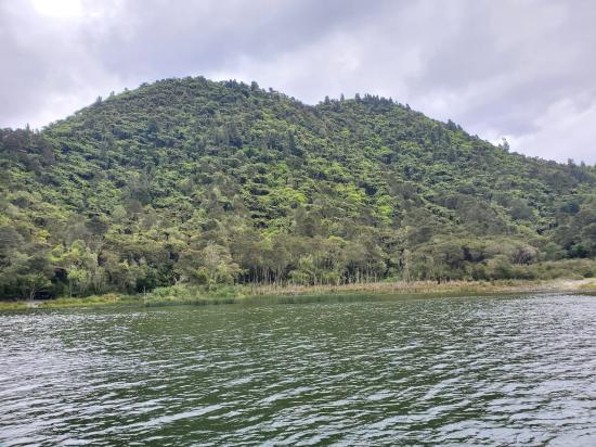
Follow a twenty minutes’ walk on the old lake floor to the scenic shore of Lake Rotomahana, through the wildlife refuge and scenic reserve. The predominant plant in this area is the New Zealand native Toetoe which is uncommon. Look for plant identification plaques on your walk.
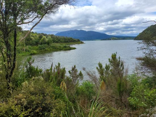
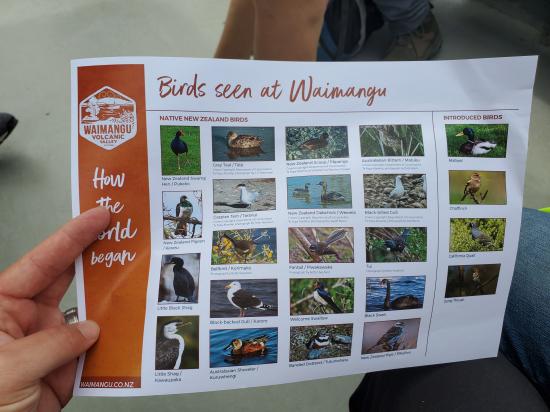
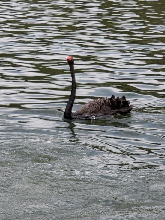
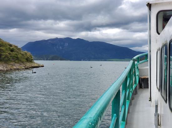
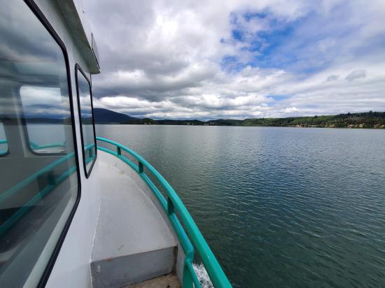
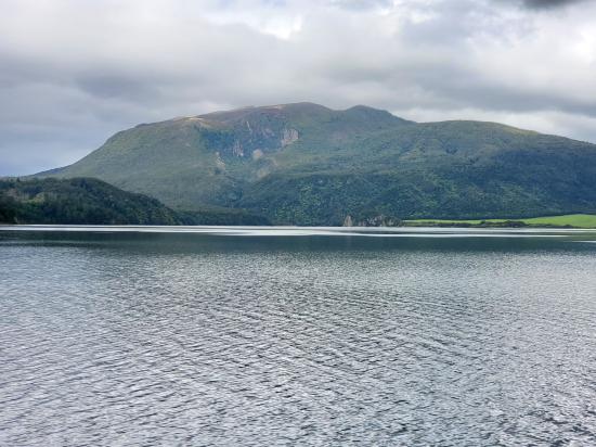
Tarawera volcano with Tarawera Chasm (also known as Red Crater – 1886) rising beyond Lake Rotomahana. This point is the 1974 boat jetty site. Lake Rotomahana is a bird sanctuary, with many species often to be seen here.
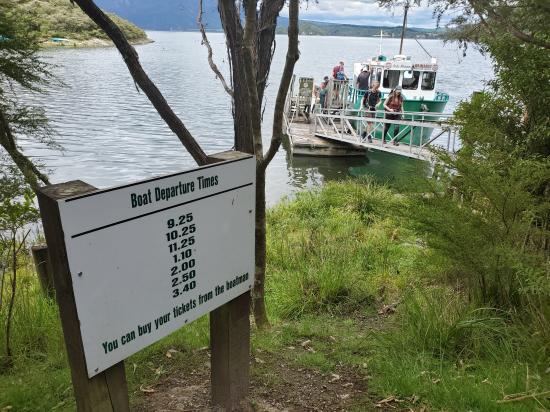
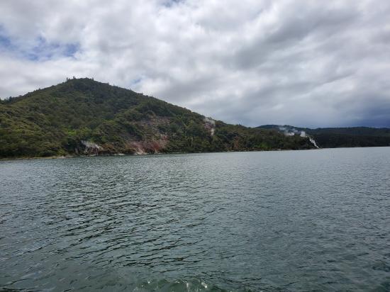
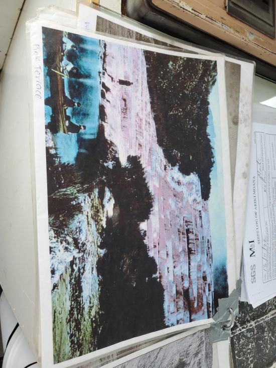
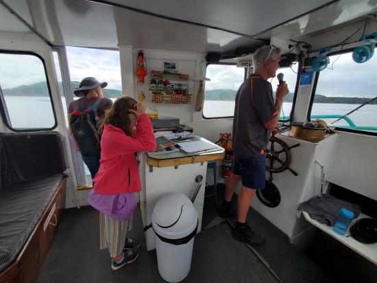
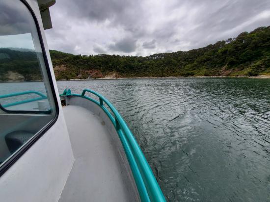
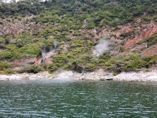
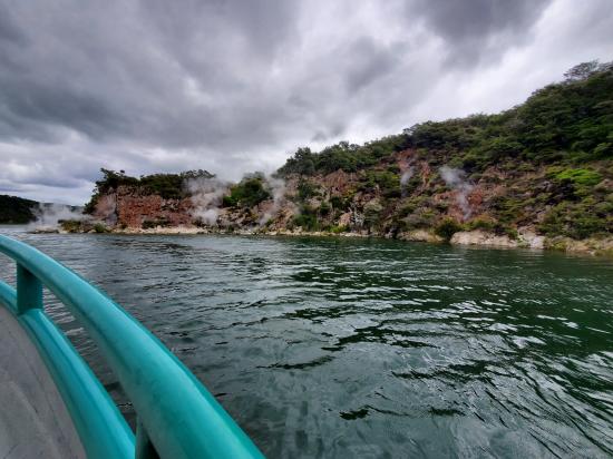
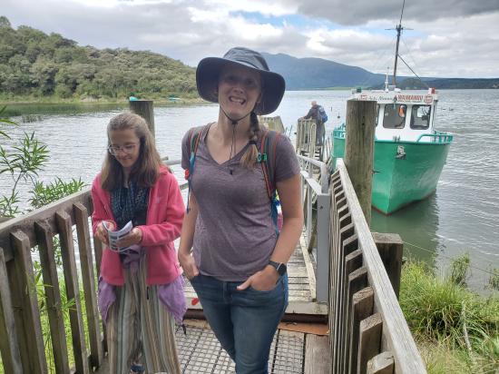
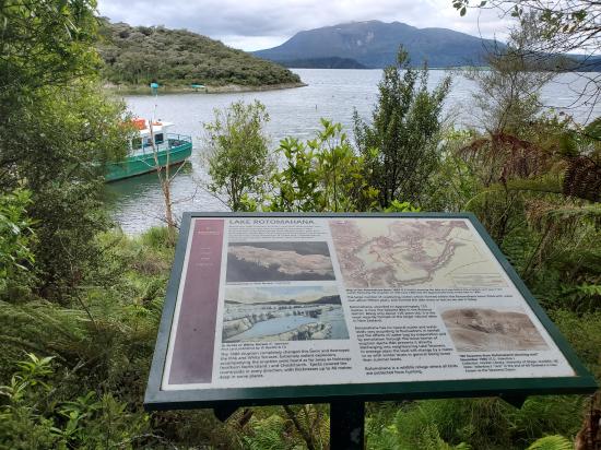
(See separate sheet for more detail.) Tickets are usually available from the boat captain. The boat cruise offers a 45 minute circle of the lake to view geothermal and volcanic features not visible from the shore. These include steaming cliffs, eruption sites and craters, geysers and many fumaroles. The captain gives a commentary on the history of eruptions in this location and the consequent reshaping of the lake and surroundings. Lake Rotomahana was the site of the world famous Pink and White Terraces prior to the eruption of Mount Tarawera in 1886.
While resting here, look back over Echo Crater with Frying Pan Lake steaming in the background. The lake occupies the western basin of the crater, with Cathedral Rocks to the right, and in the foreground lies Waimangu Geyser Basin the now sediment filled floor of the old Geyser itself. Note the cross on the rim of the crater where four people were standing when they lost their lives by an untimely eruption on 30 August 1903. Dominant on the south-western skyline is Rainbow Mountain (Maungakakaramea) an 180,000 year old volcano known for its colourful slopes.
In October 1900 Waimangu Geyser was first seen in eruption and by the summer of 1902/03 a regular tourist trip was operating from Rotorua visiting Te Wairoa (Buried Village). Lakes Tarawera and Rotomahana, and Waimangu, before returning to Rotorua “The Round Trip” (This tour still runs today). During 1902 a shelter was built on this site for visitors to rest as they watched Waimangu Geyser in action. The Geyser’s last eruption was on 1 November 1904.
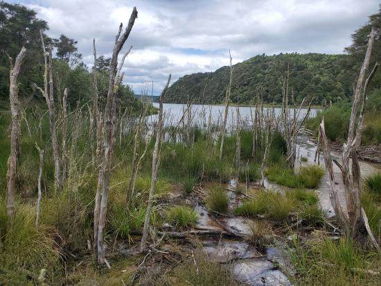
In the foreground lies shallow Raupo Pond Crater, formed in 1886 by the Tarawera eruption. It was host to the ‘Mud Rift’, a geothermal feature which was active from 1906 to 1981 when a minor hydrothermal eruption destroyed it. In the middle distance steam can be seen rising from the walls of Black Crater. Lake Rotomahana in the middle distance, infills craters created in the 1886 eruption. In that eruption, rising basalt magma (lava) caused an immense hydrothermal eruption of the geothermal system that supplied the Pink and White Terraces. This was followed by very explosive ‘phreatomagmatic’ eruptions. (Explosive boiling of water both in the lake and within saturated rock beneath it, caused by its contact with the magma). The two terraces were destroyed (see #32 Boat Cruise). To the right within the lake lies Patiti Island, the remains of an 18,000 year old lava dome.
Beyond Rotomahana is Tarawera Volcano, estimated to include about 13.5 cubic kilometres of rock. Tarawera was built up by a series of eruptions approximately 18000, 15000, 11000 and 650 years ago. In 1886 the intruding basalt magma rose through a series of dykes that formed beneath the mountain, beneath Rotomahana and beneath the Waimangu area. At this point you are standing 94m above Lake Rotomahana which is itself 340m above sea level. Tarawera mountain summit rises 1111m above sea level.
This deep, steep sided crater is another of the series blasted through the summit of Mt Haszard on 10 June 1886. From this viewpoint the spectacular lava bluffs forming the crater walls can be seen. The crater reaches depths of 56m. The crater was not named at the time of its formation and was first recorded with its present appellation in the 1920s. From here the trail follows approximately the line of the original ‘Round Trip’ track as you start to descend towards Black Crater.
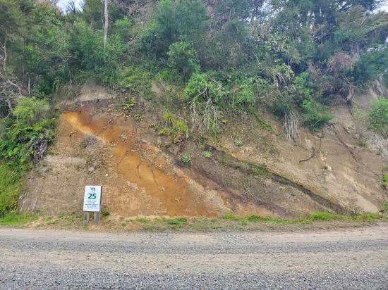
From this vantage point one sees a mixture of geographic forms. Below you to the right lies the lower Waimangu Valley, a stream valley, approximately parallel to the ‘Rift Valley’ (line of craters), (see also #25). The Haumi and Waimangu Streams flow through this lower part of the valley below their confluence, (see #24).
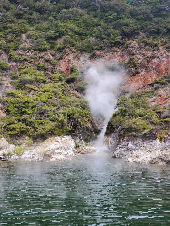
Above this valley lies the ‘ignimbrite plateau’ of the Taupo Volcanic Zone, thousands of hectares of volcanic rock eroded to form unusual flat top hills known as tors. Land on the plateau is dominantly used for farming and growing exotic forest. In the far distance can be seen the summits of the Urewera ridges, more distant parts of which form a section of the North Island axial ranges. As you descend from this vista, the Waimangu delta, Lake Rotomahana and Mt Tarawera dominate your view. The prominent steam plume in the lower Waimangu Valley rises from Iodine Pool. Lake Rotomahana and Tarawera volcano are framed by the walls of the Rift Valley.
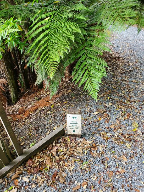
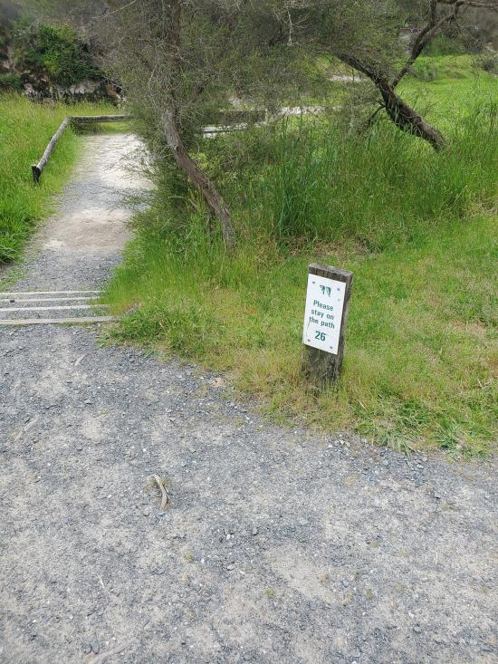
Please stay on the trail at all times.
Here one looks up into Black Crater, walled by the massive lava outcrops of Mt Haszard on the east (left side) and steaming hot ground on the other, discoloured to pinks and reds. Two craterlets were formed here during the 1886 eruption and the resulting divide can be seen crossing the crater floor in the middle distance. This crater was named by the first exploring expedition to Rotomahana after the 1886 eruption and the choice was based on the appearance of the deposits accumulating around it at that time.
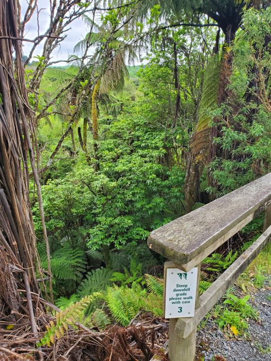
From the Saddle, the Rift Valley (Line of Craters) continues down towards Lake Rotomahana. Geothermal activity is dominated by steaming ground on the rift walls. Steam rises also from numerous hot areas on the crater floor including the Warbrick Terrace boiling spring (see #28). From this point the trail descends to the valley floor before rejoining the Waimangu Valley walkway at #25. Steep hill down to rejoin main valley walkway at #25 - Please be careful.
Closest City or Region: Rotorua, New Zealand
Coordinates: -38.285254, 176.386259
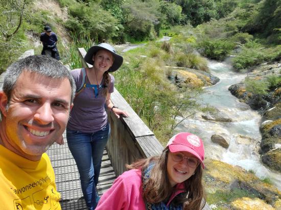
By Jeremy Dye
Jeremy Dye, Tara Dye, Savannah Dye,
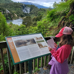
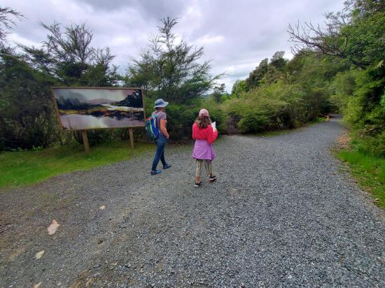
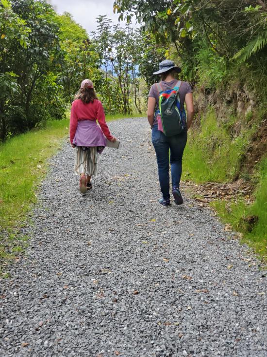
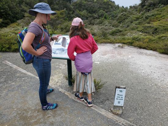
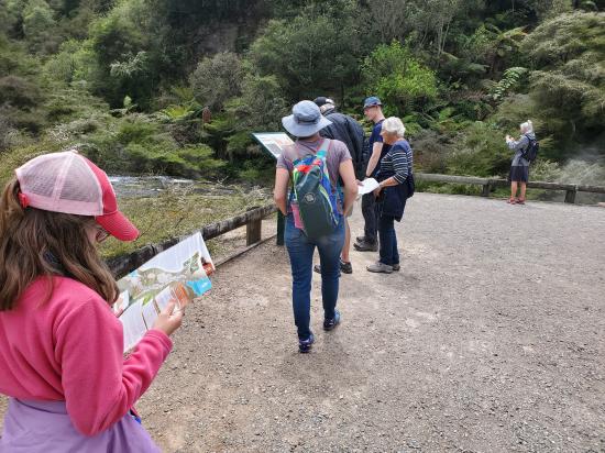
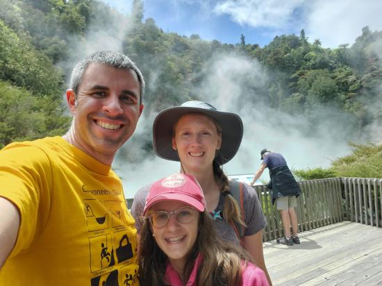
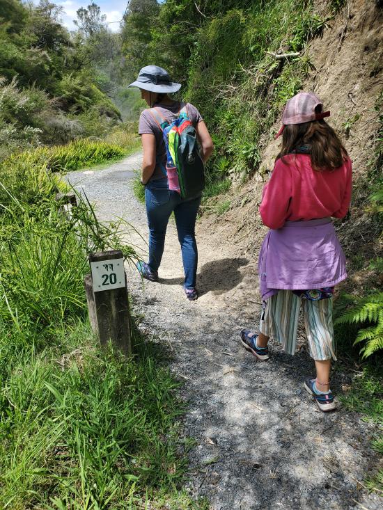
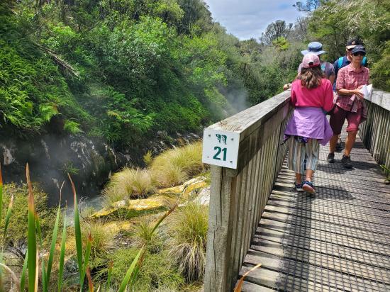
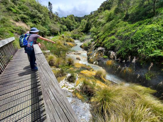
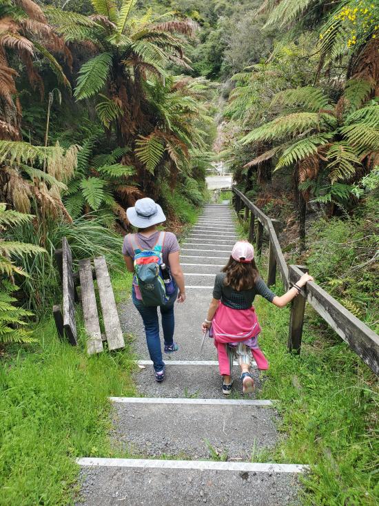
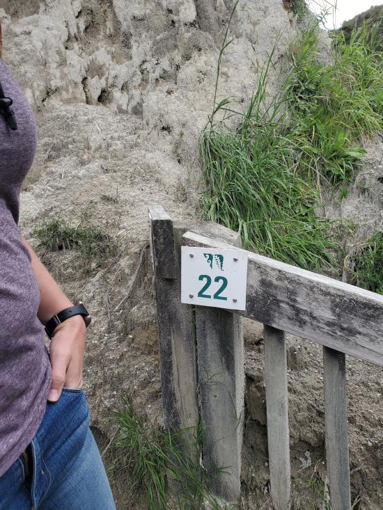
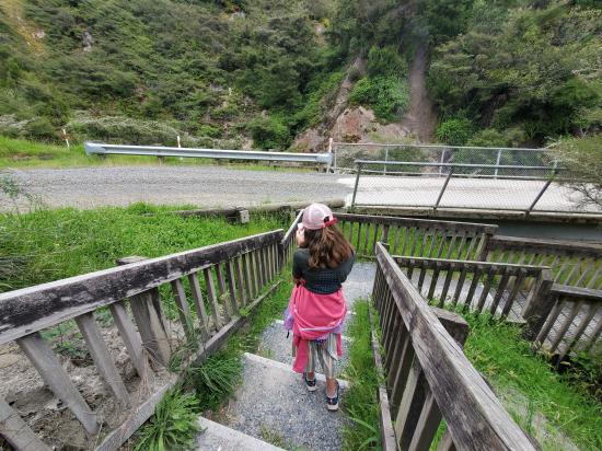
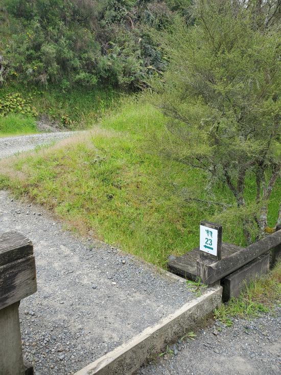
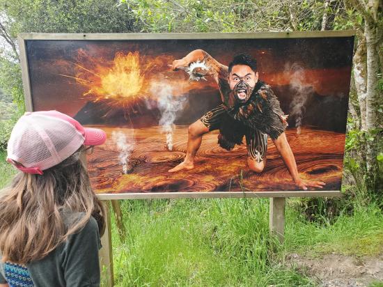
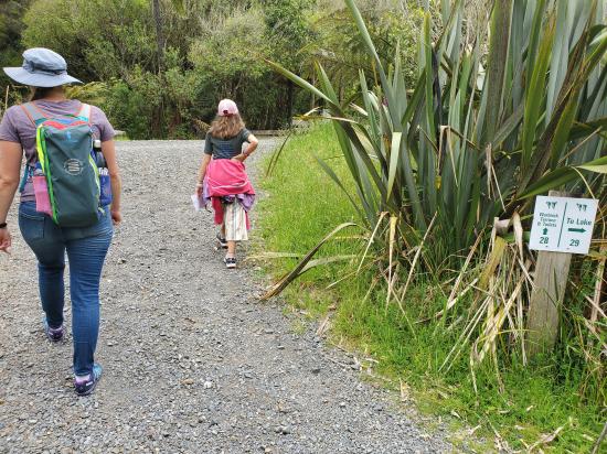
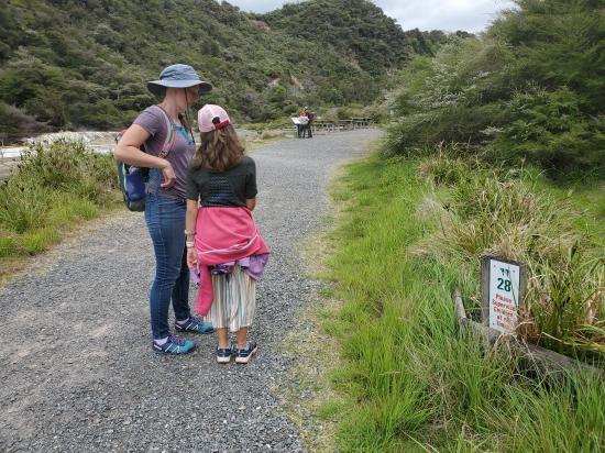
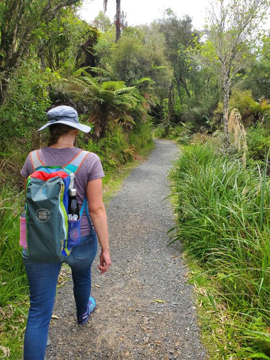
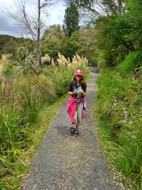
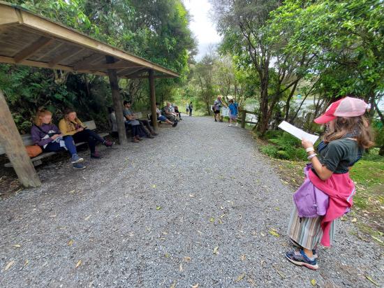
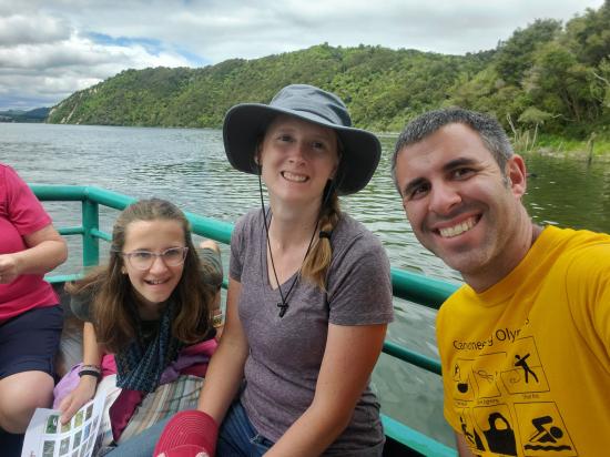
On Tuesday afternoon, we went to Waimangu Volcanic Valley. We ate leftovers for lunch then hiked the 4 km from the visitor center to the lake shore. There were a number of interpretive stops along the way, and Savannah was our map holder and read the different waypoints to us.
At the lake, we got on a boat tour that took us around the lake and showed us the volcano crater and several little geysers and hot springs and fumaroles along the lake shore. Then we caught their shuttle bus back to the visitor center and proceeded on down the road.
 Sigatoka Sand Dunes National Park
 Sigatoka Sand Dunes National Park Visitor Center
International Antarctic Centre
Fiordland National Park Visitor Centre
Boniface Water Gardens View Point
Turangi Leisure Lodge Mini Golf
 Geothermal Features
 Hiking Trails
 Lakes and Reservoirs
 Mountains
 Interpretive Signs
 Viewpoint, Overlooks, Vistas
 Road Access is Paved
 Access Road is 2WD Accessible
 Restrooms - Flush
 Boating
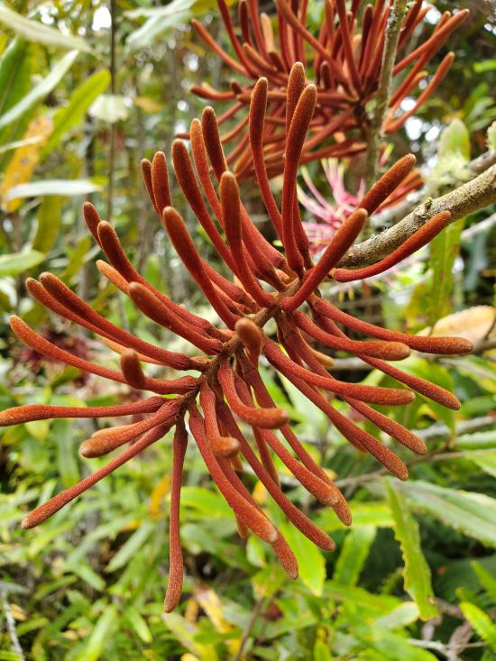
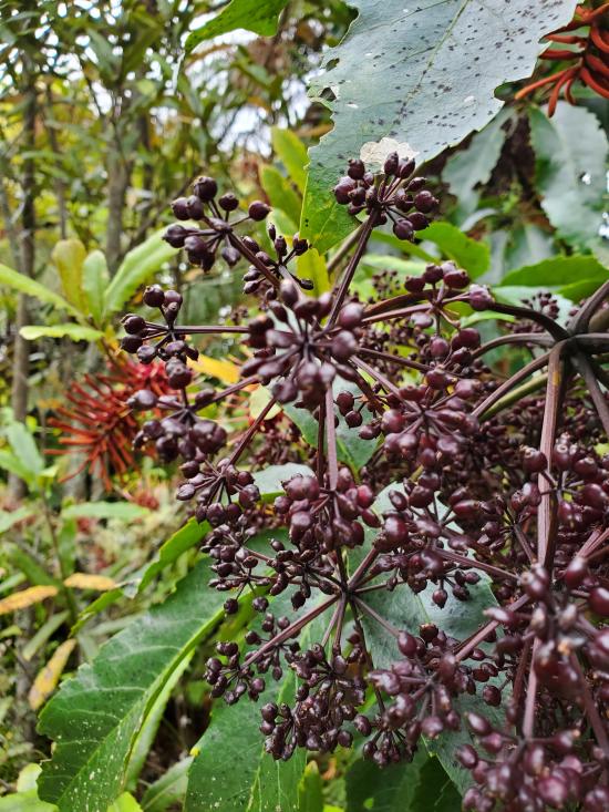
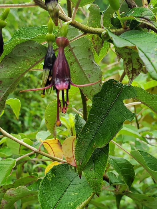
 Wildflowers and Vegitation
 Wildlife and Birding
