 Canyoneering | Neon Canyon


Hype:
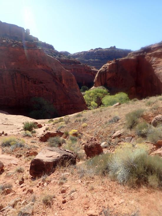
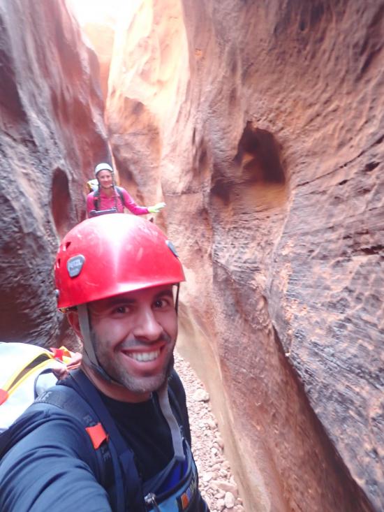
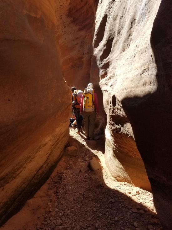
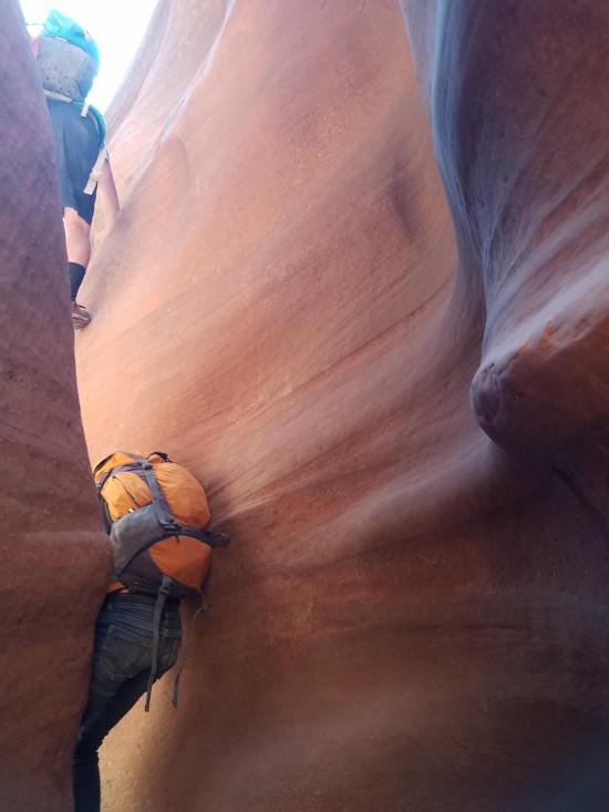
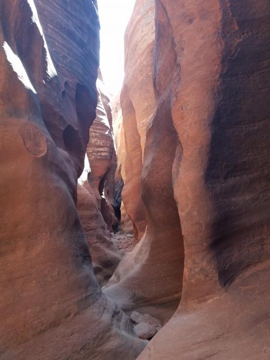
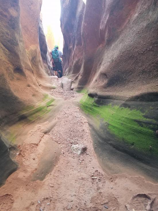
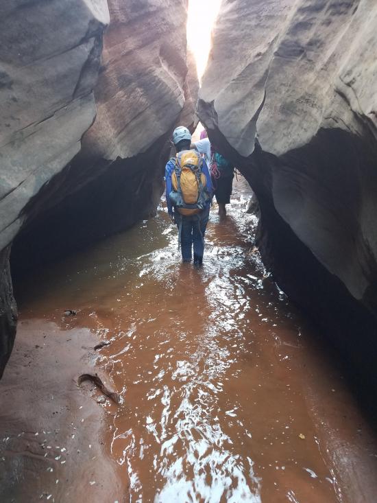
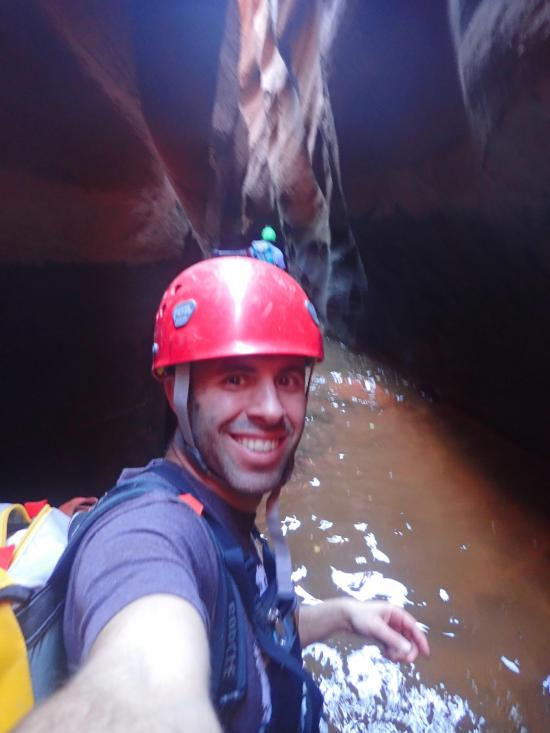
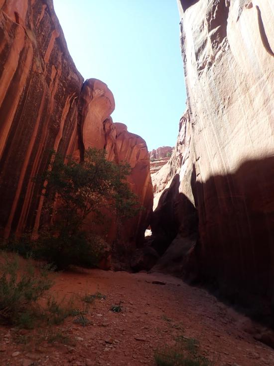
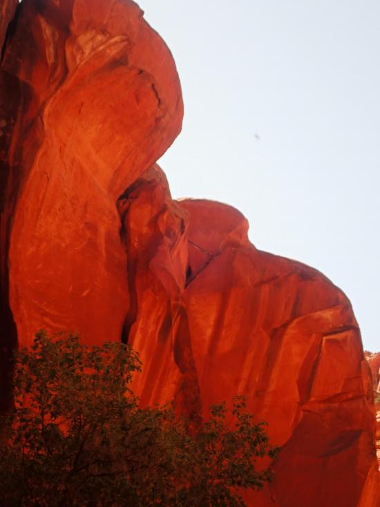
Neon Canyon is an amazing canyon. Because it is so remote, canyoneers often combine Neon Canyon with other canyons in the area for a multi-day backpacking trip. The most memorable part of Neon Canyon is the Golden Cathedral, a spectacular alcove with a double arch in the roof. The Golden Alcove is a popular hiking and photography destination. The canyoneering route through Neon Canyon ends by rappelling down into the Golden Cathedral. However, the Golden Cathedral is not the only amazing part of Neon Canyon. Neon also boasts several other rappels and downclimbs, swimming and wading sections, potholes, and narrow scenic slot canyon sections.
Canyon Rating: 3B 
Time: Neon is often combined with other canyons in the area to form a multi-day trip. Completing Neon Canyon from the Escalante River, up the approach, and down the canyon back to the Escalante River takes 4-6 hours.
Length: 10.5 miles round trip. 3.4 miles round trip for just the canyon.
Longest Rappel: 85 ft
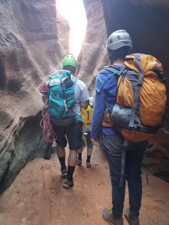
Gear: Standard canyoneering gear. Wetsuit. Pothole escape gear (pack toss).
Fees: None
Recommended Ages:
 | 0-3 |
 | 4-11 |
 | 12-19 |
 | 20-49 |
 | 50-69 |
 | 70+ |
Recommended Months to Visit:
| Jan |
| Feb |
| Mar |
| Apr |
| May |
| Jun |
| Jul |
| Aug |
| Sep |
| Oct |
| Nov |
| Dec |
Links: https://www.roadtripryan.com/go/t/utah/escalante/neon
Navigate to 37.593298, -111.218387.
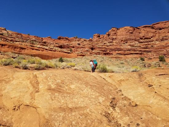
This is the Egypt Trailhead, sometimes also called the Golden Cathedral Trailhead. From the trailhead, hike about 3 miles northeast to the bottom of Neon Canyon.
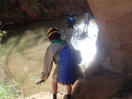
From the Egypt Trailhead, hike 3.6 miles southeast to the Escalante River. There is no trail, so good navigation skills are required.
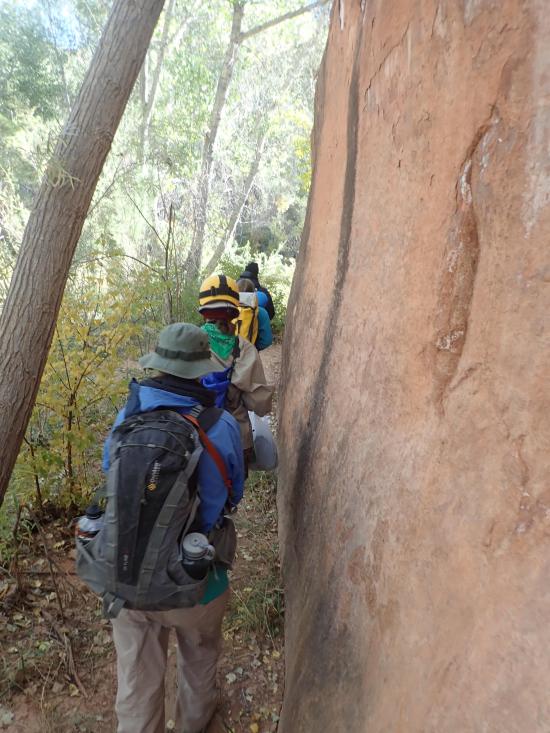
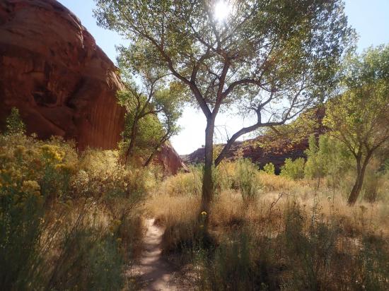
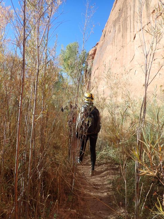
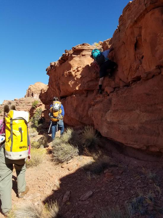
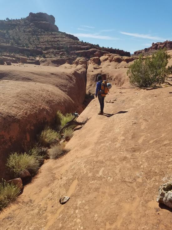
Once you're at the Escalante River, start hiking up Neon Canyon. In about 0.2 miles, leave the canyon bottom and scramble up to the rim on the north side. Don't hike all the way up to the ridge. Instead, once you're at the shelf, follow the shelf northeast and contour around. Stay at this level for the rest of the approach. The approach basically parallels the canyon below.
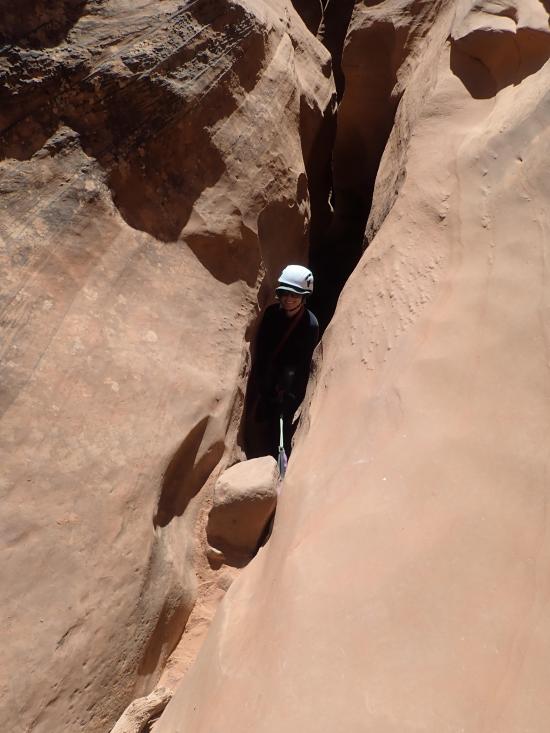
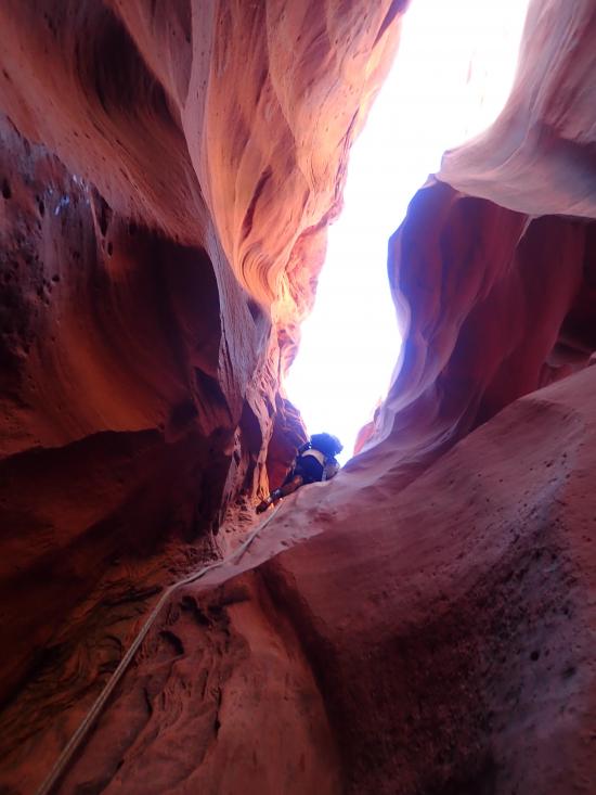
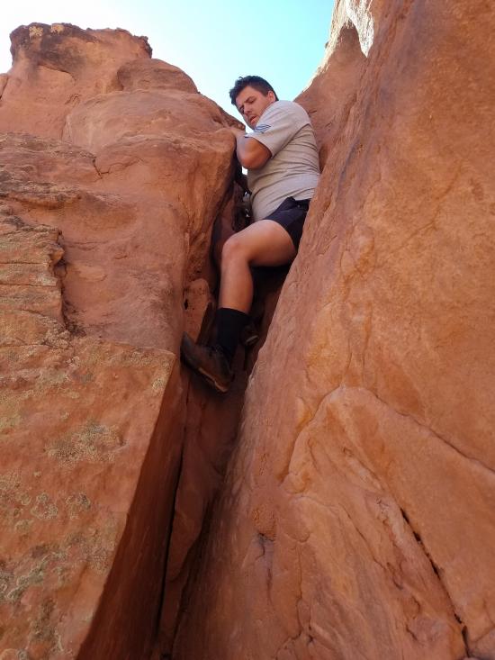
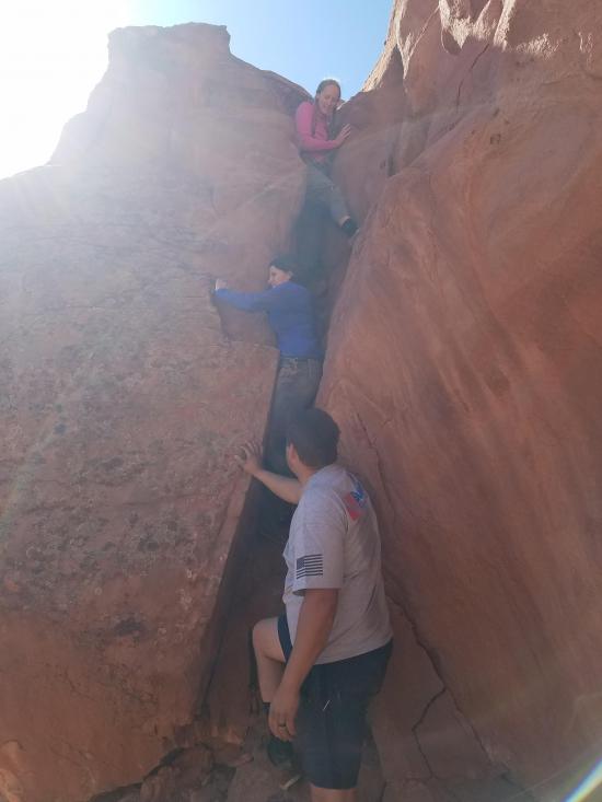
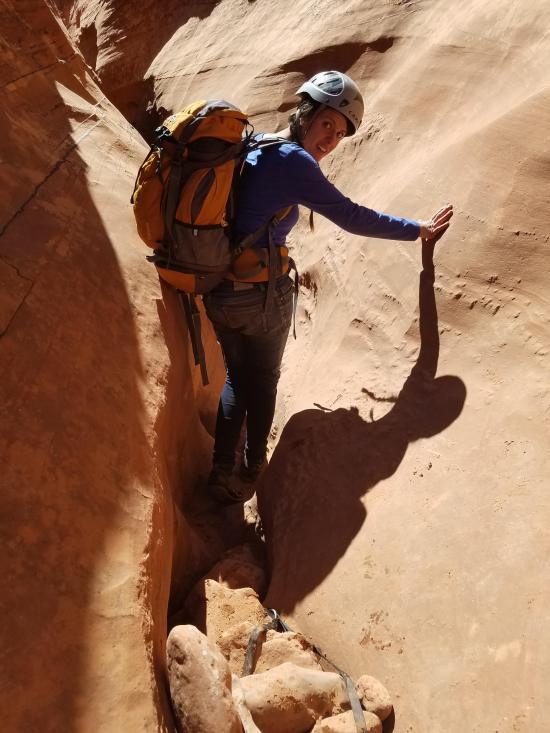
Once you're at the top of Neon Canyon, there is a long crack that you can downclimb to get down to the canyon floor. It looks intimidating, but it's not that bad.
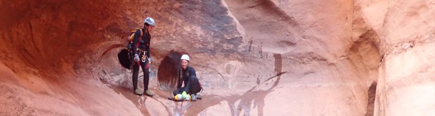
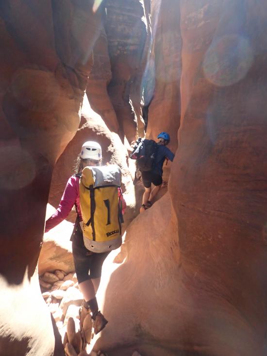
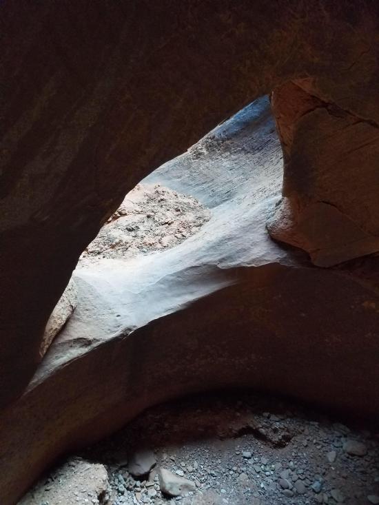
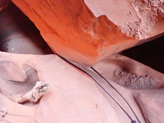
After a couple of minutes, you'll soon arrive at the first drop. There is a chockstone rigged for a rappel, but this drop can be easily downclimbed. Shortly after this drop, there is a small, triangular arch.
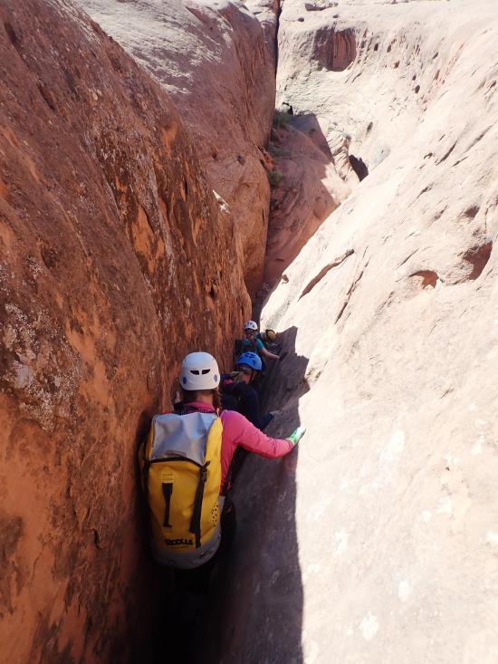
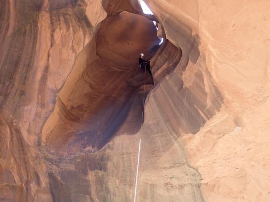
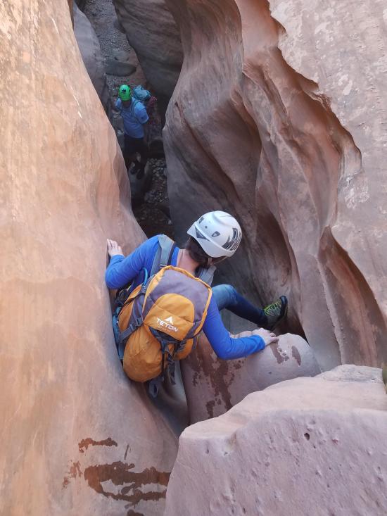
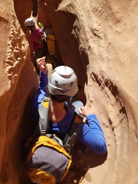
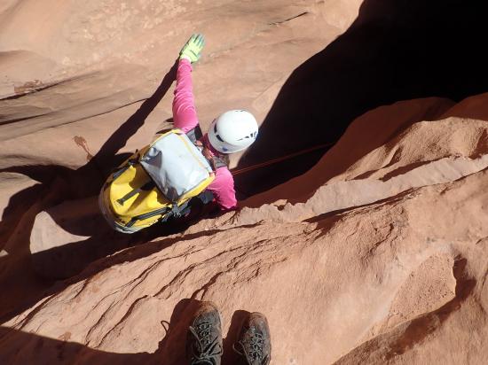
Walk down canyon for almost a quarter mile to the next drop. This drop is taller and more challenging to downclimb but still doable. Many will want to rappel.
The next drop is short and narrow. There is a rappel anchor set up, but this drop is quite easy to downclimb.
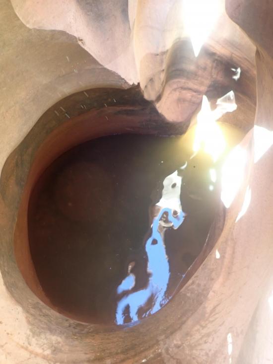
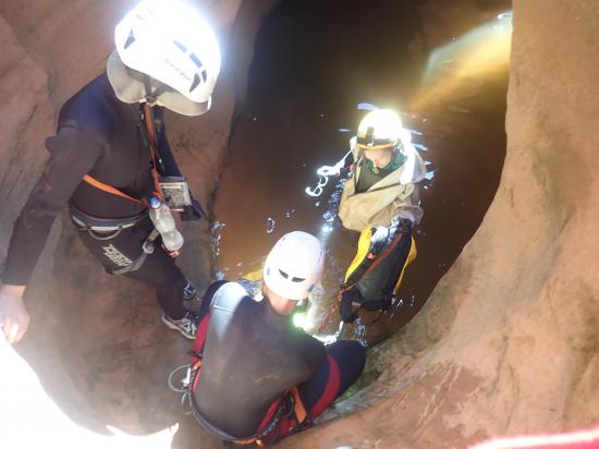
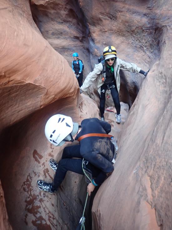
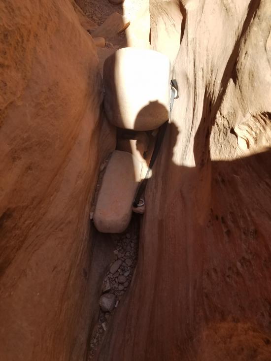
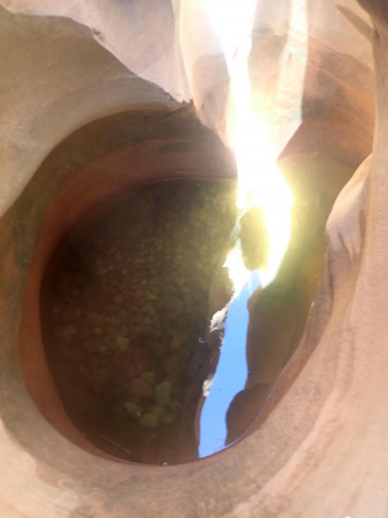
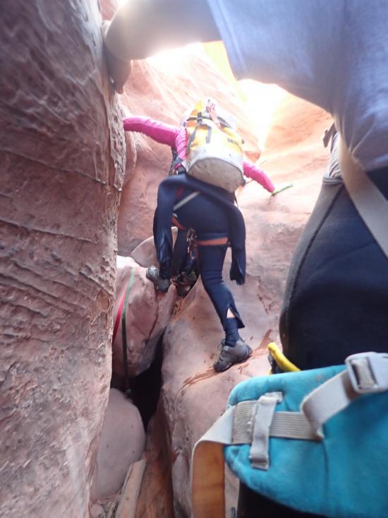
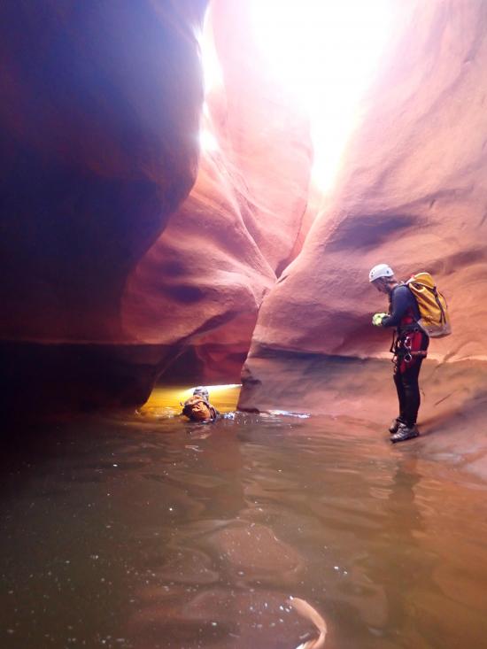
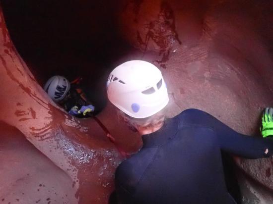
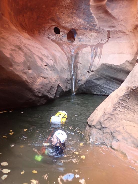
In a few more minutes, you'll arrive at the largest pothole in Neon Canyon. The pothole is close to 20 feet deep on the downstream There are three ways past this obstacle.
Make sure you have a backup plan if you're not able to escape the pothole. For example, have one person bridge over the pothole or rappel around the pothole so they can rescue the rest of the group if needed.
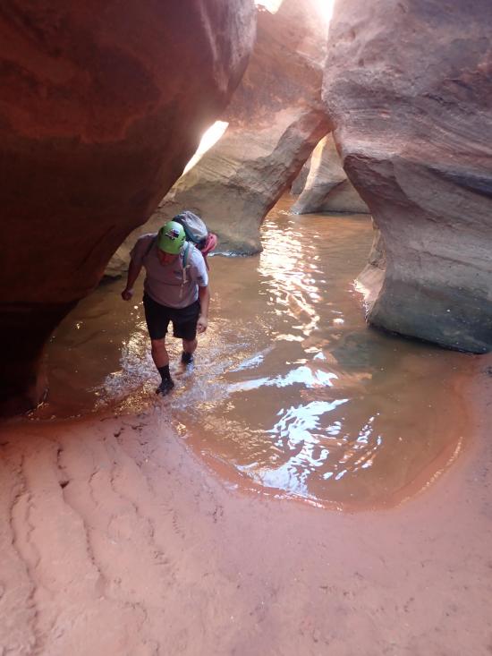
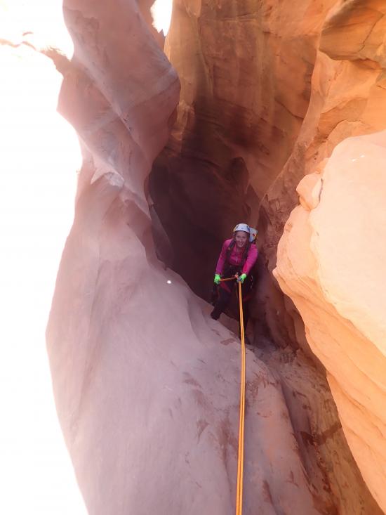
After the pothole is a short rappel and a scenic section of shallow potholes and pools.
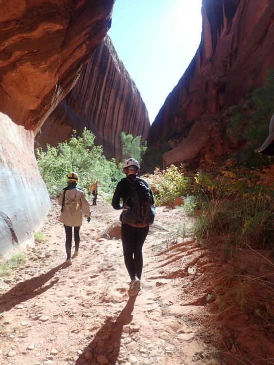
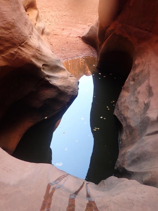
At this point, the canyon opens up into a walking section for about 0.2 miles. While you're hiking, you'll pass a very unique pothole that is off to the side of the main watercourse. It's about 8 feet deep and 4-5 feet in diameter. It's not required at all, but if you have the time, drop down into the pothole and try to climb out by yourself. It's a fun little challenge to practice your skills.
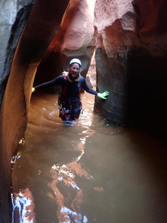
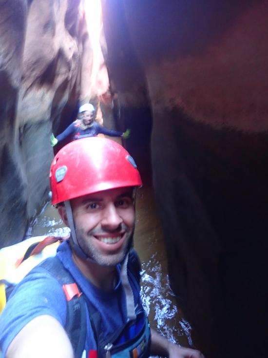
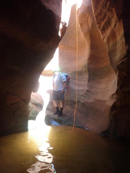
Next up is a medium-length rappel, a pothole that is easily escaped with a partner assist, and a wading section.
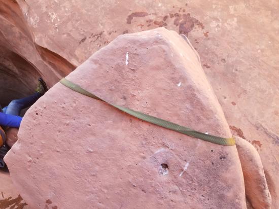
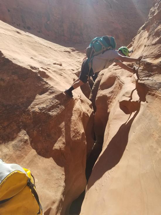
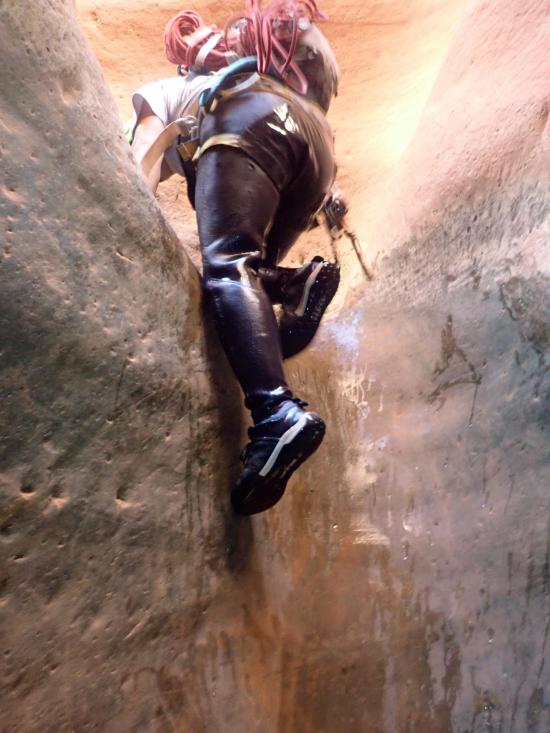
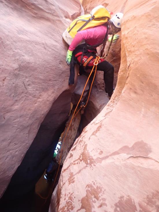
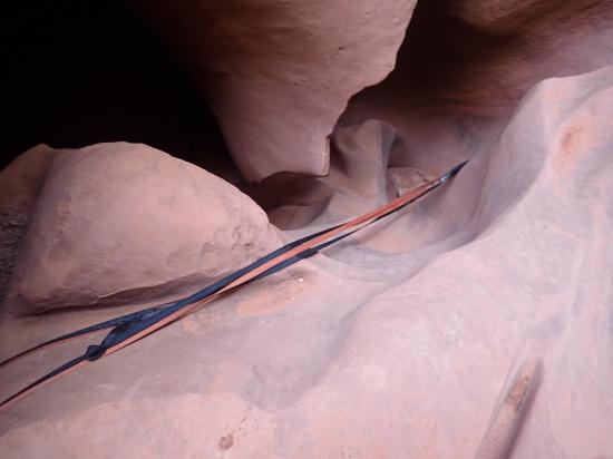
The next drop has two options for rappels. Either rappel from the close chockstone down an awkward wedge or stem across to a second chockstone and have a clean rappel straight down. You can also stem over to the second chockstone, climb under the chockstone and elevator down, but this is a difficult and exposed move.
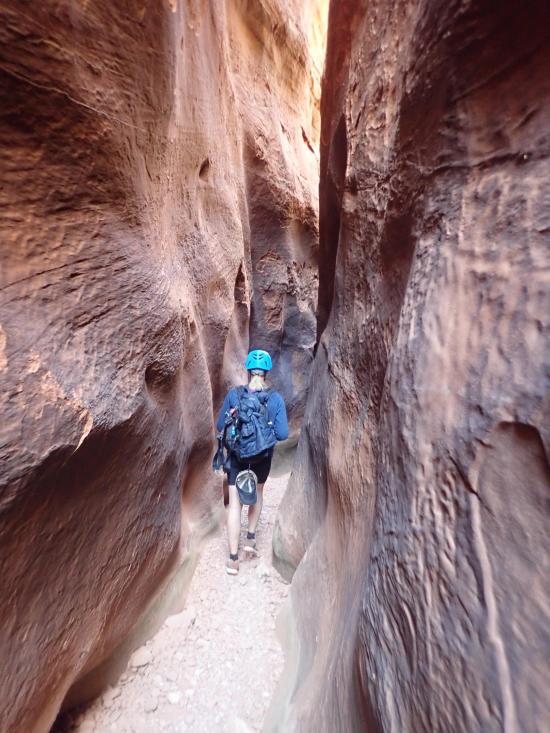
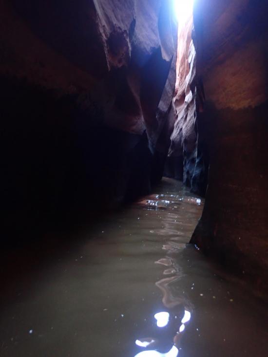
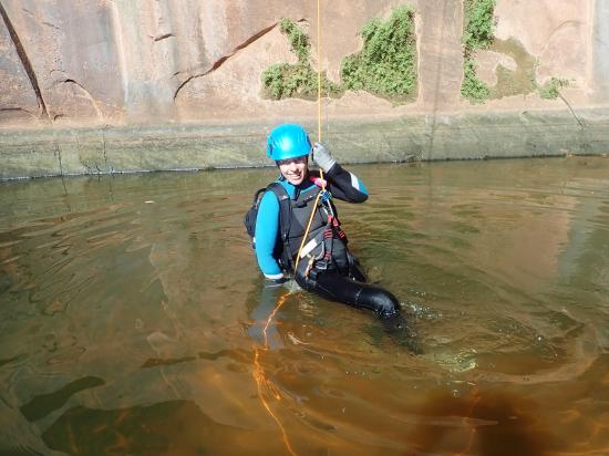
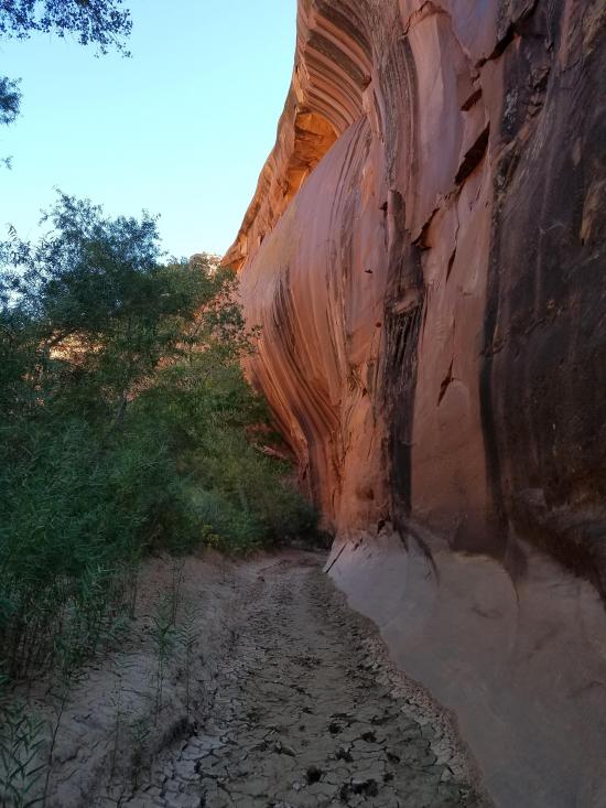
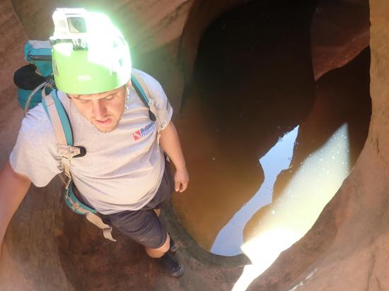
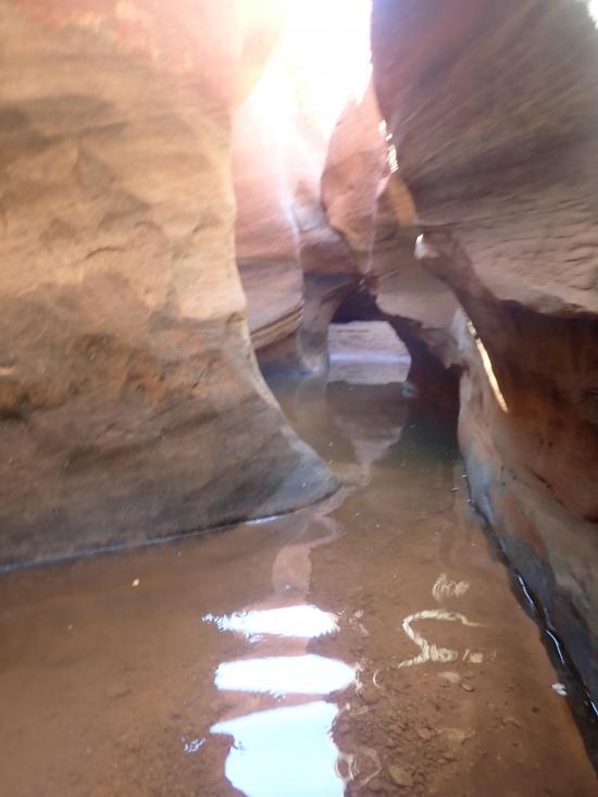
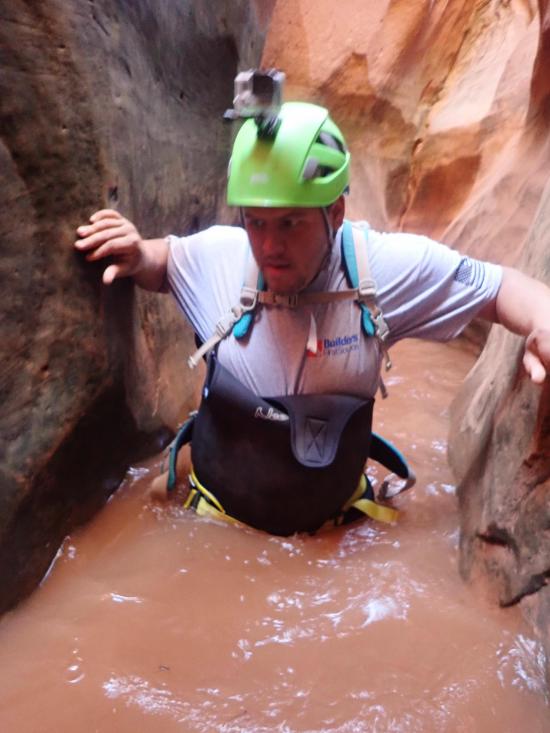
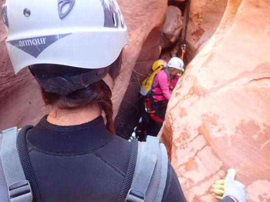
Right after this drop, there is a scenic chamber with a pool and a short swim. The swim may be longer or shorter depending on water conditions.
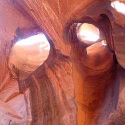
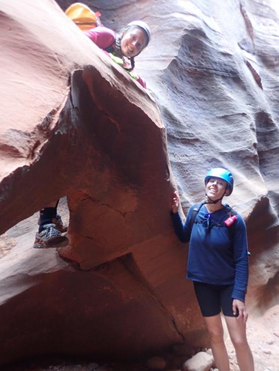
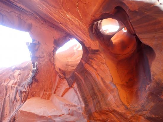
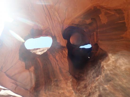
The next drop features two small round arches side by side. They're actually more like tunnels than arches. I'm guessing they used to be potholes until a drain formed in the bottom. You can climb through either one of the tunnels or follow the main drainage around the arches. This puts you at the top of a drop into a pothole filled with water (depending on water conditions). You can meat anchor all but the last person down and check the water level. If the water is deep enough, you can just jump. If it's shallow, you can do a partner capture. You can also just climb down and use a pack drag to slow your decent. Swim or climb out the other side.
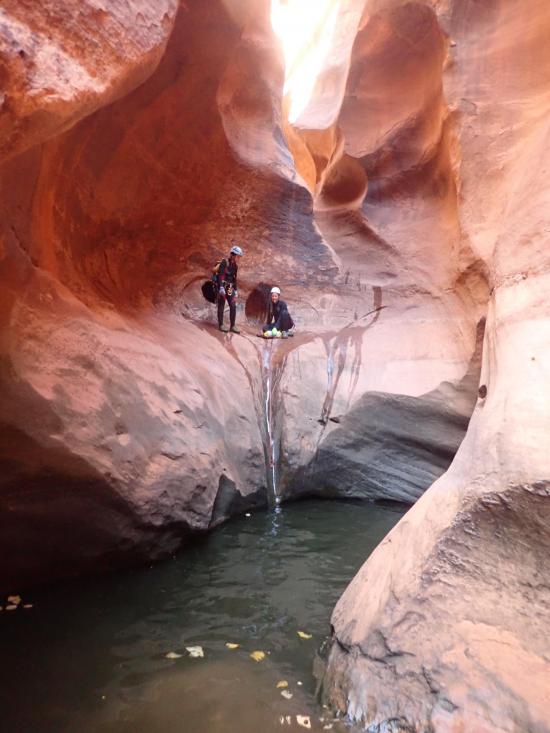
A few minutes down canyon, you'll see a rappel anchor high on your left where some people drop into the canyon for just the last rappel.
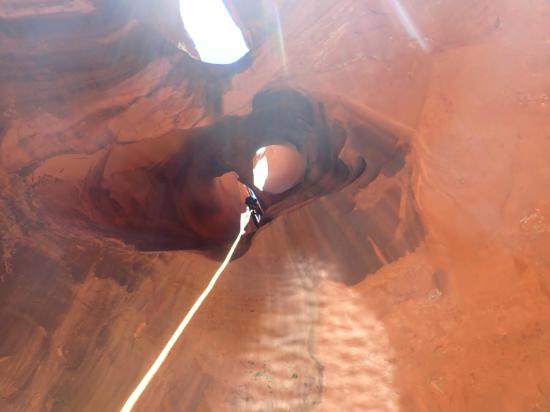
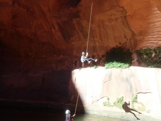
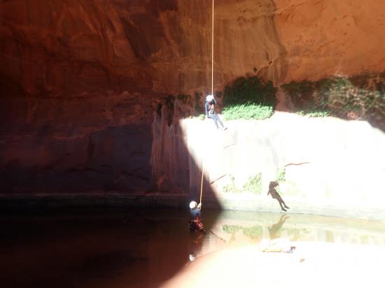
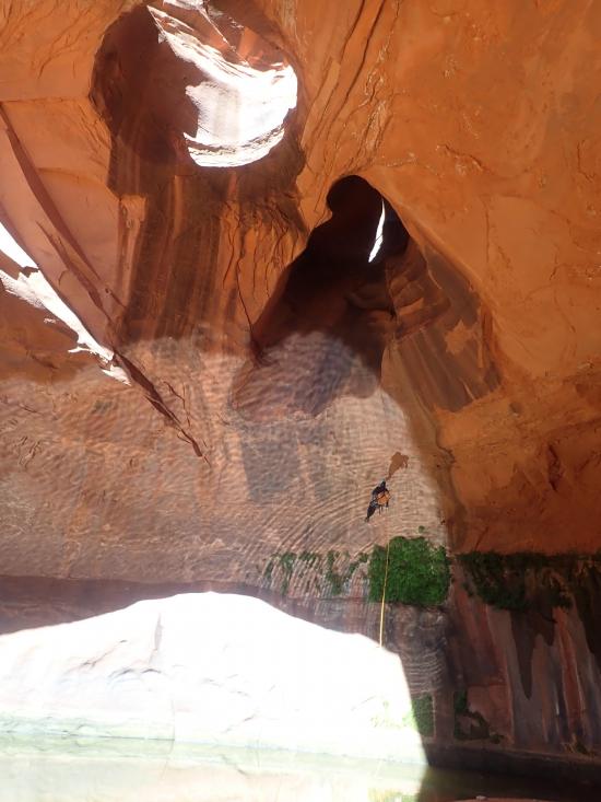
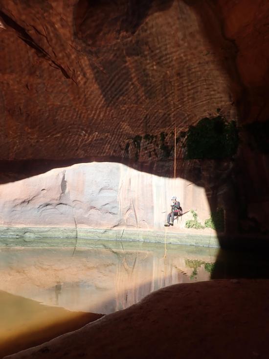
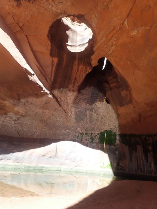
In a couple more minutes, you'll reach the final rappel. This rappel needs about 40 feet of webbing to extend the anchor to the lip of the rappel. Rappel about 80 feet past a spectacular double arch into an alcove. This is the Golden Cathedra.
Continue down canyon for about 0.8 miles to the Escalante River.
From here, you can either hike back to the Egypt Trailhead, or if you're staying multiple days, you can head to camp.
Closest City or Region: Escalante, Utah
Coordinates: 37.621026, -111.158322
By Jeremy Dye
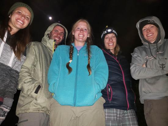
Jeremy Dye, Tara Dye, Savannah Dye, Becca Bevan, Marci Parker, Chelisa Pack,
Depart Camp: 9:30 a.m.
Escalante River: 10:00 a.m.
Top of Neon Canyon: 11:10 p.m.
Golden Cathedral: 2:35 p.m.
Escalante River: 2:50 p.m.
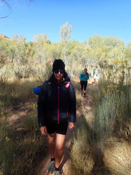
In the night, it dipped below freezing, so all our gear was frozen. Our frozen wetsuits were very cold. We soaked our shoes in the river to thaw them enough so we could get our feet in. Anthony, Ondy, Ross, and Jared did Choprock Canyon while Tara and I took Becca, Marci, and Chelisa through Neon Canyon. We left camp and hiked down the Escalante River from Fence Canyon to the bottom of Neon Canyon.
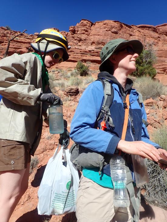
The approach to the top of Neon went much better than the previous day's because we knew where the trail was this time. Tara and I took more of a backseat role and let the other three analyze each of the drops and decide how they thought we should tackle each obstacle. At the keeper pothole, the four women rappelled down into the pothole and worked together to escape it. The water was about waist deep. It took them several attempts to escape. Tara did the top level of the shoulder stand first and got a pack over the lip, but she couldn't quite climb out. Becca tried next but ended up tipping over backwards into the water with the pack because the rope didn't hold. She got pretty freaked out by it and had a mini panic attack. Eventually they made it out by having Becca and Chelisa form the bottom of the pyramid while Marci stood on their shoulders. Marci threw a pack over the lip and was able to climb out then help the others out.
By Jeremy Dye
Jeremy Dye, Tara Dye, Anthony Dye, Ondylyn Wagner,
Trailhead: 8:45 a.m.
Escalante River: 11:00 a.m.
Top of Neon Canyon: 12:20 p.m.
Golden Cathedral: 2:45 p.m.
Escalante River: 3:00 p.m.
We had 3 beginners with us on this trip. Marci had done one other canyon with us on a different trip, but this was Chelisa's and Becca's first canyoneering trip. They were nervous about the cold weather and overall anxiety, so Jared stayed back with Marci, Chelisa, and Becca, and they did a couple of the easier Egypt canyons. I think it was 1.5 and 2, but it might have just been 1.5.
Anthony, Ondy, Tara, and I scoped out Neon to make sure it wouldn't be too difficult for the rest of the group. We backpacked down to the Escalante River and dropped off our overnight packs at the bottom of Neon Canyon. We then hiked up to the top of Neon Canyon. The GPS track that we were following wasn't very detailed, and we ended up on the cliff band above where we were supposed to be. We scouted around for a while and found a crack in the cliff that we were able to chimney down with some effort. Once we got on the approach trail where we were supposed to be, the rest of the approach was very easy. We did the first little downclimb, found some shade, and ate lunch.
The canyon was very fun. Anthony and I bridged over the giant pothole while Tara and Ondy climbed up the ledge on the left and rappelled past the pothole. Because of this, Anthony and I got ahead, and while we were waiting for them to catch up, we played around in a completely optional pothole just for fun. It was a fun challenge to climb out of. We cruised through the canyon and were amazed at how photogenic the canyon was. We did the final rappel and hiked back down to the Escalante River.
From there, we grabbed our overnight packs and hiked to the bottom of Fence Canyon, where we camped for two nights. Jared, Marci, Chelisa, Becca, and Ross joined us at camp that evening.

Camping at Halls Creek and Millers Creek Confluence
Escalante River Primitive Camp 1
Escalante River Primitive Camp 2
Fence Canyon Primitive Camping
Iceberg Canyon Primitive Camping
Navajo Canyon Primitive Camping
Stud Horse Point Primitive Camping
West Canyon Primitive Camping 1
West Canyon Primitive Camping 2
Baboon Laughs Canyon (aka Laughing Baboon Canyon)
Poe Canyon (aka Smiling Cricket Canyon)
Early Weed Bench to Escalante River
Escalante River to Early Weed Bench
Lee's Ferry Historic District River Trail
Navajo Bridge Interpretive Center
Big Hollow Wash Primitive Camping
Chimney Rock Primitive Camping
Early Weed Bench Primitive Camping
Escalante River Primitive Camp 1
Escalante River Primitive Camp 2
Fence Canyon Primitive Camping
Jacob Hamblin Trailhead Primitive Camping
Micro Death Hollow Primitive Camping
Zebra and Tunnel Trailhead Camping
Dry Fork Narrows of Coyote Gulch
Early Weed Bench to Escalante River
Escalante River to Early Weed Bench
Escalante Interagency Visitor Center
 Rappels
 Downclimbs
 Swimming
 Wading
 Stemming
 Pothole Escapes - Sand Bag
 Pothole Escapes - Partner Assist
 Fixed Anchors
 Wetsuit Generally Required
 No Drinking Water
 Arches
 Slot Canyon
 Wayfinding
 No Restrooms
 Road Access is Dirt - Low Clearance
 Access Road is 2WD Accessible
 Road Access is Dirt - High Clearance