Hiking | Grosvenor Arch


Hype:
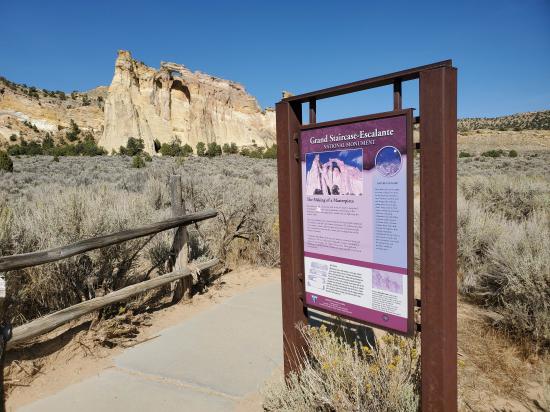
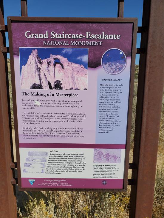
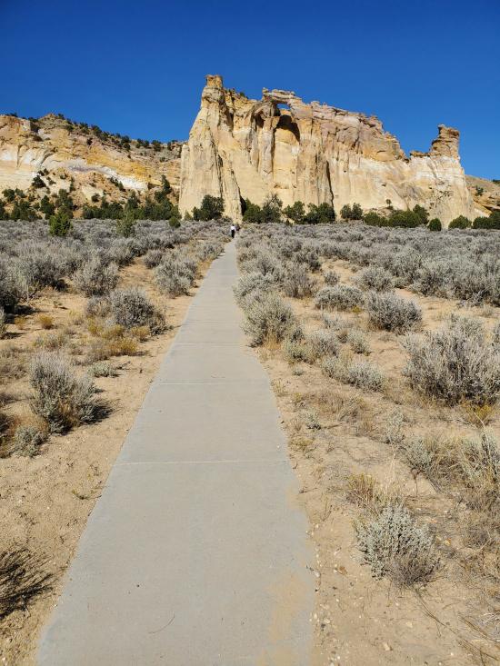
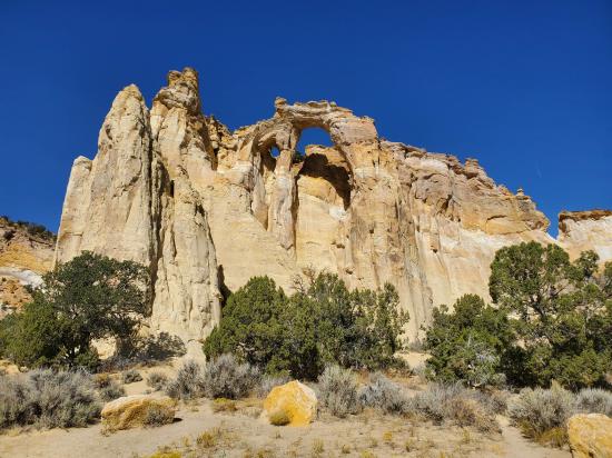
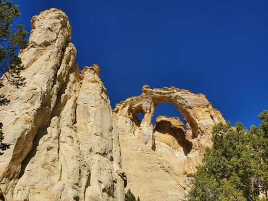
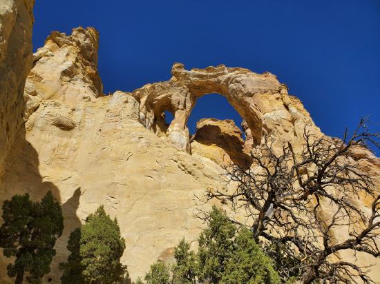
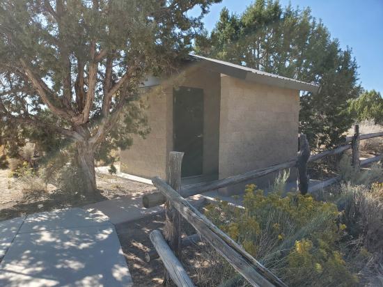
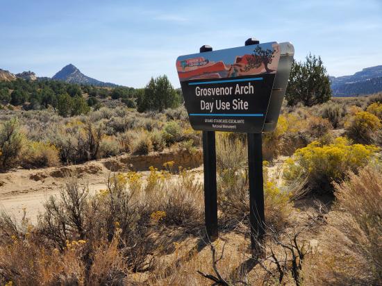
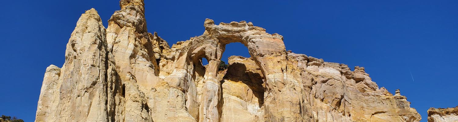
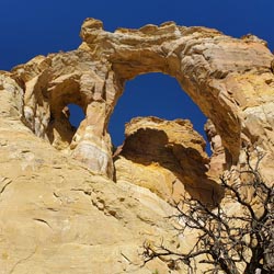
Grosvenor Arch is a unique sandstone double arch located within Grand Staircase-Escalante National Monument in southern Kane County, Utah. It is named to honor Gilbert Hovey Grosvenor (1875–1966), a president of the National Geographic Society. Located in northern Kane County, it is close to and south of Kodachrome Basin State Park and is accessed from the north or south via Road 400, a dirt road that traverses Cottonwood Canyon in the western portion of the national monument. The site is well maintained and has an outhouse restroom and benches. There is a concrete sidewalk that goes almost to the base of the arch which is handicap accessible.
Trail Condition: Class 0 (Trail is paved. No elevation gain.)
Time: 15 minutes
Length: .25 miles round trip
Elevation Gain: Negligible
Fees: None
Recommended Ages:
 | 0-3 |
 | 4-11 |
 | 12-19 |
 | 20-49 |
 | 50-69 |
 | 70+ |
Recommended Months to Visit:
| Jan |
| Feb |
| Mar |
| Apr |
| May |
| Jun |
| Jul |
| Aug |
| Sep |
| Oct |
| Nov |
| Dec |
Closest City or Region: Grand Staircase Escalante National Monument, Utah
Coordinates: 37.456185, -111.831478
Big Hollow Wash Primitive Camping
Chimney Rock Primitive Camping
Early Weed Bench Primitive Camping
Jacob Hamblin Trailhead Primitive Camping
Micro Death Hollow Primitive Camping
Skutumpah Road Primitive Camping
Zebra and Tunnel Trailhead Camping
Dry Fork Narrows of Coyote Gulch
Skutumpah Road Primitive Camping
Shakespeare Arch/Sentinel Trail
Bryce Canyon National Park Visitor Center
Bryce Canyon Wranglers at Ebenezer's Barn and Grill
 Arches
 Mountains
 No Drinking Water
 Marked Trails
 Restrooms - Vault
 Road Access is Dirt - Low Clearance
 Access Road is 2WD Accessible
 Hiking Trails
 Wildflowers and Vegitation
 Wildlife and Birding