 Fun Places | Multnomah Falls


Hype:
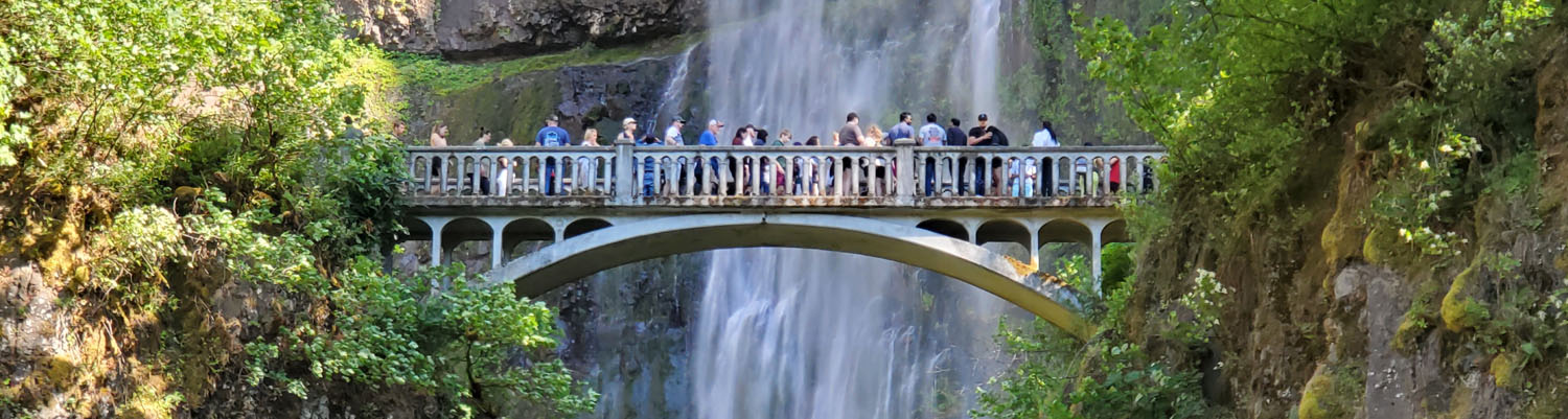
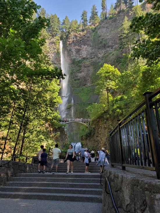
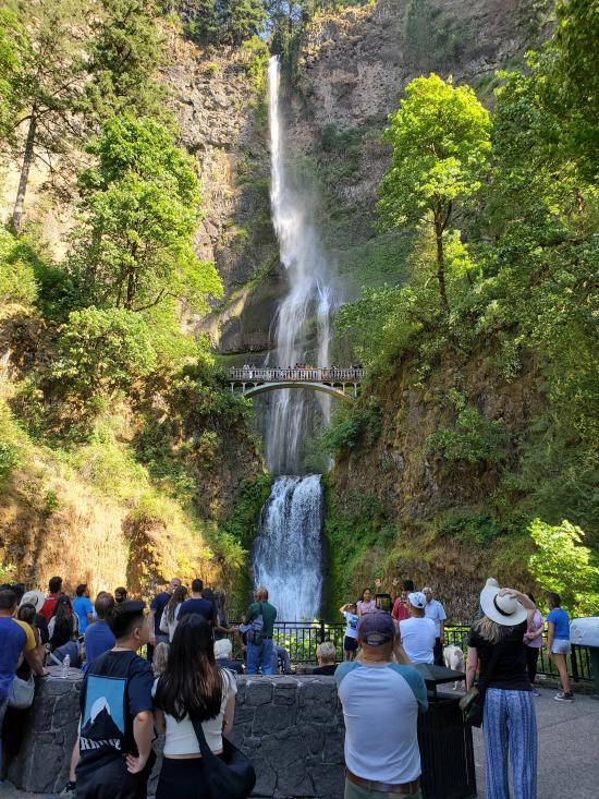
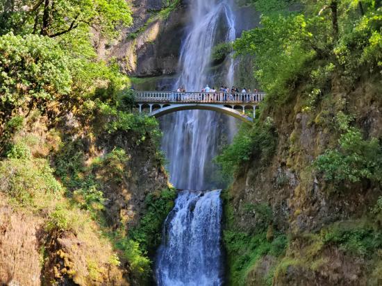
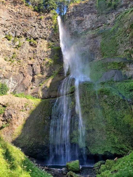
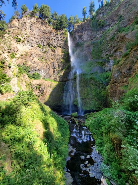
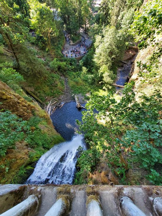
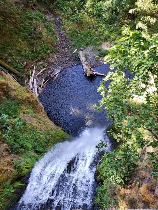
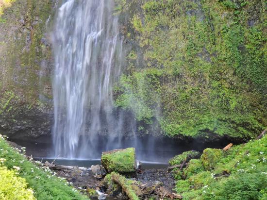
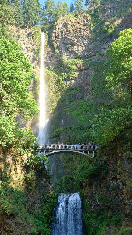
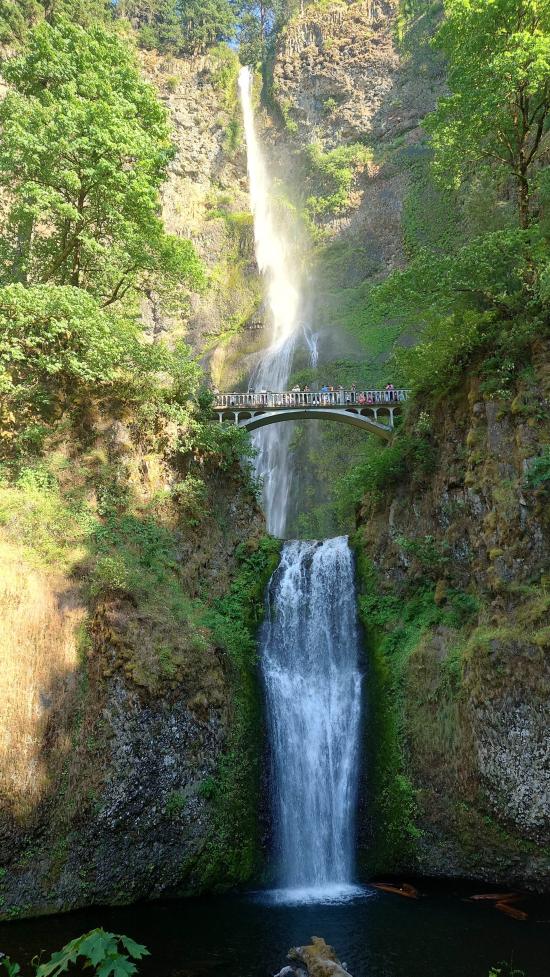
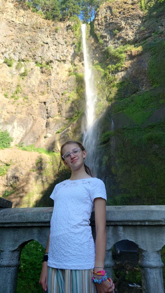
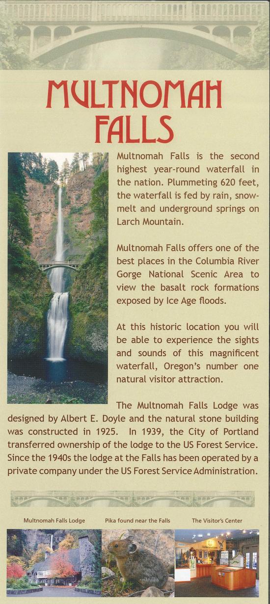
Multnomah Falls is a waterfall located on Multnomah Creek in the Columbia River Gorge. The waterfall is accessible from the Historic Columbia River Highway and Interstate 84. Spanning two tiers on basalt cliffs, it is the tallest waterfall in the state of Oregon at 620 ft in height. The Multnomah Creek Bridge, built in 1914, crosses below the falls, and is listed on the National Register of Historic Places.
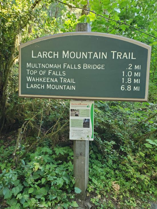
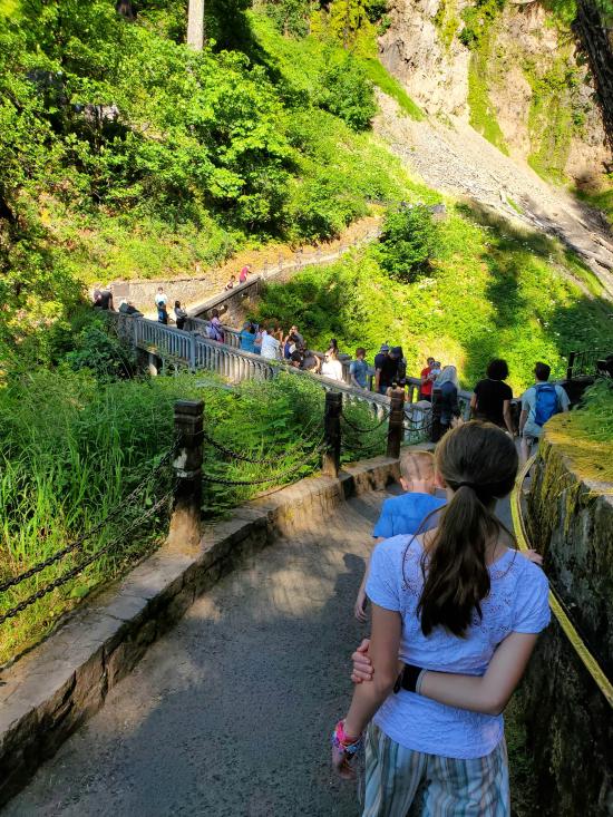
The land surrounding the falls was developed by Simon Benson in the early-twentieth century, with a pathway, viewing bridge, and adjacent lodge being constructed in 1925. The Multnomah Falls Lodge and the surrounding footpaths at the falls were added to the National Register of Historic Places in 1981. Contemporarily, the state of Oregon maintains a switchback trail that ascends to a talus slope 100 feet (30 m) above the falls, and descends to an observation deck that overlooks the falls' edge. The falls attract over two million visitors each year, making it the most-visited natural recreation site in the U.S. Pacific Northwest.
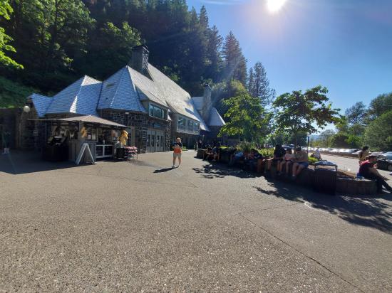
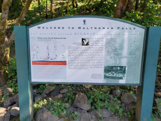
The Multnomah Falls Lodge Visitor Center, restaurant, gift shop, snack bar and restrooms are open to the public. Multnomah Falls is the most visited natural recreation site in the Pacific Northwest with more than 2 million visitors stopping by each year to take in the views. Fed by underground springs from Larch Mountain, the flow over the falls varies, but is usually highest during the winter and spring seasons. This is also one of the best places in the Columbia River Gorge National Scenic Area to study geology exposed by floods. The Multnomah Falls Lodge, which is run by a concessionaire, is well maintained with restrooms, a Visitor Center, a snack bar, a gift shop and a restaurant that is fully ADA accessible. The visitor information area within the lodge is jointly staffed by Friends of Multnomah Falls volunteers and the U.S. Forest Service. Offerings include a simple trail map and brochures about Multnomah Falls in multiple languages. Books, detailed maps of the Columbia River Gorge & Pacific Northwest, and Northwest Forest Passes are also available for purchase.
Time:
Fees: Parking
Recommended Ages:
 | 0-3 |
 | 4-11 |
 | 12-19 |
 | 20-49 |
 | 50-69 |
 | 70+ |
Recommended Months to Visit:
| Jan |
| Feb |
| Mar |
| Apr |
| May |
| Jun |
| Jul |
| Aug |
| Sep |
| Oct |
| Nov |
| Dec |
Links: https://www.fs.usda.gov/recarea/crgnsa/recarea/?recid=30026https://en.wikipedia.org/wiki/Multnomah_Falls
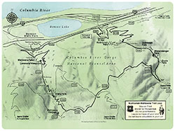
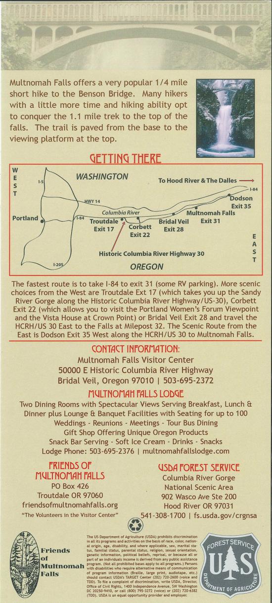
Navigate to 45.577794, -122.117749.
Park at teh parking lot at the base of the falls.
Alternatively, you can park at 45.578758°, -122.118432° off I-84.
Closest City or Region: Columbia River Gorge
Coordinates: 45.575922, -122.115451
By Jeremy Dye
Jeremy Dye, Tara Dye, Savannah Dye, Madilyn Dye, Cooper Dye, Greg Dye, Laura Dye, Anthony Dye, Arianne Dye, Miller Dye, Kingston Dye, Ondylyn Wagner, Jaren Wagner, Killian Wagner, Calliope Wagner,
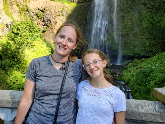
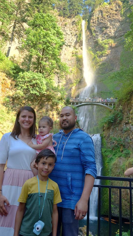
After Horsetail Falls, we proceeded to Multnomah Falls. Parking was a nightmare and we ended up driving around a bunch trying to find a spot. We ended up taking my dad's parking spot so he could go pick up the rest of the group at the other trail. We viewed the falls from the lookout at the bottom then proceeded up to the bridge to get a view from there. We also stopped at the visitor center and got some magnets.

 Hagerman Fossil Beds National Monument
 Columbia Gorge Discovery Center & Museum
Fort Dalles Museum and Anderson Homestead
Mount St. Helens National Volcanic Monument
Mount St. Helens Visitor Center at Silver Lake
Recycled Spirits of Iron Sculpture Park
Henry M Jackson Visitor Center
Longmire Transportation Exhibit
Historic Columbia River Highway State Trail
Columbia Gorge Discovery Center & Museum
 Waterfalls
 Rivers and Streams
 Mountains
 Forest
 Shopping
 Potable Water
 Visitor Centers
 Restrooms - Flush
 Road Access is Paved
 Access Road is 2WD Accessible
 Interpretive Signs
 Viewpoint, Overlooks, Vistas
 Wildflowers and Vegitation
 Wildlife and Birding
