 Hiking | Larch Mountain Trail


Hype:
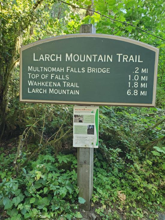
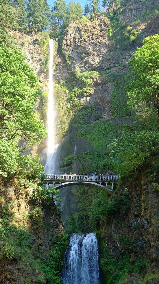
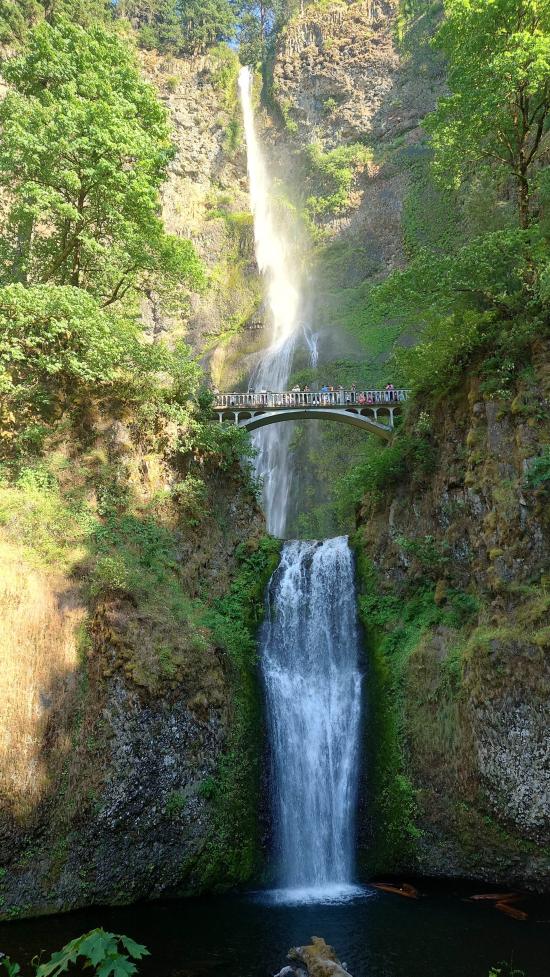
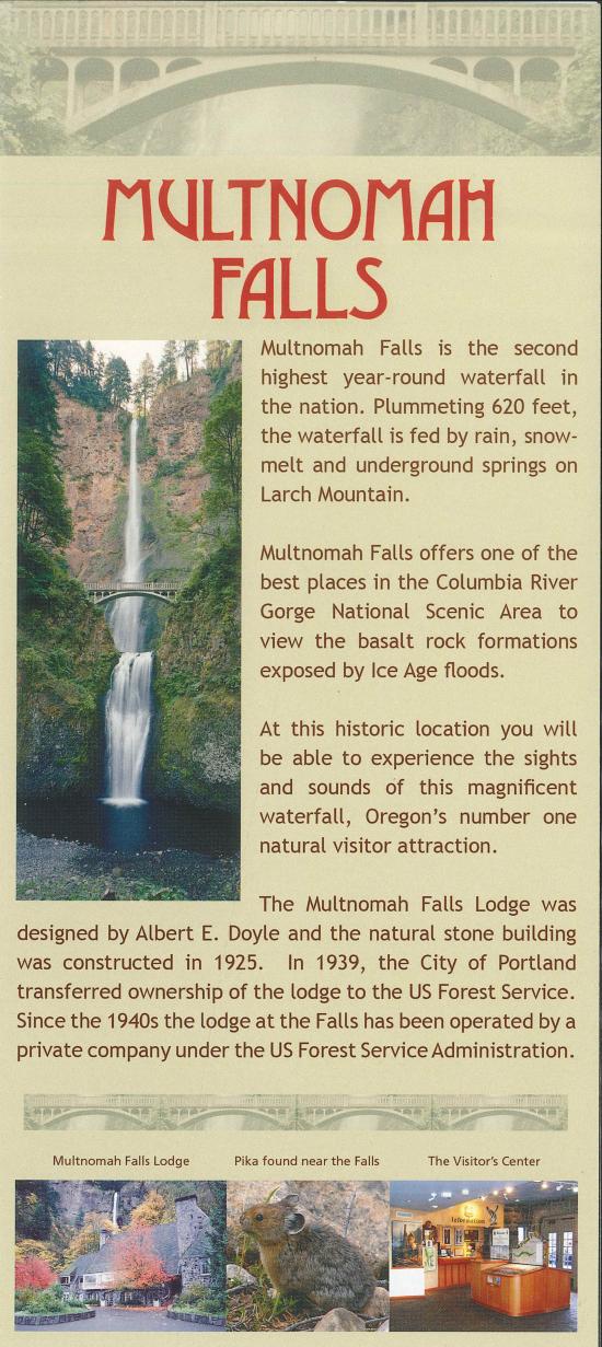
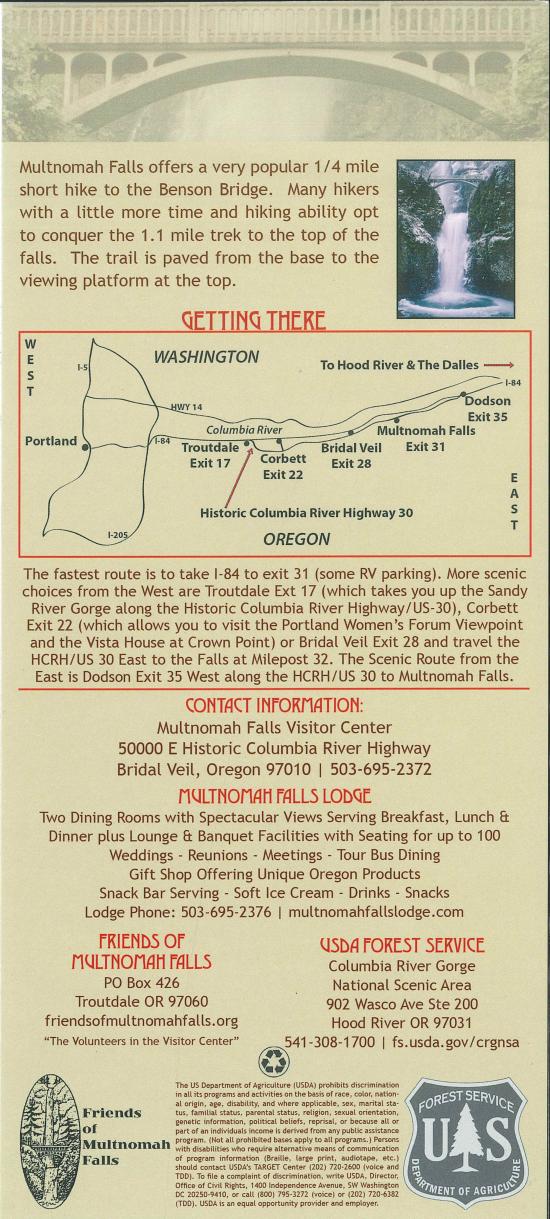
The Larch Mountain Trail takes hikers from Multnomah Falls to the summit of Larch Mountain.
Trail Condition: Class 2 (Trail may have tree roots or rocks jutting out. Navigation skills may consist of following rock cairns and choosing turns at junctions. Elevation gains may be more substantial.)
Time: 3-5 hours one way
Length: 6.7 miles one way
Elevation Gain: +5,060 / -1,112 ft
Fees: Parking
Recommended Ages:
 | 0-3 |
 | 4-11 |
 | 12-19 |
 | 20-49 |
 | 50-69 |
 | 70+ |
Recommended Months to Visit:
| Jan |
| Feb |
| Mar |
| Apr |
| May |
| Jun |
| Jul |
| Aug |
| Sep |
| Oct |
| Nov |
| Dec |
Closest City or Region: Columbia River Gorge
Coordinates: 45.532729, -122.087867
By Jeremy Dye
Jeremy Dye, Tara Dye, Savannah Dye, Madilyn Dye, Cooper Dye, Greg Dye, Laura Dye, Anthony Dye, Arianne Dye, Miller Dye, Kingston Dye, Ondylyn Wagner, Jaren Wagner, Killian Wagner, Calliope Wagner,
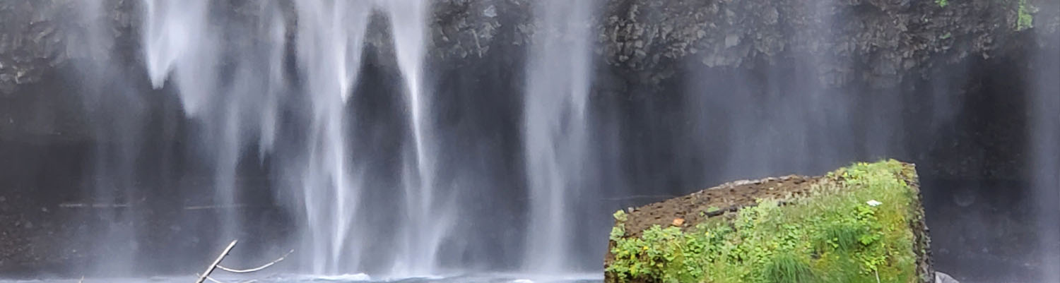
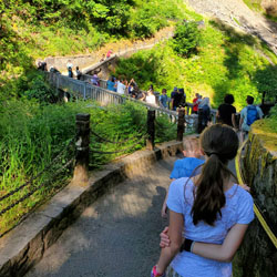
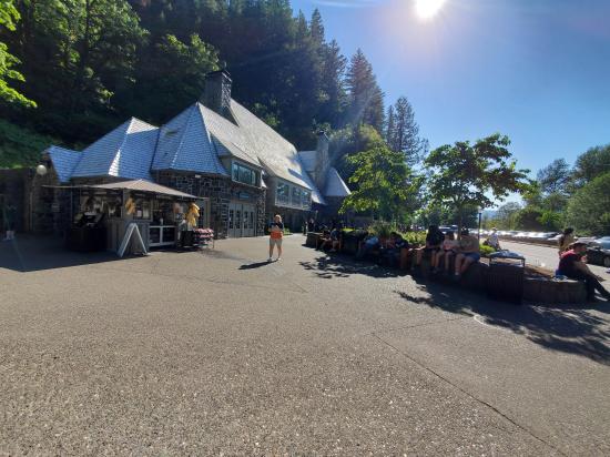
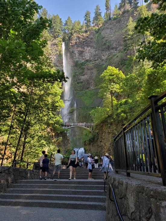
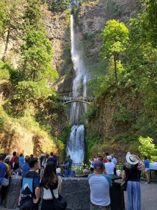
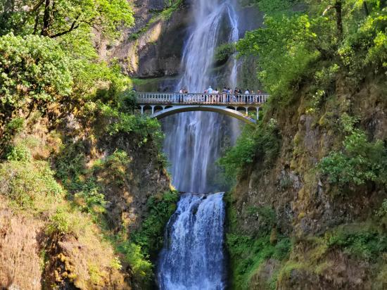
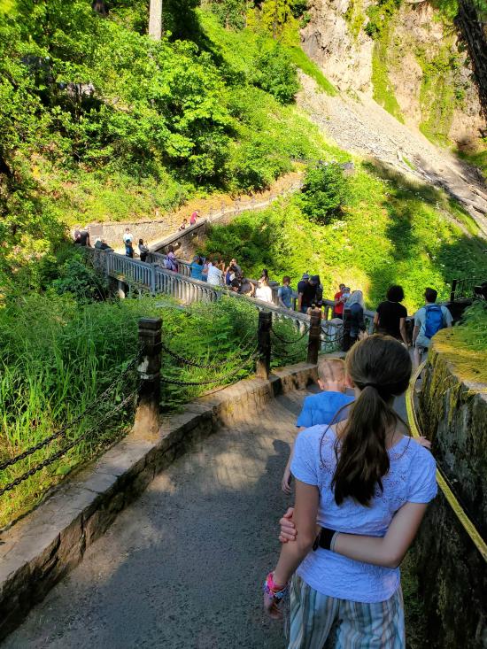
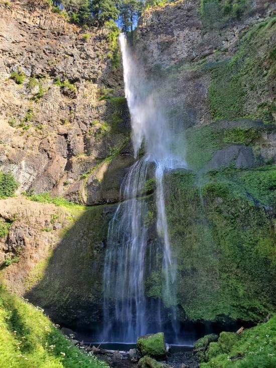
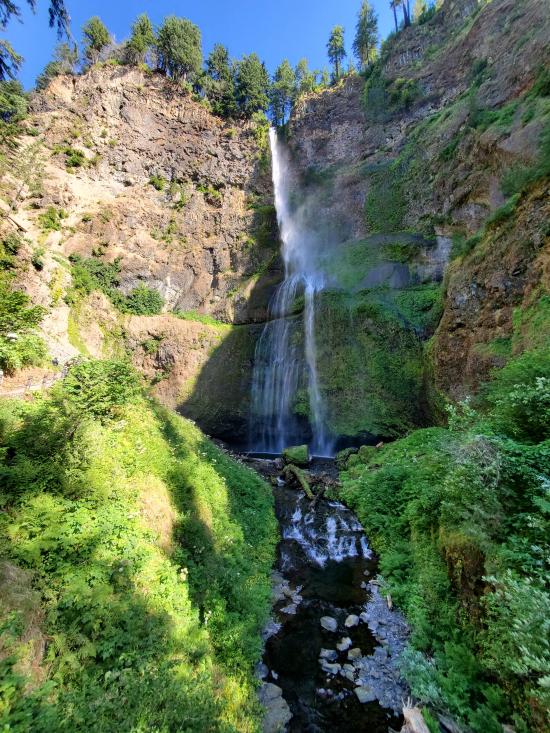
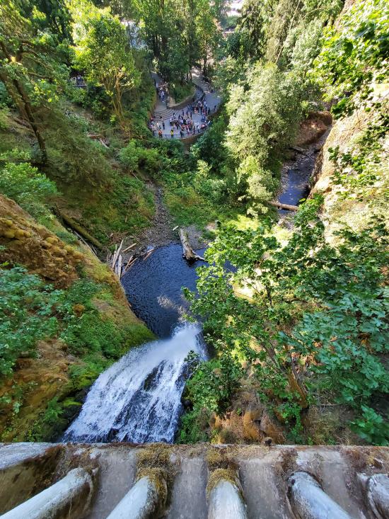
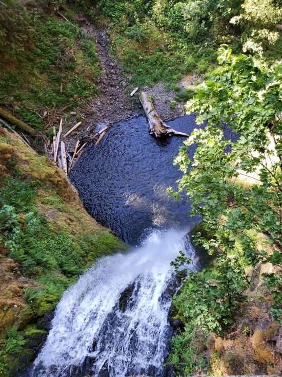
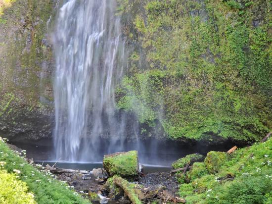
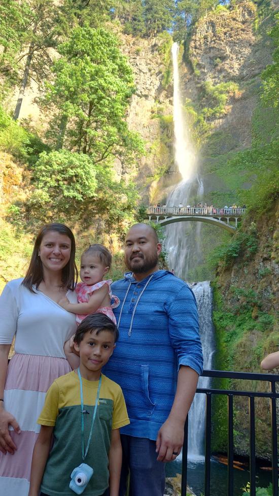
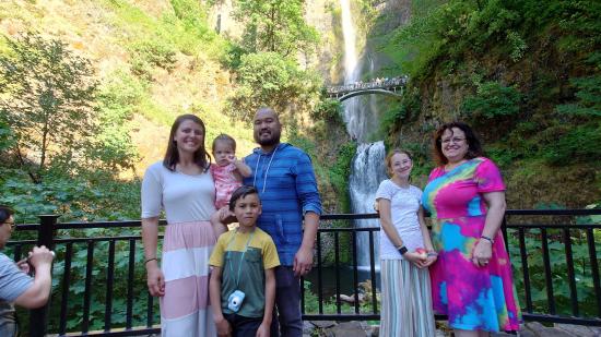
After Horsetail Falls, we proceeded to Multnomah Falls. Parking was a nightmare and we ended up driving around a bunch trying to find a spot. We ended up taking my dad's parking spot so he could go pick up the rest of the group at the other trail. We viewed the falls from the lookout at the bottom then proceeded up to the bridge to get a view from there. We also stopped at the visitor center and got some magnets.


 Hagerman Fossil Beds National Monument
 Fort Dalles Museum and Anderson Homestead
Columbia Gorge Discovery Center & Museum
Mount St. Helens National Volcanic Monument
Mount St. Helens Visitor Center at Silver Lake
Recycled Spirits of Iron Sculpture Park
Longmire Transportation Exhibit
Henry M Jackson Visitor Center
Historic Columbia River Highway State Trail
Columbia Gorge Discovery Center & Museum
 Hiking Trails
 Mountains
 Waterfalls
 Rivers and Streams
 Forest
 Road Access is Paved
 Access Road is 2WD Accessible
 Viewpoint, Overlooks, Vistas
 Wildflowers and Vegitation
 Wildlife and Birding
