 Hiking | Pink Ledges Trail


Hype:
This interpretive trail begins from the Red Canyon Visitor Center and takes you through red rock scenery, hoodoos, and ponderosa pines. An interpretive guide available at the visitor center highlight 13 things to see along the way.
Trail Condition: Class 2 (Trail may have tree roots or rocks jutting out. Navigation skills may consist of following rock cairns and choosing turns at junctions. Elevation gains may be more substantial.)
Time: 15-30 minutes
Length: 0.55 miles
Elevation Gain: 170 ft
Fees: None
Recommended Ages:
 | 0-3 |
 | 4-11 |
 | 12-19 |
 | 20-49 |
 | 50-69 |
 | 70+ |
Recommended Months to Visit:
| Jan |
| Feb |
| Mar |
| Apr |
| May |
| Jun |
| Jul |
| Aug |
| Sep |
| Oct |
| Nov |
| Dec |
Links: National Forest Service
Navigate to 37.747193, -112.320319.
Welcome to Red Canyon located in the heart of the Dixie National Forest and western gateway to Scenic Byway 12!
The awe inspiring drive through Red Canyon sets the stage for Bryce Canyon National Park, Grand Staircase Escalante National Monument and Capitol Reef National Park along its 124 mile traverse. Three state parks and numerous recreational opportunities also abound along this unforgettable corridor through the past.
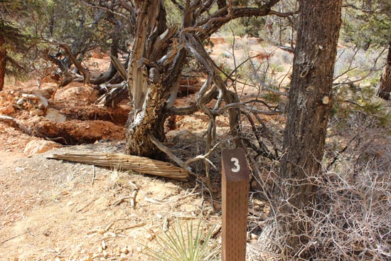
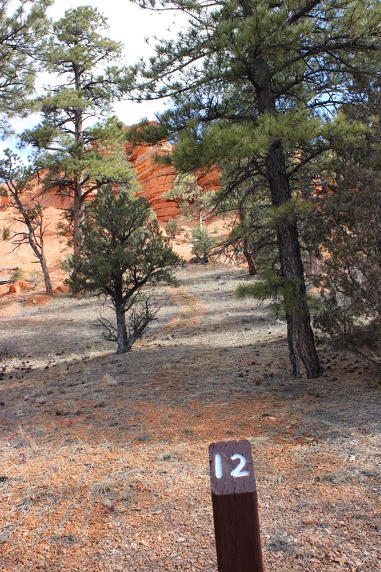
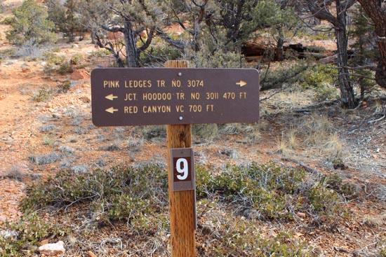
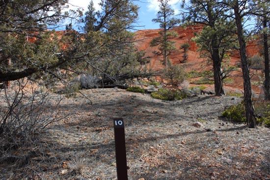
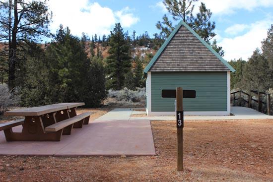
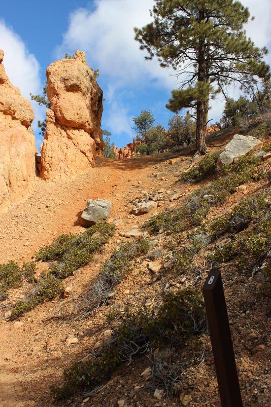
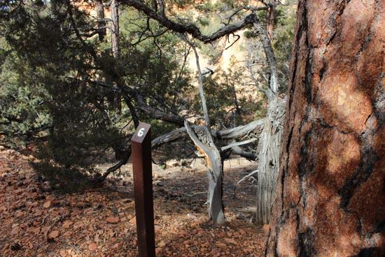
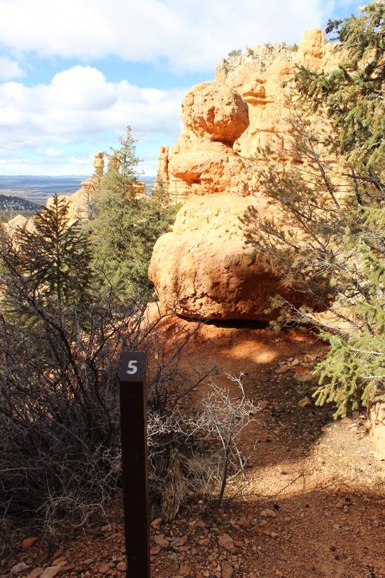
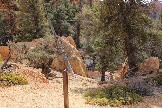
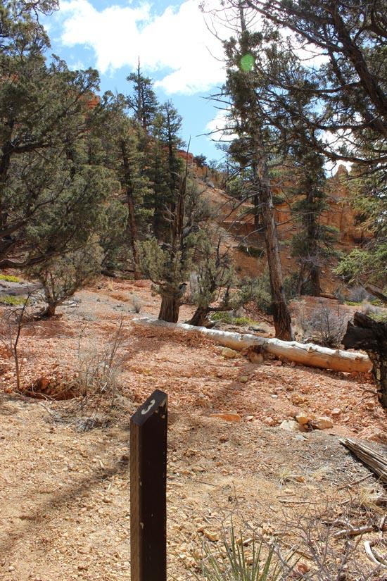
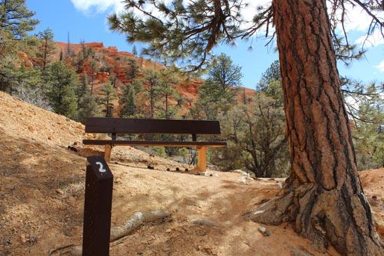
To use this trail guide, follow the numbered stops on the trail, which correspond to the identifying numbers in this guide.
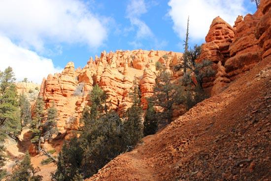
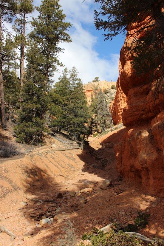
The Pink Ledges Trail is an easy to moderate one mile round trip hike beginning at the Hoodoo Trail junction west of the visitor center and ending at the restored Podunk Guard Station.
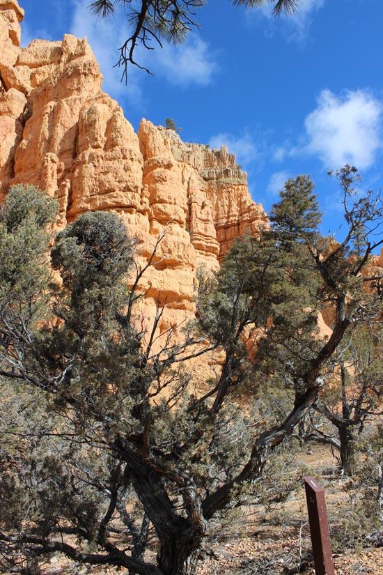
This hike is perfect for those who have a limited amount of time or don’t want anything too strenuous. The trail winds along the north side of the canyon through a shady pine forest and contains a few moderately steep rises along a sloped pathway. Hikers will be treated with a close-up view of the incredible geology and plant communities that make Red Canyon a natural wonder.

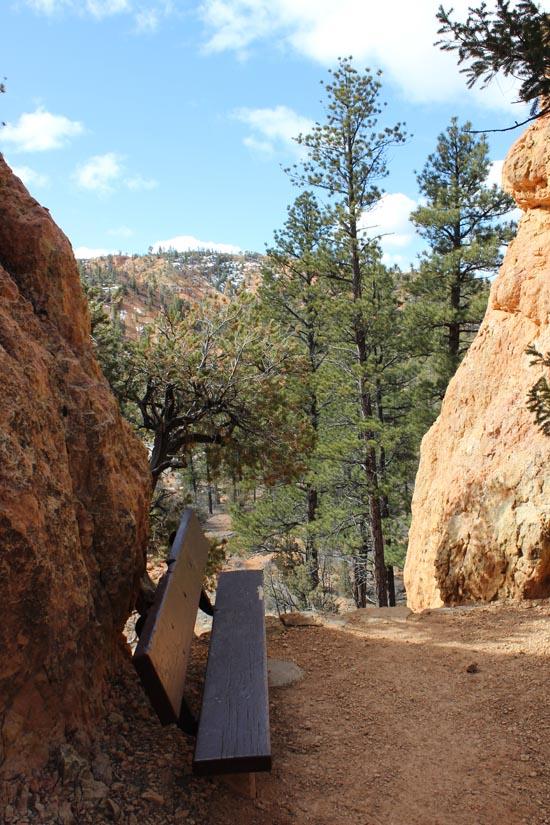
As you sit on the bench adjacent to Post 1 you will notice the black rock capping the distant red and white layers of sedimentary rock. The black rock is an igneous rock known as “basalt†and is evidence of a volcanic eruption even that occurred in the geologic past.
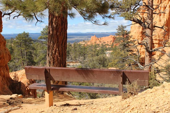
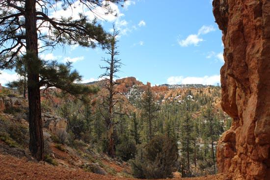
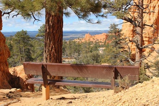
A large ponderosa pine tree and hoodoos frame a distant view of the Markagunt Plateau and Scenic Byway 12 below. The high elevation Markagunt Plateau is a sister plateau to the Paunsaugunt Plateau which the Red Canyon is carved into. In the distance you can see cinder cones, the remnants of ancient volcanoes, which erupted within the last 10,000 years.
The Limber Pine (Pinus flexilix) can be identified by its flexible limbs and four-five needle bundles. Its large, wingless pine “nuts†have high energy content and provide critical food for rodents and birds which often cache the seed for later use.

This shrub is Greenleaf Manzanita (Arctostaphylos patula), and Spanish word which means “little apple.†The name comes from the fruit that emerges during the summer. Manzanita is easily identified by its flat green leaves and smooth mahogany-red bark. American Indians used the leaves to cure stomach ailments.
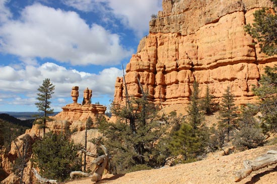
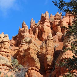
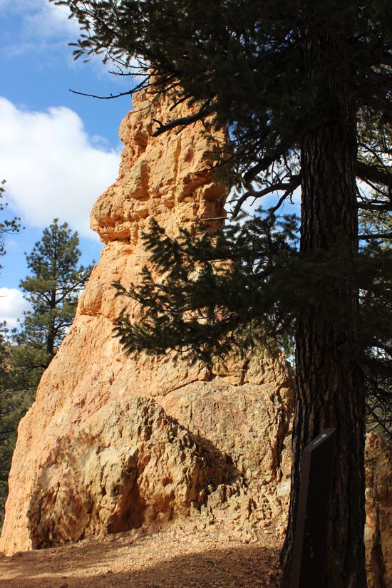
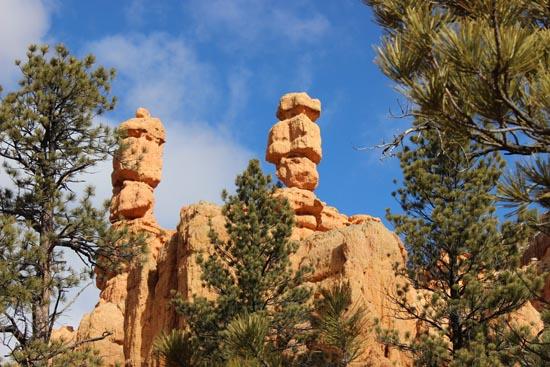
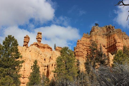
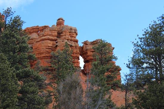
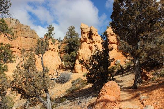
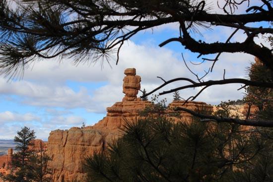
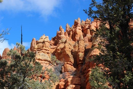
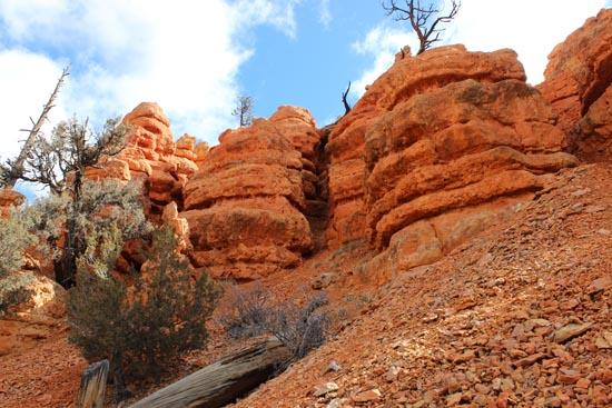
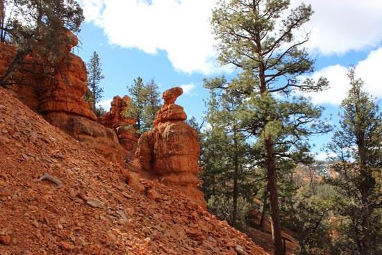
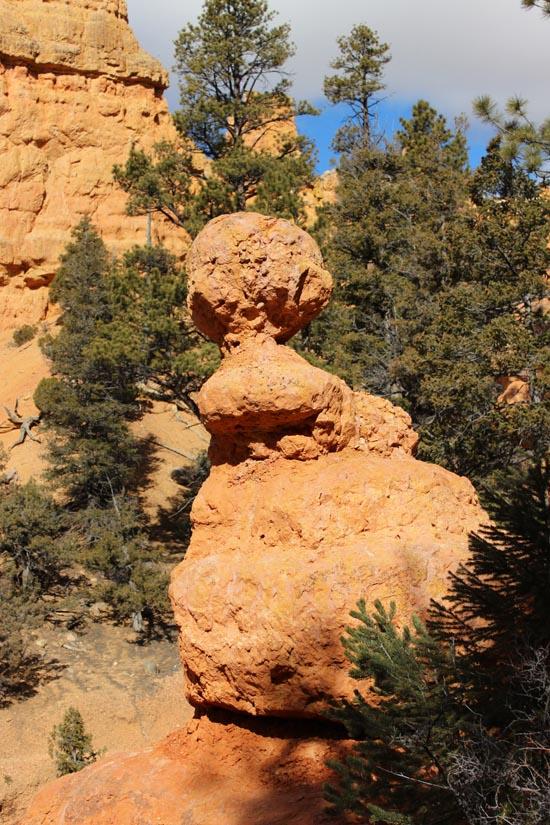
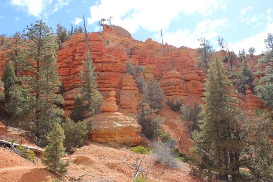
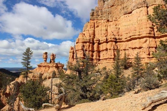
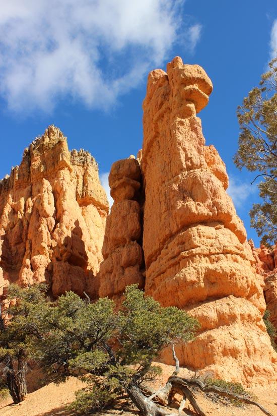
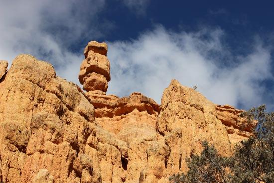
Geologists use the term “Hoodoo†to describe the mystical and magical appearance of the rocks that make Red Canyon famous. Hoodoos are columns, pinnacles or pillars of rock that have variable thickness and a totem pole shaped appearance. The formation of these hoodoos started nearly 10 million years ago with the relentless agents of weathering and erosion attacking the weaker layers leaving the more resistant layers in place. These hoodoos are mainly composed of the sedimentary rock known as limestone and get their distinct pink, red and yellow coloration from tiny iron-rich clay particles contained in the rocks.

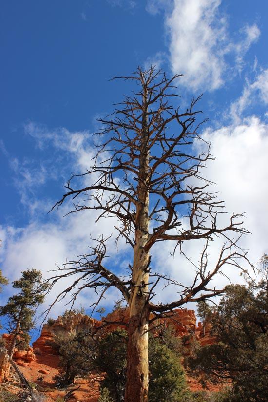
The trail continues descending along the edge of a small side canyon passing around a large ponderosa pine (Pinus ponderosa) is recognized by its coarse reddish brown bark and long, 2-3 needle bundles. Take a moment to smell the deeply furrowed bark which will give the hint of vanilla or butterscotch.
Standing or sitting at this location, you will notice a large Douglas fir (Pseudotsuga menziesii) tree easily recognized by the papery cones with bracts that look like a mouse’s hind feet and tail. Numerous species of songbirds extract seeds from Douglas fir cones or forage for seeds on the Ground. Douglas fir trees grow in the more shaded north aspects of Red Canyon.

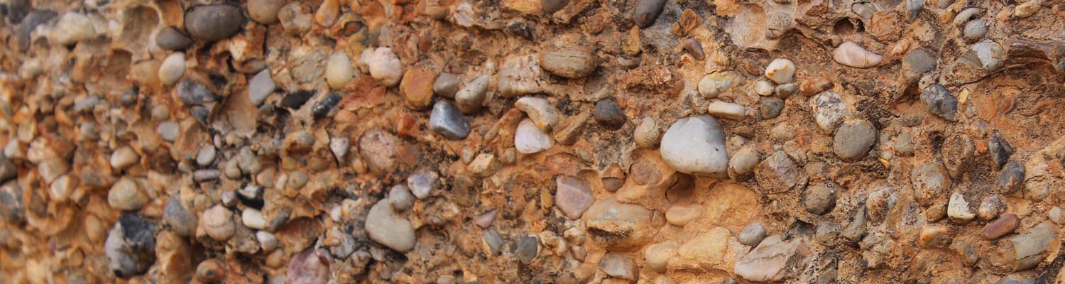
Ancient Stream Channel – The concrete looking rock material that you see at this stop offers clues to the deposition of the Red Canyon rock layers. The rounded pebbles scattered along the ground are remnants of sedimentary and metamorphic rocks that formed a large mountain chain along the boundary of what is now eastern Nevada and western Utah. These well traveled rocks have been transported nearly 200 miles by rivers and streams that flowed into an ancient freshwater lake. This lake was known as the Claron Lake System and covered much of southern Utah between 50-35 million years ago.

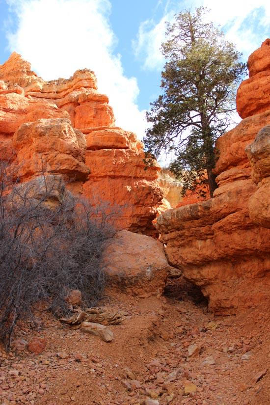
Trail Junction 2 – Take a moment to sit, relax and enjoy the view around you. This is a good stop to take pictures, as the colors, textures and shadows of Red Canyon are on display all around. There is also a good view of Red Canyon’s famous totems to the left of the bench. Trail Junction 3 – Stay to the left. Trail meanders through ponderosa pine, rock mountain juniper, pinyon pine and manzanita.
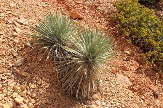
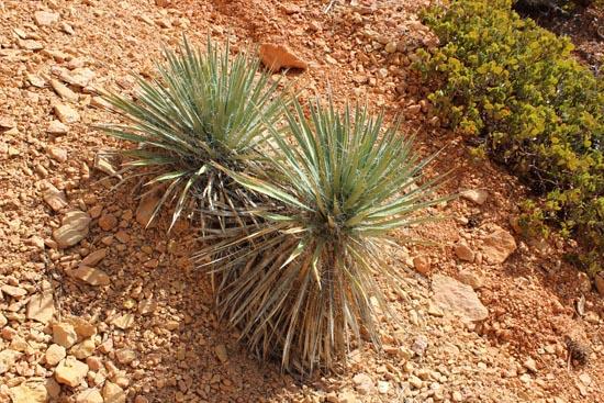
Numerous plants are seen from this shaded location such as Oregon Gram (Mahonia repens), Yucca (Yucca Utahensis), and Rocky Mountain Juniper (Juniperus scopularum).
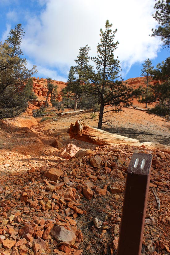
Walking along the final segment of the Pink Ledges Trail, you will notice the small to medium sized rock fragments that cover the trail. Passing through a series of small gullies provides a lithic snapshot into the processes that are shaping Red Canyon. These processes along with gravity are known as weathering and erosion. Weathering is the breaking down of larger rocks into smaller rocks. Erosion is the process of transporting the debris created by this constant cycle and revealing new layers underneath. During summer thunderstorm events, these small gullies will carry the material broken apart by frost wedging during the winter season.
On either side of the trail is a large scratch in the trunk of a two needle pinyon pine (Pinus edulis). A porcupine (Erethizon dorsatum) made this mark. Porcupines chew bark and twigs for nutrition during times of limited food resources. American Indians that traveled through and lived in this area utilized these trees for various needs including the harvesting of a nut that served as a seasonal food stable.

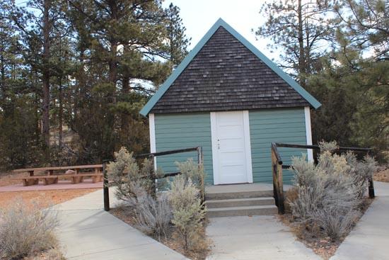
The Podunk Guard Station is a symbol of a bygone era. Guard stations like this one were once the seasonal residence of Forrest Service rangers. The winters were spent in town, but once the snow melted and work could be done in the field, the ranger or other employees would move into the guard station. The ranger’s family might also spend the summer at the station. By the 1960s roads and vehicles had improved to the point that many of the guard stations were not used as often. Dixie National Forest employees shill use guard stations when working in remote areas of the forest for extended periods of time. The guard station was originally located along Podunk Creek on the East Fork of the Sevier River. It was relocated here in 1999.
Closest City or Region: Red Canyon, Utah
Coordinates: 37.747193, -112.320319
By Jeremy Dye
The Red Canyon visitor center was closed when I went, so I wasn't able to get the trail guide. Without the trail guide, I had no idea what the numbered posts were indicating. We'll definitely want to go back sometime and read about the points of interest.


Panguitch Lake North Campground
Skutumpah Road Primitive Camping
Shakespeare Arch/Sentinel Trail
Bryce Canyon National Park Visitor Center
Bryce Canyon Wranglers at Ebenezer's Barn and Grill
 Hiking Trails
 Interpretive Signs
 Hoodoos
 No Drinking Water
 Mountains
 Marked Trails
 No Restrooms
 Road Access is Paved
 Access Road is 2WD Accessible
 Viewpoint, Overlooks, Vistas
 Wildflowers and Vegitation
 Wildlife and Birding